Tumacacori Mission Mines RE: Sister Micaela Molina Document

We have all these different source. The molina doc,jesuits,stone maps.
They seem to be unconnected sources leading to the same thing.
Im wondering if maybe they are more connected then we previously thought.
 

We have all these different source. The molina doc,jesuits,stone maps.
They seem to be unconnected sources leading to the same thing.
Im wondering if maybe they are more connected then we previously thought.

IMO , the only common which have these maps , is how primarily were Jesuit . The maps ( Molina and stones ) don't lead to the same region .
 

Church West of Tumacacori 2 copy.jpgGuadalupe to Conception.jpgJanos Pass .jpg
 

Attachments

  • Janos Pass .jpg
    Janos Pass .jpg
    71.2 KB · Views: 234
  • Mine 1891-92.jpg
    Mine 1891-92.jpg
    87 KB · Views: 198
Last edited:
View attachment 1079534View attachment 1079535View attachment 1079536

The Virgin de Guadalupe is also not a mine. If you know the area, then you should know that there is NO mineralization on Tumacacori or in Javelina Canyon. While there were several mines associated with Tumaccacori, the VdeG was built solely to store wealth.

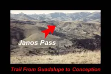
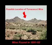
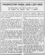
An old story about how a group of mine engineers found a document that stated one of the main mines of Tumacacori could be seen from the front door of the Church. Looking to the SouthEast, you will see a sharp mountaintop. The mine is on that mountain. The miners went there, and found a rich vein of Galena. They named the mine "The Wandering Jew". While exploring that vein:

Kansas_City_Daily_Gazette_Sat__Apr_4__1903_.jpg

Enjoy - Mike
 

Interesting posts, thank you for them. I don't see much to address, however maybe I can shed some light on this Virgin de Guadelupe.

The Virgin of Guadelupe story is fairly well known, an interesting story in itself, a fair example from Britannica;
Our Lady of Guadalupe (patron saint of Mexico) -- Encyclopedia Britannica

What the various articles about this religious figure do not explain however is that the lady of Guadelupe somehow came to be venerated as the patron saint or goddess of mines and mining to many Mexicans. It was not unusual for Mexican miners to erect a small "temple" to her near the entrance of mines, or even deep inside, where the miners would ask for her blessing and for success in their mining endeavor.
books

<from Geology and Quicksilver Deposits of the New Almaden District Santa Clara County California By EDGAR H BAILEY and DONALD L EVERHART, US Geological Survey Professional Paper 360, pp 181, published 1964>

This reverence for the Lady of Guadelupe became very widespread in Mexico and of course extending into the American southwest.

Guadalupe is worshiped in the church the end of the calzado as the protector of the Mexican people and the goddess of mines water and commerce. Listening at one time to a sermon preached by a Jesuit father in Guadalupe's own church he urged all persons interested in mines to be very faithful in their devotions to shrine of Virgin because he said, Guadalupe was with God the Father when He made the mountains and saw the hand of the Father place the veins silver among the rocks the everlasting hills, and will reveal richest pockets to those who are most faithful in their devotions to our august Lady. And all kneeled and bowed to image of the Indian girl, praying doubtless for clean silver rather than clean hearts. Does such preaching mean the Roman Catholic Church shall add the dogma of the Immaculate Conception of Mary that of the eternity of Mary?
<Woman's Work for Woman and our Mission Field, vol 4, pp 61>

It was also commonplace for miners to dedicate a tithe of their income from mining to the Virgin, as a sort of payment for the blessing and success. This leads me to the speculation part.

It is quite possible that the Virgin of Guadelupe "mine" was never intended as an actual mine but as a place to pay reverence to the Virgin and deposit the tithes (tenths) of the riches obtained. This shrine would likely be 'managed' by the padres, perhaps even leading the miners in prayers, and of course the need to conceal the wealth of the Virgin when events overtook the Jesuits in Spanish colonial America. If this speculation is true, then the amounts of silver and gold actually mined would be ten times what is listed on the Molina document, though where it may be today is anyone's guess.

Another possible speculation is that the Virgin of Guadelupe mine was indeed a mine at first, but the ore or native metals simply played out, leaving large empty mine workings which then became used as a sort of shrine and storage vault for treasure of the church. I have not seen any trace of what I could recognize as ore in the area Mike is referring to, although perhaps I simply did not recognize it as that was decades ago and I have learned a bit since. I am not convinced that is the location of the Virgin de Guadelupe but it is as good a guess as any.

Anyway hopefully this helps explain how/why this "mine" probably never was a mine but a shrine, where treasure would be stored belonging to the Virgin in the eyes of the Indians but "managed" by the padres as "agents" for God.
Oroblanco

:coffee2::coffee2::coffee2:
 

Interesting posts, thank you for them. I don't see much to address, however maybe I can shed some light on this Virgin de Guadelupe.

The Virgin of Guadelupe story is fairly well known, an interesting story in itself, a fair example from Britannica;
Our Lady of Guadalupe (patron saint of Mexico) -- Encyclopedia Britannica

What the various articles about this religious figure do not explain however is that the lady of Guadelupe somehow came to be venerated as the patron saint or goddess of mines and mining to many Mexicans. It was not unusual for Mexican miners to erect a small "temple" to her near the entrance of mines, or even deep inside, where the miners would ask for her blessing and for success in their mining endeavor.
books

<from Geology and Quicksilver Deposits of the New Almaden District Santa Clara County California By EDGAR H BAILEY and DONALD L EVERHART, US Geological Survey Professional Paper 360, pp 181, published 1964>

This reverence for the Lady of Guadelupe became very widespread in Mexico and of course extending into the American southwest.


<Woman's Work for Woman and our Mission Field, vol 4, pp 61>

It was also commonplace for miners to dedicate a tithe of their income from mining to the Virgin, as a sort of payment for the blessing and success. This leads me to the speculation part.

It is quite possible that the Virgin of Guadelupe "mine" was never intended as an actual mine but as a place to pay reverence to the Virgin and deposit the tithes (tenths) of the riches obtained. This shrine would likely be 'managed' by the padres, perhaps even leading the miners in prayers, and of course the need to conceal the wealth of the Virgin when events overtook the Jesuits in Spanish colonial America. If this speculation is true, then the amounts of silver and gold actually mined would be ten times what is listed on the Molina document, though where it may be today is anyone's guess.

Another possible speculation is that the Virgin of Guadelupe mine was indeed a mine at first, but the ore or native metals simply played out, leaving large empty mine workings which then became used as a sort of shrine and storage vault for treasure of the church. I have not seen any trace of what I could recognize as ore in the area Mike is referring to, although perhaps I simply did not recognize it as that was decades ago and I have learned a bit since. I am not convinced that is the location of the Virgin de Guadelupe but it is as good a guess as any.

Anyway hopefully this helps explain how/why this "mine" probably never was a mine but a shrine, where treasure would be stored belonging to the Virgin in the eyes of the Indians but "managed" by the padres as "agents" for God.
Oroblanco

:coffee2::coffee2::coffee2:

Roy,

I have been to the site several times. There is no mineralization, so the chances that the VdeG was originally a mine are very slim (unless of course it is not in the area of Tumacacori or Javelina Canyon (which every story and yarn say it is).

There is a good reason for this. You dig a big shaft in a mountain that has NO mineralization. You stash a great deal of wealth there. You say your wealth is stored in a mine. When people search for the VdeG Mine, they pass this place by because there is no mineralization. Where there is no mineralization, there are no mines, so the VdeG could not be here. Meanwhile, your treasure is safe.

Judy,

I like to get straight to the point. No beating around the bush so to speak.

Mike
 

Interesting posts, thank you for them. I don't see much to address, however maybe I can shed some light on this Virgin de Guadelupe.

The Virgin of Guadelupe story is fairly well known, an interesting story in itself, a fair example from Britannica;
Our Lady of Guadalupe (patron saint of Mexico) -- Encyclopedia Britannica

What the various articles about this religious figure do not explain however is that the lady of Guadelupe somehow came to be venerated as the patron saint or goddess of mines and mining to many Mexicans. It was not unusual for Mexican miners to erect a small "temple" to her near the entrance of mines, or even deep inside, where the miners would ask for her blessing and for success in their mining endeavor.
books

<from Geology and Quicksilver Deposits of the New Almaden District Santa Clara County California By EDGAR H BAILEY and DONALD L EVERHART, US Geological Survey Professional Paper 360, pp 181, published 1964>

This reverence for the Lady of Guadelupe became very widespread in Mexico and of course extending into the American southwest.


<Woman's Work for Woman and our Mission Field, vol 4, pp 61>

It was also commonplace for miners to dedicate a tithe of their income from mining to the Virgin, as a sort of payment for the blessing and success. This leads me to the speculation part.

It is quite possible that the Virgin of Guadelupe "mine" was never intended as an actual mine but as a place to pay reverence to the Virgin and deposit the tithes (tenths) of the riches obtained. This shrine would likely be 'managed' by the padres, perhaps even leading the miners in prayers, and of course the need to conceal the wealth of the Virgin when events overtook the Jesuits in Spanish colonial America. If this speculation is true, then the amounts of silver and gold actually mined would be ten times what is listed on the Molina document, though where it may be today is anyone's guess.

Another possible speculation is that the Virgin of Guadelupe mine was indeed a mine at first, but the ore or native metals simply played out, leaving large empty mine workings which then became used as a sort of shrine and storage vault for treasure of the church. I have not seen any trace of what I could recognize as ore in the area Mike is referring to, although perhaps I simply did not recognize it as that was decades ago and I have learned a bit since. I am not convinced that is the location of the Virgin de Guadelupe but it is as good a guess as any.

Anyway hopefully this helps explain how/why this "mine" probably never was a mine but a shrine, where treasure would be stored belonging to the Virgin in the eyes of the Indians but "managed" by the padres as "agents" for God.
Oroblanco

:coffee2::coffee2::coffee2:

Roy,

I have been to the site several times. There is no mineralization, so the chances that the VdeG was originally a mine are very slim (unless of course it is not in the area of Tumacacori or Javelina Canyon (which every story and yarn say it is).

There is a good reason for this. You dig a big shaft in a mountain that has NO mineralization. You stash a great deal of wealth there. You say your wealth is stored in a mine. When people search for the VdeG Mine, they pass this place by because there is no mineralization. Where there is no mineralization, there are no mines, so the VdeG could not be here. Meanwhile, your treasure is safe.

Judy,

I like to get straight to the point. No beating around the bush so to speak.

Mike
 

Oroblanco

Is known how Spanish miners and some religious Orders , had used to give religious names to the mines which they owned , I believe to protect their mines from any bad event . If Virgin of Guadalupe de Tumacacori was a shrine for the Spanish and Indian miners , I believe would been never lost because of the many witnesses who would continued to go for pray and knew the region . The most of these mines had near a monument which was used for their prayers and was dedicated to the Saint who represented the name of their mines .
I believe the Virgin of Guadalupe cave , was a mine which later become a secret warehouse . This wealth which has inside was not deposited there from all the region in few days , but in a period of few years .

Well I have to agree in part, and respectfully disagree in part. Yes Spanish, Mexican and especially the padres habitually named mines after saints and other religious figures. This leads to terrific confusion for Anglo treasure hunters trying to find a long lost mine, as the chances are there are several mines with that same name or a close variation of it.

I must respectfully disagree that a shrine and storage vault would never have been lost. The fact is this one IS lost and has been since 1767. The Jesuits whom knew the location were never able to return, and any Indians that helped to conceal it, carried the secret of the location to their graves. We do not know if it were simply a shrine or was originally a mine converted to a storage vault, which is what I suspect is the case. The site referred to by Mike above, is not the Virgin of Guadelupe "mine". Pretty much all treasure hunters seeking the mines and treasure from the Molina document and map are working from a mis-interpretation of the key which is on the document and map. Javelina canyon certainly fits with the obvious way to interpret these documents and is a logical place to look, but unless one understands the key, it is not possible to identify the correct locations. Even the distances as written, are not in plain English. I am half tempted to post what I have learned about these documents but since I plan to act on what I learned don't ask me to. I can tell you that the places where people have been searching for two centuries, are not near where the actual mines and treasure are located. I will give a hint - the mission called Tumacacori has been moved, more than once. Measuring out from the mission you can see standing today will never lead you to the treasure OR the mines.


Please do continue, sorry for sliding off topic there.
Oroblanco


:coffee: :coffee: :coffee2:
 

Roy,

Yes, the mission was moved, but not a long distance. Further from the hills and across the river. I don't know if you have been there or not, but Javelina and Rock Corral Canyons fit the bill perfectly. Not long before he passed away, Chuck Kenworthy was with a friend of mine. He pointed to a place up Rock Corral and said "If I had to put an X on a map, that's where I'd put it." I have also found a few things in Javelina that got my hair to stand on end. I won't take the time out there right now due to all the drug/illegal/etc action. My buddy that has been living there and working that story for about twenty years now. He is one of the few people that has an active Treasure Trove Permit (all of that area is in the Coronado National Forest). He won't go unarmed to his site. It drives me mad, but I have to keep that one on the backburner for a bit. While I am not 100% convinced that I am 100% correct, I firmly believe that I have found something nobody else has there.

Mike


Mike - I know about the moves of the Tumacacori mission, and did not say that is the "key" to understanding the Molina documents. It is not the key, it is a hint. Another hint would be that people are not looking as far afield as the padres were sending their Indians to find silver and gold. Look at your map of Arizona and measure the distance from the Vekol mine to San Xavier del Bac or Tumacacori or Guevavi. The true distances from the mission to the mines are considerably greater than what it seems by reading the map and document, but without the key it is not possible to get at the distances. Now remember that the boundary we have today separating Arizona from Mexico did not exist in 1767. There is a reason why Milton Rose was hunting south of the line for Purisma Concepcion, but he did not have the key either.

I know your buddy and count him as a friend as well, and I wish him the best of luck, however I am 100% certain that the treasure he is working on has nothing to do with the Virgin de Guadelupe. Almost every mission and visita had its own treasure and in most cases its own mines. The visita at Arivaca had mines which have been thought to be connected to Tumacacori but really beloned to the Arivaca mission, as an example.

Have to agree that area is not very safe today, spent some time there two years ago and would not recommend it for anyone, and certainly not without a nasty dog that barks and sleeps light, and a good gun.

But anyway if you think about it, look at where the Salero is in relation to Tumacacori, how does that fit with the Molina document? That alone might tip off the key so I won't say any more. People have been working off some false assumptions for a very long time. If I told you what I found, you would flip.
Roy ~ Oroblanco

:coffee2::coffee2::coffee:

The only issue I see with your idea is that you are going by the Molina Document, and trusting it as correct (or you have one of the very few copies of the amended Molina Doc). The one earlier in this thread, and 99% of the copies floating around out there are heavily flawed.

Also, if you are going by the copy of The Molina Map posted earlier in this thread by me, you are far off base. I do have a copy of the oldest version of the Map I have seen (likely late 1800s). It is not the same as 99% of the others floating around.

Mike

It looks like you are making assumptions there. I did not say that the documents are 100% accurate, just that you need to know the key to use them. Even with the key, there is the problem with the Spanish colonial leagues and varas, which is an issue in itself. JSTOR has a pretty good article that is helpful, for anyone interested.

[URL]http://www.jstor.org/discover/10.2307/2513219?uid=3739904&uid=2129&uid=2&uid=70&uid=4&uid=3739256&sid=21104552883001
[/URL]
The map is not even necessary, and considering the provenance, something to be skeptical of.

EDIT that link worked when I first tried it but now does not - just go to JSTOR and look for an article The Elusive Spanish League; by Roland Chardon, it should pull right up for you. I have no idea why the link will work on one try and then fail on the next?

One last thing too - the Papago reservation was not a reservation in 1767, so much of what we consider "out of bounds" today was not then.

Please do continue, sorry for heading off into the weeds a bit. :thumbsup:
Oroblanco

:coffee2::coffee2::coffee:
 

Last edited:
Sorry Oroblanco!

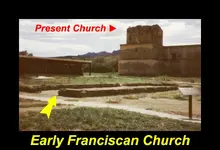
It was the Onate expedition of 1596! In regards the Franciscans not being in Arizona prior to the Jesuit expulsion of 1751, that's not true. The Franciscans were here early on and it started with Coronado. In fact, Arizona was already a province of New Spain in the 1500's, known as Nueve Vizcaya. The Paloparado ruin and the so called rectangular church east of the present church are from the early Franciscan period. Sanford's book "Architecture of the Southwest" describes what an early Franciscan church looked like and it faced East To West, which is unlike the present monument ruins built later, facing south to north. The Virgin De Guadalupe mine was found in the 1500's and the treasure was buried in 1839 after Mexico won it's independence in 1821 and the new government defunded and secularized the chain of missions developed by the Jesuits and Franciscans. Another reason they hid their church treasures was because government officials were confiscating[robbing] the good padres of their loot.

It's apparent you're relying on what modern, propagandist, historians have written, used to cover up the truth. The last time historians told the truth about Arizona history was in the 1950's. It was in 1958 the reknown historian Edward Peplow proclaimed Tumacacori the oldest church in the U.S., because it is. Historically, there were churches in Oklahoma as early as the 1500's. These churches are what's known as frontier missions, that were built prior the mission chain used later along major rivers and their tributaries.

I'm not knocking you Mike for your opinion, but I suggest that you spend hours-as I did-in the U of A library and Special Collections. However, you'll find it difficult to use the search engine to find some of the documents that were easily accessible when I did my research. I caught Liberals and Academics purposely hiding the facts at the U of A and Arizona Pioneers Society, because artifacts are worth millions of dollars and they want it all for themselves. I laughed when the news announce that a famous U of A archeologist died and he left an estate worth more money than he could earn in his lifetime working for the college.

If you're truly interested in finding viable evidence I suggest that you go to the Capitol Museum in Phoenix. It contains all of the early history of Arizona. I've added this video with my photo gallery, showing marks and the peaks blasted off to cover up the treasure, including the song I wrote titled "Tumacacori". You can click on the link and you'll see that I've been all over the Tumacacori and Atascosa Mtns.

What Say Ye Treasure Geeks!
Bob
 

Last edited:
Oroblanco

The league is a time's type of measurement and it's length depends of the terrain difficulty and of the human capabilities in hiking or walking . One league in the jungle could be 500 yards and on the road 3 miles . So , the distances in leagues which are written on the maps , are with approximation . To find the site , have to use the other details which are described , with an oral attachement to the map or with a specific drawing on the map .
In the Molina's map , the distances are not measured in a straight line , but following and adding the length of the lines .
 

rpezzp51 wrote
Sorry Oroblanco!

It was the Onate expedition of 1596<snip>

Sorry to you Bob, you are replying to our mutual amigo Gollum, the statements you address are his. As a side point here I have been at this for thirty years plus now, proof is in the pudding as they say. Besides, the Onate expedition nor any of the earlier Franciscan 'entradas' into Arizona never founded any missions so their presence was ephemeral, leaving little trace that they had even been there.

 
Markmar wrote
Oroblanco
 
The league is a time's type of measurement and it's length depends of the terrain difficulty and of the human capabilities in hiking or walking . One league in the jungle could be 500 yards and on the road 3 miles . So , the distances in leagues which are written on the maps , are with approximation . To find the site , have to use the other details which are described , with an oral attachement to the map or with a specific drawing on the map .
In the Molina's map , the distances are not measured in a straight line , but following and adding the length of the lines .

Well you are partly correct here in that the league as a measure of time and distance, being how far you travel in an hour, and partly incorrect in that these areas we are talking about were MAPPED by father Kino, and others. A map is done quite differently from simply estimating how long it takes to walk a distance. Father Kino packed his astrolabe all over Pimeria Alta with him, physically measuring distances, latitudes etc and his map was the best available for a century. The issue is that there was a "legal" league and a "common" league, we do not know which was used by the padres and it appears that they used both almost interchangeably when they are different. This issue has been a problem all over the southwest for the old Spanish land grants and surveys often have different measurements, just ask any surveyor working in Texas what I am talking about. When exactly was the map or chart made? The league varied over time too so this is important for there were DOZENS of local variations in almost all measurements especially the league, and no standardization until the reform of 1801! Now toss in that many of the padres were not even Spaniards and may have used German, Swiss, Basque or Italian measurements in their mapping and records, and you start to see the issue!

Then there is the Vara, supposedly based on a normal step of a man, the "official" vara being 0.8359 meters, however once again there are dozens of local variants also used as "official" ranging from 0.768 meters to 0.912 meters and a Barcelona 'cana' vara being 1.555 meters. Now, exactly which of these Varas was the map maker referring to? This is what I was talking about when I said that even if you have the key to the Molina documents and/or map, you still have the problem of working out exactly which measurements the map maker used.
 

Sorry for once again wading far into the weeds, please do continue.
Oroblanco


:coffee2: :coffee: :coffee2:


Senores Oro, Marius, Rpezzo51, Gollum…….excellent discussion from which I have learned much…..gracias…….
 

Oroblanco

But because the league and the varas have various lengths , were used in the map . Were used to lure and confuse . Have to see the map geometrically and the key is the San Ramon waters .
Want to make it more simple ? Go from the mission to San Ramon waters and do a measurement . After go about the same distance to a location which is between San Ramon waters and the mission like in the map . Now you are very close and if you use the other clues , you will find it .
 

Roy,


Even with the correct usage of a key, using the wrong copy of the Document will get nobody anywhere. It is chock full of misspellings and poor grammar that are different from the original document.


Also, thanks. That was my reply to Markmar as well. Franciscan involvement in the Coronado Expedition was strictly for the expedition. The Coronado Expedition founded no missions or churches.


rpezzo1,


Sorry, but I don't do revisionist history. I don't know what you are capable of, but I can translate Colonial Spanish Documents in Italic, Procesal, and Cortesana. Can you do Chain Writing? I know abbreviations and Colonial Spanish Terminology. If you have indeed spent as much time as you claim, then you should be able to (otherwise you have to rely on someone else's translations).


One thing we do agree on 100% is that Colonial Spanish History is constantly being revised by liberal academics. Your own Rep Raul Grijalva (as well as the BLM) is trying to say that very little mining was done in the Santa Cruz River Valley. They are doing that so the entire area can be made either a State or National Park, and out of bounds to miners and prospectors. They even say that the "Planchas de Plata" was only a surface anomaly and that it was all worked out in a couple of months. HAHAHA Don't get me started on that.


Mike
 

Top Member Reactions

Users who are viewing this thread

Back
Top