mrs.oroblanco said:
People DID make money on the Stones - just not as much as they wanted to, starting with Tumlinson's wife.
B
Beth,
Since it has been a while since all this was hashed out in my old Stone Maps Thread, I will reiterate it briefly here.
I spent MONTHS researching the history of the Stone Maps AFTER Tumlinson supposedly found them in 1949. I received information from several sources. Some of it was "trust me" type information, and some of it was copies of legal documents. I have also said it OVER and OVER and OVER.......Don't look at what was said. Look at what people did!"
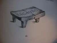
1. Travis Tumlinson kept the stone maps pretty much secret for the years he first possessed them (1949-1956). When he got too sickly, he passed them to his brother (Robert).
2. His brother possessed them for several years, and NEVER attempted to sell them. The only person he ever told about them was his landlord in order for him to pay for several trips (four I think) from Oregon to the Supers to try and figure the secret. When he became too sickly, he passed the stone maps back to his brother (about 1960).
3. Travis Tumlinson, still to sickly to do anything with them, kept them a secret until his death in 1961.
SO FAR..... Neither Travis Tumlinson nor his brother Robert, in TWELVE YEARS of ownership NEVER attempted to sell them. THAT ALONE tells me that they both believed them to be authentic treasure maps. Pretty simple assumption.
4. After Robert Tumlinson passed away. his wife (Aileen) told an old family friend about the stone maps (Clarence O. Mitchell). Mitchell OFFERED to buy the stone maps for $1200. Aileen Tumlinson sold them to him. NOW.........would you (or anybody you know) sell something you knew or thought to be fake to an "old family friend"? I wouldn't.
5. Clarence O. Mitchell formed MOEL Inc. (MOEL= Mining, Oil, Exploration, and Leasing). The purpose of MOEL was Mineral and Oil Exploration and mining. Also leasing of mineral rich land to mining and oil companies. He kept the stone maps a complete secret (from all except his partners) from the time of his purchase in 1961 until 1964. It was around that time that "Travis Marlowe" came on the scene. Travis Marlowe was the ficticious "nom de plume" of none other than Clarence O. Mitchell. A LOT of people don't know that. It was at this time that the 12 June 1964 edition of Time Magazine featured an article about the Stone Maps. THAT'S when the proverbial sh... hit the fan.
6. I separated this section because it is a HUGE point of contention with many people regarding the authenticity of the stone maps. The story that most people have heard is that The SEC filed charges against MOEL Inc for illegally selling stocks using the stone maps to boost publicity and profits. THIS IS NOT TRUE!!!!!!! It is also said that the FBI confiscated the stone maps and took them to a Professor of Geology at the University of Redlands, Ca. I have not been able to verify that this happened, BUT Bob Corbin (the former Attorney General of the State of Arizona) stated that one day in 1964 (long story short), he saw the stone maps in the Justice Dept Office (in the possession of two FBI Agents). He was told by the agents that they had the stone maps inspected, and they believed that the stone maps were "AT LEAST" 100 years old.
Here is what REALLY happened:
MOEL Inc was indeed selling shares in the company. They had been doing that since MOEL'S formation. They had just not filed ONE form that was necessary for them to legally sell stock shares in the company during the year 1964. They were stopped from selling stock for a few weeks until their court hearing in Los Angeles in September of 1964 (I am on my laptop right now, and my copies of the legal documents are home on my desktop). The trial lasted for all of about ONE HALF OF A DAY! They basically showed up for court to prove that nothing fraudulent had happened. They then filed the proper form, and the issue was closed.
7. MOEL went about business as usual until about 1969 when the company started petering out. As part of a mutual agreement, Mitchell had an exact set of copies of the stone maps made, and he gave two originals and two copies to a partner, and he kept two originals and two copies. In 1971, Mitchell made a donation of the stone maps (for tax purposes) to the AL Flagg Foundation. They have been owned there, stored and shown by the Arizona Mining and Minerals Museum. In the mid to late 1980s, the museum wanted to have a few sets of copies of the stone maps made, so they could be taken around the country and displayed without endangering the originals (they didn't know that only two were original). They contracted a special effects company from Phoenix (I believe) to make about four sets of copies. They actually made 8-10 copies and sold some. They then sold the molds to an artist in Laguna Beach, Ca, who made original size and half size copies. All-in-all, there were about 25 or so sets of copies the stone maps made. A good friend of mine has one of the sets of copies hanging on the wall of his office.
Hope this helps.
Best-Mike
 I'll never tell!


 and going for a cold beer.gd
 ), and I had been working with 2 friends on finding it, and one of my friends called me up and said "I figured it out, come with me", I'd be packing my bags.