The very FIRST articles ever published about the Lost Dutchmans mine

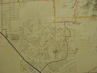
Coming from Apache Junction it was after "Silly Mountain". Close to where the new housing development went in. Golden something. Been a while since I went past there. Back then there was nothing between "Silly Mountain, maybe also called Dino Mountain. We stopped there more than once and I read the inscription more than once at the bottom of it. Now Waltx didn't take the stage and no it was not Wagoner, he did it from Globe. This one was Waltzer, not Waltz. Waltzer was the one that was supposed to have turned in $18,000 in gold at the Wells Fargo Office in Tucson. That was from more than one source I heard over the years and on another Treasure hunting site. That one also had a guy that said he went to the Denver mite and that they still had some of the gold samples there. Gold with Rose Quartz attached. He didn't say how he was able to see it. So that part is hearsay, but it did match a lot of the stories, but puts the Matchbox samples in bad light as that looked like White Quartz, not Rose. But in my mind 2 Dutchmen with "gold mines", one that cashed in $18,000 in gold and left going back East and back to Germany, and one that never showed much money, IE Homesteading a house and buried in a pauper's grave.
One with the "Fame" and one with the Money.
 

Hey Gollum and Oro, has anyone tried tracking down the AZ State Hyway monument that used to be on US Rt. 60 between Apache Junction and Florence Junction? I know it was still there in 1964, before they changed it from a 2 lane to 4 lane road. It stated "This is where the Dutchman would leave the Stag to go to his mine." It has a metal stamp out of a Prospector with a beard leading a Burro. It had a pull out for peole to read it and wee used the pull out to eat lunch there on the way up to Williams AFB, where my dad would take my mom for the Doctor visits. Just another landmark that time has removed.LOL

Wow you can remember that! I can remember seeing it but the gas station at Florence Jct was still there and running, I don't think I could find the exact spot where that sign stood. Anyone know?

:coffee2: :coffee: :coffee2: :coffee2:
 

LOL I remember stopping there on the way to the lakes for fishing and buying Cokes (Green bottles), the gas station that is. Trying to think of the correct name of the housing project. Golden Valley, Acres? Golden something, is about where the Monument was. Like I said when they widened the hiway to 4 lanes it was removed. That is why I started putting the different pieces together about there being 2 Dutchmen, 4 if you count Wiesner and Wagoner. Waltz and Wiesner were partners until Waltz went to Queen Creek for supplies and found Wiesner staked out and dying when he got almost back to the diggings. Waltz stagered into Phoenix almost dead from exaustion and lack of food and would not go back out for months, as he was afraid of the Indians. Waltzr was the one that would ride the stage and get off past the hill and hike to the outside edge of the Supes rock hunting. Until he stopped showing the stage driver the rocks he had found, LOL But that monument was there as a marker for where he "left the stage". I always figured the Waltz entered the Supes by the Peralta Trail head as he went to Queen Creek for more supplies rather than going back to Phoenix. Just trying to be logical about what storys that could be verified. I believe that Waltz had his "Bank" in the candle Box from when he worked other mines and Hi Graded ore from them. He never seemed to have any "Real Money/Gold" that he showed anyone while alive. He was a Citizen so he could have filed a claim in the Supes if he wanted to. He did files other claims, why not one in the Supes? Those are the questions that come up in my mind about Waltz. BTW Both Waltz and Waltzr were also Jacobs. LOL Just to add to the fun of trying to get the real facts from the storys.
 

audigger53

I agree with you the Mexicans and Waltz have entered the Superstitions at the south side through " Peralta trail ". And this because this place is the only gorge that enter the Superstitions from the west at the south side. All the other ( Hogs and Hieroglyphic ) are side canyons.
 

Ah but the Peraltas went up and back down the Salt River. That's why The Masacure Grounds. They were coming down the Salt River when they were driven up in the box canyon, twice. The mule skeletons and the 2 trenches the guy found in 1948 prove that to me. The only other "easy way" is First Water entrance. Been through both ways.
 

audigger53

I agree with you the Mexicans and Waltz have entered the Superstitions at the south side through " Peralta trail ". And this because this place is the only gorge that enter the Superstitions from the west at the south side. All the other ( Hogs and Hieroglyphic ) are side canyons.
I don’t think the Peralta trail existed in Waltz’s time
 

Never heard of a hardware or general store in Queen Creek at that time, either .
And Silly Mountain, Dinosaur Mtn. are Gold Canyon development landmarks.
Sounds more like a local folk tale, than a true historical account.
Might have been the developer who put the sign up, as a way to generate more interest in his project/building lots.
 

Last edited:
Ah but the Peraltas went up and back down the Salt River. That's why The Masacure Grounds. They were coming down the Salt River when they were driven up in the box canyon, twice. The mule skeletons and the 2 trenches the guy found in 1948 prove that to me. The only other "easy way" is First Water entrance. Been through both ways.

The monumented trail entered from the south. They used to enter from Salt River at the beginning , when they were tracking the placer gold to their source. Since they found the gold outcrops, they used to enter from the south. To the massacre grouns they were led by the Apache, and was not an easy exit having to pass Black Top Mesa and few canyons in their way.
 

I don’t think the Peralta trail existed in Waltz’s time

For this I have quoted the name in my post, because I was referring to the place.
 

Never heard of a hardware or general store in Queen Creek at that time, either .
And Silly Mountain, Dinosaur Mtn. are Gold Canyon development landmarks.
Sounds more like a local folk tale, than a true historical account.
Might have been the developer who put the sign up, as a way to generate more interest in his project/building lots.

There was a trading post where present Queen Creek is now. Silly Mountain is what I was told it was named by the guys that were bused from Apache Junction to Florence High School in 1960-63. Later people started calling it Dino Mt. Only hill off Rt 60 coming from Apache Junction on the Supe side before they made it a 4 lane Hi way. The Peralta Trail Head was there, just not named. Only way in from the South without climbing on foot. From the West it is First Water trailhead. At least from the bottom of the Supes. Further North there are other ways into the Supes, The Military Trail and from Tortilla Flats. many Arista sites were found on both sides of the Salt River by the guy looking fore the LDM some years ago. Not that many in the southern area of the Supes. That i have heard of any way, maybe Others have found them and can educate me on them. Always willing to learn real facts. BTW my handle I made 20 years ago on other forums and it has always been the same. I have been listened to and yelled at and it doesn't bother me. LOL What does bother me is that I no longer work which curtails my being able to go from the East coast back to Arizona, and having to take a lot more time hiking in due to getting older. I fully admit to doing dumb things like climbing up rock faces to top out and look at vistas and finding safer ways to get back out.
 

Last edited:
There was a trading post where present Queen Creek is now. Silly Mountain is what I was told it was named by the guys that were bused from Apache Junction to Florence High School in 1960-63. Later people started calling it Dino Mt. Only hill off Rt 60 coming from Apache Junction on the Supe side before they made it a 4 lane Hi way. The Peralta Trail Head was there, just not named. Only way in from the South without climbing on foot. From the West it is First Water trailhead. At least from the bottom of the Supes. Further North there are other ways into the Supes, The Military Trail and from Tortilla Flats. many Arista sites were found on both sides of the Salt River by the guy looking fore the LDM some years ago. Not that many in the southern area of the Supes. That i have heard of any way, maybe Others have found them and can educate me on them. Always willing to learn real facts. BTW my handle I made 20 years ago on other forums and it has always been the same. I have been listened to and yelled at and it doesn't bother me. LOL What does bother me is that I no longer work which curtails my being able to go from the East coast back to Arizona, and having to take a lot more time hiking in due to getting older. I fully admit to doing dumb things like climbing up rock faces to top out and look at vistas and finding safer ways to get back out.

Gold Canyon map which shows both Silly Mountain and Dinosaur Mountain.....
The town of Queen Creek was called Desert Wells in Waltz's day. It had a Stage Stop , but it was a long walk to the Sups from there. Also had a general store, "Higleys".... 1910-2012.
 

Attachments

  • Gold Canyon Map.webp
    Gold Canyon Map.webp
    115.7 KB · Views: 261
Last edited:
I am reposting this article here where it may belong.
1893


558F9B71-1459-42B1-9C86-2C4041D48AF9.webp
 

Last edited:
The "crematoria" cave maybe ?
"Two Men" = the two soldiers ?

The crematoria is not a large cave though. Big rock....little cave. Probably talking about the concavity above the Don's Camp at the base of the Dacite Cliffs.

Mike
 

The crematoria is not a large cave though. Big rock....little cave. Probably talking about the concavity above the Don's Camp at the base of the Dacite Cliffs.

Mike

Thanks.
I've never been to it myself. Or into any of those that are or might be in the bluffs at the south end.
I'd thought of the big alcove at the Don's Camp. But the article said UP, so I thought it must be something higher than that.
 

Thanks.
I've never been to it myself. Or into any of those that are or might be in the bluffs at the south end.
I'd thought of the big alcove at the Don's Camp. But the article said UP, so I thought it must be something higher than that.


There are no big caves up there. The crematoria is easy. Its between Don's Camp and Peralta Trailhead, and half of the way up from Peralta Rd to the base of the cliff:

PeraltaRoad.webp

Mike
 

some interesting snips from this book.........

Lost mines and buried treasures of the West : bibliography and place names, from
Kansas west to California, Oregon, Washington, and Mexico by Thomas Probert

can be found here, its free to sign up and borrow
https://archive.org/details/lostminesburiedt00prob


i havent looked for this article yet, sounds like it
might be about julia
A Queer Quest Another Lost Mine Being Hunted By a Woman
Arizona weekly Gazette,sept.1,1892

Screenshot 2019-08-19 at 5.23.47 PM.webp


anyone know who Milton F.Rose is,or know of the research material

Screenshot 2019-08-19 at 5.26.51 PM.webp


how the dutchman/waltz section is set up, there are 15pgs
of listed books, articles. from pg 25-39 in book

Screenshot 2019-08-19 at 5.29.17 PM.webp
 

some interesting snips from this book.........

Lost mines and buried treasures of the West : bibliography and place names, from
Kansas west to California, Oregon, Washington, and Mexico by Thomas Probert

can be found here, its free to sign up and borrow
https://archive.org/details/lostminesburiedt00prob


i havent looked for this article yet, sounds like it
might be about julia
A Queer Quest Another Lost Mine Being Hunted By a Woman
Arizona weekly Gazette,sept.1,1892

View attachment 1744468


anyone know who Milton F.Rose is,or know of the research material

View attachment 1744469


how the dutchman/waltz section is set up, there are 15pgs
of listed books, articles. from pg 25-39 in book

View attachment 1744470
milton rose claimed to have found the ldm..in four peaks....his family owned a newspaper..i think the mesa tribune,,,,
 

To rk85044: I tried to reply to your message but it would not go through using "rk85044" Cordially, Gregory E. Davis
 

some interesting snips from this book.........

Lost mines and buried treasures of the West : bibliography and place names, from
Kansas west to California, Oregon, Washington, and Mexico by Thomas Probert

can be found here, its free to sign up and borrow
https://archive.org/details/lostminesburiedt00prob


i havent looked for this article yet, sounds like it
might be about julia
A Queer Quest Another Lost Mine Being Hunted By a Woman
Arizona weekly Gazette,sept.1,1892

View attachment 1744468


anyone know who Milton F.Rose is,or know of the research material

View attachment 1744469


how the dutchman/waltz section is set up, there are 15pgs
of listed books, articles. from pg 25-39 in book

View attachment 1744470

Outstanding work! Thanks, Jim
 

Top Member Reactions

Users who are viewing this thread

Latest Discussions

Back
Top Bottom