I apologise for not reading the whole thread only the last three pages but I was wondewring you said their was a fault and it parrells the veins. which is to be expected be cause faults are zones of weaknes that the mineral laden water can migrake along. Small matter is the land fairly level when you say all 3 veins and the fault strike 218 degrees?
No, not at all. I tried to get Map Developers to draw me out a elevation profile, but for some reason I could not get the application to work. But to give you a rough idea, the terrain is somewhere around a 250 foot + or - drop in elevation along the strike lines.
Yes the dip is almost 90 degrees, perhaps 85 degrees and runs pretty consistent throughout the 2000 acres or so of this unique geologic zone.
Are they normal faults, reverse or thrust faults or side slip faults like the san andrayus fault.
This is a strike-slide fault, and is likened to the San Andrius Fault in almost every way. This one is inactive, but like the San Andrius Fault, when two tectonic plats came together, one being mainland Maine, and the other over the Atlantic, it pressed together and caused hills to form. Kind of like how when you push a blanket it bunches up and causes a series of folds. That is what we have here, in a very small area that can be seen on a relief map of Maine.
When you talk about the bed rock fading out soon after leaving your land do you meen that it it is deeper because along a fault the block that is away from your land has droped down and been covered by deeper soil and or alluvium?
No, not at all, and on this I guess I was not very specific, so thanks for pointing this out so I can clear this point up. Maine has very thin soil, most under 10 feet due to glacier action, so what I meant was, the TYPE of bedrock we have where I live, faded out. It just changed from this garnet-quartz-schist to a sandstone type of bedrock that is pretty common throughout Maine.
When you mentioned all the quartz rock in the old field walls, caused me to remember that south east of idaho city their was a mine cut on a most wonderful pure vien of quartz. alas the quartz was too pure not having any mineralization do not know how far down they mined but not one speck of gold was found.
It makes sense now that I think about it, and that what was I read too, that bull veins, or big wide veins of quartz just did not produce much because gold was dispensed up through cracking of the quartz. Without cracking, such as a wide vein of quartz, there would be no place for the gold to push through. But of course today, we have all this history of mining to go back to, and know what we know, because of all the mistakes that miners made back in the old days.
Very intrestiong writting just trying to visualize the structure underground. how deep is the soil in your fields?
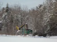
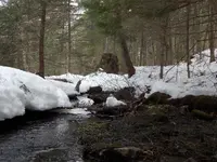
It depends on which side of the hill I am farming on. Because the glacier ran southwest in Maine, the southwest fields of the ridgeline have pretty thin soil ranging from exposed bedrock on the surface of the fields, to 18 inches. However the northeast fields, might have topsoil down to fifty two inches. But even then, the depth of topsoil varies widely. I can have 50 inches of topsoil in one end of the field, and yet in the middle have bedrock a few inches down.
This plays havoc with plowing, as I might wear out a set of plow points ever few hundred acres because the plow bottoms are riding over bedrock so much. In fact 90% of the time the spring resets quiver because the plows are riding on top of bedrock. It is very fertile soil, just not very deep in places, but thankfully grass and corn only need 4 inches of soil to grow.
Sorry for writting so much but you do sound like you have an intresting geologic formation
This is what the geologists tell me as well. For me, I feel kind of silly as I never recognized how unique this area is. But I have lived here all my life so I never knew any other kind of soil or bedrock. But we have been here since 1746, a story unto itself, but I think because of that, the mineralization here has been rather undiscovered. I suspect the geologists might know there is something unique here, but being private property, they cannot exactly say so. All their photos state, "public access can be seen on this road cut".


