The Peralta Stones

Morning Beth: you posted --> Sheesh - I believe with my whole heart that Ruth's death was natural. He was hunting for the dutchman mine, therefore, it is only natural that he had to die
***********

Sheesh, now you know why I only hunt the LDM from Mexico. I have enough holes in my head according to those that know me best.

Don Jose de La Mancha
 

Just for fun, I like to remind everyone, now and again, of just where the Stone Map Trail is:

StoneMapTrail-1.jpg


WestSideStoneMaps-1.jpg
EastSideStoneMapTrail-1.jpg


This is probably a first time view for David.

Joe Ribaudo
 

I saw that. What i didn't see, were the other marks that are on the stone maps. Where are those ?
At least my solution shows them all in their proper position.
 

Attachments

  • topomap.jpg
    156.5 KB · Views: 726
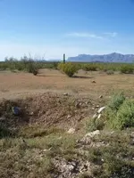
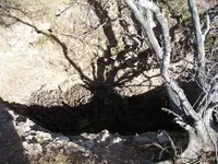
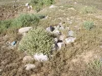
A shallow pit,dug in the area where the stones are said to have been found.One of five excavations in the area.
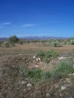
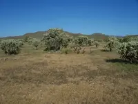
A view,as well in the direction that Joe believes the trail to lead,according to his topo map interpretation.

Regards:SH
 

Attachments

  • 100_0437sm.jpg
    100_0437sm.jpg
    141.4 KB · Views: 731
Right place,wrong pic.
This one is the proper direction.
SH.
 

Attachments

  • 100_0438sm.jpg
    100_0438sm.jpg
    57 KB · Views: 750
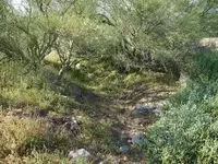
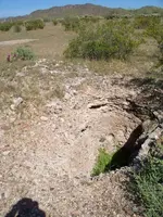
This is one of the other pits.
Note the mature growth on the embankments.
Regards:SH
 

Attachments

  • 100_0441sm.jpg
    100_0441sm.jpg
    93.5 KB · Views: 739
Don't mean to get off subject and hijack your thread, but, just wanted to know if anyone has seen the new topos now?

Many of the trails are gone, but they have added extra "overlays" that you can buy, one adds the smaller trails, one adds some of the older water sites, etc. A complete set, with all the landmarks equals either 6 or 7 maps (can't remember the exact number he told me on the phone).

I had called them because some of the new maps we ordered did not have many of the old features. He directed me to the site where I might buy the extra overlays that covered the landmarks we wanted.

So, if you buy a map and it is missing areas now, you'll have to go to the website and lookup the ones you want. A way to collect more money for the same information.

B
 

mrs.oroblanco said:
Don't mean to get off subject and hijack your thread, but, just wanted to know if anyone has seen the new topos now?.....

Check with the local hike/bike shops for older USGS quads. A possible better source is your local land surveyor. He might be talked into making you a full sized xerox copy of the early 20th century quads - the ones with the good stuff on them. Like most of our American culture that began its decline in the 1960's, the 'newer, better' maps are flashy fluff. Go figure ... or go tweet ... or whatever.
 

Quinan Bear said:
Sorry but I will have to decline on answering that question.
I will say that if you read about the history of certain Native groups, you will know that they were upset of the fact that gold was being removed and transported away. Gold to these people was a symbol of their god in one way or another., They saw this act as desecration to their secret lands and a crime against their god.

This Native vault will not be shown to you by me. The places that i show are in respect to the Peralta stones and nothing else, although I did find a place that corresponds to the directions that waltz gave that lead to his mine.

This place was hidden by an army of people (natives) and it will take an army to reveal the entrance. Sorry but I will not give you any more then that about the "Native Vault". I did say earlier that there could be a large room that is in the center of a cave system.
Ah come on now. Bet the Apache were tripp'in when they saw the Spanish Map Maker 800 feet up with hemp rope and a Hot Air Balloon, as he designed where they would alter the terrain in a way that could only be seen if you were up high on hemp too. Notice those twisted look'in paper shape and space maps that have been fool'in ya'all all this time? Ya know the Spanish ones? Tie your ballons off at the Main Outfield Apex gentlemen.
 

Balloons?
See what happens when you take a vacation.
Balloons are so.........yesterday.
Now we got GOOGLE EARTH.

Regards:SH
 

Hello Somehiker, I see you have an interest of the location where the psm's were found. Some say it's a trackless section of the superstitions, an area with no distinguishing marks. Others say it was to close to the road, not exactly out in the sticks. Another's conclusion is that they fell out from a running mule in that very spot. This I find very hard to swallow, since none of the four stones got broken. Here are my thoughts as to what took place: 1847 the date on the psm's, not a date picked out of the blue just to fit my theory, the mexicans working the mine were in the middle of a losing war with the U.S. Unsure of the future, the map was made of stone to be buried there, not to take anywhere. They didn't want to be caught by U.S. soldiers with any map. They precisely buried them days before heading out with what gold they could carry. The one or two who buried the stones was or were probably killed. The simple waybill to the psm's? After crossing the Gila towards the Apacheria, find the X that marks the spot. The X ? Two imaginary lines that cross there, found with a compass. The highest mountain to the north ( 4 peaks ), and the highest mountain to the east ( pickett post ) Homar
 

Hi Homar:
That section,of what is currently grazing land,is far from trackless and there are a number of distinguishing features that give clues as to it's historical importance.I have only explored it once,for a few hours,finding five definite excavations.Three of those were relatively shallow but of a fairly large area.One of the three had a pile of large rocks (rare for the area) to one end,as though someone had moved them aside before beginning the dig.These were not mixed in with the piles of excavated material (mostly sand and gravel) as was the case with all of the other excavations.The other two holes,as you can see in these photos,were different.It looked to me that someone had decided on a more precise location and was going to dig downward until the object was reached.The holes were scattered over an area beginning about 100 yds from the present highway and for a further 200 yds or so.The two deepest holes were both within about 30 yds of the bluff on the southeast side of Queen Creek.Just beyond the last hole was a ravine that would have allowed easy access to the creekbed about 40 ft below and onward to the Supes..There are a number of aged saguaro scattered about as well.A rockhound could just about do a complete geological collection by walking the banks of Queen Creek in this area.Of the four corners made from the highway crossing of Queen Creek,this is the highest and only one from which Weavers Needle is visible.An old drainage ditch forms a triangle with the longest side at the highway.This may have been where the rest stop was located in 1949.
I am developing my own theory regarding the history of the Stone Maps,based on what I have found through research and my time spent on what I believe to be the trail depicted on the stone map set.I feel that the maps have no connection to the Peraltas,or to DeGrazia for that matter.I am certain that the Stone Maps as well as the Bilbrey Crosses and the Perficio Map all refer to that which was taken into,not out of the mountains.That what lies at the end of the trail(s) is not what the Peralta and Gonzales miners came to find,and died for many years later.They were close,though.Very close.
You have made some good points,Homar.Worth looking into.I will tackle those in my next post.

Regards:SH.
 

Attachments

  • 100_0414 sm.jpg
    100_0414 sm.jpg
    183.2 KB · Views: 523
  • 100_0427sm.jpg
    100_0427sm.jpg
    116.6 KB · Views: 515
  • 100_0431sm.jpg
    100_0431sm.jpg
    129.5 KB · Views: 510
Homar:
It did make sense to me,the supposition that the stones had fallen from one of the mules that eluded capture by the apache at the time of the Peralta massacre.It seems to be well established that such a massacre took place.The question remained,for me,as to why the maps were inscribed on stone in the first place.I could never envision a navigator,astride a horse or mule at the head of an expedition,negotiating rough terrain,whilst carrying a slab of stone in one hand and reins in the other,without the vision being somewhat comical.
Mapmakers have been using hide,sailcloth and paper for hundreds of years and sending these maps worldwide by land and sea.Stone maps,in comparison,are rare.They are also heavy and their transport in and especially out of the mountains would have meant leaving something of greater value behind.Supplies on the way in and gold ore on the way out for instance.As such,the use of stone seemed to be problematic when it came to attributing their origin to the Peraltas or any intent by the map maker that they be used as portable guides.
Your idea as to the reason for the inclusion of the 1847 within the heart pocket of the second trail stone is interesting.Others have suggested that the deteriorating situations with both the US and the Apache prompted the mexicans to make a final and risky expedition into their mines during the time frame that 1847 falls within.But why carve a second 1847 on the bottom of the Priest Stone? And why record a date at all,unless that action was taken in a post discovery attempt to legitamize the maps as Peralta relics? Several details have made me wonder if this was not the reason for the Miguel and P(edro) names addition to the trail maps as well.
Your observation that perhaps Four Peaks and Picket Post were used as cardinal direction compass locators is well taken.There is a problem,however,in that Four Peaks as viewed from the discovery site does not appear as the highest point to the north.It may be of the highest elevation,but the perspective makes it appear of less height than other mountains along the N/S sight line.It's not prominent at all.Picket Post mountain is south of the easterly sight line a bit,and can barely be seen from the discovery site,due to intervening terrain.

Regards:SH.
 

Attachments

  • looking east.jpg
    looking east.jpg
    70.6 KB · Views: 494
Hello Somehiker, In my opinion the maps were made of stone for the sole purpose of enduring being buried in the ground, not meant to be carried around. Once uncovered they could be traced or copied to lighter material. finding the X as I said would take one or maybe two persons. If picket post was south of the easterly sight line, it only means you are not right on the X. If you found the X where picket post is directly east, is this X on the top of the road? Meaning no disrespect, how can you believe the psm's fell out of a running mule from the Peralta massacre, and yet don't believe they are Peralta maps? Homar
 

"Meaning no disrespect, how can you believe the psm's fell out of a running mule from the Peralta massacre, and yet don't believe they are Peralta maps?
Some things make sense to me,Homar,before I look into them myself.Such was the claim,made by those who had,that the stones had fallen from a mule which was returning untended,to home base after the massacre.Domesticated animals often do that,following the route that they are most familiar with.
Any load carried by a draft animal needs to be re-secured occasionally to prevent loss.That also makes sense and fits the narrative,which seems to be accepted by most,if not all.This acceptance does not mean that the scenario is correct,however,and the flaws are what I was trying to point out.
Perhaps I was not clear enough,but it is my belief which is based on an ever growing body of evidence that I have been accumulating,that the Peraltas had no connection to any of the stone maps.

Correct me if I am wrong,but it seems as though you are subscribing to the concept proposed by previous analysts that the curved "F" on the lower "DON" map represents Picket Post mountain and that the first "X" indicates the location of the buried maps.In my opinion they do not,a conclusion based on tangential research, that I reached some time ago and reinforced with my recent visit to the site.If one were to reposition oneself to a point where Picket Post was due east,clearly visible and recognizable,he would find himself very close to Florence Junction.So no,I don't have any reason to believe that the original discovery side was located under what is now the Superstition Freeway.While the maps were,of course,intended for burial at points predetermined by their maker,I suspect that those points lie within the terrain between the Priest and the Horse,nowhere near Queen Creek.

Regards:SH.
 

HI SH: for the land grab, the land grab. If they had simply fallen out, they would have been found long before since they would have been on the surface.

I have never heard of a stone map prior to this. As you said, they used animal skin, fish skins, paper, parchment, or whatever was at hand. No-one in their right mind would use something that required a precious and scarce animal to move.

I had access to one of Tayopa from the 1600's that was made in two halves of a goatskin, and another of the loot that the Pirates buried in the grounds of the Church at Mulege. It is on a piece of fish skin. Still there he hehe.

Don Jose de La Mancha
 

Hi RT:
I've studied the Reavis Land Claim controversy and have yet to come across any reference to the stone maps within the accounts of the day,or the deeds and documents available for examination.The first references to the maps being part of that fraudulent scheme seem to appear as part of the debate over the origin of the stones well after the existence of the stones was first published.
Surprising,when you consider that a movie,the"Baron of Arizona" had premiered in movie theaters in 1950.The only reference to any marked stones was related to petroglyphs that Reavis insisted were border or corner markers of the land grant area that he was attempting to claim.
I see nothing on any the stones that would suggest to me their creation as part of the land grab attempt.
There are other stone maps out there.Not as well known,nor complicated though.

Regards:SH.
 

SH,

There are most definitely other stone maps out there. One is documented, but I have yet to see it.

Best-Mike
 

Okay,

For those of you who wonder why ANYONE would make a set of stone maps instead of using skin or parchment, here you go:

Lets say you don't go into the same area every year. Maybe every 5 or 8 years. Your country in Northern Mexico is in constant upheaval. Fighting the Spanish. Civil War. Fighting with the Texicans. Parchment or skin maps can be burned, eaten by rats, erased by water, and destroyed any other number of ways. It can also be stolen by any number of bad guys.

Instead of making maps that lead all the way to your mines/treasures, you make maps that lead you to an area outside the mountain range that is your destination. Once there, your paper maps will guide you to the stone maps that are made in sections and hidden. Once you dig up and piece together all the stones, you copy those over to paper and rebury the stones. The only thing you have to worry about is someone getting the first set of maps leading from the Real to the edge of the range. Even if they do get those, they have no guarantee of finding the stone maps (that extra layer of security seems good to me), therefore your mines/treasures are still safe.

Best-Mike
 

Top Member Reactions

Users who are viewing this thread

Back
Top