The Indian Way Bill

Hey Curtis! Love to take credit for that video but Ky Hiker posted that. Pretty interesting stuff! Seems I heard they ran across a mine when building the dam. Maybe I read it here somewhere? Yeah I’m guessing the rock house caves in a little concealing the other side of the mine. I’m mixed on if the Waybill and Swift are connected as well. I think it’s possible Swift mined here, however for the most part I believe it’s two separate legends.
 

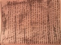
Well I found a folder that I had a lot of my research in! Thought it was gone! I have a copy of the manuscript that was obviously printed on an old typewriter. At the top it says “copied from the old manuscript in August 1927. I posted a pic I took of it. Just thought it’s interesting if it was copied then. 86B92C4A-943F-4D7F-9461-C0A1FC30B892.jpeg
 

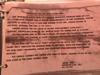
Got another copy that looks old too. Don’t look as old as the first I sent and looks cleaned up more.
 

Attachments

  • 32677785-C026-4DCF-AA2E-2B65C55E89E7.jpeg
    32677785-C026-4DCF-AA2E-2B65C55E89E7.jpeg
    2.1 MB · Views: 225
Wow I found this on the last page of that second manuscript I sent . Provides a little history of the manuscript. Wondering if the first one I sent could be a copy of Sellers and the second a cleaned up copy? I forgot I had all this.796EAB48-23F2-4D55-825E-33E70C53C163.jpeg
 

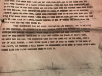
At the end of both copies someone adds a paragraph and says “we have the gap and our property at Cranes Nest is similar” (not exact quote). Interesting cause Matthew Sellers owner property there and the first copy I posted may be the original005C0061-9221-4992-B37B-0D21094721B9.jpeg written by him. Here’s a pic of that last paragraph taken on the second copy. Again it’s cleaned up more.
 

So second copy must have been typed in 1974 but was a direct copy of what Matthew Sellers the 3rd had, which may be the first copy I posted. Again not sure if it is the first copy but looks much older. The cool thing for me is the statement by the Edward Peck guy saying it was copied “verbat in” from Matthew Sellers the third original copy. If that is so then it would be the most reliable version.
 

Last edited:
Even the land owner thought these were the Swift mines? Hmm!
To you guys who know the area, is the richest mine described SW of the the others? or West? It sounds from the description that these 'mines' are all in close proximity to each other?
Obviously the crane is the tribe indicator for the mines possession. I remember Boomer saying there is a crane carved at the mouth of Indian Creek at the Red river and another further South in KY...on the Rockcastle river maybe? I know I read the thread here somewhere. I should have taken notes when I read all these threads!
 

I found that interesting as well. The land owner was Thurston Skaggs. His family still lives on that land. Im not sure who the Edward Peck guy is though. The four mines are within a short distance of each other. I cant remember which mine is supposed to be the richest, Ill look tonight when I get home. Yes there is a crane with an Indian pointing at it with his bow. The carving is underwater part of the year and is starting to fade due to erosion. I remember Boomer saying something about another crane being around Painstville maybe? Not sure on that.
 

I found that interesting as well. The land owner was Thurston Skaggs. His family still lives on that land. Im not sure who the Edward Peck guy is though. The four mines are within a short distance of each other. I cant remember which mine is supposed to be the richest, Ill look tonight when I get home. Yes there is a crane with an Indian pointing at it with his bow. The carving is underwater part of the year and is starting to fade due to erosion. I remember Boomer saying something about another crane being around Painstville maybe? Not sure on that.

The tribal crane marking may be what ties all the locations together, a sign of who owns or has possession of the mine. Cranes are birds that live on and along water.
 

I'm actually going to research the crane and see if I can find any tribes that it was special to! Be interesting to try to nail down the exact tribe that may have carved it.

QUOTE=KY Hiker;6366157]The tribal crane marking may be what ties all the locations together, a sign of who owns or has possession of the mine. Cranes are birds that live on and along water.[/QUOTE]
 

I'm actually going to research the crane and see if I can find any tribes that it was special to! Be interesting to try to nail down the exact tribe that may have carved it.

QUOTE=KY Hiker;6366157]The tribal crane marking may be what ties all the locations together, a sign of who owns or has possession of the mine. Cranes are birds that live on and along water.
[/QUOTE]

The discussion about the crane in much earlier threads said there was one on the Kanawha and Sandy, as I recall, and then on the Red at Indian Creek and also another river further South. Probably would take a day searching for it through all these threads. I don't remember if the tribe or a chief was associated with it though.
 

Think it was a Chief that was called Crane. There is one carved in stone on Paint Creek, under water now by means of Paintsville Lake.
 

https://www.wyandotte-nation.org/culture/history/biographies/tarhe-grand-sachem/

Found this article on a Chief "Crane" Tarhe. I had never heard of him and he probably nothing to it but a couple things stand out to me. Havnt researched much but here is what I learned from this article.

1. The time frame for this Chief is right for the Waybill. Chief Tarhe lived from 1742 to 1816

2. Fought with Chief Cornstalk who is associated with the Swift and Waybill legends

3. Chief of the Ohio nation all the way to Ohio River. Certainly he crossed into Kentucky at some point

4. Associated with the Braddock Campaign, who I believe Swift is said to fought under.

5. Was at battle of Point Pleasant which is getting closer again to Waybill area.

6. He was also in the battle on the Kanwha which runs near Point Pleasant. The Waybill starts at the Big Kanwha.

7. The article says he was somewhat educated, so perhaps he could read and write.

Again I just quickly pulled this information from this one article so I could be way off base but something interesting to think about.
 

There,s a lot of info that points to the eastern part of Morgan Co. In some of the journal supposedly penned by Swift.
 

Hey Rebel! So you think this Chief Crane may be where the Crane carving of the waybill came from? Just curious your thoughts. I had never heard of him before!
 

Awesome man. Did you find any evidence he was in the Little Sandy area? Im assuming he was. He would make a lot better sense then Chief Joseph. Was Crane educated like I read? Not many Indians during that time were so I could see how him and Joseph would be mixed up. Has that carving been found in Ohio as well? Any additional information would be greatly appreciated!

YEP! Done LOTS of R & I on the tribes in "OLD" Virginny, which covers YOUR area...
 

Top Member Reactions

Users who are viewing this thread

Back
Top