Spanish Missions

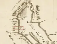
It also shows up as part of the Treasure of Tumacacori on that map. Could be another Jesuit Map? Nah, just a fake!

View attachment 1640719

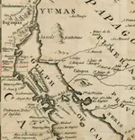
Cant ever tell about that map Bill. Mitchell first showed it in 1931. Santa Isabel was well known. Santa Isabel is not in Southern Az. It is supposedly in Northern Baja on the Gulf of Cortez.

Somewhere, I have a copy of the oldest version of that map. Looks like it was drawn on a brown paper grocery bag. HAHAHA

Mike
 

Waiting.... :hello:

LOL I have a real job too. I will dig it out this weekend. I am going to be at Tom K's Memorial Service on Saturday, but Sunday should be good.

Mike
 

Cant ever tell about that map Bill. Mitchell first showed it in 1931. Santa Isabel was well known. Santa Isabel is not in Southern Az. It is supposedly in Northern Baja on the Gulf of Cortez.

Somewhere, I have a copy of the oldest version of that map. Looks like it was drawn on a brown paper grocery bag. HAHAHA

Mike

Better tell that to Dan DaSarno so the poor guy can stop searching for that Tumacacori Grocery Store Treasure!
The first version I saw was from Ron Quinn and it was a fake also. The one I just posted came from Dan back in 2001. If I only had all the money people have spent over the years looking for this Treasure and the stone Maps Treasure I would be rich!
i wish i had the money these poor investors have spent on the stone maps...lol
 

i wish i had the money these poor investors have spent on the stone maps...lol

Ron Quinn knew John Mitchell well and never gave him any credit for telling the truth. If Mitchell was the first to display the map I would definitely say it's a fake. I was told it came from Don Page's collection of Franciscan Mission Maps before he died. Of course Mitchell and Page knew each other I believe so anything is possible. It may be possible the Franciscan's acquired and hid the Jesuit Treasures after the expulsion in 1767. Before that all Jesuit Mission complex's on the frontier were mud hut Ramada's with small houses and oval walled compounds just like the original Tumacacori was. There were more than one historical uprising against the Jesuit's though.
 

Cant ever tell about that map Bill. Mitchell first showed it in 1931. Santa Isabel was well known. Santa Isabel is not in Southern Az. It is supposedly in Northern Baja on the Gulf of Cortez.

Somewhere, I have a copy of the oldest version of that map. Looks like it was drawn on a brown paper grocery bag. HAHAHA

Mike


Sur, un poco

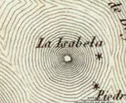
Isabel.JPG

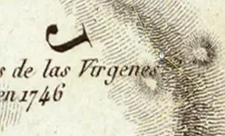
Virgins.JPG


AJones
 

If ya wanna see St Isabel, look for another word "AGUAJE". A lot of people make the mistake that the water source was named Santa Isabel. No, Santa Isabel is just close to the water source.

Mike
 

Some magazine stuff on Santa Isabel...If there's any interest, I have a lot more such stuff which I will dig out as time allows...

View attachment 1646157

There are actually two Santa Isabel Stories;

1. The Mission Santa Isabel which is in the mountains East of San Diego. This story has buried church vestments. A tree with two miner's candle holders driven into a "V" in a tree to point the way.

2. A Santa Isabel Mission that most say never existed. This one is in the rugged mountains of Northeastern Baja. It was supposedly a waypoint for Jesuit treasure going to the coast to be loaded onto Manila Galleons for transit to the Philippines.

Mike


Nice articles . I will stay little on the Tumacacori mission article . There are some hilarious ( to me ) assumptions about father Kino didn't know where the old mission site was . Also , maybe he didn't find the treasure site because the document's text was changed with the purpose to confuse and he was not skilled in decrypting it .
The word " Redotero " is an anagram of " derrotero " and warns how the clues were mixed up to misslead .
The old mission is there where was all over the time , but maybe its ruins were confused with an old Spanish building .

The accurate clues from the water of San Ramon are ( the direction I will keep secret for now ) : 1800 varas from San Ramon water to the hieroglyph marker , 1200 varas from hieroglyph marker to the black rock marker and 600 varas from black rock marker to the Virgen de Guadalupe mina .
These are clues which you can't find in a whole life of research . Keep them to your chest .

I post a GE image of the San Ramon water site for those who don't know how looks like .

San Roman water.jpg
 

Last edited:
Nice articles . I will stay little on the Tumacacori mission article . There are some hilarious ( to me ) assumptions about father Kino didn't know where the old mission site was . Also , maybe he didn't find the treasure site because the document's text was changed with the purpose to confuse and he was not skilled in decrypting it .
The word " Redotero " is an anagram of " derrotero " and warns how the clues were mixed up to misslead .
The old mission is there where was all over the time , but maybe its ruins were confused with an old Spanish building .

The accurate clues from the water of San Ramon are ( the direction I will keep secret for now ) : 1800 varas from San Ramon water to the hieroglyph marker , 1200 varas from hieroglyph marker to the black rock marker and 500 varas from black rock marker to the Virgen de Guadalupe mina .
These are clues which you can't find in a whole life of research . Keep them to your chest .

I post a GE image of the San Ramon water site for those who don't know how looks like .

View attachment 1646573

You come up with some very interesting information at times marius...I wonder if I have been to any of those locations that you speak of???We may never know...

I will admit that there was a large black rock on the way to the real de minas that I have been to...And what of the watering hole???Or the certain formation on a trail leading to the trail that the black rock was on...

Does any of the information speak of the image that is carved into the large black rock marius???There is a very distinct image carved on the large black rock...And it is not a heart...lol

Ed T
 

Last edited:
To add something to my previous post and to the worthy clues . The hieroglyph marker is exactly half way in a straight line from the San Roman water to the Virgen de Guadalupe mina .
 

Top Member Reactions

Users who are viewing this thread

Back
Top