Spanish & KGC in the ozark mountains.

That can help... a little.
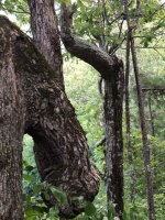
Thereā€™s a line of, trees that can define property lines.

The growth rate and types of trees on one side can rule parts out, as signs on trees [emoji269].

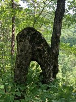
Your bent trees and burled tree may stand out as old or new depending upon which side of that line.

Lumber companies dictated the terrain that they left behind.

In the latter part of the nineteen hundreds, there was significant pressure from the federal guidelines, placed on the large scale lumber business to
either replace the trees, or create farmland.

That can help time era, of the re-growth that is around your site.

I hope this helps you, at least a little.

#/:0{>~
 

Thanks MIKEL your always making me think in different ways. That is always a help and blessing.
 

That was your information.
Just stirred it up with my imagination, and experience working in a sawmill, as a lumber grader, back in the seventies.
Dang, I suddenly feel old!

#/:0{>~
 

Orange, if you think it is a fence line, it may or may not be, BUT, to make sure, if you take two L rods and walk across the line, if it is an old fence line the rods will either cross or open wide. Try that on a chain link fence first to see how they work for you. They don't work same for everyone.

Thanks for the addvice elh. I can use rods pretty well. Used to locate water lines and power lines underground a lot. Put in many buildings back in the day.
 

Spanish & KGC in the ozark mountains.

Orangeman, I didnā€™t get the photo yet.

Maybe later....

#/;0{>~(c)
 

Last edited:
Orangeman I believe your tree and rock signs were put there by someone who had knowledge of kgc or oak etc. Do you use a detector? or wires?
 

If your allowed to dig in this area i may be able to help with that area in picture #608
 

Orange man: Your pictures # 608 I'm putting my directions on here and not pm how I believe it should be read because it is fairly simple. I'm surprised it is still standing and an animal hasn't knocked it down. Never seen one done this way which makes me think it is fairly early. The over all shape is a squared U, which indicates , a door, opening, gate etc. The white rock at the top is a pointer which because it is longer your expected to follow it in the direction it is pointing. BUT, looking at the other end of the U if you look at the shape of that orange colored rock close, it is a ducks bill. This duck is a water sign/ mirror image so you work it backwards. Go around to the back now, your second picture, and you'll see the treasure hole and the two signs, the white pointer rock and the duck. Now step back and bring these two lines together till they cross. It shouldn't be but a few feet since the signs are so close. The lines should cross somewhere around that flat rock . Now dig. If you find something there keep it even if its not money, especially if its metal but even if its just glass or a strange piece of rock. It may be a key which will give you the place where the treasure is. Good luck, hope its the real thing; Rebelsmom
 

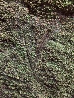
Thanks for the information rebelmom. No metal detector but can use wires. I can also dig there. Thereā€™s some civil war storyā€™s here of troops camped in a cave not far from my home now. The old folks told the stories and some believed others wrote them off. I didnā€™t know till I found there camp site, fox holes, short rock walls on a small flat under a cliff with a good size over hang. I found a single carving on a huge boulder right below there camp. Talking feet. Looked like it was done with a knife. ImageUploadedByTreasureNet.com1536552549.427201.jpg
 

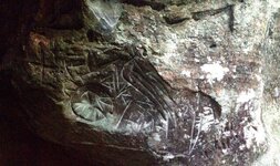
Do you have a picture that isn't so close up? you need to step back a few feet, I think I see an owl but your picture is cutting part of it off. PM me if you don't want to post it here.
 

Iā€™ll have to go back to it to get a bigger picture and I will. The V is only two inches or so and itā€™s in a crack between to huge boulders. The end of the crack looks like it was rocked up. Thatā€™s the end thatā€™s on the old river bank. The river doesnā€™t flow through there any more not when gets way up then itā€™ll over flow through again. Iā€™ll get back over there and get some more pictures to give you an idea of whatā€™s going on.
 

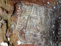
Rebelsmom I got interested in your map pictures because Iā€™ve got several here. ImageUploadedByTreasureNet.com1536677992.329902.jpgImageUploadedByTreasureNet.com1536678008.911899.jpg.
 

Thereā€™s lots of carving scattered out over about a mile. The two I posted are yards apart. On the same bluff.
 

Hello Orangeman, I haven't forgotten you, been out of town on business. I asked my partner ( my mom to look at your signs while I was gone). She's the one who taught me most of what I know and has worked out where the signs lead to. We will pm you in a few days as it might be to easy for others to get there first if I post it here. Will talk to you then ; Rebelsmom
 

Top Member Reactions

Users who are viewing this thread

Back
Top