Spanish & KGC in the ozark mountains.

Chadeaux is correct about the tree signs Orangeman but besides telling you which exit to take they also tell you what to look for when you find the right exit. It's more like a paradigm; A pattern or a model of something that exits or existed before. If you follow up the hollow to the left will it come out about where the google map I sent you faces? Since I already know where you need to be, following the sign is just to help you learn how to read the trail. Hope you received the google map if not let me know. And since I don't know which way your coming from and don't want to know you will have to decide which direction to take to get there.
 

We will pm you some more pictures in a day or two. Takes a little more time drawing them on the computer.
 

I’ll be walking a trail this fall. I’ll post pictures. Know I’ve been off awhile. But I’ll be back on more.
 

Those weather folks keep saying that fall is due any day... but not this week!!

Makes me wonder what they will say next week!!
I have been chasing some old train track right of ways, that were running in 1901.
Lots of train wrecks and a few early automobiles that were modified for the tracks one of which had all of its passengers jump for their lives!

The research has been fun and horrifying at the same time.

We are hoping to find a few campsites and pocket spills.... may come up with nothing, but the research has been really eye popping.


I’m having to learn how to navigate by learning the names of all of the “Knobs “(round hills)


They all look the same, makes me feel like a newbie.

#/;0{>~
 

Supposedly, an old Spanish silver mine was the source of the legendary "Yokum Dollars" of the Ozarks. The four Yokum brothers (no relation to Lil Abner) of southern Missouri (near present "Silver Dollar City"/Branson) had discovered an old Spanish mine with stacks of silver bars inside. When the Bank of Saint Louis failed around 1817, and the subsequent Panic of 1819, paper money was worthless - at least no one would accept it. The Yokums began producing dollar coins of the Spanish silver to allow the locals to engage in commerce. The story goes that "guvmint men" from Washington came to inspect/confiscate the coins and verified that they were, in fact of GREATER purity (94% silver) than official US currency (90%). The supposed site of the Spanish mine is suspected to be covered by Table Rock Lake, now. Although several "example"/specimens alluding to be Yokum dollars are extant, none has ever been verified as "authentic"...but without an original, by what standard are they judged? Whether or not the Dollars, or the mine, ever existed cannot be proven or disproven.
 

MIKEL we used to find the old loggers camps all over the woods when I was a kid. I haven’t seen one in a long time.
 

ImageUploadedByTreasureNet.com1587948241.066499.jpgImageUploadedByTreasureNet.com1587948272.999908.jpg. Took a walk today with a friend. This is what we seen along the trail.
 

We went looking for turkey tracks he had seen 15 or so years ago. Found this stuff instead. Still gotta try and find the turkey tracts.
 

The heart is chipped out on top of a long narrow rock. It’s sticking out of ground about 2 feet
 

I’ve studied up on the signs related to the trails left for us to find. I’ve figured out several of them already but the heart has got me confused. Has anyone got some experience with these markers and how did they work for you.
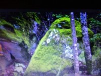
 

I’ve studied up on the signs related to the trails left for us to find. I’ve figured out several of them already but the heart has got me confused. Has anyone got some experience with these markers and how did they work for you.


My best find of a broken heart [emoji174] is for all practical purposes, is lost and forever gone, as it vanished after one of the many floods that have plagued mine and Weekender’s site.

ImageUploadedByTreasureNet.com1589067725.276126.jpg

One lobe forms the breast of the raven and the other lobe is turned around to form the wing.

Such a great loss, before it could be studied to it’s end, is tragic.

#/;0{>~
 

The high water has claimed on of my markers to. It’s a bad thing. I went back looking all over the place for it. It was not far off of a small stream. Only two things could’ve moved it water or a person.
 

I’m posting pictures of a trail I’ve been working lately. I’ve posted pictures of it before. But I’ll put them I order of how I think you follow it. ImageUploadedByTreasureNet.com1589079142.173389.jpgImageUploadedByTreasureNet.com1589079235.580173.jpgImageUploadedByTreasureNet.com1589079331.517885.jpgImageUploadedByTreasureNet.com1589079384.503862.jpg.
 

Thanks dog. Not had much time to get out and chase the signs. Been messing around with a topo map some. It’s interesting how it all lines up in strait lines.
 

Top Member Reactions

Users who are viewing this thread

Back
Top