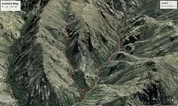
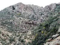
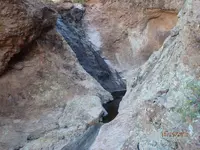
Similarities of the Perfil Map and Frog Tanks Trail

wayne...they already have them....

I've looked at what's available so far, but I'm looking for something that small with at least a 1/4 mile range and enough juice to go that far, linger a bit, and still make it back.
And because of the greater risk of loss in areas with many hazards, a low enough price to be able to say "oh well".
Might pick up one of the lower priced pocket drones though, and give it a try out where I've got some stuff to look at, but difficult to get to.

Going to have to get a smartphone to operate one of them pocket drones.

That'll force you into the 21st century, old man. :wink:
 

I've looked at what's available so far, but I'm looking for something that small with at least a 1/4 mile range and enough juice to go that far, linger a bit, and still make it back.
And because of the greater risk of loss in areas with many hazards, a low enough price to be able to say "oh well".
Might pick up one of the lower priced pocket drones though, and give it a try out where I've got some stuff to look at, but difficult to get to.

there are plenty of cheap small drones with 1/4 mile range...most of them have pretty good cams....if you want to go much beyond 1/4 mile then your stuck with dji
 

Already got an android tablet.......even know how to turn it on.
 

https://www.fs.usda.gov/detail/tonto/home/?cid=fseprd528575

Note the line that reads as quoted below...

No description I could find as to what happens if you get caught doing it, but I would assume at least a hefty fine. Use at your own risk


  • "Cannot take off from, land in, or be operated from congressionally-designated wilderness areas. Examples within the Tonto National Forest include the Superstition Wilderness and Four Peaks Wilderness areas."
 

That's one of the reasons I want something with a greater range, but that I can also pack in my carry-on when I fly.
There have been quite a few drone videos posted on Youtube, shot within the boundaries of the SWA and other wilderness areas.
I have yet to see any news of any of these amateurs having legal problems as a result. So overflights are apparently legal. I suspect the rule has been formulated more to absolve the FS from any responsibility towards those who might be injured or suffer property damage as a result of drone use around parking areas and hiking trails within wilderness areas, where the FS has greater power to impose such restrictions. Also keeps the tree-huggers off their backs.
 

Researchin

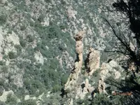
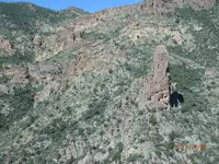
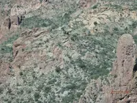
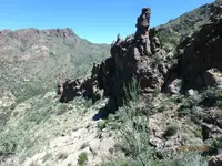
OK here it is guys, I`ve been interested in this area for some time now. And the more I look into it the more believe that this could be the place that Adolph Ruth was seeking. The Lost Dutchman. I guess like anyplace, you could make it fit if you wanted to and had an imagination. I know I`m probably way way out in left field, but here is what I came up with. I got a heapin` helpin of info from Glovers last book. Good book by the way.

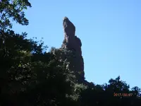
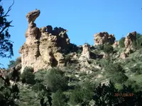
Waltz said his spire was 3k`s from a spring, Frog tanks spring is 3k from the spire in the photos

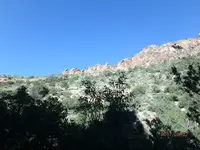
If you go up the hill, past the cave, then cross over to the saddle above the spire, you can see all the way up and down the canyon. A good look-out camp site.

To the south of the saddle above the spire is a peak with a hole in it, the hill going up past the cave

From the saddle above the spire looking north towards Rough Canyon is the drawing on pg. 324

Follow the 1st side canyon on the right past the head and spire until the wash splits.

Up there is a big rock structure with an elongated corner on the down slope

There is a big water tank that is deep in the shade and lasts a long time, but you need a rope to help get to it

Look at the area on G.E. and put the date on 6-2011. You will see a round pit on the west side, and a round shadow/hole on the east at the apex

P8070010.JPGP8070021.JPGP8070017.JPGP8070013.JPGP8080022.JPGP8080023.JPGP8080024.JPGP8080029.JPGldm.jpg
 

That's one of the reasons I want something with a greater range, but that I can also pack in my carry-on when I fly.
There have been quite a few drone videos posted on Youtube, shot within the boundaries of the SWA and other wilderness areas.
I have yet to see any news of any of these amateurs having legal problems as a result. So overflights are apparently legal. I suspect the rule has been formulated more to absolve the FS from any responsibility towards those who might be injured or suffer property damage as a result of drone use around parking areas and hiking trails within wilderness areas, where the FS has greater power to impose such restrictions. Also keeps the tree-huggers off their backs.

The only thing stopping me from splurging on a drone is the exposure issue- if you leave exposure on auto, it adjusts to the bright Arizona sun which means that every hole is going to show up on the screen as pitch black. Even if you manually adjust the exposure and open up the aperture as much as possible, you risk blowout, or blurry stills if you slow down the shutter speed.

Cheap cameras do not handle deep contrasts very well. To have any luck you'd need, at a minimum, a camera that shoots in RAW format and even then, a very early morning flight would be your best chance of "peering" into holes of interest.

I have been toying with a few other ideas as well- hopefully work up something manageable in the near future.
 

OK here it is guys, I`ve been interested in this area for some time now. And the more I look into it the more believe that this could be the place that Adolph Ruth was seeking. The Lost Dutchman. I guess like anyplace, you could make it fit if you wanted to and had an imagination. I know I`m probably way way out in left field, but here is what I came up with. I got a heapin` helpin of info from Glovers last book. Good book by the way.

Waltz said his spire was 3k`s from a spring, Frog tanks spring is 3k from the spire in the photos

If you go up the hill, past the cave, then cross over to the saddle above the spire, you can see all the way up and down the canyon. A good look-out camp site.

To the south of the saddle above the spire is a peak with a hole in it, the hill going up past the cave

From the saddle above the spire looking north towards Rough Canyon is the drawing on pg. 324

Follow the 1st side canyon on the right past the head and spire until the wash splits.

Up there is a big rock structure with an elongated corner on the down slope

There is a big water tank that is deep in the shade and lasts a long time, but you need a rope to help get to it

Look at the area on G.E. and put the date on 6-2011. You will see a round pit on the west side, and a round shadow/hole on the east at the apex

View attachment 1484126View attachment 1484127View attachment 1484128View attachment 1484129View attachment 1484130View attachment 1484131View attachment 1484132View attachment 1484133View attachment 1484134

the problem you run into when following waltz's clues is that we really have no idea what waltz really said....
 

Dave,

So true. Many Dutch Hunter's have come along....years later, and found interesting formations and made up stories surrounding those formations and attributed them to Waltz utterances. Others have created clues in the mountains to match stories. Some have even done that while in the company of noted historians.

That's not to say that Chuck has not found perfectly good clues. At least he's out there with his nose to the ground. Nice pictures Chuck.

Monument picture from Doug:


The Jesuit:


Good luck,

Joe
 

Last edited:
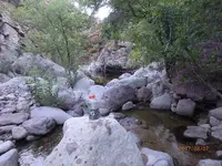
Side Canyon

Here`s a shot of the hill where the wash splits. Up there on the right side just out of site should be a pit/mine. 021 (2).JPG

The tank that you`ll need a rope to get down to, (is that gold nuggets in the front?) :zoom: 031.JPG :usflag:
 

The only thing stopping me from splurging on a drone is the exposure issue- if you leave exposure on auto, it adjusts to the bright Arizona sun which means that every hole is going to show up on the screen as pitch black. Even if you manually adjust the exposure and open up the aperture as much as possible, you risk blowout, or blurry stills if you slow down the shutter speed.

Cheap cameras do not handle deep contrasts very well. To have any luck you'd need, at a minimum, a camera that shoots in RAW format and even then, a very early morning flight would be your best chance of "peering" into holes of interest.

I have been toying with a few other ideas as well- hopefully work up something manageable in the near future.


I spent a year working the issues out of my Pocket Drone. If you want something turn key with a great 4k camera, get the DJI Mavic Pro. They run about $1300 retail. Best current folder around. Best video as well.

Mike
 

I spent a year working the issues out of my Pocket Drone. If you want something turn key with a great 4k camera, get the DJI Mavic Pro. They run about $1300 retail. Best current folder around. Best video as well.

Mike

i'm with you on the mavic...but wait about 6 months and dji will come out with a better model and you'll be able to pick up a mavic pretty cheap
 

I spent a year working the issues out of my Pocket Drone. If you want something turn key with a great 4k camera, get the DJI Mavic Pro. They run about $1300 retail. Best current folder around. Best video as well.

Mike

Mike,

The other issue I have is in regard to the focus. Have you been able to get your drone close to a hole or cave, close enough to see how the focusing works? Since auto-focus works by taking the majority of pixel information and maximizing the intensity difference, what I'm going to assume is that the autofocus will choose the most flat feature of the shot to manipulate.

But when you have a cave or hole with no fixed depth, that is going to throw the auto-focus off and you'll get a shot where the auto-focusing never really settles on one thing.


Focus isn't usually an issue. Most Drone Cams have fairly wide angle lenses, and focus is set at Infinity. Anything over ten or fifteen feet is considered infinity. Most zoom is performed post production, because the higher end drone cams are 4K. Some of the larger drones can carry a DSLR, but nothing so far as I know in a folding drone will.

Mike
 

the problem you run into when following waltz's clues is that we really have no idea what waltz really said....
It is what it is, and you have to start somewhere. It started for me when I made the decision to do more than think about it from behind a computer screen. One of the best moves I ever made.
 

Stroker

My opinion is how nobody ever will can find the LDM , if he/she don't knows where exactly is or don't knows at least how the place of the mine looks like .
Really , how you believe the mine place looks like ? Let's start with the thought how is not at the walking ground level .
 

Last edited:
Well Marius, I guess the Ldm by now looks like a shallow depression up on a side of a rocky hill. There should be something left behind by somebody. And then there's your third eye!
 

Top Member Reactions

Users who are viewing this thread

Back
Top