Now that the stone maps are out of the way, no movie/series....what's next?

Hi Joe - doing my best to keep my head above water and hoping to survive another winter out here. Still checking in now and then on "Dutchman" stuff, but most of my "hobby time" nowadays is spent reading and studying information about the Apache. Hope to get out to AZ this spring to check out a few places like Aravaipa Canyon, Fort Bowie, the Dragoon Mt's and a couple identified battle sites.

Between eating, sleeping and working that's what I do with my free time :).

Take care yourself and say hello to your wife for me.

Paul

Paul,

Glad to hear from you. If you get the chance, stop by and peruse my library. I have a pretty extensive collection on the Apache, both historical and pre-history. It's an interesting subject.

Our best to you and your wife,

Joe
 

Paul,

Glad to hear from you. If you get the chance, stop by and peruse my library. I have a pretty extensive collection on the Apache, both historical and pre-history. It's an interesting subject.

Our best to you and your wife,

Joe

I think you'd be surprised to see my ever growing collection. It doesn't rival your signed copies but I'm well over 150 books covering a variety of Native America, Apache War/Military, Archaeological, etc... and that doesn't include the LDM, Inca and other treasure hunting related books I have that are well over 100 too.

That said though, if I can swing 2 weeks off I'll see if I can make it up your way for a day. I'll be in touch.

Paul
 

Hope to get out to AZ this spring to check out a few places like Aravaipa Canyon, Fort Bowie, the Dragoon Mt's and a couple identified battle sites.

I've been to all three places.

Aravaipa has a old mining district east of the fort site. It's close to Dudleyville and Winkleman with the old stage roads. If you take the Arivaipa canyon west it suddenly has running water out of no where there is an underground spring. A good place where the Gila Monsters like to drink. The other direction takes you away from the ruins of the fort but towards the east which used to be a closed off area. I heard it has since reopened and you can go much further up the canyon. The Dragoon's you have council rock. Not to mention mines up there that belonged to the Urp's. On the other east side is the strong hold. There's a camp ground back there. The town of Dragoon is on the east side down Dragoon Road from Texas Canyon. An old stage coach trail back in there goes by one of few really old mines and there abandoned settlements. Fort Bowie is cool but a lot if it used to be closed off. At least when I went there years ago. You'll pass by the grave site of "Little Robe" Geronimo's son on the way there. I metal detected up by For Bowie. I just received a new minilab 4500 for Christmas and have only used it a few times. The town of Christmas is halfway between Winkleman and Dripping Springs from Arivaipa canyon north. It no longer exists as the mining company tore it down. There is a restroom stop named Christmas right near the old town. We stop there all the time on our way to Globe and onward through salt river canyon towards Showlow. There's a lot of old stuff from the 1800's all over these places and I've picked up quite a few trinkets detecting those sites. Even found some old Buffalo Soldiers buttons near Arivaca in the Las Guijas Mountains near the Arivaca King Gold mine.

You'll have a good time!
 

Very similar......
 

Last edited:
View attachment 1671900

Is this what it
would look like?

Thanks
-Weekender

Very close to the priest , but to me looks like Mary Poppins holding her umbrella . :tongue3:

pic.webp
 

Markmar

The Priest protects you on your journey. That's what he's there for.
He's not in a pic or a carving like a lot of you claim you have. Symbolic is all it is,

wrmickel1

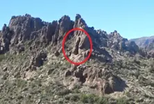
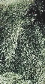
Here are pics which I have posted before in this forum . One is a modified ( cropped and darkned to could be seen better the " priest " shape ) pic of a real picture , and a GE image of the " priest " , with the red dot to be the church's spot .

priest.webp priest (1).webp
 

Last edited:
Sure, the Priest/Horse stone was slightly sticking out of the ground edge wise when Travis found it, and dug it out. After studying it at his home he then went back a year later, and dug out the rest. The Priest side of that stone indicated with a 1 that it is that stone, and one of 4. It tells you to look for the map, and the heart. The Priest is showing you to dig in the same hole for the 2 and 3 that are the map, and to keep digging for the heart which is the forth. The set is complete, there is no fifth, or missing stone. They show the general area, and show where the trail starts with the first of 18 markers. Some markers were stacked rocks, some of which still stand, others have been knocked down. Other markers were stones on saguaros, or tree forks where the trail took a turn, showing you the way the trail went. Waltz mentioned that the Mexicans marked their trails this way, and destroyed the markers he found close to his mine. He said the stones were wedged in and had to be taken out with an ax. This is why one of his clues is a tree with a cut off limb.

Homar
What about the number18? What if it’s not 18 places what if the place is called 18?
 

What about the number18? What if it’s not 18 places what if the place is called 18?
Howdy josh711,
The Priest does say he goes to 18 places, so he is calling every marker on that monumented trail a place. Some of those markers were stacked rocks, or rocks wedged on tree forks, or rocks stuck into saguaros, but he calls them places. The end of the trail is the 18's "place" which would either be a mine, or a Jesuit cache?
 

Top Member Reactions

Users who are viewing this thread

Back
Top Bottom