Riverbum
Sr. Member
Be careful out there and FIND some treasure so We can read about it!!!!
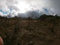
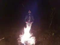
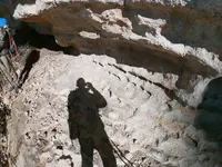
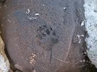
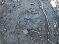
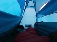
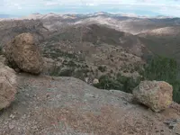
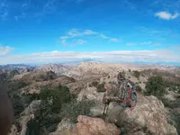
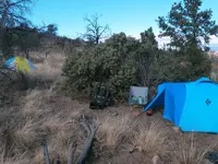
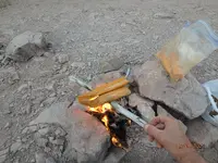
I was out by 15:00 Thursday. Heard a storm was coming. On the second night, I heard what I think was a cat that followed me up the trail. Makin` that sound that sounds like an owl or something. Maybe he smelled me heating up them chicken tortillas.howdy all.. it was a good trip full of crazy weather. 2 of the worst wind and rainstorms i have ever seen on top a mountain in a tent(at 6000 ft.). the wind had to be pushing 50 mph or so. dang near trying to lay my tent down on top of me. freezing temperatures 4 of the other nights. frosted out the tent really bad the next night after the rain. lots of moisture in a tent with my breathe and below freezing outside makes ice on the ceiling of your tent.. then the daytime comes and it all drips down on your sleeping bag. lol.. perfect.... the other nights were cold like normal that time of year. it was funny i hiked in with shorts and left with no shirt on and jeans but froze my butt off the whole rest of the time. just my luck i guess. after the rain stopped and the ground was soft it was much easier to tell what animals were interested in me being there. tracks are sometimes spooky to find.. ( cat and bear) lol.. overall, I had a great time. answered some of my questions but not all. so, i will be back again in March and hopefully the weather will be better for me.
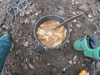
chuck, you heard my stomach growling.. and that was me sniffing out your food.. lol.. glad you got out before the storm hit.. it was very bad.. i was already in the hills before i received your sat. number. sorry i could not call ya on it. how many miles did you do. we did about 30 miles.. i am still tired.. i also had chicken tortilla in soup form.. lol.I was out by 15:00 Thursday. Heard a storm was coming. On the second night, I heard what I think was a cat that followed me up the trail. Makin` that sound that sounds like an owl or something. Maybe he smelled me heating up them chicken tortillas.
hi bob. i am looking for anything not found already or is unknown.. and you would not believe how many unknown rocks i have found... lol..What are you looking for. Hope its the fountain of houth!
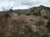
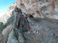
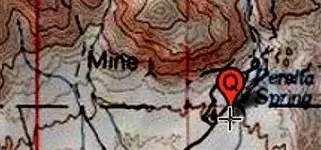
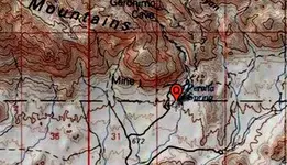
I went a little over 3 miles away from Peralta trailhead to Coffee Flat, up by Whisky Spring. I believe that Waltz’s mine is there. He was seen all up and around that area.chuck, you heard my stomach growling.. and that was me sniffing out your food.. lol.. glad you got out before the storm hit.. it was very bad.. i was already in the hills before i received your sat. number. sorry i could not call ya on it. how many miles did you do. we did about 30 miles.. i am still tired.. i also had chicken tortilla in soup form.. lol.
hi red.. i am not in that area at all .. sorry bud. 393stroker was just over that way.. i am looking around on the eastern side of the range.. but the things i hope to find will not be on a topo..Where are you, in this area? I don't know my way around, another map mine location is to NW and before reaching Black Top Mesa. Quartz alteration zone stops at that point also.
Stay safe and head on a swivel.10 days and i am headed back.. i cant wait..