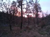
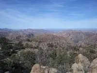
long dry walk

hi russ. it was a very good trip. the rains over the winter sure made a mess out there. huge mudslides happened and alluvial blow outs. it was hard to find the trail again sometimes. I seemed to have strained some mussels in my calf. of course it had to happen when I was furthest in. which made my exit hike a real pain . literally.. the road was pretty muddy in a spot or two, thought I was getting the rental truck stuck for sure. but we made it.. good trip overall. found a small cliff dwelling site way up high. amazing anyone would ever live up there. looking forward to getting back again. seems like I will never get enough of it. my buddy said this morning. " I cant stop thinking about getting back up there. " lol, me either. lots of crystals and some blue quartz. pretty stuff for sure. there is a huge patch of geodes laying right on the surface. very interesting for sure. just such a pain to get up there.

I'm glad you were able to make it. Geodes are really something, over in Rough Canyon, is an area with some that have light purple amethyst crystals.

The blue quartz is cool, were you able to get a piece?
Cliff dwellings too. Very cool ��
 

Dredgernaut, ditto what Idaho said, great pics! Looks like you ran across some botryoidal blue chalcedony? Nice color to it.
 

thanks jim. there seems to be a lot of it up there. literally crossed a large area covered with all different colors of crystals and chalcedony and geodes. must have been some sort if vent or fissure up there.
 

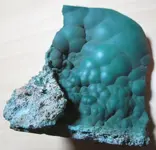
Sounds like a good area. If you run across something that looks like this, might want to take a closer look:

Malachite-Silver-Copper-Ore.JPG

This came from south of your area, and is so heavy with silver and copper, it feels like picking up a chunk of lead. The green boytroidal stuff is malachite.
 

cool stuff jim. thanks for giving me a clue to watch for. I am looking forward to getting back down there to do it all again.. I did cover about 70 miles in total in the last year. but I guess it was not enough.. cause I am still looking. lol.
 

70 miles in the Supes is a LOT of work in a year:notworthy:. Are you looking for the Spanish mines Hermann Petrasch talked about? Best of luck in your travels, hope you will keep us updated as you make your trips in!
 

hi jim.
yes , I am chasing after the Spanish legends. I did the 70 miles in 3 separate trips down. and yes it was a lot of work. when I look back at certain pictures I remember how exhausted I was at points. I have to say I believe march is the best time to be up there. the best temperatures and there seems to be enough water around. I will do my best to keep everyone interested updated. I am glad you fellas like my pics. thanks..


Hi dredgernaut

I like your pics and your insistence to find the Spanish mines in the Superstitions. But to save your time, IMHO you are " little " afar from your target.
The first Spaniards were searching for the seven cities/caves/mines of gold which are in this region. They found them and worked them secretly until they were killed by the Natives of that era. They surveyed the caves and made a map, but that map ( folded in a copper foil ) has never " make it " to the Spanish authorities, so the caves remained lost. Later, three of those caves were used by the Padres to hide their church's ornaments and they could find them with the help of the Natives of that era who became Christians and were loyal to the Padres.
After the Padres, a new Spanish ( later became Mexicans ) family came to the scene in the search of the infamous seven caves of gold at the request of the king of Spain, and they were the Peraltas. They were new in that region, so they believed would find the caves of gold by following the gold traces in the streams to their source. Of course they found few new gold outcrops but never the seven caves of gold. At a specific time frame of their research, were very close to the caves, but the Natives who were watching over them, killed them before can do an extensive research and find the " sacred " caves.
So, if you want to be close to what you are searching for, is better to follow some Peraltas maps, which IMHO are depicting the other side ( western ) of the mountains. Of course you are free to decide what region is the proper for your research.

Have a nice weekend and a fruitful research in the future.
 

Last edited:
yes . and its hard to sit sideways like that. and yes I really am that ugly... lol.
Great pictures sounds like alot of fun I had to admitt Im ugly too the funny thing is when you take a picture or look in the mirror you wonder why no one can make a decent mirror or camera the way I look in my mind doesnt match the pictures or mirror lol or when you hear your voice on a recording its like I dont sound like that lol sorry for the rant Stay safe out there my friend.
 

Hi dredgernaut

I like your pics and your insistence to find the Spanish mines in the Superstitions. But to save your time, IMHO you are " little " afar from your target.
The first Spaniards were searching for the seven cities/caves/mines of gold which are in this region. They found them and worked them secretly until they were killed by the Natives of that era. They surveyed the caves and made a map, but that map ( folded in a copper foil ) has never " make it " to the Spanish authorities, so the caves remained lost. Later, three of those caves were used by the Padres to hide their church's ornaments and they could find them with the help of the Natives of that era who became Christians and were loyal to the Padres.
After the Padres, a new Spanish ( later became Mexicans ) family came to the scene in the search of the infamous seven caves of gold at the request of the king of Spain, and they were the Peraltas. They were new in that region, so they believed would find the caves of gold by following the gold traces in the streams to their source. Of course they found few new gold outcrops but never the seven caves of gold. At a specific time frame of their research, were very close to the caves, but the Natives who were watching over them, killed them before can do an extensive research and find the " sacred " caves.
So, if you want to be close to what you are searching for, is better to follow some Peraltas maps, which IMHO are depicting the other side ( western ) of the mountains. Of course you are free to decide what region is the proper for your research.

Have a nice weekend and a fruitful research in the future.

hi markmar. thankyou for your info and advice. I would like to hear more about the map that never made it home. maybe you can show me your copy.. just kidding.
I am so deep into my beliefs that it would be very difficult to up and change where I hunt. you would really have to show me something massive to change my mind.
hope all you hunters are staying healthy and safe during these uncertain times.
 

Great pictures sounds like alot of fun I had to admitt Im ugly too the funny thing is when you take a picture or look in the mirror you wonder why no one can make a decent mirror or camera the way I look in my mind doesnt match the pictures or mirror lol or when you hear your voice on a recording its like I dont sound like that lol sorry for the rant Stay safe out there my friend.

hello A2. hell I guess we could be worse. lol. we could start a team called the ugly hunters. lol. stay healthy, and keep your sense of humor , its a good one..
 

hi markmar. thankyou for your info and advice. I would like to hear more about the map that never made it home. maybe you can show me your copy.. just kidding.
I am so deep into my beliefs that it would be very difficult to up and change where I hunt. you would really have to show me something massive to change my mind.
hope all you hunters are staying healthy and safe during these uncertain times.

Hi Dredgernaut

That map was found in the middle of the last century, hidden somewhere close to Weavers Needle. You can find it in the public domain, and is that which was given by Al Morrow to Celeste Jones.
Now, I have nothing massive to show to make you change your mind about the region you have decided to research, but there are the Waltz clues, the gold ore which has been shown by NP in this forum and which are from the Palomino Mt. area, the Peraltas maps which show the north region from the WN, the Peraltas camps, etc.
I hope you have seen the same " massive " evidence from those who made you feel the Spanish/Mexican mines are in the area of your interest.
As I wrote, I wish you a fruitful research in the future. Be well.
 

hello again. thanks markmar. i am not swayed at all. anything near weavers needle is an automatic No for me. my search is solid on its own. cant wait to get back down there. thank goodness winter is coming
 

Last edited:
20191109_092731.jpg20191110_084256.jpg20191109_173350.jpg2020030595094610.jpgjust a few shots. I am really missing being there.. the right season is coming .. thank goodness
 

hello. has anyone been out lately. i am hoping to hear water is flowing in the creeks. i am headed out for another hike in a few weeks. hope to be there the beginning of march. i know that is still a bit of time. but i was wondering if there is currently anything flowing.. besides the salt.. lol. thanks in advance
 

Not sure myself, but the area has been in a really bad drought the last year or so. Might want to carry a cache in as far as you can, then at least it's closer than having to go all the way back out to the truck.
 

ya buddy. this November when i was out. i carried 3.5 gallons plus all my regular gear. water is just sooo heavy.. i know of a fairly reliable spring but its extra miles to go there.. i will keep hoping...
 

Many of the streams and creeks run year around, just about .... just not alway on the surface.
A shallow well dug in a creekbed, can work out great. Look for signs of underground water.
There is more water than one would think. I had all the water needed ..... in early June.
Location was East Boulder Creek.

Other locations naturally get more water .... like the area you’re headed.
Took about an hour to dig and about another 30 - 45 minutes to clear up for drinking.
Only had to go about 2-1/2 feet for good access.

Fill it in when done.
 

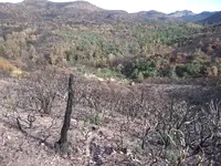
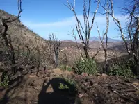
hello crow. that would be great. unfortunately it is a wilderness area. it was part of the woodbury fire. when i was out in november i could not believe how much already grew back. good to see it back, but much harder to cross over now..
 

Top Member Reactions

Users who are viewing this thread

Back
Top