You are using an out of date browser. It may not display this or other websites correctly.
You should upgrade or use an alternative browser.
You should upgrade or use an alternative browser.
JESUIT TREASURES - ARE THEY REAL?
- Thread starter gollum
- Start date
markmar
Silver Member
- Joined
- Oct 17, 2012
- Messages
- 4,302
- Reaction score
- 6,536
- Golden Thread
- 0
- Primary Interest:
- All Treasure Hunting
And for the fans of Real de Guadelupe de Tayopa mines and treasure, I post an aerial image of the Tayopa church's ruins.
An image for collection and dreams.
View attachment 1767939
An image for collection and dreams.
View attachment 1767939
deducer
Bronze Member
Hello HPardo,
I have not heard nor read anything about a Father Hidalgo in Pimeria Alta. I will check my files to see if there was such a person in Nueva Vizcaya. There is no doubt the Jesuit Order made it into Arizona. The only argument is how far North did they reach?
On one of Padre Kino's Entradas, he described being at the confluence of the Rio Azul and Rio Verde. He looked Northward from there towards the mountains. So basically, by most historical records, the Jesuits made it as far North as about Phoenix. There are stories of Jesuits burying treasure in the Superstition Mountains:
Mike
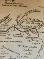
Sedelmayer went as far north as the Bill Williams fork of today. This was in 1744. He allegedly had gone to try and succeed where Keller's entrada in 1743 had failed, in the conversion of the Hopi's. He also ended up at that confluence you spoke of.
Keller was said to have "traveled down the Santa Cruz to the Gila River, crossed it and continued for a few days in the direction of the Moqui pueblos.
Last edited:
markmar
Silver Member
- Joined
- Oct 17, 2012
- Messages
- 4,302
- Reaction score
- 6,536
- Golden Thread
- 0
- Primary Interest:
- All Treasure Hunting
After decrypting the Tayopa " inventory ", I found out how the circle in the Tayopa treasure map on which is written " 896 MANZANAS de ORO " lies exactly on the church building and little back, showing the centre of the circle to pinpoint the back side of the church.
The other treasure sites are around the church's yard at a not long distance.
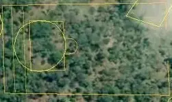
The other treasure sites are around the church's yard at a not long distance.

markmar
Silver Member
- Joined
- Oct 17, 2012
- Messages
- 4,302
- Reaction score
- 6,536
- Golden Thread
- 0
- Primary Interest:
- All Treasure Hunting
After decrypting the Tayopa " inventory ", I found out how the circle in the Tayopa treasure map on which is written " 896 MANZANAS de ORO " lies exactly on the church building and little back, showing the centre of the circle to pinpoint the back side of the church.
The other treasure sites are around the church's yard at a not long distance.
View attachment 1776113
It's amazing how great precision was used in the Tayopa maps in regards to the measurements and the scale in the field. An example is how they managed to fit the circle from one map exactly between the church's walls and the walls behind the church building.This is a master of engineering.
markmar
Silver Member
- Joined
- Oct 17, 2012
- Messages
- 4,302
- Reaction score
- 6,536
- Golden Thread
- 0
- Primary Interest:
- All Treasure Hunting
I want to write few more things about the Tayopa site/region and how the redotero which Custard had in his possession is connected to the map " Camino de Tayopa " which Dobie had. With my explanation , you will understand little the Jesuit concept in making maps.
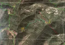
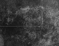
After the Jesuits finished the maps and the redotero, they managed to split them to different churchs from the same region with the intention to make them hard to be found and if by chance one would be find one, to make no sense without the other. We are very lucky todays to have them all together and to can work on them. In my explanation, I will use a GE image, with the margins of the " Camino de Tayopa " map ( title included ) to be marked with a white rectangle. Here I have to mention how the " Camino de Tayopa " map was made with a declination of about 10 degrees NE. Like you can see in the Tayopa Ge image , the site is covered by overgrown vegetation, maybe a reason it wasn't found in the past years.
I believe the Redotero de Tayopa is known to the most of the treasure hunters, and the Spanish version looks like this:
" Tómese primero la rama del camino del lado izquierdo del risco del Campanero en la Sierra Madre, después viajando hacia el oeste, a lo largo del camino a Arisciachi, se doblará hacia abajo en un sendero muy estrecho y quebrado que se detiene. Entonces, se llegará a una espesura de árboles de madroño de follaje muy abundante. Al lado derecho y lejos hacia abajo, aparecen dos cerritos chapos rematados con basura de tepustete rojo. De los madroños se sigue 1200 varas hacia abajo y ahí, en un declive de un cañón, se encontrará un grupo de árboles de güérigo. Aquí parece no haber ningún camino, pero siguiendo su curso hacia abajo por cosa de 45 varas, pasarán bajo dos árboles de güérigo — notablemente gruesos — que tocan sus picos con el pico de un roble vivo. Desde aquí los dos cerritos chapos ya mencionados forman una especie de puerta a través de la cual se entra a Tayopa. El talud entre estos cerritos es muy empinado y por una distancia está lleno de ocotillos, torote prieto, vino rama y otras plantas espinosas. Descendiendo ahora mas gradualmente, llegas a las fronteras del valle, donde están la iglesia y el pueblo, demarcados por diez y siete minas de buen ensayo”.
I doubt someone ever tried to follow this redotero, because the Real de Tayopa and its treasure would have been found long time ago. The redotero " tells " to follow the left bank of the Campanero mt. until the trail turn west to Arischiachi. At this point the trail don't turn only to Arischiachi but the trail if continue west goes to Moris. So there is a junction after the trail turns west, wich separate the Moris trail which goes west with the Arischiachi trail wich goes south.
The Jesuits could use only the Moris trail in their description , but they wanted to approach the site from the SE and across the canyon, to be better recognizable and the Jesuit mark carved in the ground to could be seen.
So, to continue with the redotero, they wrote to continue on the Arischiachi trail which is a wide one, until there will appears a thin and broken trail which derives from the main trail. This thin and broken trail is not the Arichiachi trail, but was used in the map to connect Tayopa to the main trail. When the redotero " tells " the thin trail stops and you see a large grove of arbutus bushes, you are already in the map area, about at the word " de " of the " Camino de Arischiachi ". You are at the top of the ridge across the canyon to Tayopa and you overlook all the region to the Tayopa site.
At this point they used a trick in the map, and this is the " Camino de Arischiachi " which is depicted as a straight line until turns to the left and after turns down. In reality this trail is not straight ( logically for these mountains ) but they used this straight trail in the map to measure the 1200 varas ( marked with red in the GE image ) from the top of the ridge above the arbutus grove to the head of a ravine with the Guerigo trees, the 45 varas down ( pink line ) and the route down to the church ( white line ) like is written in the redotero.
The measurements have been made in a " bullet trajectory " fashion like in all the Jesuit maps. Why they wrote " 1200 varas afar/down " and not " across the canyon ", is because with the distance you would see the correct ravine ( there are plenty ) and because they wanted to create more confusion on how the terrain could be in the reality. They chose that ravine because is about at the same level with the top of the ridge from where the measurement was done. The level of the runt hills at the right from the top of the ridge above the arbutus grove in regards to the " Arischiachi Trail " from the map, is at the same level with the church, about 300 feet lower from that ridge.
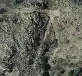
At the point which was described in the redotero the passing through the Guerigo trees, they made a parenthesis, returnining to the two runt hills description and leaving for the end the rest of the description of the supposed " Arischiachi trail ". This is a Jesuit practice used in all the redoteros, with the intent to confuse the readers. But like the redotero " says ", the two runt hills are really at the " gates " of Tayopa because from there starts the Camino de Tayopa to the church and the other facilities ( blue line ), and there is also the Jesuit mark " V " ( yellow in the GE image ) which they used to mark their regions. From what I have seen, the Jesuits used different markings for their regions, something like a blazon used by each prominent family in the Medieval era, but keeping the " V " as a main symbol.
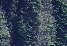
For example the Tayopa's mark is facing south and has the " tail " to the west, the Tumacacori's mark is facing SE, is up side down and has the " tail " to the SW and the Plazuela's mark is facing south with the " tail " to be added as a cover to the " V " to make it look as a " grande vaso sagrado " which they used it as a clue to the treasure vault.
Like you can see in the GE images of the Jesuit marks, they used to put the " V " symbol on a small triangle like a base which supports the symbol, some bigger than other, with the Plazuela's to be very big, almost like the symbol, for this the " dos vasos sagrados " used in the Plazuela's treasure vault clue.
The green paths in the Tayopa's GE image, are actual secondary dust roads used by the locals in their activities. In another GE image you can see the thin and broken path which derives from the main Arischiachi trail and enters the " Camino de Tayopa " map at the down left corner.


Last edited:
JohnWhite
Bronze Member
- Joined
- Aug 20, 2017
- Messages
- 1,546
- Reaction score
- 1,430
- Golden Thread
- 0
- Detector(s) used
- Whites gmt
- Primary Interest:
- All Treasure Hunting
Jesuits treasure - are they real or not?
Beats the heck out of me...I have a pretty interesting site that I have been to that has all the makings of an ancient Jesuit site...But I don't know IF there is any treasure associated with said site...Though I will not be sharing it with the world anytime soon...Just in case it does have treasure held within its bowels...lol...
Ed T
Last edited:
Blindbowman
Bronze Member
- Joined
- Aug 15, 2007
- Messages
- 2,068
- Reaction score
- 1,005
- Golden Thread
- 0
- Primary Interest:
- All Treasure Hunting
" the only true treasure is the life you live "
deducer
Bronze Member
They are very real. More real don't exist.
Do you have any proof? Any examples which could be used to show the strong likelihood that Jesuits did such things as hoard and/or bury treasure?
That's the subject of this thread.
markmar
Silver Member
- Joined
- Oct 17, 2012
- Messages
- 4,302
- Reaction score
- 6,536
- Golden Thread
- 0
- Primary Interest:
- All Treasure Hunting
Do you have any proof? Any examples which could be used to show the strong likelihood that Jesuits did such things as hoard and/or bury treasure?
That's the subject of this thread.
No, there are not proofs or examples which could used in a court to prove Jesuit hid treasures. For the treasure hunters this works good because there will not exist any claimant if a treasure will be find on their marked sites or ex missions. That would be gold which fell from the sky. Few tons of gold and silver would be a good fortune after a rainy day.
Blindbowman
Bronze Member
- Joined
- Aug 15, 2007
- Messages
- 2,068
- Reaction score
- 1,005
- Golden Thread
- 0
- Primary Interest:
- All Treasure Hunting
yes in fact ,I do ...the Topira or Tayopa treasure trove list is in fact just that ....and the Jesuit church I found has a smelter less then 45 ft away from the church ...and the church did have claim markers ...Do you have any proof? Any examples which could be used to show the strong likelihood that Jesuits did such things as hoard and/or bury treasure?
That's the subject of this thread.
ConceptualizedNetherlandr
Silver Member
- Joined
- Apr 17, 2014
- Messages
- 2,628
- Reaction score
- 2,199
- Golden Thread
- 0
- Location
- Sagittarius A*
- Primary Interest:
- Other
yes in fact ,I do ...the Topira or Tayopa treasure trove list is in fact just that ....and the Jesuit church I found has a smelter less then 45 ft away from the church ...and the church did have claim markers ...
Hello Blindbowman, is the bow in your ID about the front end of a ship or an arrow launching device? Thanks!
deducer
Bronze Member
No, there are not proofs or examples which could used in a court to prove Jesuit hid treasures. For the treasure hunters this works good because there will not exist any claimant if a treasure will be find on their marked sites or ex missions. That would be gold which fell from the sky. Few tons of gold and silver would be a good fortune after a rainy day.
We are not in court, and none of this will be tried in court. What we are doing with this thread is attempting to establish a strong likelihood that the Jesuits did traffic, and did attempt to conceal (where possible) what we, today, would call "treasure."
In short, we are looking for motive, means, and opportunity.
markmar
Silver Member
- Joined
- Oct 17, 2012
- Messages
- 4,302
- Reaction score
- 6,536
- Golden Thread
- 0
- Primary Interest:
- All Treasure Hunting
We are not in court, and none of this will be tried in court. What we are doing with this thread is attempting to establish a strong likelihood that the Jesuits did traffic, and did attempt to conceal (where possible) what we, today, would call "treasure."
In short, we are looking for motive, means, and opportunity.
We are attempting and only this. All the documents and maps which revealed Jesuit " treasures " are a good reason to believe how they had amassed " treasures " for a Holy motivation when the opportunity arose and hid them when another motivation arose.
All in this Universe are done for some reason.
deducer
Bronze Member
We are attempting and only this. All the documents and maps which revealed Jesuit " treasures " are a good reason to believe how they had amassed " treasures " for a Holy motivation when the opportunity arose and hid them when another motivation arose.
All in this Universe are done for some reason.
Did they have motive?
Yes- Ignatius of Loyola commanded that churches of the Jesuits shall convey awe for God by being adorned with the finest "ornaments" and "relics."
Did they have the means?
Yes- they had, at the time, the best trade system in the Americas, so efficient that the Spanish as well as the frontier folks had to rely on it.
Did they have opportunity?
Yes- they were among the very first to exploit the Americas, right there on the frontier, and in some cases going further than anyone had ever gone before.
It's no accident that the Jesuit "Golden Age" occurred during this time of great plunder.
gflores71
Full Member
- Joined
- Nov 26, 2005
- Messages
- 173
- Reaction score
- 112
- Golden Thread
- 0
- Location
- Central Coast, CA / Bolivia
- Detector(s) used
- White's V3, MXT All Pro, DFX, XLPro,TM-808, TDI-SL with 25" coil
- Primary Interest:
- All Treasure Hunting
got me a 1948 copy of Antonio Vasquez de Espinoza's book
Similar threads
- Replies
- 1
- Views
- 661
Users who are viewing this thread
Total: 3 (members: 0, guests: 3)
Latest Discussions
-
-
-
-
-
Garrett Vortex VX9 potential major flaw(s) with latest version software
- Latest: Calabash Digger

