You are using an out of date browser. It may not display this or other websites correctly.
You should upgrade or use an alternative browser.
You should upgrade or use an alternative browser.
Early Tayopa newspaper story
Real de Tayopa Tropical Tramp
Gold Member
- Joined
- Nov 8, 2004
- Messages
- 14,582
- Reaction score
- 11,947
- Golden Thread
- 0
- Location
- Alamos,Sonora,Mexico
- Primary Interest:
- All Treasure Hunting
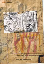
G'd morning Marius. will do as soon as I dig up my files meanwhile, here is a photograph of the Paramo Placer. It is composed of a no. of deep potholes formed on the fault itself. Many are difficult to access even with ropes and it is constantly being replenished. However ORO has spoken for it.
Incidentally Marius all of this has been previously posted in one of the other Tayopa series in here. I would suggest that you review them.
However feel free to continue to post here, no problem. In fact I welcome them on the condition that you find fault in my reasoning or location. The only secret at this point is exactly where is ""X"", the actual entry to Tayopa.
Don Jose de La Mancha
K. p.s. 28* 00' 35' n., 108* 57' 19.95 w This is our head quarters
Last edited:
markmar
Silver Member
- Joined
- Oct 17, 2012
- Messages
- 4,300
- Reaction score
- 6,531
- Golden Thread
- 0
- Primary Interest:
- All Treasure Hunting
Don Jose
I will not make any comment about your site . We are not doing any competition . I respect your beliefs and I don't expect or push to change them .
I am not the dragon in your fairy tale . I am the dragon's killer .
I will not make any comment about your site . We are not doing any competition . I respect your beliefs and I don't expect or push to change them .
I am not the dragon in your fairy tale . I am the dragon's killer .
Last edited:
Real de Tayopa Tropical Tramp
Gold Member
- Joined
- Nov 8, 2004
- Messages
- 14,582
- Reaction score
- 11,947
- Golden Thread
- 0
- Location
- Alamos,Sonora,Mexico
- Primary Interest:
- All Treasure Hunting
Marius, to earn your coffee I WANT you to comment upon my data. If you can find an error I would love to have you point it out. Too much is riding on this to allow my ego to have any say, just the facts.
For example when I pointed out the corrected distances from the church door I posted --> simply multiply by 5, no 0ne questioned that ? .
? .
Incidentally you posted --> Moris (Bermudez) to the East, This would place your location in Sonora or the Sonora/Chihuahua line..
Small point but Bermudez and Moris are quite a ways apart, especially by mule.
Challenge me Marius.
Don Jose de La Mancha
For example when I pointed out the corrected distances from the church door I posted --> simply multiply by 5, no 0ne questioned that
 ? .
? .Incidentally you posted --> Moris (Bermudez) to the East, This would place your location in Sonora or the Sonora/Chihuahua line..
Small point but Bermudez and Moris are quite a ways apart, especially by mule.
Challenge me Marius.
Don Jose de La Mancha
markmar
Silver Member
- Joined
- Oct 17, 2012
- Messages
- 4,300
- Reaction score
- 6,531
- Golden Thread
- 0
- Primary Interest:
- All Treasure Hunting
Don Jose
First , I can't do any comment about your site because the coordinates which you have wrote are from a village El Serruchito . Show me your Tayopa ( like me ) and i will do comments .
I don't see the reason to multiply by 5 the distances from the church to the mines . Why to do this and where is written .
The village Bermudez is in Chihuahua and in the past had the name Moris and don't has any relation with Moris which is about 28 miles SE from Yecora . Look at Panoramio - Photo of Bermudez, Moris Chih
The map show clearly how Tayopa is between Serrania del Campanero and Moris .
Every map is a challenge for me , and ever I follow the clues in the maps . So simple .
Real de Tayopa Tropical Tramp
Gold Member
- Joined
- Nov 8, 2004
- Messages
- 14,582
- Reaction score
- 11,947
- Golden Thread
- 0
- Location
- Alamos,Sonora,Mexico
- Primary Interest:
- All Treasure Hunting
Have fun Marius. Do you have any idea just how far or how long it takes to go from Bermudez to the present Moris. - which incidentally is still / was the only Moris in the area 
As has been suggested to you in the past by others, "Don't rely upon Google Earth etc., for precise locations. The close ups are always distorted, Use aerial photographs if possible, most of Mexico was photographed with co operation by the USA in the late 40's and 50's and are available from INEGI..
I use Google earth for crude locating but always end up with stereo Aerial photographs and the viewer..
Bermudez was settled in the late 1800's by civil war Southerners fleeing the Lincoln US. the most prominent nama was De Moss, Most of the decendents still use that name, but are now found in mostly in Cd Obregon today.
Most of what you re discussing has been gone over many times in previous articles in here. I suggest that you go and read them before any further comments which will be quite welcome 'After' reading the previous posts.
Don Jose de La Mancha
Last edited:
Crow
Silver Member
- Joined
- Jan 28, 2005
- Messages
- 4,027
- Reaction score
- 11,215
- Golden Thread
- 0
- Location
- In a tax haven some where
- Detector(s) used
- ONES THAT GO BEEP! :-)
- Primary Interest:
- Other
Hello Don Jose
I recall that sweetie Amy may of have confirmed the De Mosses presence the as you mentioned.. Google earth has its uses but things look a hell of a lot bigger on the ground.
Old kanacka said was going post about our little side trip from Suva on Cessna float plane. He is a little dirty with me as I won a bet yesterday with him at the Bar. Well this old sea dog has one or two drinks left in him before he waddles off on the walk of shame back to the Drumbeat for his grandpa nap.
It is stinking hot
until next time
Crow
I recall that sweetie Amy may of have confirmed the De Mosses presence the as you mentioned.. Google earth has its uses but things look a hell of a lot bigger on the ground.
Old kanacka said was going post about our little side trip from Suva on Cessna float plane. He is a little dirty with me as I won a bet yesterday with him at the Bar. Well this old sea dog has one or two drinks left in him before he waddles off on the walk of shame back to the Drumbeat for his grandpa nap.

It is stinking hot
until next time
Crow
markmar
Silver Member
- Joined
- Oct 17, 2012
- Messages
- 4,300
- Reaction score
- 6,531
- Golden Thread
- 0
- Primary Interest:
- All Treasure Hunting
Don Jose
Ok , for you I am wrong . I don't insist in my theory .
I am still waiting for some answers :
Why to multiply by 5 the distances from the church to the mines ?
I would see the location of your Tayopa using an aerial photograph from INEGI ...
What you say about " Serania del Campanero " which is written in the map ?
Why in the picture link which I posted , is written the name Moris together with the name Bermudez ?
Why the roads in my picture from GE fit exactly with the roads in the map ?
Real de Tayopa Tropical Tramp
Gold Member
- Joined
- Nov 8, 2004
- Messages
- 14,582
- Reaction score
- 11,947
- Golden Thread
- 0
- Location
- Alamos,Sonora,Mexico
- Primary Interest:
- All Treasure Hunting
Marius my friend: I suspect that perhaps 100,000,000 places on this planet can fit your data on Google earth, but 
As for the '5' thingie, I rather thought that it was self evident. Mines have to be a bit of distance from each other to even allow work. In your post you don't even allow enough room for El Crow to wave a can of beer around to emphasize whatever he is empathizing. You have too many mines stacked one upon the other to be practical.
You also posted --> What you say about " Serania del Campanero " which is written in the map ?
It exisists exactly where it should, it run N / S for some 35 miles north of Tayopa, S of the present Hermosillo - Yecora highway.The actual site of the Campanera, Bell maker, is only about 1 /3 of the distance. Some day I have to locate where he was securing his copper/ tin.. The site of the Campanera is before you get to Bermudez. Almost before you enter Chihuahua from the highway.
You posted --> would see the location of your Tayopa using an aerial photograph from INEGI ..
It has been posted many times, this tells me that you haven't read some of the past posts as I have suggested, however I wlll post it again for you.
Comparativer data so that you can post actural aerial distances, original foot and Animal distances were / are much greater..
Bermudez -- 25* 18' 22" N 109* 02' 48" Moris 28* 08' 18 108* 38' 33' Rebaje 28* 02' 67" 108* 56' 40"
Remember I covered all of this country in the 50's on foot or mule. There were no fences, roads, etc, just open range.

markmar
Silver Member
- Joined
- Oct 17, 2012
- Messages
- 4,300
- Reaction score
- 6,531
- Golden Thread
- 0
- Primary Interest:
- All Treasure Hunting
Don Jose
You are right and I am wrong . I like your logical reason to modify the distances from the church to the mines , in the map .
You wrote " Mines have to be a bit of distance from each other to even allow work " . To multiply the distances from the church to the mines , don't mean how multiply the distances between the mines .
I haven't something more to add about Tayopa . I leave the readers to make their own investigation based in the clues of the map , and to make their conclusion . I wish good luck in their research to all who are interested in Tayopa , and I hope some day , somebody to vindicate me .
Real de Tayopa Tropical Tramp
Gold Member
- Joined
- Nov 8, 2004
- Messages
- 14,582
- Reaction score
- 11,947
- Golden Thread
- 0
- Location
- Alamos,Sonora,Mexico
- Primary Interest:
- All Treasure Hunting
Coffee Marius?? Crow uses Beer. Prob San Miguel export. May I remind you to always subject all documentation to very careful examination ., The problem between codos and Varas may have been just a copying error or purposefully placed in there to confuse or misdirect.
Varas were able to be used by a double interpretation, where as Codos fit by the simple addition of the '5' factor. Since this fit every mine that I knew of, it also told me just about where to look for the others.
This is the reason why no one was able to use it to find Tayopa. However once it became clear it fit 100% since I already had found 3 of the mines, and had the Templo and headquarters located.
The same applies to the other stories and data, remember we are using data for many different Ideas on Tayopa as well as the fact that there were 3 actual Tayopas. Data that fit one obviously would not fit another, and so it has been through the centuries.
Plus although the Jesuits worked my area, even they couldn't find it again . So Tayopa still sleeps unopened -- of course I know just how to enter it when the time comes. Until then I will quietly admire the site from a distance and let them speculate..
For the moment, I am after other thingies that they left - documents and maps etc. .
As of today there is absolutely no doubt that I have THE Tayopa.
May just go to south America and find Crow's lost mines and precious metals deposits. After all they were Jesuit operations also no ? and am I not a reincarnated Jesuit ? hehehheh?
.
Don Jose de La Mancha

Furness
Full Member
since joining T net I've followed joses posts on Tayopa, and had read quite a few stories about it before hand,
jose posted a photo of the area some time ago the prominent feature to the left was waste from a logging operation,
now assuming jose was not extracting the urine and the photo was accurate then that is an easily found feature on GE
jose posted a photo of the area some time ago the prominent feature to the left was waste from a logging operation,
now assuming jose was not extracting the urine and the photo was accurate then that is an easily found feature on GE
Real de Tayopa Tropical Tramp
Gold Member
- Joined
- Nov 8, 2004
- Messages
- 14,582
- Reaction score
- 11,947
- Golden Thread
- 0
- Location
- Alamos,Sonora,Mexico
- Primary Interest:
- All Treasure Hunting
G'd afternoon Furness. You are correct, but not of Tayopa. I have never posted a picture of it's access point. What you are referring to is "The Santo Nino . which is below the saw mill. There is also a large Arrastre in the arroyo which I mentioned before - now buried under ?? ft of arroyo overburden from the Hurricanes.
Incidentally, you cannot see The Santo Nino with GE.
Keep up the good work Furness.
Don Jose de La Mancha
Incidentally, you cannot see The Santo Nino with GE.
Keep up the good work Furness.
Don Jose de La Mancha
markmar
Silver Member
- Joined
- Oct 17, 2012
- Messages
- 4,300
- Reaction score
- 6,531
- Golden Thread
- 0
- Primary Interest:
- All Treasure Hunting
Don Jose
A last comment about your site .
The above photo is from the aserradero in El Serruchito , and has view to the east . From your description ,the Tayopa's location must be in the basin between aserraderro and the shown peaks . As in this picture
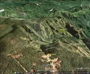
Am I correct ? And now a picture to compare the map with the location . My opinion is how I don't see similarities .
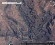
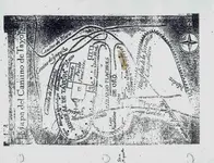
PS
The next picture is a new view of the Dobie's overlay . What is wrong in this picture and in the original photo ? The wrong is , how the north in the Tayopa's map is up side down with the north in the topo ( the original photo ) and the GE picture .
What irony ...
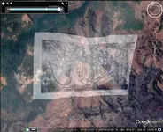
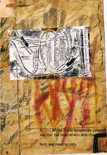
A last comment about your site .
The above photo is from the aserradero in El Serruchito , and has view to the east . From your description ,the Tayopa's location must be in the basin between aserraderro and the shown peaks . As in this picture

Am I correct ? And now a picture to compare the map with the location . My opinion is how I don't see similarities .


PS
The next picture is a new view of the Dobie's overlay . What is wrong in this picture and in the original photo ? The wrong is , how the north in the Tayopa's map is up side down with the north in the topo ( the original photo ) and the GE picture .
What irony ...


Last edited:
Crow
Silver Member
- Joined
- Jan 28, 2005
- Messages
- 4,027
- Reaction score
- 11,215
- Golden Thread
- 0
- Location
- In a tax haven some where
- Detector(s) used
- ONES THAT GO BEEP! :-)
- Primary Interest:
- Other
Hello Marius
There is no one who doubts your intense enthusiasm. 2 points I like to comment about However one can detect a little over reliance of Google earth. Don't get me wrong Google earth is fantastic tool. I even use it myself. But it is not a stand alone tool. It is tool that used in connection with other tools. Nothing beats boots on the ground at the end of the day and the archeology will speak for itself.
2nd This Tayopa Map are Copies not photo copies but hand drawn copies from the turn of the last century. Copied by treasure hunters who I daresay inbuilt their own insurance policy into the map. These maps are highly stylized and to some degree not accurate as one would imagine. Many parts of the map however as Don Jose has said is accurate other parts not so accurate. To accept the map in its entirety would be fraught with folly.
You cannot expect Don Jose to give away the access point to his Tayopa on a public forum either my friend. For anyone to do so would create more problems for what its worth. Having mineral rights for such a site is one thing. Developing and policing his own site is enormous and costly task. Developing a modern working mine is very complex. Developing a mine in the 17th and 18th century's was less complex as long as the lode was assessable and workable. Today there are many factors that come into the equation. It comes down to the economies of scale for such a mine. Market demands. Processing and labor costs. I do not envie the task still ahead of Don Jose as he has to tread his ground very carefully as he is fully aware how quickly a discoverer could end up with nothing from all his years of hard work.
As for other Tayopa's the owners of the miners rights to the 2nd Tayopa have made a deal with a Canadian Mining company with the pitiful operating capital of 1.5 million dollars. That is nothing to today's modern mining era. The reality is they do not have the money or resources to develop the mine. That company is a small exploration miner. In other worlds they hope to find a site that can be developed into a major mine site. And they themselves hope they will be bought out by a multinational. That is where they make the money and partner owner of the mining rights. And development could take years.
Such is the way of the mining game. I know this from experience as I worked for exploration mining companys for years all over the world Until I retired in 1999. I still have shares in various mining company and real estate among other things.
That why I can bum around the Pacific not really worry about work anymore.
Crow
Real de Tayopa Tropical Tramp
Gold Member
- Joined
- Nov 8, 2004
- Messages
- 14,582
- Reaction score
- 11,947
- Golden Thread
- 0
- Location
- Alamos,Sonora,Mexico
- Primary Interest:
- All Treasure Hunting
G'd evening Marius, join Crow and I for some of Oro's infamous sock coffee?
ON 'both' sets of pictures it would help you if you aligned the geographical points the same , as it is, you have them 180 degrees out.
AS my very dear friend Crow said, "I can't / won't home you in on the last ft or so for obvious reasons.
Get back to understanding the distances from the data.
Crow soo good to hear from you, and I admire your will power, still chaste? Hi to all of the gang up to el Kanacker, the magnificent.
Where's mi AMY luv
Will post more in the manana.
Don Jose de La Mancha
ON 'both' sets of pictures it would help you if you aligned the geographical points the same , as it is, you have them 180 degrees out.
AS my very dear friend Crow said, "I can't / won't home you in on the last ft or so for obvious reasons.
Get back to understanding the distances from the data.
Crow soo good to hear from you, and I admire your will power, still chaste? Hi to all of the gang up to el Kanacker, the magnificent.
Where's mi AMY luv

Will post more in the manana.
Don Jose de La Mancha
Crow
Silver Member
- Joined
- Jan 28, 2005
- Messages
- 4,027
- Reaction score
- 11,215
- Golden Thread
- 0
- Location
- In a tax haven some where
- Detector(s) used
- ONES THAT GO BEEP! :-)
- Primary Interest:
- Other
Gidday amigo Don Jose
Chaste my friend? Does the devil Pray?
I am just holed up in chart room Nav station and getting some internet time.. Before the girls will be hogging it all.
Had a fairly hot lazy day today. Had a big clean up on the Drumbeat, She is spick and span on the inside at the moment. Amazing how much crap gets moved about during voyage. Kanacki said he get around to posting but hes tied up with other things at the moment. I have crack the cat of nine tail on him.
Your little lady is doing some work for the Dutch at the moment. About missing diamonds. She even talked to head Archivist in regards to the Jesuits archives. They are captivated by her. See what happends when your young and pretty doors open for you.
Anyway manana, your starting sound more Polynesian day by day?
crow
Chaste my friend? Does the devil Pray?
I am just holed up in chart room Nav station and getting some internet time.. Before the girls will be hogging it all.

Had a fairly hot lazy day today. Had a big clean up on the Drumbeat, She is spick and span on the inside at the moment. Amazing how much crap gets moved about during voyage. Kanacki said he get around to posting but hes tied up with other things at the moment. I have crack the cat of nine tail on him.

Your little lady is doing some work for the Dutch at the moment. About missing diamonds. She even talked to head Archivist in regards to the Jesuits archives. They are captivated by her. See what happends when your young and pretty doors open for you.
Anyway manana, your starting sound more Polynesian day by day?
crow
markmar
Silver Member
- Joined
- Oct 17, 2012
- Messages
- 4,300
- Reaction score
- 6,531
- Golden Thread
- 0
- Primary Interest:
- All Treasure Hunting
Hello Crow
Nice to meet you again .
You wrote :
1) " There is no one who doubts your intense enthusiasm " .
I have not enthusiasm . As I wrote , I don't consider this debate a competition . To decrypt a map , is a routine for me and a hobby . I write my opinions just to help the hunters in their research . Of course , I keep the best treasures for myself .
2) " This Tayopa Map are Copies not photo copies but hand drawn copies from the turn of the last century. Copied by treasure hunters who I daresay inbuilt their own insurance policy into the map ".
This is only your opinion and you can not prove this statement . Is illogical to modify a map before you find the mines . And if you find the mines , after you don't need the map . If you want to remain the mines secret , just you burn the map . To modify don't make sense .
3) " You cannot expect Don Jose to give away the access point to his Tayopa on a public forum either my friend "
He gave many details of his Tayopa , and I believe is very hard to keep it secret . I don't know for the other hunters , but from me is impossible . I am not interested in Tayopa . I did this research just for a training .
Have a nice day
Last edited:
Real de Tayopa Tropical Tramp
Gold Member
- Joined
- Nov 8, 2004
- Messages
- 14,582
- Reaction score
- 11,947
- Golden Thread
- 0
- Location
- Alamos,Sonora,Mexico
- Primary Interest:
- All Treasure Hunting
There will be two posts this morning, first to Marius:
Except for photographs, I have not posted anything that is not readily availble in the central mining office in Cd. Mexico. Soo no secrets have been given away despite my apparent openess.
Yes, I have The Tayopa, I have had it since 1998. It has been a long drawn out process. I am on a nickle and dime attempt which as Springfiled / Crow correctly state is a 'mom & pop' approach to a multi milion dollar project.
While Tayopa readily is an excellent investment, how do you prove it without the proper pre-investment money being available, or even the proper contacts, so you also concentrate on the Treasure angle, a sort of "The chicken and the Egg syndrome".
Lastly, believe it or not, I have ulterior, but honest, motives, there are always several groups world wide that form each year to look for it, so in my way I try to tell them to go look for something else since it has been found. And NO, it is not a matter of hiding it for myself , it has been found as I have asked openly for the others in these Forums to prove that I haven't. To this end I have also freely given information to other lost mines,placers, treasures, ships, etc. things that I will not live long enough to recover, but should be passed on to other seekers.
I hope this makes a bit of sense to you Marius, but I am not nuts or simply lying, it is just the nest that I have developed for myself / Tayopa has rather trapped me in so far as Tayopa is concerned. The old white elephant gift to an enemy, hence the decision to leave Tayopa closed and go on to other associated treasures, as I have posted.
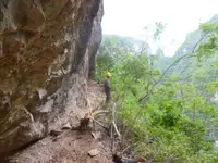
Example "where does this trail which we found lead to ?? I believe that I know, and so far only only 'I' know. I defy anyone to find it with Google or any other form of computer work, only by foot access, as our Buddy Crow said, would it have ever been found. Hint, it was last used around 1767.

Last edited:
Similar threads
Users who are viewing this thread
Total: 1 (members: 0, guests: 1)


