nobodie
Hero Member
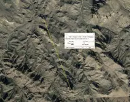
35-40 meters.
Howdy Wayne,
A mess load of maps were turning up at that time. In my honest opinion some were made to try and sell them, while others were made to obtain a grubstake. A prospector could do a lot of prospecting on someone else's dime with a fake map.
The letter that Skyhawk posted, is a copy made by Gonzalez. Barrigan kept the so called original that Gonzalez had, which had the letter, and map on the same page. But even that one is thought to be a copy.
The Ortiz letter in my honest opinion was inspired by the story of Waltz helping out Don Peralta in a bar fight in Mexico. I don't believe this ever happened. Waltz may have made that story up to justify his ownership of his mine, and to ease his conscience. In his death bed he confessed that he had killed three Mexicans to take the mine. He even relived all the details of how he went about it. In another of his fake stories, he said shot some Mexicans thinking they were Indians, trying to ease his guilty conscience.
In my honest opinion neither the letter, or the map lead anywhere, much less the LDM.
Homar

I did a little research on this subject. It’s possible that the letter is a forgery based on its almost identical directions as Bick’s article. The map, I have no idea.
Jim Hatt’s timeline was a little off in his posts on the “other bus station” as Marius puts it.
The lady’s name was actually Genevieve Gutierrez Barragan, vice Barrigan.
They were of Mexican descent as follows:
1. Francisco Barragan (possibly the “Frank” referred to in the letter?) Born 1857. MX. Immigrated to USA/AZ 1880. Farm laborer, Florence AZ.
2. Francisco Barragan Jr., Born AZ 1900. Laundry Operator in Florence.
3. Ernesto ‘Ernest” Barragan, Born 1924 AZ. Died 25 March 1999. His wife was Genevieve Gutierrez Barragan, who Jim Hatt spoke of. She died April 5, 2003.
This seems to be Frank Ochoa’s aunt that Jim mentioned. It would appear that the provenance of the map and letter are at least possible using Jim Hatt’s recollections.
Perhaps one of the other family members was the bailiff, Arnold Ortiz, that told the story to the AZ AG as outlined in Helen Corbin’s book. He later verified that Tom K's copy of the map was probably the same as the one his father used in hunting the mine.
There also seems to be another family member, a lady from northern AZ, who also had a copy of the map and letter.
Barragan’s son that possibly had the original map, that Jim was wondering about and was possibly a dentist, was Ernest G. Barragan Jr. I’ll leave it at that…
I see Marsh Valley as the best location for a base camp that could satisfy the needs of a large group of miners and their livestock. From the base camp, workers could fan-out to specific mine sites. There also seems to be ample historical evidence of activity by Mexican miners above Marsh Valley on Peters Mesa. All that mining activity points to some rich mines nearby that warranted the ever-present risk of death from natural causes and Indian attacks. I agree, though, that the Ortiz Letter and Bicknell's newspaper article don't give sufficient information to find any mine, including from Marsh Valley as a starting point.

35-40 meters.

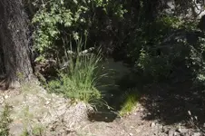
I see Marsh Valley as more of a "transportation hub" for lack of a better word, or a "bus terminal" ("mule train terminal" rather). The Mexicans did frequent it and probably kept reserve livestock there as well as fetch water from Charlebois spring in very dry seasons, or for their arrastras. No matter how dry it got, there was always water in Marsh Valley primarily because of Charlebois spring which is well shaded and deep (see my pic below), which meant vegetation, which meant game. However, they did have their various sites above and surrounding Marsh Valley. There was a large site on Peter's Mesa near the hairpin above Charlebois, the northern end of the lower slopes of Bluff Springs, as well as on top, and also on BTM, and nearby.
In the wintertimes, the valleys would have been downright cold and it would have been more warmer on the higher grounds, and quite a few firebeds were found by some of the earliest prospectors in the high areas.
I wouldn't be surprised if Marsh Valley was the point of departure for Mexico proper. The "northern" group from the Indian Springs area would have come down to join the "southern" group at Marsh Valley for the long trek home.
View attachment 1800180
There is a well dug just down canyon from where Old and New Squaw canyons meet La Barge canyon.
This old well is about 10 feet deep and is lined with rock. It periodically fills in with sand and rock but over the years people have dug it out. The last time I saw it was in about 2009 and the sand had filled it to about a foot from the top.
I don't know who dug this well, cowboys, Mexicans, prospectors .....?
You're always right on target, deducer. Sherlock would be proud of you. Also, most probably know that Marsh Valley was once a very lush place, with good forage for livestock and multiple springs for water sources. Not like it is now. It must have seemed like paradise to the Mexican miners. As a hospitable base camp and starting point, the Marsh Valley encampment would have enabled relatively long distance forays to mines by smaller groups of miners.
View attachment 1800281
Marsh Valley water. At one time there were 3 springs in the bend of Marsh Valley. Two of those springs have stopped flowing although after the February 1980 floods both springs seeped water for a short time. I was in the mountains at that time and marked the site of those two springs. Today only White Rock spring still flows in the Marsh Valley bend. Charleboise spring has always been the best source of water in the area of Marsh Valley.
There is a well dug just down canyon from where Old and New Squaw canyons meet La Barge canyon.
This old well is about 10 feet deep and is lined with rock. It periodically fills in with sand and rock but over the years people have dug it out. The last time I saw it was in about 2009 and the sand had filled it to about a foot from the top.
I don't know who dug this well, cowboys, Mexicans, prospectors .....?
Marsh Valley was at one time the wettest place in the Superstition Mountains.

I forgot to add that Frank "Francisco" Barragan "Jr." was also a long-term employee at St. Joe's Hospital in PHX, according to his obit. All-in-all, the family has a pretty cool history as AZ Pioneers. There's much more to their story than I could post here.
One other thing that occurred to me was this: I've always read the date on the letter as "March 1894". I just can't see "1864" in it? Anyway, it's at least POSSIBLE that Bick got the directions for his 1895 article based on this letter. He was prospecting and mining in the area where several Barragan family members lived and worked. Bick wrote some other articles in 1894, one of which the directions to the mine seem to be what the "Profile Map" is based on...the directions that mirror the "Ortiz Letter" didn't come until 1895.


deducer,
That old well at the point of LaBarge and Squaw canyons (east side) has been known from early times. Bark and Ely knew of it and Cavaness before them so there is no telling how old it is.
The positioning of that well where it is makes one think something was going on farther up Squaw canyons and the well served as a water source in dry times when LaBarge creek stopped running. It is one mile from that well to the bend in Marsh Valley and another mile to Charliboise spring. The big flat area just to the west of the bend in Marsh Valley was the site of a large encampment and one book tells of a Mexican racetrack being on that flat.
If the writing on the old map/map copy was for leading to Marsh Valley, and it is by way of the tributary canyon that you go. It appears that Needle Canyon would match up to be it. . . through a gorge on the south side, up over a lofty ridge, down past (hidden) Needle into a canyon . . then tributary canyon. . . . and then you're there.
If the letter was 1894, it was likely that Marsh Valley was still the premium spot for water. So perhaps that is what the letter was giving directions to.
Almost the exact same directions as Bicknell wrote, telling how to get somewhere . . probably very close to Marsh Valley then. Except if you pass the red hills, you've gone too far
Idaho Dutch

That is interesting in light of the timeline of events, since Jacob Waltz passed away in 1891. It is not that unusual for someone to not get word of the death of a friend for several years, but it is another eyebrow raising point if it is in fact supposed to be read as 1894.


Does anyone have the complete text of Don Peralta's 1864 letter to Jacob Waltz? I'm able to read most, but not all, of the words. The words that I can't read I've indicated as (---). Also, when Don Peralta wrote "tordis," was he trying to write the English word "tortoise," instead of using the Spanish word "tortuga?"
"... first go to tordis mountain, then south side go eastward until you find the first gorge on the south side from the west end follow the gorge until you find another trail which will lead you northwards over a lofty (ridge) then downwards past (---) needle to a long canyon and then (left) to a tributary canyon about 35-40 (---) from the end after you find the mine destroy (---)" ... 1864 Don Peralta
I've included, below, Bicknell's wording from his newspaper article, which has similarities to the Peralta letter, but Bicknell's source was oral testimony from Julia Thomas, as I understand it from the historical records.
"... The mine lies within an imaginary circle, whose diameter is not more than 5 miles, and whose center is marked by the Weaver's Needle, which is about 2,500 feet higher, among a confusion of lesser peaks and mountain masses of basaltic rock. The first gorge on the south side from the west end of the range. They found a monumental trail which lead them northward past Sombrero Butte into a long canyon. Travel northward in the gorge and up over a lofty ridge, thence downward past the Needle into a canyon running north, and finally into a tributary canyon, very steep and rocky, and densely wooded with a continuous thicket of scrub oak."
And, what do most who are reading this post assume to be "the gorge" mentioned in Don Peralta's letter? I'm assuming that the Mexican miners would have chosen the easiest passage into the Superstitions. It would be an existing trail, monumented, not too steep for their horses, pack animals, and livestock, and preferably having a water source at, or very near, the trailhead.


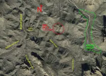
Here is a shot of the area, but just a bit closer to look at Needle Canyon through this area.
View attachment 1800381
As a lot of you know, I do like this ravine.
Idaho Dutch


Hello Oro,Have you been to that area? Thanks in advance.


