Oroblanco
Gold Member
- Joined
- Jan 21, 2005
- Messages
- 7,841
- Reaction score
- 9,872
- Golden Thread
- 0
- Location
- DAKOTA TERRITORY
- Detector(s) used
- Tesoro Lobo Supertraq, (95%) Garrett Scorpion (5%)
Adams Escape Route:
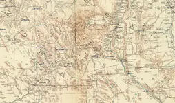
The route that Adams, and possibly a companion, followed after the Apache attack is one of the easiest parts of the LAD puzzle to figure. From the speculated location of the Adams placers on Bear Creek, it makes perfect sense that the survivors followed the same canyon downstream approximately twenty miles to the Gila River. They likely knew that once they reached the river, Fort West would be nearby, since the prospecting party crossed the wagon road leading to the fort near Mangas Springs (the “pumpkin patch”) on their trip into the diggings some weeks earlier. Also, some of the miners had been sent to the fort from the diggings for supplies - these men knew the way but were killed by the Apache on their return trip to the diggings. The map below summarizes the landmarks and escape route.
View attachment 1170199
Adams escape route
Malpais
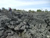
Aka "bad country". This is usually assumed to mean a basalt lava flow, such as the Mount Taylor flow that lies generally east of the Zuni Mountains and west of Highway 114 in the Grants NM area - now the El Malpais National Monument. This is one of the anchor clues in the LAD versions that place the diggings somewhere westerly of Magdalena NM and easterly of Springerville AZ, and strongly tied to Fort Wingate, the “fort in the malpais”.
Many will object, but I'm ignoring the malpais reference. I generally reject the later versions of the LAD legend in lieu of the earlier tellings, and I also reject the malpais reference and its implications. I have spent a fair amount of time in this part of New Mexico trying to reconcile the Byerts et al versions of the legend to the terrain, and it just doesn't work for me. First, there is no gold in the area. That doesn't bode well. Second, it's too damned far from the Pima Villages. Third, it's too far from the Apache's primary venues. I suspect the reference was added solely to bolster a northern location for the diggings - for whatever reason. Obviously, I favor a southern location.
Dos Piloncillos
The two peaks appear in nearly all versions of the LAD legend, older and more recent ones. The Adams party’s guide pointed to the peaks from a high position as they began their final approach to the diggings. Many LAD versions place the peaks beyond the placer deposit, and some allude that the peaks were the source of, or were close to, a much richer gold source. The peaks were referred to as “dos piloncillos” - a reference to the cone-shaped lumps of hardened brown sugar common in the day (and today too, in certain places).
It’s likely that Twin Sisters Peaks, on the Continental Divide northeast of Pinos Altos, were the dos piloncillos. They are twin cone-shaped peaks and well-known landmarks in the region, visible for miles from several directions. The Adams party would have been shown the peaks from the head of Blacksmith Canyon, which they climbed from Mangas Springs to LS Mesa, as shown in a previous post. From this location, the peaks are visible on the horizon to the east, about thirteen miles away. From the suspected location of the diggings in Bear Creek, the peaks would have been accessible by traveling upstream a few miles, then climbing one of several possible routes to the top - about a 2,000 foot elevation gain. Below is a line-of-sight profile from LS Mesa to Twin Sisters.
View attachment 1170192
Analysis using Maptech
To sweeten the deal, there are several rich mine/lost treasure traditions in close proximity to Twin Sisters. They are not associated directly to the events of the Adams party except by vague reference in the stories and won’t be expounded on here. Interestingly, the horizontal rock structure connecting the peaks was a view point for Adams at the beginning of later efforts by him and others trying to return to the placer diggings.
View attachment 1170193
Approaching Twin Sisters from the west
Another great post amigo!


