The Milk Ranch

Status
Not open for further replies.

Matthew Roberts

Bronze Member
Apr 27, 2013
1,144
5,016
Paradise Valley, Arizona
Primary Interest:
All Treasure Hunting
In a previous thread there was some confusion about a location known as the "Milk Ranch" which is confused by some with the Cavaness Ranch or the Board House Ranch.

Matt Cavaness was the first man to run cattle on the Superstition Mountains range. Around 1871 he founded what was known as the Cavaness ranch or the Board House ranch as it was sometimes called. This is the same ranch later owned by George Marlow, Jim Bark, Tex Barkley and today Charles Backus. In Cavaness day it operated with the "River" brand, later the ranch took the JL brand and later became the Quarter Circle U ranch. The ranch is located in the foothills of the south end of the Superstition Mountains.

Matt Cavaness was married to Alice Rowe and had three young boys living at the ranch, Anson, Albert and Aaron. Matt Cavaness wife Alice was a daughter of William Rowe who lived on the McDowell crossing of the Salt River. This ferry crossing of the Salt was the main crossing on the Gila to Fort McDowell wagon road. A small community grew up at the crossing first known as Rowe's Station and later Maryville (named for one of Wm. Rowe's daughters). Rowe's station was on the south side of the Salt River. Later the Mormon town of Lehi would be located there on the north side.

William Rowe had a large family, a wife and 8 children. Apache raids on Rowe's Station in the early days drove many settlers out of the area. On March 28, 1874 Apache's raided the Station, burned some buildings and stole every head of stock. Less than a month later, on April 14, 1874 Paul Handel and Edwin Toomey left Fort McDowell for Phoenix and were captured by the Apache within a few miles of Rowe's Station, horribly tortured and killed. William Rowe sent his wife and several of their children to live with their daughter Alice and Matt Cavaness at the Cavaness ranch where they would be safe.

Matt Cavaness had originally built a stone house at his ranch. But following a trip to San Diego when he hauled some ore to be refined there, he returned with a load of lumber and built a board house at the ranch. This was one of the first board houses in the territory including the town of Phoenix. His ranch became known to some as the "Board House" ranch.

With that load of lumber Cavaness also built another house and corral about a mile or two to the east of his ranch. This house became known as the Milk House Ranch and it was at this location where Matt's mother-in-law Mrs. William Rowe, and her children came to stay. The place was called the "Milk Ranch because William Rowe's main source of income was raising hay for the Army and selling milk. With the Apache stealing stock at Rowe's Station it became impossible for Wm. Rowe to earn any money selling milk. So William Rowe and Matt Cavaness stocked the Milk House Ranch with milk cows and Mrs. Rowe and her children used the proceeds from the sale of the milk to live.

The Cavaness ranch and the Milk ranch were two separate places a few miles distant from each other. Both owned and built by Matt Cavaness and his wife Alice Rowe-Cavaness. The Cavaness ranch is today commonly known as the Quarter Circle U Ranch. The Milk House and ranch is gone today, nothing is left of it except desert.

It was the Cavaness Board House where Jacob Waltz stated he had gone for supplies and made the round trip from his mine to the ranch and back again in a day. Waltz didn't state however if that trip took him all day or just part of a day. It is assumed by some to have meant it took him the entire day to make the trip.

Hopefully this clears up any confusion about the Milk Ranch from the Matt Cavaness time period.

Matthew
 

I received a PM from another member who said he had always thought the Whitlow ranch was the Milk ranch.

Not many know this but at one time there was a wagon road that ran from the Cavaness Ranch (Board House, Quarter Circle U) over to the Whitlow Ranch which was located several miles southeast of the Cavaness ranch. The Milk Ranch was located on that old road but not at the Whitlow ranch site. The Milk Ranch was before you got to the Whitlow ranch.

The close relationship between Whitlow, Cavaness and Rowe went way back.

On June 7, 1867 George Roberts, Abraham Peeples, Joe Green and Peter McCannon filed the first water user claim from the Salt River. Predating Jack Swilling's water claim by 4 months. The site of that first water claim was at the McDowell crossing which would in a few years become Rowe's Station (Maryville).

William Rowe was on the scene shortly and helped dig the irrigation canal there that would become known as the Maryville irrigation Canal Company.
Charles Whitlow was on the scene about the same time. Whitlow became the ferryman at the crossing and the Stations first Postmaster.
Matt Cavaness and Joe Green, one of the men who filed the water claim were best friends, Cavaness was married to William Rowe's daughter and Cavaness was a brother in law to both George Roberts and Abraham Peeples.

Joe Green had discovered a rich ledge of gold somewhere in the mountains north of the crossing while a civilian scout at Fort McDowell. He interested Cavaness, Peeples, Roberts, Rowe, Whitlow and about 10 other men to go looking for that gold ledge. Peter McCannon headed up the expedition which traveled through the Superstitions, Pinal's and Tonto Basin country. They were unable to find the ledge due mainly to the fact that before they were able to leave, Joe Green had been killed by an indian at Fort McDowell and could not lead the group back to where he had discovered the ledge. Matt Cavaness writes of his conversations with Joe Green concerning this gold discovery in his memoirs which are at the Hayden Library in Tempe. Cavaness was too downhearted to follow along with the rest of the expedition after his friend was killed however.

It was Matt Cavaness and William Rowe who convinced Charles Whitlow to pull up stakes at Maryville and start ranching near the Cavaness ranch in the Superstitions.
I am not 100% certain but I believe Charles Whitlow may have married another one of William Rowe's daughters. That may account for why the member who sent me the PM confused the Whitlow ranch with the Milk ranch. I do not have my copy of Matt Cavaness memoirs with me here in Huntington Beach but I am sure Cavaness tells of his mother in law (Mrs. Rowe) being on that ranch just east of the Board House.

Matthew
 

Good afternoon Matthew: Was the Milk Ranch the same as the Goat Ranch? There is a stone foundation in what they call today Elephant Butte Canyon. It is where the old road turns west and about 2/3 of the way along the road before the road enters Whitlow Canyon. I have always thought that this was the location and remains of the Milk Ranch. At one time you could drive that road all the way to Reed Water or turn west at the fork at the old Whitlow Corral and drive all the way to the Quarter Circle Ranch. Cordially, Gregory E. Davis
 

Matthew Roberts, Something in this part of the history that should not be forgotten is Government Wells , or as some refer to it as Government spring. thanks, good job. np:cat:
 

I just looked at my topos.
Milk Ranch Road and creek are 2 milkes North of Elephant butte.
South of Buzaards Roost.
1 Mile East of Whitlow canyon.
Barks ranch on my topo is 3 miles West of Whitlow Canyon and Buzzards roost.
Just East of Barks ranch at the head of a canyon you can make a turn south.
Is this the area of the milk ranch actually, and not North of Elephant Butte.

Hi roadrunner,

I am always very cautious when trying to find old sites on topo maps using names of roads and canyons and such that were named in modern times. This is especially true in the Tonto National Forest. Most all the roads, trails canyons and springs were named by Forest Service persons who may or may not have known where the actual site was and it's history. Many times canyons and roads and trails were misnamed because the person in charge just didn't know where things were and was going on someone else's best guess.

You said, "just east of Bark's ranch at the head of a canyon you can make a turn south". Yes this is the general direction of the Milk ranch. Al Reser took me down that road one time and showed me where he had been told (by Abe Reid) the Milk ranch had been located. It was southeast of the Bark ranch about a couple miles if I remember the distance we hiked that day. Everything was gone there of course, the lumber long since hauled to another site and the place scavenged over. A few old cans, bottles and rusted ranch artifacts laying around. It was the only place around that looked as if there may have been water there at one time. The old road that went from the Cavaness (Bark) ranch to Witlow's ranch is now gone also but you can still follow it in many places.

Gregory,

The Milk ranch and the "Goat" ranch were two separate ranches, both belonged to the Cavaness family.
The "Goat ranch" was confused also as to it's location. You have been to the Goat ranch. It is in the Bloody Basin about 12 miles north of Seven Springs.
Just before you get to Holmes Canyon and Holmes creek in Bloody Basin where Dick Holmes had his horse and cattle operation there is a ranch on the right side of the road. Today it is the 51 ranch owned by Bob and Rosemary Pock from New River. That ranch is the old Cavaness ranch that was known by some as the Goat Ranch. The old stone house that sits up along the road was built by William and Silas Cavaness. Matt Cavaness's mother and father lived at that ranch for a while before moving to Cave Creek.
The Goat ranch was confused with that ranch at Cave Creek also.
It seems a lot of confusion went on with the Cavaness over the years, mainly because they were a large family and moved around a lot and owned numerous ranches and business throughout the territory, buying a ranch here and selling out later to buy another one.

Matthew
 

Last edited:
Didn't Will Rowe find that gold deposit of Joe Green and Matt Caveness ? I read where Rowe had a rich gold mine and caused a big gold rush around phoenix. Maybe that was Waltz mine ?
Great history Matt !

azhiker
 

In a previous thread there was some confusion about a location known as the "Milk Ranch" which is confused by some with the Cavaness Ranch or the Board House Ranch.

Matt Cavaness was the first man to run cattle on the Superstition Mountains range. Around 1871 he founded what was known as the Cavaness ranch or the Board House ranch as it was sometimes called. This is the same ranch later owned by George Marlow, Jim Bark, Tex Barkley and today Charles Backus. In Cavaness day it operated with the "River" brand, later the ranch took the JL brand and later became the Quarter Circle U ranch. The ranch is located in the foothills of the south end of the Superstition Mountains.

Matt Cavaness was married to Alice Rowe and had three young boys living at the ranch, Anson, Albert and Aaron. Matt Cavaness wife Alice was a daughter of William Rowe who lived on the McDowell crossing of the Salt River. This ferry crossing of the Salt was the main crossing on the Gila to Fort McDowell wagon road. A small community grew up at the crossing first known as Rowe's Station and later Maryville (named for one of Wm. Rowe's daughters). Rowe's station was on the south side of the Salt River. Later the Mormon town of Lehi would be located there on the north side.

William Rowe had a large family, a wife and 8 children. Apache raids on Rowe's Station in the early days drove many settlers out of the area. On March 28, 1874 Apache's raided the Station, burned some buildings and stole every head of stock. Less than a month later, on April 14, 1874 Paul Handel and Edwin Toomey left Fort McDowell for Phoenix and were captured by the Apache within a few miles of Rowe's Station, horribly tortured and killed. William Rowe sent his wife and several of their children to live with their daughter Alice and Matt Cavaness at the Cavaness ranch where they would be safe.

Matt Cavaness had originally built a stone house at his ranch. But following a trip to San Diego when he hauled some ore to be refined there, he returned with a load of lumber and built a board house at the ranch. This was one of the first board houses in the territory including the town of Phoenix. His ranch became known to some as the "Board House" ranch.

With that load of lumber Cavaness also built another house and corral about a mile or two to the east of his ranch. This house became known as the Milk House Ranch and it was at this location where Matt's mother-in-law Mrs. William Rowe, and her children came to stay. The place was called the "Milk Ranch because William Rowe's main source of income was raising hay for the Army and selling milk. With the Apache stealing stock at Rowe's Station it became impossible for Wm. Rowe to earn any money selling milk. So William Rowe and Matt Cavaness stocked the Milk House Ranch with milk cows and Mrs. Rowe and her children used the proceeds from the sale of the milk to live.

The Cavaness ranch and the Milk ranch were two separate places a few miles distant from each other. Both owned and built by Matt Cavaness and his wife Alice Rowe-Cavaness. The Cavaness ranch is today commonly known as the Quarter Circle U Ranch. The Milk House and ranch is gone today, nothing is left of it except desert.

It was the Cavaness Board House where Jacob Waltz stated he had gone for supplies and made the round trip from his mine to the ranch and back again in a day. Waltz didn't state however if that trip took him all day or just part of a day. It is assumed by some to have meant it took him the entire day to make the trip.

Hopefully this clears up any confusion about the Milk Ranch from the Matt Cavaness time period.

Matthew

Hello Mat
Isn't the old Mormon town of Lehi on the south side of the Salt River and is part of Mesa now? A Mormon relative of mine told me that there was a ditch cut into bed rock in that area back in the late 19th and early 20th century between the river and the high ground of Mesa.
FEMF
 

Hi FEMF,

Yes I believe you are right, today what is considered Lehi is a part of Mesa and is generally located just SW of the old Salt River crossing. Lehi was founded the early part of 1877 by Daniel Jones and his Mormon followers. Lehi took over the former location of Rowe's Station (Maryville). The Apache raids of 1874-1876 pretty well wiped out Rowe's Station which at that time had been built up on both sides of the river because of the ferry crossing. Lehi followed the same path building on both sides of the river and operating the ferry. The south side of the Salt at that point was always the more prosperous location so I believe the community of Lehi gravitated in that direction. I'm not certain but I believe today everything on the north side of the river there is indian reservation.

Matthew
 

Didn't Will Rowe find that gold deposit of Joe Green and Matt Caveness ? I read where Rowe had a rich gold mine and caused a big gold rush around phoenix. Maybe that was Waltz mine ?
Great history Matt !

azhiker


Hello azhiker,

That's an interesting question but in my own personal opinion the answer is no. William Rowe did find a rich gold deposit and yes a gold rush to the area did happen.
After Wm. Rowe had put his wife and children on the Cavaness ranch (Milk ranch) he abandoned his ranch at Rowe's Station (Maryville). In 1874 the Apache depredations were just too much for the residents, all the stock had been stolen and it was not safe to venture very far without a large group. Rowe's Station became a ghost town with the Army operating the ferry there. (The Army employed Charles Whitlow to operate the ferry under protection of an Army escort).

William Rowe who had earlier been with McCannon's expedition to find Joe Green's gold ledge, struck out on his own prospecting. He prospected northwest into the area where Cave Creek and Carefree are today. There he made a rich strike on a thumb shaped butte with a wash running away from it. It was May or June of 1874 . Rowe filed his claim he called the "Lion". Rowe also found placer gold in the wash nearby. The butte and wash were named Rowe's Butte and Rowe's Wash although today the butte is better known as Gold Hill. The richness of Rowe's strike caused a gold rush to the area and many other mines were located nearby, some of those mines are patented and still mined occasionally today. William Rowe met a tragic fate when in 1877 he got into an argument with a man named Theodore Munroe. When Rowe turned to walk away from the argument, (Munroe thought to get a gun), Munroe shot him in the back and killed him.

Interestingly one of the gold rusher's was P.C. Bicknell who also struck it rich but ended in tragedy. Bicknell located a gold claim he called the "Moneymaker". He got Phoenix merchant Frank Gray to finance him and a friend William Ambler to be the mining engineer. Bicknell's claim was just south of Rowe's claim. Bicknell, Gray and Ambler went to work digging a tunnel. Ambler was the blasting man and following several blasts the three entered the tunnel and started removing the rock. The roof caved in and Ambler was killed. Bicknell was injured but not seriously, Gray escaped harm. After the death of Ambler, Bicknell did no more actual mining. He kept the claim until 1891 and hired miners occasionally to dig the ore.

Was Rowe's find the Joe Green location ? I don't think so because Rowe was farther west than the McCannon expedition had gone and out of the country Matt Cavaness had said Joe Green described to him. It's an interesting theory though.

I found an article in the Prescott Miner from the 1868 time period where Peter McCannon had advertised for men to join an expedition to find a gold ledge. The Prescott Miner said he either wanted or had 25-30 men but according to Matt Cavaness and Abraham Peeples only about 10-15 men actually went looking. I always wondered (my own opinion) if Jacob Waltz hadn't gone along on that McCannon expedition and that was when he discovered his mine and kept it a secret. Again, that's just an opinion I considered, nothing to prove the theory. Waltz had been friends going back to California with Peeples, George Roberts and Joe Green. Joe Green had lived in the same dwelling with Henry Wickenberg at Kenneysville Tulare county and with several other German prospectors who wound up in Arizona. Waltz, Green, and Wickenberg were all with Abraham Peeples on the Peeples expedition to central Arizona in 1863. Maybe Waltz's mine was the same ledge Joe Green had discovered while scouting for the Army.


Matthew
 

Last edited:
Good morning Matthew: Thank you for your last post. Great Job of research with lots of good information including your theories and thoughts duly noted. There is an old stone house located in what is called Milk Ranch Creek on the Florence Junction, Arizona topography map dated 1966. The same canyon is also noted on the old 1900 topography maps. The old stone house is located about 1/4 of a mile East of the junction of Milk Ranch Creek and Whitlow Canyon. It is 3 1/2 miles directly East of the Quarter Circle U Ranch as the crow fly's or about 5 miles hiking distance if one takes the old road from the Quarter Circle U Ranch to Reeds Water and the old Whitlow Corral and is just below Buzzards Roost. Milk Ranch Creek is at the end of what is called today Elephant Butte Canyon. On the current topography map there is noted in Milk Ranch Creek a structure sign. This is not the site of the stone house. The only thing left of this marked site on the topography map is a concrete foundation which indicated to me that it was built long after the Milk Ranch. The stone house is another 1/2 mile to the West. The stone house if just slightly above the creek on a small bench. It is thick brush. There are only 3 sides of the walls still standing. Across from the stone house to the soute is a modern day mining claim on another bench and the road goes right through this claim. Could this actually be the old Milk Ranch House? Cordially, Gregory E. Davis
 

Good morning again Matthew: When the Whitlow Boy found one of the dead soldiers, was he coming from the Milk Ranch to the Quarter Circle Ranch or back from the Q Ranch to the Milk Ranch or some other place? I seem to remember having read an early newspaper article or story from a book about this incident. Cordially, Gregory E. Davis
 

matthew, I commend you on your research capabilities, and your past history knowledge, some people need to understand that to know the superstitions is not to live them on a computer, but you have to
be intimate with the mountain itself. and that applies no matter were you are or what your looking at. thank you for giving people a chance to read about lost history. we need more of it. np:cat:
 

Good morning Matthew: Thank you for your last post. Great Job of research with lots of good information including your theories and thoughts duly noted. There is an old stone house located in what is called Milk Ranch Creek on the Florence Junction, Arizona topography map dated 1966. The same canyon is also noted on the old 1900 topography maps. The old stone house is located about 1/4 of a mile East of the junction of Milk Ranch Creek and Whitlow Canyon. It is 3 1/2 miles directly East of the Quarter Circle U Ranch as the crow fly's or about 5 miles hiking distance if one takes the old road from the Quarter Circle U Ranch to Reeds Water and the old Whitlow Corral and is just below Buzzards Roost. Milk Ranch Creek is at the end of what is called today Elephant Butte Canyon. On the current topography map there is noted in Milk Ranch Creek a structure sign. This is not the site of the stone house. The only thing left of this marked site on the topography map is a concrete foundation which indicated to me that it was built long after the Milk Ranch. The stone house is another 1/2 mile to the West. The stone house if just slightly above the creek on a small bench. It is thick brush. There are only 3 sides of the walls still standing. Across from the stone house to the soute is a modern day mining claim on another bench and the road goes right through this claim. Could this actually be the old Milk Ranch House? Cordially, Gregory E. Davis

Gregory,

Just got a look at that 1900 topography map and yes, that is the location where the milk ranch was once located. That is the place Al Reser took me to. After the ranch house was gone the site was used to water cattle in the area so I'm not 100% certain if the old stone foundation is from the Milk ranch house or a watering tank. Could be the ranch house, I haven't been there in 20 some years and didn't have a camera the day Al and I were there so can't look at any photos of the site. I remember it was right after the road (trail) turned south and there was a nice flat area along Milk Ranch Creek where the little side canyon flowed into it. That's also about the right distance Al and I hiked so I'm sure you and roadrunner have the place located correctly. I'd like to go back there again, maybe this fall during the Rendezvous in October.

Matthew
 

Good morning again Matthew: When the Whitlow Boy found one of the dead soldiers, was he coming from the Milk Ranch to the Quarter Circle Ranch or back from the Q Ranch to the Milk Ranch or some other place? I seem to remember having read an early newspaper article or story from a book about this incident. Cordially, Gregory E. Davis

Gregory,

Yes you are correct, it was George Marlow's son who found the body of the dead soldier not too far east of the Quarter Circle U ranch. I don't remember either which way young Marlow was going but it sticks in my mind he was traveling to the Quarter Circle U. The story is the body was buried right where it was found and later Jim Bark had a hand in moving the remains a few feet because it was right on the trail and cattle and wagons were trampling the grave site.
A couple years ago at the Rendezvous a couple of us hiked down that trail from the Quarter Circle U to see if we could find the grave of the soldier. Peter Esposito had a photo he had gotten that Al Reser took of the grave site for reference. We found the site right where Al had said it was and the site matched Al's photo perfectly. It was just a few feet off the old road (trail).

Matthew
 

Last edited:
matthew, I commend you on your research capabilities, and your past history knowledge, some people need to understand that to know the superstitions is not to live them on a computer, but you have to
be intimate with the mountain itself. and that applies no matter were you are or what your looking at. thank you for giving people a chance to read about lost history. we need more of it. np:cat:

Not Peralta,

Thanks for those words. We are fortunate we live close to the mountains and have the opportunity to search and hike them when we have the time. Those who live far away and a visit to Arizona is out of the question are forced to use Google Earth and other means to do their research. I have always tried to help others with their searching. I've spent a considerable amount of money grubstaking other dutch hunters and buying or trading things that might further the search. I've guided many people in the mountains and helped them learn about the places and sites they were interested in. I've introduced some to other old dutch hunters who also furthered their searches. I've made many good lasting friends in that endeavor as well as a few individuals that turn on you as soon as they got what they wanted from you. The Dutchman community is full of all kinds of humanity from every walk of life. There are no average dutch hunters, each has their own personality and method of getting from point A to Waltz's mine.

Matthew
 

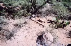
Found the photo Peter Esposito took of the soldiers grave on the road between the Quarter Circle U ranch and the Milk ranch. A group of us were at the Rendezvous a few years ago and went over to the QCU to see if we couldn't find the gravesite which is about a mile or so east of the QCU ranch. The site matched the description and photo Al Reser had taken of the grave back in the 1960's.

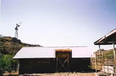
The other photo is the stone house that Matt Cavaness first built at his ranch in 1871. The Quarter Circle U ranch uses it today as a grainery.

QCU soldiers grave.JPGQCU Cavaness stone house .jpg
 

Not Peralta,

Thanks for those words. We are fortunate we live close to the mountains and have the opportunity to search and hike them when we have the time. Those who live far away and a visit to Arizona is out of the question are forced to use Google Earth and other means to do their research. I have always tried to help others with their searching. I've spent a considerable amount of money grubstaking other dutch hunters and buying or trading things that might further the search. I've guided many people in the mountains and helped them learn about the places and sites they were interested in. I've introduced some to other old dutch hunters who also furthered their searches. I've made many good lasting friends in that endeavor as well as a few individuals that turn on you as soon as they got what they wanted from you. The Dutchman community is full of all kinds of humanity from every walk of life. There are no average dutch hunters, each has their own personality and method of getting from point A to Waltz's mine.

Matthew

Matthew,

Quite true. I think most of us have run into some low-life Dutch Hunters who lie to your face trying to build up their own ego's and than turn on you like a wild dog.

Good luck,

Joe Ribaudo
 

Joe,

I'm not sure what any of this has to do with the milk ranch but I do recognize that Matthew introduced the unscrupulous individuals' subject to the thread and you are simply responding so your post is not out of place. But....

I know many of us have and some continue to be played for fools. I think it is human behavior for people to "want" to believe and trust others so when we are betrayed we frequently strike back with strong words. It is my opinion that these words may give us temporary satisfaction but in the long run they add little to exposing the truth. The final objective for everyone "should be" the truth and I don't believe these exchanges get us any closer to that objective.

Just my 2 cents,:laughing7:

Garry
 

Status
Not open for further replies.

Top Member Reactions

Users who are viewing this thread

Back
Top