you may not like this, but here it is anyway..........
If monumented trails have been knocked down,
I would expect markers on the cactus removed
as well, for one reason or another.......
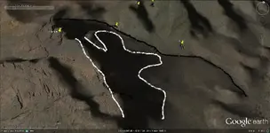
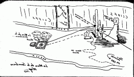
Near as I can tell, it's just a drawing someone made back in 1927.
For some reason, perhaps wishful thinking, they thought it was the Sombrero Mine.
Maybe because there is a small peak, shaped like a Sombrero, nearby.
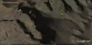
Approaching it from the east, it looks very much like a peak on another couple of maps in this collection.
Another view looks a lot like the Perfil Map as well.
I've hiked out there three times,and spent probably 10 hours or so, mostly down below.
Likely missed seeing some of what's in the neighbourhood.
You have reversed the map, but I'm not sure that's necessary.
There is a needle with a balanced rock in the un-cropped photo I shot back in 2008 or 09.
But it is to the left and further away than the drawing shows it......and down on the opposite side of the canyon.
I'll post that crop later,along with a couple of other shots of what I've mentioned.
Was up there three years ago, on a cold and windy,wet day. Wound up looking around by flashlight,as it was getting dark, so I didn't check for any rocks stuck in cactus. Just too much to look at down below.
But I'd be surprised if they were still there, after all this time.
Since then, I've been all wrapped up in the Stone Maps, so I haven't been back for a better look-see. But it did look like some digging would be necessary.
Regards:SH.
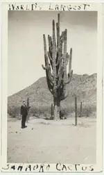
It's a crop...but shows a bit more of the view
Shot from lower down and back
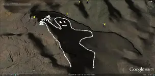
reminds me of the Perfil mapa...but from a different perspective maybe