LDM why you cant get it ! MAP #10

Joe

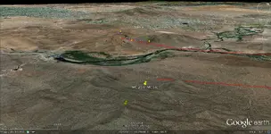
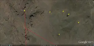
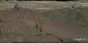
" South of Black Mountain ( not Black Top Mesa ) between La Barge and Needle Canyon " is the place were Ruth wrote on his notebook " Veni , Vedi " , because is the only place from where you can see the " Perfil " or " Ruth - Gonzales " map reversed . Namely the " Weaver's Needle " to the right and the other hight mountain ( Bluff Spring Mountain ) to the left . On the map the author didn't show The " Weaver's Needle " from the base but only the top and the other picture to the base is a part of the mountain in front of it . I s a trick to confuse .
Maybe " Ruth was a greenhorn, tenderfoot " but he was smart and before reject the clues , he tryed to decode them . If he didn't killed , today not talking about were is the LDM .

MM,

I assume, you aware of the mine on the west end of that mountain.


Take care,

Joe
 

Hello my friends, I have another map thats probably not related. It's in spanish and shows montana negra (BLACK MOUNTAIN )
it is related to a treasure but i'll try to post it this week.the only other word is apacheria.
 

I give credit for these images to Joe Ribaudo's Thread "Adolph Ruth".

I do not see any copyright/trademarks on these images, and will use
them freely.

I do not use these images to offend or take profit from them.......Jack Herman
 

Attachments

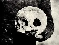
  • Ruth%20Skull%20%20%20Left%20side.jpg
    Ruth%20Skull%20%20%20Left%20side.jpg
    24.3 KB · Views: 805
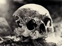
  • Ruth_'s%20Skull.jpg
    Ruth_'s%20Skull.jpg
    62.8 KB · Views: 207
Last edited:
Joe


The LDM is " en medio de cimas ( the word " S.CIMA " of "Perfil " map is an anagram )" of " Sierra mas alta " , and not on the west end . Near " Bluff Spring Mountain " are a lot of mines . To find how looks the LDM region , look the Peralta's " Cross trail " stone map to the end of the trail .


Marius
 

Last edited:
Homar

The " cave " 200 feets from LDM is not a common cave . Read the post at " LDM why you can't get it ! MAP #33 " thread owned by JackH .


Marius
 

this "Heart" thing is just starting to sink in........

I think someone was trying to direct me here......
 

Attachments

  • Heart in the interior.jpg
    Heart in the interior.jpg
    264.2 KB · Views: 266
Is a beautiful " shadow ' heart . Sometimes the " heart " is in incredibly place . Who knows , maybe is the " golden " heart , enought to seem from the ground and not only from the space .

Marius
 

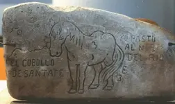
The Horse

"EL COBOLLO" (CABALLO)

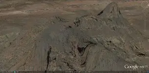
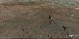
Map #10 from (MEQSA) Mesa on the satillite image, the highest
and nearest Peak across the Salt, I would think that the "HORSE
is visible, if not visible from a lower angle from (Usery Mountain).

Pin placement is between the ears, HORSE mane and long tail is visible,
HORSE looking from right to left, front & rear legs are visible as well.
 

Attachments

  • HORSE.jpg
    HORSE.jpg
    250.8 KB · Views: 258
  • NEAREST HIGH PEAK ACROSS SALT.jpg
    NEAREST HIGH PEAK ACROSS SALT.jpg
    303.6 KB · Views: 249
Last edited:
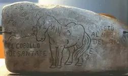
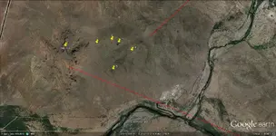
Horse + five (5) markers

I have always said the RIO on EL COBOLLO is the Salt River.

Now I have presented here, how the 5 fits in relationship to Red Mountain
(exactly the same spacing and placement) as the outcroppings/major fixtures
across the Arroyo from Red Mountain.
 

Attachments

  • El Cobollo.jpg
    El Cobollo.jpg
    66.5 KB · Views: 188
  • Horse + 5 markers.jpg
    Horse + 5 markers.jpg
    270.2 KB · Views: 220
Hello again Jack
I'm squintin real hard but can't figure out what the 6 pushpins are suppose to represent. Mind helpin me?
V
 

Not really. The first overhead image does not lay out anywhere near the configuration of the stone "dimples". And the second image shows how minor these points are. You can overlay the "dimples" to an infinite number of points in the supes by changing the scale and end up with a closer layout than that.

But maybe I'm just blind or a novice that hasn't learned how to do the Dutch-squint yet.

But if it looks good to you, go with it. Send back photos if possible.

V
 

I was talking about the heart marking. The horse and 5you markings are not correct, sorry.but of course this is your hunt.I just tell you this so you don't make the hike. I submitted peralta heart months ago, check it carefully.
 

You have to look for one or the other.they lead to different treasures and .areas h
 

You have to look for one or the other.they lead to different treasures and .areas h
 

Everyone has an Opinion.......and that is Good !

Seems to be more than One Opinion. Based on the "Handle" and the
neighborhood from which the second opinion responded, I give "peralta"
the nod.

We all take Liberties, and I might take a Few more because of the tools
of my Investigation.

I Personally do not use Overlays. If I believed that the MAP Makers used
Overlays, I would have looked further into that Tool.

Because of the Richness of the Area of these Threads, there cannot be
any doubt on the vast number of Mines that have been discovered and
most likely mined out, based on the value of the Gold to retrieve it at the
time.

Based on the information available (Spanish are not talking) the Spanish
have been taking out precious metals from the North American continent
(New Spain) since the late 1500's, and Waltz's time (he's not talking either)
which accounts for about 3 Centuries.

Is it Possible that Named Mines have been Secreted and re-found in areas
that the New Finders have labeled as the Original Named Mines ? Only now
that they have been called by the Old Name for so long that they are now
known as "The Named Mine." I Think So.

Quote:
Apache Jack further said that the Apache left a marker. In a steep-climbing arroyo high upon a mountainside where no white prospector would normally think of looking for gold, was a bright yellow ribbon of it in a narrow vein of rose quartz. It lay under towering cliffs, which overhung the whole arroyo, within plain sight of nearby Weaver's Needle, and thinking no white man would ever venture there, the Apaches did not conceal this place. Below was the secret marker, an eight-foot high boulder hoisted upon the skyline of a ridge which, because it formed an abrupt bend in the north-south trending Needle Canyon, formed also for a few hundreds yards the only south slope. This boulder had been chiseled to look like a rampant horse's head with mouth open, one ear laid back and with the other ear standing straight up. However, it was only so recognized against the sky when viewed from down canyon a short ways to the north.

If the Apache's were capable of this Feat, there would be many Monuments to be Witnessed !
Although these Indigenous Peoples have created other Landmarks, they were NOT as creative
(Engineering) as other Civilizations, except like Waltz, in the Direction of the Mine which is Offered !

I believe that Quote above just as much as all the Clue's Waltz offered, other than maybe the
last couple which may have been mis-interpreted!

Quote: I was not a citizen of the United States, nor had I declared my intentions of becoming one. So, for that reason I couldn't locate and record the mine." Since he was, in fact, a legal citizen, having been naturalized in Los Angeles, California in 1861, one has to wonder why he made this statement. It tends to shed doubt on anything he ever said. Unquote.
 

Top Member Reactions

Users who are viewing this thread

Latest Discussions

Back
Top