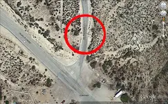
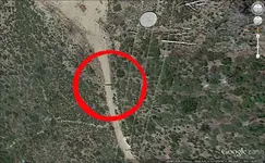
Laurence Foreman's Land Parcels Near Palmdale, California
I wanted to revisit Larry Foreman’s real estate dealings near Palmdale, California in the 1950’s.
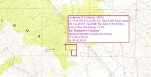
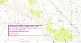
Larry, and in one case, in concert with Minnie Weeks, obtained title to three parcels of land that were owned by the Federal government and administered by the BLM. The three parcels were all located in the foothills of the Sierra Pelona Mountians in Los Angeles County and they lie within about 4 miles of each other.
Looking at some of the surrounding parcels in the area it appears that a large portion of the desirable land had passed to individuals in the 1930’s but there remained a quilt patchwork of unclaimed remnants.
It would appear that Larry, and in some cases Minnie, located these parcels by researching records and identifying them as unclaimed federal land. There was also a record of another parcel that Larry obtained in San Diego County. I would believe that Larry physically checked out these parcels before filing on them.
Since we believe that Larry had a full time job with the Municipal Court in these years, these land acquisitions would have been an additional time consuming and tedious effort. It would have almost been a second job. Lots of paper work and boots on the ground effort would have been involved.
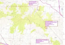
Below is an approximation of where I located the 3 parcels of land in Twp 5N, Range 12 W.
I apologize for the quality, as I zoomed out to include the surrounding area, the print became small and everything is fuzzy. For anyone interested in pursuing these parcels, the map is from the
15 Minute Ritter’s Ridge Topo (1958). The topo pdf can be downloaded from the USGS site
The 1958 map would be roughly contemporary with Larry's land acquisitions and would reflect the roads, etc.
 Why was Larry Foreman obtaining this land?
Some place to store his gold bars?
Speculative investments in real estate?
Weekend base for prospecting and rock collecting in the surrounding mountains?
Could this be the setting for Larry’s encounter with the aliens?
Other?
The largest and most expensive tract (52 Acres) that we have a record for is located with fairly easy travel access. Travel North from Los Angeles on Highway 14 toward Palmdale and take the exit before you reach Palmdale (Palmdale Lake) and travel West on West 40th Avenue. On Google, it looks to me like the main road begins to swing north after about a mile and a half but there is a dirt road that continues straight west. Larry’s property begins about 2 miles west of Highway 14 on the south side of the road.
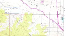
The following map shows the approximate location of Larry’s 52 acres.
Note: The reason that the parcel is not square is because the surveyors had to make corrections for the township in the northern most sections to account for the earth’s curvature.
If you are working with the grids on the 2012 Ritter’s Ridge topo, they do not represent sections.
Larry's land its self is rather nondescript. There were mines in the mountains to the west but I’m unaware of what type of minerals were being mined. I also don’t know what the exposed geological formations were in the surrounding mountains.(Any Help?)
We have indications that Larry was an amateur prospector and he owned a Rock Shop later in life. Could these hobbies have had anything to do with these parcels? I wonder if Larry ever filed any mining claims?
I’m going to insert jpgs of the other two parcels for reference. These parcels apparently didn’t have the ease of access that existed for the 52 acre plot. I believe the GPS information is close. I appreciate anyone looking over my shoulder and if I have made any errors in the analysis to point them out.
Just adding a bit more detail to Larry’s past but unanswered questions are still plentiful.
Garry


