Who can locate the missing pilot by map dowsing?

Dell Winders said:
oh bull crap..................It dont work, it aint real.....No way jose...........Sorry you self deluded morons...................What a joke.....There I said it.............Hahahahahahah.....Poor people.................

Sorry to see you have a such low opinion of yourself.

"The door to knowledge & understanding is never open to a closed or prejudiced mind" Dell

I have a high opinion of myself, just not on hocus pocus, the more I hear people talk about this BS, the more I laugh...If it worked, you would all be rich, you can bank on it....It would be proved in the light of day....I love some of these far out explanation i've read on here...Well it least it is amuseing....I can prove to you my metal detector works, aI can even tell you pretty much how it work...I can use it just about any time, and any place.....I would really love to see you do your thing.....No personal attack on you, I just think it is pure bull, but if you go for it, more power to you...I mean alot of people believe in Witchcraft, and voodoo also.....Tom
 

priest004.jpg


1847PeraltasWitch.jpg


Oh he's a priest on one side, and a witch on the other..........Twisted

1847PeraltasSleepingGiant.jpg
 

I took a ride across Nevada on Highway 50. I crossed 14 different mountain passes. All the mountain ranges toward the East had a lot of snow on top of them. If the plane is over there it will be hard to spot until summer....Art
 

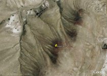
I noted Boundary Peak appears more than once on Nevada Google Earth so see below coordinates. There is a reddish soil area. I figure he may have flown North into this depression.

38° 6'41.67"N 117°47'42.52"W 50 miles East of Boundary Peak NW from Goldfield

I noted Dell's effort is not that far from here. I did mine before seeing his.


waveland
 

Attachments

  • fossett 4.jpg
    fossett 4.jpg
    104.8 KB · Views: 385
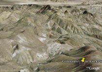
Take a look at this terrain pic from Google Earth of the area in previous post. I couldn't find that many potential landing spots on that range but did the dowstimate before I saw the terrain. There's 1/5th of a mile of what looks like flattish ground there, which he may have seen as an airstrip in this situation. Was there a fierce wind up there perhaps?

See many other landing areas? I see it's about 30 miles outside the main search area but one assumes distance wouldn't have meant much to Fossett.

waveland
 

Attachments

  • fossett5.jpg
    fossett5.jpg
    161.1 KB · Views: 356
Hey Jim…I haven’t heard any reports latley…The mountain tops in Northern Nevada now have a lot of snow on them,,,Art
 

It's been reported that he was scouting out dry lake beds for a potential land speed record when he disappeared. He left the Flying M Ranch near Yerington NV in a Citabria Super Decathlon stunt plane. The search by the civil air patrol is covering this area.
He has an emergency locator beacon on the plane that should have gone off had he crashed.


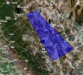
As early winter weather begins to descend on the rugged high country of northwestern Nevada, the search for aviator Steve Fossett, missing since September 3rd, continues from the Flying M Ranch (near Yearington, NV) with an important extension to the privately funded and directed effort planned for the coming week. This will include the use of high altitude digital mapping technology linked with computer analysis and anomaly search techniques.

Rotary and fixed wing aircraft as well as ground personnel are still in place to run down leads and theories as they emerge. And although visual, infrared and hyper-spectral analysis of large areas have all generated specific leads over the past 6 weeks (as have radar trace and satellite image analyses), all have so far failed to reveal any sign of Steve's Bellanca Super Decathlon single-engine aircraft. Additionally, side scan sonar searches of the several area lakes have now been completed.

While satellite generated images such as those from Google Earth (at a resolution up to 1 meter pixel size) are well able to see an intact aircraft (or large aircraft sections / elements), the members of the ranch-based search team are now looking to analyze much higher resolution images, potentially revealing debris or a forced landing / crash site. Using a dedicated jet aircraft, the High Altitude Mapping Missions (HAMM) photography expected to begin this Sunday (21 October) will generate an image with a pixel size of 6 inches (approx 15 cms), many times more detailed than standard satellite images.

Flying at approximately 20,000 feet AGL over the mountainous terrain, the HAMM aircraft will photograph 800 sq. miles per hour or about 2000 sq. miles per day. Limiting factors will be essentially seasonal ones: increased cloud cover and low solar angle - with the sun getting lower in the sky every day. However, searchers believe that weather will be favorable from Sunday through Friday next week.

Initial missions are planned for the Sierra Nevada and White Mountain areas as winter snows will cover them first. Then the mapping will move to lower ground south of the ranch and east of the Sierra Nevadas, including into Death Valley and the Owens River valley along Highway 395. Mission flight paths are being determined by analysis of a Geographical Information System (GIS) map incorporating all known GPS traces from the aircraft involved in the private part of the search, plus data received from the Civil Air Patrol (CAP), Army and Air National Guard and US Air Force search efforts.

Analysis of the HAMM data will be done initially by Fireball International via a network of computers, with anomalies to be sorted by shape (searching for straight lines, etc), color (especially the bright blue part of the aircraft's fabric cover) and reflection / shine - or a combination of any and all these elements. Then SAR experienced personnel will review these leads to prioritize further - with helicopter, fixed wing and ground assets available to be mobilized to get eyes on each potential target.

http://www.stevefossett.com/index.html
 

Attachments

  • fossett_search.jpg
    fossett_search.jpg
    53.5 KB · Views: 320
Hey gypsyheart….Thanks for the information. Myself and a few others have the crash site to the east. This is the first time I have Dowsed for a missing person. I don’t think I will try it again as I feel bad about the fact that I was no help to him when he was alive…Art
 

Gyspy... yes, I wanted to - then forgot to thank you! :P

I don't feel bad either way... I was just goofing around.

Although I really did try...

Now - if he's within a half mile - maybe I'll start more experimenting...
 

Hey Montana Jim….If you don’t try there is no way to tell if you can do it. After doing many many maps you can start to see if there is a pattern. When I am way off I have found the target is located North East of my Mark…Art
 

aarthrj3811 said:
Hey gypsyheart….Thanks for the information. Myself and a few others have the crash site to the east. This is the first time I have Dowsed for a missing person. I don’t think I will try it again as I feel bad about the fact that I was no help to him when he was alive…Art
Don't feel bad, Art.

It looks like this thread hasn't been updated, but since the general concensus is he died upon impact, all this hunt consisted of was really a "remains recovery" from the beginning. At least you tried! :thumbsup:
 

Yea... I thought about comming back in here and awakening the topic again - then decided not to.

I tried, but - wasn't even close.

There goes THAT career plan. :P
 

I found some Map Dowsing lessons a while back. I learned a lot . This is the Dowsing oath I read before each map.

May I, can I, should I, ESTABLISH, CHANGE OR ADD Dowsing Conditions and Agreements or Programs which will be continually in effect until changed by me.
"Primary Program is to be continually in effect until I choose to make changes.
Covering the overall primary controls, limits, agreements and dowsing responses.
The Purpose is to determine amounts, effects, conditions, circumstances, influences, times, measurements, distances, numbers, percentages and other requested areas.
Dowsing Communications to be inter- cooperative and restricted to: the Overall Universal Superconscious, my Superconscious, my Higher Self and their approved Spirit Guides/Guardian Angels, and others of their choice, my Mind Systems, my Subconscious and its related systems. This is to cause me no harm, discomfort or loss of energy, either physically or spirituality.
Influences such as misleading thoughts, imaging, wishes, or any other conditions from any source, physical or non- physical, including my own or other persons, entities or mind systems of any kind, are not to affect me adversely or cause incorrect dowsing answers.
Time as related to dowsing is to be in my time unless other wise requested.
Answers are to be selected from all available knowledge and information sources.
The Method of Answering by the pendulum or any dowsing systems is to be: General, swinging or moving to "yes", "no" or other information, indicating the most appropriate answer for the question asked. Clockwise spin is for searching or other agreed-on systems.
Temporary Changes may be made by me while dowsing, reverting back after use.
Program Changes like adding, deleting or changing may be made by me, but only by using a three step system of my choice. End of program."
"May 1. Can 1, Should I Program, is to become a working part of all my Dowsing Programs, and be continually in effect until I choose to make changes. When used in reference to dowsing questions, the May 1, Can 1, Should 1, is to have the following meaning:
May I is to mean: Do I have appropriate permission?
Can I means: Do I have the ability to successfully dowse in this area and am I ready?
Should I means: Considering all aspects related to this situation would it be appropriate, proper and suitable to dowse in this area?
"Map Dowsing Program is to become part of and work with all my programs or agreements, and to be in effect until I choose to make changes. When using a map or drawing, some type of dowsing device, and with or without an additional pointer or straight edge, the dowsing system is to indicate when the pointer, straight edge or dowsing device is indicating the present map represented location of the object, subject or target specified by the dowser. End of Program., thank you"


When I first start on a new map I have a list of questions I want to ask. Once I know what I am looking for I start to divide the map into sections. When I have it down to a very small area I then make another list of questions like depth and markings. If I don’t make a list I often find that I missed asking the right questions as they change with every new location….Art
 

Top Member Reactions

Users who are viewing this thread

Latest Discussions

Back
Top