SODABOTTLEBOB
Silver Member
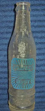
"What Is It?" It's "Solved!" (Thanks to all)
Important Note* (Added after original posting).
Please read this entire thread, especially my post #17 before formulating an opinion on this topic, or posting additional comments.
Thank you.
Respectfully,
Bob
 ~ SUGGESTION ~

As a big fan of the "What Is It" section of TreasureNet, I would like to suggest posting "Google Earth" links/coordinates showing where individuals find their items in question. Every time I read one of the threads, I can't help but wonder where it was found, and what the terrain and other features of the area look like. I realize some members may not want to disclose this information, and I respect that. But I'm sure there are many others who would gladly share it, but just never really thought about doing it. It think it would be facinating to have a visual to add to the enjoyment of participating in and following many of the ongoing topics.
Google Earth is easy to navigate through, and once you're familiar with how to determine coordinates, it's just a simple matter of posting that information here for others to look at. As many of you already know, Google Earth is so advanced now it will take you down to almost ground level, not to mention other features too numerous to include here.
Anyway, it's just an idea I had and wanted to throw out there for others to think about. I hope many of you will agree, and I will look forward to "zooming in" with you as dig your way into history.
Thanks for reading this. Your comments are always welcome.
Sincerely,
SODABOTTLEBOB
Important Note* (Added after original posting).
Please read this entire thread, especially my post #17 before formulating an opinion on this topic, or posting additional comments.
Thank you.
Respectfully,
Bob
~ SUGGESTION ~ As a big fan of the "What Is It" section of TreasureNet, I would like to suggest posting "Google Earth" links/coordinates showing where individuals find their items in question. Every time I read one of the threads, I can't help but wonder where it was found, and what the terrain and other features of the area look like. I realize some members may not want to disclose this information, and I respect that. But I'm sure there are many others who would gladly share it, but just never really thought about doing it. It think it would be facinating to have a visual to add to the enjoyment of participating in and following many of the ongoing topics.
Google Earth is easy to navigate through, and once you're familiar with how to determine coordinates, it's just a simple matter of posting that information here for others to look at. As many of you already know, Google Earth is so advanced now it will take you down to almost ground level, not to mention other features too numerous to include here.
Anyway, it's just an idea I had and wanted to throw out there for others to think about. I hope many of you will agree, and I will look forward to "zooming in" with you as dig your way into history.
Thanks for reading this. Your comments are always welcome.
Sincerely,
SODABOTTLEBOB