Wallowing in memories

I live 20 minutes from New Bedford, it is #1 or 2 fishing port in the US. In the late 18th and early 19th century it also was the #1 whaling port in America.


WD
I seem to remember that the wreckage on the east side of the southern tip of Great Isaak consisted of iron ribs and some wire rope. Would this be consistent with the Elijah Swift?
Were the Whalers of that time period built with the composite method?
 

Last edited:
The enigma of the 1765 Bahamas shipwreck.

Will we ever solve that one?

This old map reminded me of it.

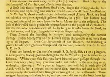
here is a description out of a 1800 Coast Pilot.
 

Attachments

  • Roman's_1765_shipwreck.jpg
    Roman's_1765_shipwreck.jpg
    748.1 KB · Views: 70
here is a description out of a 1800 Coast Pilot.

I wonder what exactly the expression "her bottom beat over" means? My guess is that the "rich Galleon" was driven on the shoal by the storm. Bumped with the waves until she went to pieces. The bottom dropped out. The upper structure went further, maybe miles, breaking up along the way, scattering the content over the sandy bottom. Dense artifacts like gold and silver swallowed immediately up by the sand. Light goods and boxes floating and driven by the wind and waves for may miles.
I have not found a chart that shows the "Money Key" yet. Did that key have this name before? Or did it get the name maybe from some coins being found after the shipwreck?
 

I have not found a chart that shows the "Money Key" yet. Did that key have this name before? Or did it get the name maybe from some coins being found after the shipwreck?

North part of Berry Islands, first map in the thread. Or is that what you were asking?
 

Money key is a popular name...several that I know of....one is on the north tip of andros...that would be the closest to the 1765 wreck....I looked for money there once many years ago. There was an old schooner driven high and dry on that key. We camped up there for about a week before sailing home to mangrove cay south Andros. I was in my 20s and we mainly drank ,spearfished for diesel money, and bar b qued. We searched around for money but found none !!
 

I wonder what exactly the expression "her bottom beat over" means? My guess is that the "rich Galleon" was driven on the shoal by the storm. Bumped with the waves until she went to pieces. The bottom dropped out. The upper structure went further, maybe miles, breaking up along the way, scattering the content over the sandy bottom. Dense artifacts like gold and silver swallowed immediately up by the sand. Light goods and boxes floating and driven by the wind and waves for may miles.
I have not found a chart that shows the "Money Key" yet. Did that key have this name before? Or did it get the name maybe from some coins being found after the shipwreck?

Big nasty jagged rocks there....some just barely submerged at low tide. Castle rock is close by also...just to the south of South riding rock. The mark for the 1765 wreck is a couple miles (just estimating)...east and south of castle Rock.
 

here is a description out of a 1800 Coast Pilot.

Didn't seem like 7 miles but very well could be...never measured it out and we always pass north of the wreck.....just went right by it on Sunday !!
 

Money key is a popular name...several that I know of....one is on the north tip of andros...that would be the closest to the 1765 wreck....I looked for money there once many years ago. There was an old schooner driven high and dry on that key. We camped up there for about a week before sailing home to mangrove cay south Andros. I was in my 20s and we mainly drank ,spearfished for diesel money, and bar b qued. We searched around for money but found none !!

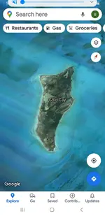
Screenshot_20210527-221833_Maps.jpg well...to be certain I would check here also....even closer to the 1765 wreck !! I've never been but most islands get a name for a reason !!
 

Screenshot_20200327-202543_Maps.jpg
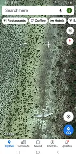
And while we're searching these keys and cays we might as well hit the island called prince William island....some drug planes of Carlos leaders are crashed there....this island was a smugglers haven in the 80s !!
 

Andros was my second home growing up !! Gosh I miss it !!
 

Money key is a popular name...several that I know of....one is on the north tip of andros...that would be the closest to the 1765 wreck....I looked for money there once many years ago. There was an old schooner driven high and dry on that key. We camped up there for about a week before sailing home to mangrove cay south Andros. I was in my 20s and we mainly drank ,spearfished for diesel money, and bar b qued. We searched around for money but found none !!
Money key on the North tip of Andros, I had this stuck in my memory. Much more logical for flotsam of the 1765 wreck to be found.
 

attachment.php

And while we're searching these keys and cays we might as well hit the island called prince William island....some drug planes of Carlos leaders are crashed there....this island was a smugglers haven in the 80s !!
I have seen a wrecked plane on Great Isaac and another one on Cay Sal. There must be hundreds all over the Bahamas.
 

Any real underwater operation is off limits without permitting....but as far as I know orange cay is no different than anywhere else. Anyone is welcome to go there like any of the other islands, keys, cays, and rocks. Of course you have to clear customs and get a crusing and a fishing permit. The problem with orange cay is its remoteness....must be a self sufficient boat with enough supplies to explore there. I went in the 90s spearfishing there and saw a very promising ballast mound in 30-40 ft. Looked spanish to me....big beige river rock like the ballast on the 1733 fleet sites. We speared black groupers on that mound for a couple days before we had to go back to Bimini for cold beer !! Woooo hoooo those were good days....I cared little for treasure hunting then.
 

Now you've got me wallowing in memories !! Care free days of freediving, and exploring !!
 

Any real underwater operation is off limits without permitting....but as far as I know orange cay is no different than anywhere else. Anyone is welcome to go there like any of the other islands, keys, cays, and rocks. Of course you have to clear customs and get a crusing and a fishing permit. The problem with orange cay is its remoteness....must be a self sufficient boat with enough supplies to explore there. I went in the 90s spearfishing there and saw a very promising ballast mound in 30-40 ft. Looked spanish to me....big beige river rock like the ballast on the 1733 fleet sites. We speared black groupers on that mound for a couple days before we had to go back to Bimini for cold beer !! Woooo hoooo those were good days....I cared little for treasure hunting then.

40 years ago one was not allowed to stop at Orange Key. There was a sand mining operation somewhere in the region. Don't remember exactly where also was no stop there, boats not welcome. Maybe the same place?
 

View attachment 1928253 well...to be certain I would check here also....even closer to the 1765 wreck !! I've never been but most islands get a name for a reason !!

That old schooner, was it a Bahamian schooner like the old wreckers and maybe spongers used? They must have been excellent sailors, but shallow draft. Surely an interesting design. I am hoping to find one like that to copy the hull shape for a reproduction. Probably they were not built to plans, just master craftsmen who inherited their craft from father to son, for many generation. Would be great to build a replica from timber of Andros Island.
 

Yes...sponges, and conch. Likely built in south andros....the bastions were good builders in Lisbon creek.....I hung around for the building of one of the "avengers"...she was a small full keel , false house , sloop. She was a shoal draft boat meant to fish conch, sponge,and crawfish. Totally open interior for loading. A swift champion in the August Monday regatta in Andros!! The schooner on money key was similar but much bigger, and double masted....1920s probably
 

Last edited:
RECYCLING.
In the old times they called it "wrecking".
What the wreckers really did, is recycle the materials and cargo of the ships that were destroyed by the sea, the rocks or the storms.
The wreckers would remove everything of value. This means everything of value to them. Ropes and tackle, sails, fittings and such could be reused for the Bahamian boats. All metals were valuable. There are countless references of wrecked ships being recycled. If I remember right Christoph Columbus dismantled the "Santa Maria" when she stranded on the reef and used the materials to build a fort on the island.
There are innumerous references all over the world. I sailed along a coast where the storms out of the South East were called "The Carpenter". This is because after such storms, there was plenty of timber to be picked up on the beach, from shipwrecks. Timber to be used by carpenters to build houses. Special furniture "built with pine wood from Riga" was highly priced. Of course the pine wood from Riga was furnished by the ships wrecked on that coast during the "Carpenter" storms.
Now, where is Riga? Riga is on the Baltic. Northern Europe. For many centuries Riga was famous for producing the best masts for ships. Also the best linen sails. The best wax and linseed oil to impregnate the sails and ropes. The best hemp ropes.
Then you ask: and where is this coast where they built special furniture with "Riga pine wood"? It is the South East coast of Brazil, down to Uruguay.
RECYCLING shipwrecks is a very old occupation. It goes back to the time of the first watercraft ever built by mankind.

Yes, I weathered several "Carpenter" storms with my Schooner there myself. I even used a few pieces of "Riga pine wood" building this Schooner. So you could say I know what I am talking bout.
 

Last edited:

Top Member Reactions

Users who are viewing this thread

Back
Top