Unusual rock carving uncovered from heavy rains

Bwbob ; Sorry, another oops was in a hurry , it's been a very busy week end. The year 1873 add the numbers 1+8, you get 9, now take the 9 and add it to the 7 that equals 16, your only adding single numbers so you add the 1 and 6 which equals 7 now you add the 3 , and you have 10. Since there are 36 sections you have to figure out how to add the other numbers, such as the day of the month etc. This was told to me by an Uncle ; now deceased, who's grandfather was grooming him to take over for him when he passed. The Uncle didn't know this and went into the army. He believed his grandfather was a sentinel. Also had a lot of knowledge about trees.

Thanks!!
 

Bwbob ; Sorry, another oops was in a hurry , it's been a very busy week end. The year 1873 add the numbers 1+8, you get 9, now take the 9 and add it to the 7 that equals 16, your only adding single numbers so you add the 1 and 6 which equals 7 now you add the 3 , and you have 10. Since there are 36 sections you have to figure out how to add the other numbers, such as the day of the month etc. This was told to me by an Uncle ; now deceased, who's grandfather was grooming him to take over for him when he passed. The Uncle didn't know this and went into the army. He believed his grandfather was a sentinel. Also had a lot of knowledge about trees.

Curious is this formula/solution, pretty standard?, I guess what I'm asking is by doing the math as you have explained the Sect,Twp, Range will not work, but if I manipulate the #'s as in combine DOB & DOD #'s together ie; adding the months together i get section, years added give me range, days = twp, after using your math I then land on an area that was owned by the people I looking into, now if I can get access to the property.. and then figure out where to start looking on 600 acre area, hope this makes sense, I need more coffee...
 

OK, so I overlay the current plat map over the one I used to check the Sect TWP and Range from 1912, I encounter a small problem with urban sprawl, the property has been divided up into so many parcels, as in 5 acres here,10 acres there, and so on, also almost all the land has been cleared Hmm ? what to do, the search continues
 

Hello Mark 60; To answer your question " Is the formula/solution pretty standard? " It would depend on the area of the country your searching in, each would have their own specific knowledge of that area. For the most part it would have to be similar. But you already have a search area so getting the area doesn't matter except to verify with a map. Looking at your picture on Nov.23 #109 you may have already found your spot and may be a storage vault, similar to one we found.
 

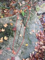
Can anyone identify these symbols 2 of them can be easily seen it looks like a third one on top of the rock very faint I've been along this river bank several times and have never seen this rock before but this river changes all the time from heavy rains and the river rock shifts

Mark60.........Found this,(triangle with Dot) looks the same as yours :).Scroll down 1/4 page here.>> https://treasureandantiqueseeking.blogspot.com/2012/02/deposit-around-tree-or-rock-triangle.html
 

Last edited:
Mark going up stream from that stone to the first mesa. There may be other stones. That one stone is the flag man stone. It was a starting point. I've found them next to the bank of the river. There will be other if you find its original place. Here its on the south side of the river on the north side of mesa. Does that creek run east to west or vise verses?
 

Mark going up stream from that stone to the first mesa. There may be other stones. That one stone is the flag man stone. It was a starting point. I've found them next to the bank of the river. There will be other if you find its original place. Here its on the south side of the river on the north side of mesa. Does that creek run east to west or vise verses?

Bob the creek runs N/S at this spot so the rock is on the west side , but overall it’s E to W not sure what you mean by a Mesa ? , I know what a mesa is when I’m out west but it’s not something we really have in the ozarks I have searched upstream for other markers but so far have come up with nothing everything I’ve come across is below and east of the carving
 

I want to thank everyone for your great ideas and thoughts it all helps in solving this puzzle. Happy New Years
 

if you check the old records 100 years ago missouri didnt have all the trees and foilage that it has now.people bringing cattle into area created the 2 inch top soil that my area has today.i did a search on my areas with signs, and all are at the same height above sea level so as to be able to see each spot from distance.
 

Hello Mark 60; To answer your question " Is the formula/solution pretty standard? " It would depend on the area of the country your searching in, each would have their own specific knowledge of that area. For the most part it would have to be similar. But you already have a search area so getting the area doesn't matter except to verify with a map. Looking at your picture on Nov.23 #109 you may have already found your spot and may be a storage vault, similar to one we found.

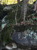
Rebelsmom, those 2 round stones under that ledge, have interested me since I took the pic, they dont look natural under there I havent been able to get back out of recent due to other obligations, and now it's just to freaking cold, hopefully it will warm up in the coming weeks, will keep you posted.. do you have a pic of what your similar spot looked like
 

Mark60; I hear what your saying about the cold, don't care for it at all the only good thing about hunting in the winter is your probably not going to have to worry about snakes. I'm sorry Mark I don't have a picture of that particular site , but I'll ask my partners. Like so many other places these days your no longer allowed to even bring detectors in, so we can't go back there. This spot was discovered in 1997, If we can't find one I'll get the two of them to draw you a diagram and compare your pictures with what they remember about it.
 

studying the picture of the ledge and the 2 stones, the stone in the back with the splotches appears to have some sort of pattern ? or it could just be me wondering aimlessly .. any thoughts.. Damn I wish this cold weather would break so I can get out there IMG_2365.JPG
 

Last edited:
Mark60: Sorry was unable to find a picture , and have been having trouble with the computer since the weather caused a power outage and the computer went down. I will try to explain as best I can until we can fix it . Shadows are very important so focus on the dark area of the bluff you will see the head of an Eagle with it's nose pointing to the ground where those two light colored rocks are. The rock on the the right toward the back is a heart rock. If you focus just on the bottom part of the Eagles head and those rocks it will appear to be setting over them as if on a nest. Now go back to the rock picture you have in that same shot #109 on the bottom of that rock is a circle, it also becomes a heart so study it when you are waiting for the weather to clear until you can compare every shape on that rock to your bluff. The rocks above that rock are also important but I can't be sure what they mean their covered up and I wouldn't want to tell you something wrong. Also since I cant see the right side of your bluff you will have to compare it to the rock. Now the one we went into had a natural stream coming out of the mountain above, the bluff hung over and low so that if the water was up it was completely unseen. It was during early fall the weather was cool and dry and the water level was just a trickle. After following rock and tree signs we came to a tree with a mule shoe on it, pointing to that overhang. We had to get down on hands and knees to see under the bluff but there was an opening , just large enough to crawl on stomachs and elbows which nobody wanted to do until a brother-in-law decided to go in first. It went back about 20 feet and looked like it was the end but then took a sharp dog-leg to the right for another 5 feet then opened up into a huge room cut out of the rock bluff tall enough to stand up, and it was empty except for a large mound of dirt which we didn't move for fear it might be a trap. If you can see an opening behind the rocks don't go that way there is a jagged edge above showing there is a dead fall trap from above. your opening should be on the right side of that spot and up higher just like your rock shows, look for an air vent coming from the room. It may be covered and sealed if so there may still be something in it. Take someone with you that you trust, and be extra careful and take lots of pictures. Hope you can understand this, it's kind of hard to explain without pictures to show you. Let me know if I can be of any more help. Rebelsmom
 

Hey mark, the white spots are part of it. Part is a word but the other are letters. On the Eagles nose that is. One is e+f or 56. Under the Eagle is the raptor or beast. Nice site!

Rebelmom, you share the language of an old friend of mine. Water is a part of my site as well. You have shared some good information. You spoke of the dead fall. Was that from above? There is the pit fall also. If I read it right. You talking about the one that be heads you. The Eagles claw.
 

in answer to your question Bwbob, about the dead-fall trap, if you go back to Mark60's #106 pic you will see a V shaped rock on top of it pointing out the area a long crack runs all the way through to the end , and I'm thinking the whole bluff would fall on top of anyone who removed the main rock that's holding it all up and bury you alive. Either way Bob I don't think it would be a pleasant way to die. lol
 

in answer to your question Bwbob, about the dead-fall trap, if you go back to Mark60's #106 pic you will see a V shaped rock on top of it pointing out the area a long crack runs all the way through to the end , and I'm thinking the whole bluff would fall on top of anyone who removed the main rock that's holding it all up and bury you alive. Either way Bob I don't think it would be a pleasant way to die. lol

Rebelsmom, V shaped rock? I don’t see it, above the ledge ? Or the other pic with the X cut into it, the area above that ledge does look pieced together somewhat some of those boulders didn’t come from above and they don’t look like they really fit together prior to where they are now but time and erosion may have caused it
 

Rebelsmom, V shaped rock? I don’t see it, above the ledge ? Or the other pic with the X cut into it, the area above that ledge does look pieced together somewhat some of those boulders didn’t come from above and they don’t look like they really fit together prior to where they are now but time and erosion may have caused it

IMG_23661.jpg
 

Top Member Reactions

Users who are viewing this thread

Back
Top