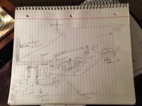
Unusual rock carving uncovered from heavy rains

as far as who used to come through here if history serves me right Frank James fought here at Wilson's creek so he would have had good idea of the area ,heck even Wyatt Earp started out just northwest of here in Lamar, MO as a deputy or sheriff ? and I remember my mother telling me stories of one of the Younger bro's was seeing or dating her great aunt down near Hollister or Forsyth, MO, can't remember which right now, will need more coffee..
 

Last edited:
as far as who used to come through here if history serves me right Frank James fought here at Wilson's creek so he would have had good idea of the area ,heck even Wyatt Earp started out just northwest of here in Lamar, MO as a deputy or sheriff ? and I remember my mother telling me stories of one of the Younger bro's was seeing or dating her great aunt down near Hollister or Forsyth, MO, can't remember which right now, will need more coffee..

James and Youngers were through the area a lot..As far as the people living where you are, were they German, Irish, English, Scots-Irish etc?

Knowing what ethnicity they primarily were helps a lot on reading sign. It also is beneficial to know as far as outlaws...Those guys went where people were sympathetic to them because they were kin in some way Or were from the same areas back east. Symbolism used most often was from their native origins. Same with Indian sign, I'd bet you find that in your area too. You aren't that far from me and there is a lot here.

Did any in that area serve with Quantrell or Anderson? Or have kin that did? You can find the roster of names online if you haven't done that already. Same with enlisted soldiers. Did the Union militia come through there at all? I probably have that information but you would know from locals especially.

If you have a county historical society in your area...it might even be in a library, that will help tremendously with getting accurate history of the area.

I'm very interested to hear what you find.

Kace
 

Last edited:
You are in Quantrill's Guerrillas' territory. They were all over Missouri and every one of his 400 or more men were members of the Knights of the Golden Circle, including the James and Youngers Brothers. The KGC used triangulation a lot in burying their caches. It appears that the long ends of the two large triangles are facing in the same direction. I would first check for obvious landmarks, out from the corners of the biggest triangle. The dot in the middle could very well represent a treasure cache. If that's the case, there will be 3 landmarks, old oaks or other trees that would have been large back in the 1860s-1880s, hills, mountains, or large boulders out from the corners of the triangle with the dot in the middle. If you can locate those three markers, then the most likely site of the cache (represented by the dot) will be right dab in the center of the triangle formed by the 3 landmarks. When and if you are able to locate the probable center point, you will need a deepseeking metal detector to locate the cache which should be 3-5 feet deep. I hope this helps you.
~Texas Jay

Home - Knights of the Golden Circle


TJ and I have to agree to disagree on ALL of Quantrell's Partisan Rangers being KGC...and that's okay.

For your quest it doesn't matter..Just keep an open mind on sign and the Obelisk....Have you found any other separate graves around there?

There's like 400-500 types of Oak trees so you could be looking at one that dies at 40-50yrs old or one that lives to 150yrs old in Missouri.

I talked to Orangeman on the Hoot Owl thread about shapes of Oak Trees if you'd like to read that. It helps on boot leather and frustration.

I'm pulling for ya Mark!

Kace

PS..OM has a great pic of a tree that's been grafted and manipulated I believe. It's pretty amazing.
 

Last edited:
James and Youngers were through the area a lot..As far as the people living where you are, were they German, Irish, English, Scots-Irish etc?

Knowing what ethnicity they primarily were helps a lot on reading sign. It also is beneficial to know as far as outlaws...Those guys went where people were sympathetic to them because they were kin in some way Or were from the same areas back east. Symbolism used most often was from their native origins. Same with Indian sign, I'd bet you find that in your area too. You aren't that far from me and there is a lot here.

Did any in that area serve with Quantrell or Anderson? Or have kin that did? You can find the roster of names online if you haven't done that already. Same with enlisted soldiers. Did the Union militia come through there at all? I probably have that information but you would know from locals especially.

If you have a county historical society in your area...it might even be in a library, that will help tremendously with getting accurate history of the area.

I'm very interested to hear what you find.

Kace

The Family I have an interest in immigrated from scotland and the wifes family from germany, and moving from maryland,ohio, tennessee and kentucky, having strong masonic ties as well, there were a lot of the Missouri Militia Co C and of course CSA had their militia's and Quantrill's men if I remember correctly, will need to check my notes but a lot from both sides traveled through here whether it was from Hartville,MO , or going to Wilson's Creek and Pea Ridge, there's a large cave used by the union to supposedly store weapons an ammo, but that was never really verified some believe it was used for other purposes and then of course there was the group that became known as the baldknobbers , a well organized vigilante group that would terrorize anyone they didnt happen to like at the time. their demise came to a climatic end when 3 members were hung in the town square of Ozark and 1 had to be hung twice since the rope didn't break his neck the 1st time.
 

You are in Quantrill's Guerrillas' territory. They were all over Missouri and every one of his 400 or more men were members of the Knights of the Golden Circle, including the James and Youngers Brothers. The KGC used triangulation a lot in burying their caches. It appears that the long ends of the two large triangles are facing in the same direction. I would first check for obvious landmarks, out from the corners of the biggest triangle. The dot in the middle could very well represent a treasure cache. If that's the case, there will be 3 landmarks, old oaks or other trees that would have been large back in the 1860s-1880s, hills, mountains, or large boulders out from the corners of the triangle with the dot in the middle. If you can locate those three markers, then the most likely site of the cache (represented by the dot) will be right dab in the center of the triangle formed by the 3 landmarks. When and if you are able to locate the probable center point, you will need a deepseeking metal detector to locate the cache which should be 3-5 feet deep. I hope this helps you.
~Texas Jay

Home - Knights of the Golden Circle


Thanks Texas Jay, appreciate the thoughts I have considered that and using that theory I think I have 2 sides the third is very elusive for some reason and could very well be gone ? but I'm still plugging away
 

ok let me throw this out there, its from a genealogy report i came across while researching a family that has a connection to my search by way of the obelisk headstone.?, I'm withholding a couple of names for now but research tells me the other 2 parties did not return back to MO --"in 1855, he went with Gen. Pool on the plains, searching for the discovery of Pike’s Peak, but failed to find it and returned home, and in the spring of 1857 he in company with #### ##### and #### ##### and families crossed the plains to California to dig gold, struck a rich lode and became wealthy. He came back to Missouri by ship to New York and then by land to home. He made 3 trips to California between 1857 and 1861." now I find no record of a Gen Pool, he may have just given himself that title? Pike Peak was discovered 1805?, how in the hell do you not find it ? lol, gold rush and the 49'ers claimed a lot of area for anyone that late to strike it rich, not saying it wasnt possible but 3 successful trips ?? these are things that make me go Hmmm..
 

ok let me throw this out there, its from a genealogy report i came across while researching a family that has a connection to my search by way of the obelisk headstone.?, I'm withholding a couple of names for now but research tells me the other 2 parties did not return back to MO --"in 1855, he went with Gen. Pool on the plains, searching for the discovery of Pike’s Peak, but failed to find it and returned home, and in the spring of 1857 he in company with #### ##### and #### ##### and families crossed the plains to California to dig gold, struck a rich lode and became wealthy. He came back to Missouri by ship to New York and then by land to home. He made 3 trips to California between 1857 and 1861." now I find no record of a Gen Pool, he may have just given himself that title? Pike Peak was discovered 1805?, how in the hell do you not find it ? lol, gold rush and the 49'ers claimed a lot of area for anyone that late to strike it rich, not saying it wasnt possible but 3 successful trips ?? these are things that make me go Hmmm..

That is strange...I don't know how Anyone could miss Pikes Peak.

Have you found the names on any genealogy site between Your place and California?
 

Kace, I haven't looked at CA at all to this point..
 

ok let me throw this out there, its from a genealogy report i came across while researching a family that has a connection to my search by way of the obelisk headstone.?, I'm withholding a couple of names for now but research tells me the other 2 parties did not return back to MO --"in 1855, he went with Gen. Pool on the plains, searching for the discovery of Pike’s Peak, but failed to find it and returned home, and in the spring of 1857 he in company with #### ##### and #### ##### and families crossed the plains to California to dig gold, struck a rich lode and became wealthy. He came back to Missouri by ship to New York and then by land to home. He made 3 trips to California between 1857 and 1861." now I find no record of a Gen Pool, he may have just given himself that title? Pike Peak was discovered 1805?, how in the hell do you not find it ? lol, gold rush and the 49'ers claimed a lot of area for anyone that late to strike it rich, not saying it wasnt possible but 3 successful trips ?? these are things that make me go Hmmm..

Mark..You might have checked this...Many folks from South of the River or SWMO that went to California for the Gold Rush came back through St. Louis...there were quite a few that were murdered either in St Louis or shortly after leaving, having been followed...robbed and killed.

Just a Thought..

Kace
 

let me throw this out there also, in regards to the family I'm researching the family plot confuses me, if the patriarch had money as history and the family plot suggests, unless there was a falling out with his parents and brother, they were excluded and are outside the perimeter, ?? even though other family members and extended family are buried there ?? I question why, ? also i remember something about the date of dec 25th being significant on suspected headstones but can't find my notes on it, ? anyone .. this is a simple layout of the plot no pictures for now may include later plot2.JPG
 

Last edited:
Mark, adding up the date for the birth and death of the daughters death should give you the township, section, and Range. This is the area you will be looking in, usually not that far but could be several miles away. Using southern slang it is down South, up North, back East, out West. Now for your first picture Oct. 2015 it is saying you are here. start your line measurement, but first go to the bottom of the rock and measure over to the right about two or three feet and dig about 6 to 12 inches, you may find something metal keep it, it is your key to find the right spot. dosn't matter if it is metal, glass,rock of a different kind, we have found them. If that works I'll post more.
 

thanks rebelsmom I will give that look and see what I come up with will update later
 

Mark, adding up the date for the birth and death of the daughters death should give you the township, section, and Range. This is the area you will be looking in, usually not that far but could be several miles away. Using southern slang it is down South, up North, back East, out West. Now for your first picture Oct. 2015 it is saying you are here. start your line measurement, but first go to the bottom of the rock and measure over to the right about two or three feet and dig about 6 to 12 inches, you may find something metal keep it, it is your key to find the right spot. dosn't matter if it is metal, glass,rock of a different kind, we have found them. If that works I'll post more.

Rebelsmom, Sorry I'm having a bald moment, can you give me an example of how your adding the dates, just want to make sure i'm on the same page , thank you
 

It's funny you mentioned a piece of metal. I have found plenty of meter pieces with strange stuff on it. The metal you talked about. Was it square?
 

Mark and BW Bob: here is what worked for us , It helps to have a map from the 1920's to maybe 1940's with the sections marked off in 1 inch squares, most have the range on the top as in say 29 W. the sections are numbered consecutively 1-36, Townships usually shown on the sides. The grave stone will most usually be the wife of someone or a daughter. The South or confederates being referenced as female. The name as in Wife of W. R. James ( West Range) You will have to kind of figure out the why fores yourself, so she was born 1873, 1+8=9-9+7=16=7+3=( 10) so you need to go to sec 10 of the 29 West Range .then do the same to her death. This should give you the township. As for the keys Bob they can be of any shape or properties, one was and old tin can lid with notches in it where you lined them up, another was a broken piece of a very old beer bottle shaped like a woman's torso it had very small writing on it that looked like clay or cement. If it looks out of the ordinary it usually is.
 

oops sorry, you get the range by adding up the birth month.Aug a=1, u= 21, g=7=29 the township by adding the date of her death. Later and be safe, Rebelsmom.
 

Bwbob ; Sorry, another oops was in a hurry , it's been a very busy week end. The year 1873 add the numbers 1+8, you get 9, now take the 9 and add it to the 7 that equals 16, your only adding single numbers so you add the 1 and 6 which equals 7 now you add the 3 , and you have 10. Since there are 36 sections you have to figure out how to add the other numbers, such as the day of the month etc. This was told to me by an Uncle ; now deceased, who's grandfather was grooming him to take over for him when he passed. The Uncle didn't know this and went into the army. He believed his grandfather was a sentinel. Also had a lot of knowledge about trees.
 

Mark and BW Bob: here is what worked for us , It helps to have a map from the 1920's to maybe 1940's with the sections marked off in 1 inch squares, most have the range on the top as in say 29 W. the sections are numbered consecutively 1-36, Townships usually shown on the sides. The grave stone will most usually be the wife of someone or a daughter. The South or confederates being referenced as female. The name as in Wife of W. R. James ( West Range) You will have to kind of figure out the why fores yourself, so she was born 1873, 1+8=9-9+7=16=7+3=( 10) so you need to go to sec 10 of the 29 West Range .then do the same to her death. This should give you the township. As for the keys Bob they can be of any shape or properties, one was and old tin can lid with notches in it where you lined them up, another was a broken piece of a very old beer bottle shaped like a woman's torso it had very small writing on it that looked like clay or cement. If it looks out of the ordinary it usually is.

Good information!!
Thanks
 

Top Member Reactions

Users who are viewing this thread

Back
Top