senior deacon
Sr. Member
- Joined
- Jul 3, 2014
- Messages
- 432
- Reaction score
- 892
- Golden Thread
- 0
- Location
- Humboldt, Iowa
- Primary Interest:
- All Treasure Hunting
L.C. just a word of caution the boundaries of the states were different in 1870 than they were today. Be sure to work off old maps for this is what they would have been working on. They meaning the KGC. Cartography was not the exact science that it is today. With our satellite imagery and GPS we can be very precise. Some of the early maps that I have seen were crude to say the least. Precise measurements on a non precise map could cause problems that is one of the reasons for marked trees and rocks
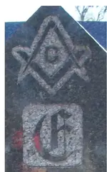
Let's face it why are we finding markers in cemeteries and grave yards. They are permanent places dead men don't move. We here in the south have a lot of confederate monuments I am going back a looking for signs on and around them. Especially those erected shortly after the war. Getting the oldest pictures possible of it. Maybe just maybe, Dead men do tell.
Senior Deacon


 " BLACK GOLD!"
