The Treasure of Captain William Kidd.

It would still be interesting to read you criteria else it's of no use to only say so.

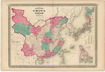
Can you show the whole map or at least the date?

Hi Bocaj,
You can find a short list of my island criteria on post #95.
The map that I referenced was published by Johnson in 1868.

(Re: Magnetic Declination)
The magnetic declination in a given area may change slowly over time, possibly 2 to 2.5 degrees every hundred years or so, depending on where it is measured.
This may be insignificant to most travelers, but can be important if using magnetic bearings from old charts.
 

Attachments

  • Johnson_1868.jpg
    Johnson_1868.jpg
    1.6 MB · Views: 6
Hi Bocaj,
You can find a short list of my island criteria on post #95.
very short indeed, is there a longer version?
  • a central mountain range with a rift running north to south.
than would be an addition to my above list. I wouldn't call them mountain as in one of the maps its written "hill", "small hill" and with the island max 3miles long I would think the max wide being a few hundred meters and max corresponding height less than 50m - no mountains I am afraid but certainly not flat neither with hills and cliffs and a valley (called death valley in the Wilkins' map)
The map that I referenced was published by Johnson in 1868.
1868 is quite recent compared to 1690 I really wonder since when they used "South China Sea" as navigation term?
(Re: Magnetic Declination)
The magnetic declination in a given area may change slowly over time, possibly 2 to 2.5 degrees every hundred years or so, depending on where it is measured.
This may be insignificant to most travelers, but can be important if using magnetic bearings from old charts.
That is true but in our case the islands shape and the compass rose is quite sketchy, I assume an uncertainty of at least one point anyway. It simply does matter in this specific case.

Wilkin's map is from a nautical map done with much more precision and details like soundings and surrounding shallows than Palmer's which are sketches probably done from memory. But as I wrote the general orientation of the island is NE with some uncertainty of max 22.4deg which excludes most suggested islands so far.

Of course everyone tends to ignore facts that don't fit their favored spot so no matter what I write here there is still an endless stream of those who want to add them self's to the list of fortunes lost by wishful thinking!
 

Last edited:
very short indeed, is there a longer version?
  • a central mountain range with a rift running north to south.
1868 is quite recent compared to 1690 I really wonder since when they used "South China Sea" as navigation term?
very short indeed, is there a longer version?
  • a central mountain range with a rift running north to south.
than would be an addition to my above list. I wouldn't call them mountain as in one of the maps its written "hill", "small hill" and with the island max 3miles long I would think the max wide being a few hundred meters and max corresponding height less than 50m - no mountains I am afraid but certainly not flat neither with hills and cliffs and a valley (called death valley in the Wilkins' map) OK. call it a "hill range" if you prefer. How did you calculate the island's length and width? (Sorry, Wilkins' maps are fake.)

1868 is quite recent compared to 1690 I really wonder since when they used "South China Sea" as navigation term? There are plenty of earlier examples. Do a Google search.

That is true but in our case the islands shape and the compass rose is quite sketchy, I assume an uncertainty of at least one point anyway. It simply does matter in this specific case. Thank you(?)

Wilkin's map is from a nautical map done with much more precision and details like soundings and surrounding shallows than Palmer's which are sketches probably done from memory. But as I wrote the general orientation of the island is NE with some uncertainty of max 22.4deg which excludes most suggested islands so far. By "Palmer", do you mean "Kidd/Palmer?" (Sorry, Wilkins' maps are fake.)

Of course everyone tends to ignore facts that don't fit their favored spot so no matter what I write here there is still an endless stream of those who want to add them self's to the list of fortunes lost by wishful thinking!

(Note: Wilkins' maps are fake. If you want to maintain any sort of credibility, I suggest that you do not reference Wilkins' maps in your comments.)
 

Attachments

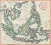
  • chinamap-1801.jpg
    chinamap-1801.jpg
    159.6 KB · Views: 5
Fun fact:
The Bank of New York opened for business on June 9, 1784, making it the first bank in New York City. Mr Kidd would have had to wait 83 years after his death to make a deposit.
The Bank of England opened for business on August 1, 1694 in Mercers' Hall in Cheapside. The bank was established as a private bank to serve as the English government's banker. The bank's primary objectives are to maintain price stability and to protect and enhance the stability of the UK financial system
:laughing7::icon_cheers:
Hi ISG,
I knew you would like that! Since Kidd was arrested in Boston on July 6, 1699, I don't think he had time to open an account. Plus, with London 3,500 miles away, and no online banking, It would have been a six to eight week voyage (each way) just to cash a check..
 

What about his wife? Can’t find much info, except plugs for some book about her. This is about the closest thing to a bio I can find.

https://www.wanderer.com/features/sarah-kidd-the-pirates-wife/#:~:text=Sarah died in 1744 from,treasure has never been found.

I've heard that "The Pirates Wife" is a good book, but I haven't read it. There's a popular story about Kidd passing a coded note to Sarah while in prison telling her where the treasure was hidden. I don't believe that Sarah knew anything about his treasure or its location.
 

How did you calculate the island's length and width?
Mostly the marked features like stones and especially the lagoon, the distance from the anchorage to the treasure, the smaller bay that cuts through the hill, the size of the valley, mentions hills but no mountains, only a single line of them, no rivers or features like small deltas, the amount of details all over the middle section with the marked path, the distances of the wrecks from the shore. All those details point to an island that is in the range of 1-3 miles and a few hundred meter across.
1868 is quite recent compared to 1690 I really wonder since when they used "South China Sea" as navigation term? There are plenty of earlier examples. Do a Google search.
I haven't found anything early enough if you seen something in the early 17th century or earlier please post a link!
By "Palmer", do you mean "Kidd/Palmer?" (Sorry, Wilkins' maps are fake.)
You misunderstand me. There is no prof that the maps themselfs are fake - means that they aren't at least based on an existing nautical chart! Wilkins? did change and add features to fit whatever was needed to make it Kidd's treasure map - which it clearly is not! But it doesn't mean its not (at least in part) a real existing island.

I only meant to show what a real nautical chart would look like in contrary to a sketch. It doesn't mean that anyone would copy a real chart and then add the treasure data on it! In contrary it would seem to be fake even more so! But a nautical map is much more precise then a sketch. That was all to demonstrate that there is quite some margin of error when it comes to the compass rose drawn on Palmer's maps. In any case it still can't be turned 90deg or more - that would be too much even for the sketch as I assume it was drawn by a skilled navigator like KIdd.
 

I've heard that "The Pirates Wife" is a good book, but I haven't read it. There's a popular story about Kidd passing a coded note to Sarah while in prison telling her where the treasure was hidden. I don't believe that Sarah knew anything about his treasure or its location.
From what I read she did what she had to in order to survive. Not the type of life for someone who had a stash tucked away.
 

"That was all to demonstrate that there is quite some margin of error when it comes to the compass rose drawn on Palmer's maps. In any case it still can't be turned 90deg or more -"

Bocaj,
I'm sorry if I may seem rude, and it's not my intent to badger you. But are you absolutely Sure that we are talking about the same maps?

1736010598112.png

(Maps drawn by Harold T. Wilkins from his book: Captain Kidd and his Skeleton Island.)
 

Hi ISG,
I knew you would like that! Since Kidd was arrested in Boston on July 6, 1699, I don't think he had time to open an account. Plus, with London 3,500 miles away, and no online banking, It would have been a six to eight week voyage (each way) just to cash a check..
🤣
Who knows? :dontknow:
Probably alot of stuff omitted from the Real Story, Bank of England probably wouldn't like being connected to known Slave Traders.
I have a feeling William Kidd had more of a connection to Henry Morgan than people talk about.
Maybe some day I will look more into it, Just not that interested.
 

Last edited:
Bocaj,
I'm sorry if I may seem rude, and it's not my intent to badger you. But are you absolutely Sure that we are talking about the same maps?

View attachment 2187125
(Maps drawn by Harold T. Wilkins from his book: Captain Kidd and his Skeleton Island.)
The left map has the aspect of being taken from an existing chart with addition and changes to fit what Wilkins did know of the Palmer maps (maybe he invented it completely) but why would he have something like "Mar Del (?)" written in it which clearly makes no sense other then a copy of a map with the actual sea (?) omitted. The second one is a copy of the first but morphed to fit some fashioned island of the day.

In any case it doesn't matter what level of fake went in it, I don't care much about those maps and this discussion just adds to confusion. I only mentioned the map to show the difference of a (presumable) nautical map of those days and a sketch - that's all!
Another thing is why would he draw a map in the first place? These days treasure maps are all over the place (in tv, films and games) and gives the false impression that treasure maps were a common feature of pirates when in fact there are even less then parrots!

Even stranger is that he would draw four of them with different level of details. (An antique dealer trying to raise the price of his furniture would explain it of course - not saying it is the case).

Normally you won't like others to know and there would be no need to draw a map to remind you other you got Alzheimer's or similar. I see two possibilities:
  • you need someone else to get to it
  • you didn't bury it but someone told you and you need to write and draw it to be able to remember it over time.
 

Who needs maps?🤣
I am just trying to figure out what actually happened & where the so-called money came from.

Personally I think William Kidd was in with Henry Morgan. I think the Real Story here is Port Royal Jamaica.
I dont think either Kidd or Morgan were knocking off Silver & Gold Spanish Galleons at will. Morgan and Kidd must of had major Businesses in Port Royal.
While Morgan & Kidd probably weren't seeing alot of Silver & Gold, I am sure other skallywags visiting Port Royal most likely or could of taken a few Galleons? Or Gold & silver from elsewhere?

So now your out in the bassically the middle of "nowhere" Jamaica the middle of the Caribean with all this gold & Silver pilling up from your succesfull businesses.

Where do you keep it and what do you do with it?
:dontknow:
Got put that s**t in a bank make some interest off it.
:laughing7::icon_cheers:
 

Unrelated,
Supposed William Kidd Map, not sure of Authenticity but Deadmans Island is probably Nassau
Edward Rowe Snows Capt Kidd Map (1).jpg

Looks like those guys did alot of Island Hopping in the day. I suppose there could be something burried on any one of them.
When you are Talking about "the Capatain Kidd Treasure" it's probably the wrong namr for it.
Probably a better name would be "The Treasure of Port Royal".
Good Luck
 

Last edited:
Unrelated,
Supposed William Kidd Map, not sure of Authenticity but Deadmans Island is probably Nassau
View attachment 2187207
Looks like those guys did alot of Island Hopping in the day. I suppose there could be something burried on any one of them.
When you are Talking about "the Capatain Kidd Treasure" it's probably the wrong namr for it.
Probably a better name would be "The Treasure of Port Royal".
Good Luck
I think I was at Booby Island once. I remember it quite fondly these days.
 

Who needs maps?🤣
I am just trying to figure out what actually happened & where the so-called money came from.

Personally I think William Kidd was in with Henry Morgan. I think the Real Story here is Port Royal Jamaica.
I dont think either Kidd or Morgan were knocking off Silver & Gold Spanish Galleons at will. Morgan and Kidd must of had major Businesses in Port Royal.
While Morgan & Kidd probably weren't seeing alot of Silver & Gold, I am sure other skallywags visiting Port Royal most likely or could of taken a few Galleons? Or Gold & silver from elsewhere?

So now your out in the bassically the middle of "nowhere" Jamaica the middle of the Caribean with all this gold & Silver pilling up from your succesfull businesses.

Where do you keep it and what do you do with it?
:dontknow:
Got put that s**t in a bank make some interest off it.
:laughing7::icon_cheers:

Sir Henry Morgan died in August of 1688. Eight years before Captain Kidd was in the privateering business..
 

Unrelated,
Supposed William Kidd Map, not sure of Authenticity but Deadmans Island is probably Nassau
View attachment 2187207
Looks like those guys did alot of Island Hopping in the day. I suppose there could be something burried on any one of them.
When you are Talking about "the Capatain Kidd Treasure" it's probably the wrong namr for it.
Probably a better name would be "The Treasure of Port Royal".
Good Luck

This map was shown on post #125 by NEExplorers. It is a fantasy promo map printed by H.P. Hood & Sons Dairy. (Look on the bottom right).
 

Another thing is why would he draw a map in the first place?

Even stranger is that he would draw four of them with different level of details.

Normally you won't like others to know and there would be no need to draw a map to remind you other you got Alzheimer's or similar. I see two possibilities:
  • you need someone else to get to it
  • you didn't bury it but someone told you and you need to write and draw it to be able to remember it over time.

I think that Kidd had drawn and secreted the maps in his final years, possibly up to and including his time in jail. I believe that he hoped that his wife or daughters would find the maps and benefit from his treasure.
The progression of details and instructions were probably increased as Kidd realized that he would not survive to collect the stash himself.
 

Unrelated,
Supposed William Kidd Map, not sure of Authenticity but Deadmans Island is probably Nassau
View attachment 2187207
Looks like those guys did alot of Island Hopping in the day. I suppose there could be something burried on any one of them.
When you are Talking about "the Capatain Kidd Treasure" it's probably the wrong namr for it.
Probably a better name would be "The Treasure of Port Royal".
Good Luck
That's an Edward Rowe Snow fantasy map. Lots of "Ye's."
 

Top Member Reactions

Users who are viewing this thread

Latest Discussions

Back
Top