The Many Lost Treasures of Mariposa, CA (Photos Added)

I'll hold on to the gold, you can have the rotten quartz. (lol)
Got a bit of that that I need to break up. Just need to create a crusher that's not a hammer and a cylinder. Just haven't gotten there yet. Meanwhile the quartz bucket and gets fuller with each trip out. Just how dirty is that quartz
 

Got a bit of that that I need to break up. Just need to create a crusher that's not a hammer and a cylinder. Just haven't gotten there yet. Meanwhile the quartz bucket and gets fuller with each trip out. Just how dirty is that quartz
How dirty is it? You should hear some of the jokes it tells!!
 

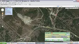
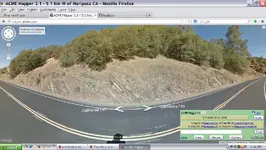
Eagle do you have any idea what that pit is out there off agua fria road?

agua fria pit.JPG
 

Halito Brother,

The first thing that "jumps out" to me from your post is; your coil. You're kinda battling Borgs with a coil that small when you're in the field, or in this case, hills. (Detecting is futile). (lol)

I could let you know the next time I'm heading for Mariposa to do a little 'tecting. I would be happy to have you go out with me on one of my little forays. I won't promise you gold, but I can show you some areas where you do have have a chance of finding some nice nuggets.

Also, you mentioned you found a mine shaft. In my nomenclature, a 'shaft' is a tunnel that goes straight down into the ground. An addit is a tunnel that has been driven (horizonally) into the side of a hill. The difference between the two would determine the right place to metal detect. (At least theoretically).

Generally, if it's a shaft, it would have been dug on a quartz 'blow-out', in the hopes of striking gold somewhere in the quartz. If it's an addit, chances are that the miner found gold further down the hill and followed it up the hill to its source.
Of course, this is not a set rule, but just something to keep in mind while out prospecting.

I was thinking that the coil was an issue. Next trip gets the 12" coil.

I would enjoy going on one of those little forays, please do let me know next time your going to be up this way.

I'm not sure if it's a shaft or An addit. All I can see is an small area that that had a far amount of digging, since covered up, and a large amount of busted up quartz below it. I'll keep your comments in mind next time I'm working that hill. I've heard that one more Shaft or Addit may be on the hill further on.

Thanks for you comments. I'm looking forward to actually meeting up with you sometime. Meanwhile Merry Christmas/ Happy New Year my friend.

Mariposa Gold.
 

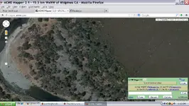
Do you know the history of this area down stream from sherlock creek, those are dredge tailing up on the inside turn?? the size of that sand rock bar is huge i bet that could use some working over again :tongue3:

dredge rows.JPG
 

Do you know the history of this area down stream from sherlock creek, those are dredge tailing up on the inside turn?? the size of that sand rock bar is huge i bet that could use some working over again :tongue3:

View attachment 917107
Ain't that purty? I'm pretty sure I have/had that bar pinned on Google Earth. But, for some reason, I can no longer call up G.E. It keeps telling me I don't have the right card to support it, even though I had G.E. for about 5 years.

Anyway, if it's the one I liked, there's a way to drive in from the top of the mountains to the East. I've studied it a lot on G.E., and came to the conclusion that it's a natural bar, rather than dredge tailings. Check out the bedrock on the right side of the bar. 10 to 1 it has never seen a metal detector. (lol)
 

yes you can get to it from Schilling road I think, but it might be 4x4 country way back there and up there re a LOT of prospects
 

The bedrock is KRAZY down there some is in perfect gold catching positions
 

There is a guy who i used to see up there he had the double decker trailer for his dredge and his boat which he fit the dredge which looked like a 5-6 inch inside the hull of the boat, then drove up river, he was there every weekend during dredge season for many years, he always headed up towards sherlock creek, i believe he was from sacramento and bet he'd pull pounds out of there every summer
 

We'll be up friday to do some hunting and maybe see what we find down below bagby bridge
 

The bedrock is KRAZY down there some is in perfect gold catching positions
Welcome to the club Brother!! You're seeing the same things I've seen. I roamed the hills above there a lot. There's old mines all over. I even found a couple of old cabins the last time I was there. I don't think the BLM has burned them yet.
 

We'll be up friday to do some hunting and maybe see what we find down below bagby bridge
Did oakview2 tell you where I found my nugget?? If you go down there, you'll see where I was digging this last Sat. (lol)
 

Merry Christmas to ALL, and a Very Happy New Year!!!
 

Ain't that purty? I'm pretty sure I have/had that bar pinned on Google Earth. But, for some reason, I can no longer call up G.E. It keeps telling me I don't have the right card to support it, even though I had G.E. for about 5 years.

Anyway, if it's the one I liked, there's a way to drive in from the top of the mountains to the East. I've studied it a lot on G.E., and came to the conclusion that it's a natural bar, rather than dredge tailings. Check out the bedrock on the right side of the bar. 10 to 1 it has never seen a metal detector. (lol)
I think I spoke too soon. I've been studying the screen shot, and I think that "bedrock" is actually tailings. I don't think from a dredge though, probably from a 'drag-line'. But in any case, they didn't do all that work for nothing, The place I had pinned might be further upstream.

Sorry about my replying before taking a closer look.
 

ohhhh ok i wondered what bedrock you were talking about, you can see the lines in that material which i've seen in other tailing type dredge piles, you know up in hells hollow they hand stacked rock and its like 10-15 feet deep up there and HELL NO they didnt do it for nothing theres huge placers in that river if i guy could get down to the bedrock. looking at the river below Mountain King mine the waters so low the river is full of boulders all the way to the middle, THATS THE SPOT TO HIT my buddy has 2 claims down there the Bigfoot claims there a mile from mcCabe flats bridge

I will give an update and take pics/video of what we find out friday

I'm using ACME mapper system give that a try eagle

http://mapper.acme.com/
 

Merry Christmas and [SIZE=+0]a[/SIZE]
Very Happy New Year!!
 

Top Member Reactions

Users who are viewing this thread

Back
Top