Stone Piles

OK, here we go. I took the quad instead of the dog (still found an old shed), to the piles and three foundations.

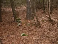
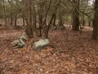
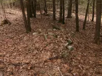
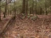
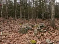
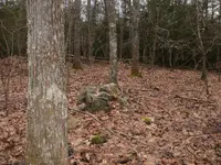
First few pics are of piles from first post. Close enough to get a couple in each pic. One you will see a nice size hemlock growing in the center of pile. Another has a smaller tree in it. They're not HUGE piles by any means, and really not stacked very high. 4th pic I took from ground level to show how high.
 

Attachments

  • P2181339.JPG
    P2181339.JPG
    2.2 MB · Views: 74
  • P2181340.JPG
    P2181340.JPG
    2 MB · Views: 75
  • P2181341.JPG
    P2181341.JPG
    2.2 MB · Views: 75
  • P2181342.JPG
    P2181342.JPG
    2.2 MB · Views: 74
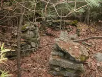
These are from the spot 15 minutes walking distance. Same size piles and you can see the wall behind them.
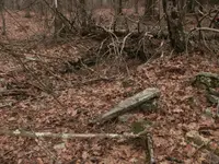
First pic there is another pile just NE of center, where the rotten log is leaning against it. Behind that is the wall.
Second pic is same pile, different angle to see the other part of wall better. A quad/cart path passes through the wall.
 

Attachments

  • P2181346.JPG
    P2181346.JPG
    2.2 MB · Views: 68
  • P2181345.JPG
    P2181345.JPG
    2.3 MB · Views: 64
Last edited:
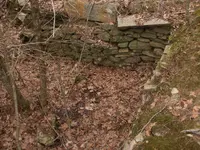
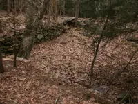
And these are the foundations. First one (2 pics) is pretty big. Just found it, will detect when I can.
Second one with tree in it, I found a tombac, 2 prong fork, skeleton key, two .69 musket balls and lots of iron.
Third one, lots of nails, but only detected it once for a short hunt.
 

Attachments

  • P2181344.JPG
    P2181344.JPG
    2.2 MB · Views: 57
  • P2181343.JPG
    P2181343.JPG
    2.2 MB · Views: 57
  • P2181347.JPG
    P2181347.JPG
    2 MB · Views: 63
  • P2181349.JPG
    P2181349.JPG
    2.2 MB · Views: 62
Seeing the difference in the trees I still think it was just from clearing to use the land and moving the rocks was just something that was put off until a later time.being that there is a rock wall could be that these were going to be used later for the wall but crops came first.
 

Looks like a great place to detect.
I'm hoping. I'm not really a relic hunter. Buttons and ox shoes just don't do it for me. BUT, if there is just one 1700's coin with a date, I'm all over that.
And, except for the second foundation, I don't know if any were detected before. Where I found the button and fork, etc. right where the trunk lays on the stone, if someone had found this foundation to detect before, they were easy targets. So, I THINK it's virgin except for myself hitting it a couple times. That tree fell within the last few years, after I had detected it.
 

Being so close to old foundations, they probably moved any or all Indian rock piles (if there were some). You can check the rocks in the piles, see if any look as altered stones.
 

When I was growing up we had a place that had a rock retaining wall and my brother hid a metal piggy bank in the wall, so I would also detect the walls themselves you never know where things could have been hidden.
 

If you can find any aerial shots of the area you might try seeing if there,s any pattern to the piles. Older pics might show the difference in vegetation between then and now.Historic aerials has a good assortment or just do a search for old maps and old aerial photos.Just a thought for you. We don,t have rocks here unless we bring them in from somewhere else.Delta soil,dirt as far down as you want to go.
 

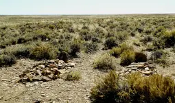
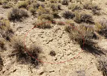
stones were moved out of the way, perhaps for farming or for future building projects. stone wall could have been a foundation. Pictures are all over the web showing walls. check out this one that can be seen on google earth, in reality it is huge at least 300 x 200 feet with 2 fire places, in the middle of the desert 30 miles from anything, your guess is as good as mine as to what it was. I've been told by some it was used as a fort to guard against Indian attacks, corral, miners camp. only those built it knows. The wass from my memory are about 4 feet tall. This has been here for at least 400 years, built by the early Spanish. It is approx 25 miles north of the Mexican boarder, 50 miles SE of the nearest Spanish mission
pp.png
who
 

Last edited:
Only going on what I have came across over the years and I'd say like others they're just random rock piles from clearing the land.
The foundations look tempting for sure. Usual habits of others detecting being there prior to you is they tens to put iron objects on top of the stone walls/foundation.
Best of luck on the future detecting trips to the area, I know I'd be dreaming of detecting those locations over sheds anyday.
 

stones were moved out of the way, perhaps for farming or for future building projects. stone wall could have been a foundation. Pictures are all over the web showing walls. check out this one that can be seen on google earth, in reality it is huge at least 300 x 200 feet with 2 fire places, in the middle of the desert 30 miles from anything, your guess is as good as mine as to what it was. I've been told by some it was used as a fort to guard against Indian attacks, corral, miners camp. only those built it knows. The wass from my memory are about 4 feet tall. This has been here for at least 400 years, built by the early Spanish. It is approx 25 miles north of the Mexican boarder, 50 miles SE of the nearest Spanish mission


If you want to look in Google Earth. I was metal detecting on a vacation to New Mexico back in 1990s (with my Garrett GTA 1,000). Soon detectors became better, deeper. Went back in historical satellite images, to look where I'd been standing. Looked at the spot, off one end of a long stone wall Spanish smelter. On both sides were alternating circular with opening outside to step in. I'm assuming these are place to use for smelter ovens (stone will keep heat). You had to walk over heaps of slag or maybe was charcoal to remove impurities (don't know the history on it). Back to what I'd started to say, there I was in Google Earth holding my Garrett facing old Spanish smelter. Assuming it was Spanish, they took many millions $$$$ worth of gold out of the area.
 

Seeing as you're in the north east the rock walls could have another reason also. Many years back my father bought an old farm stead and we found all kinds of rock walls all through the woods. With some intense research my dad found out that there was a man that went all over the northeast building rock walls for some sort of conservation project . He went around like Johnny Applebee's doing this. I wish I could remember his name.
 

If you want to look in Google Earth. I was metal detecting on a vacation to New Mexico back in 1990s (with my Garrett GTA 1,000). Soon detectors became better, deeper. Went back in historical satellite images, to look where I'd been standing. Looked at the spot, off one end of a long stone wall Spanish smelter. On both sides were alternating circular with opening outside to step in. I'm assuming these are place to use for smelter ovens (stone will keep heat). You had to walk over heaps of slag or maybe was charcoal to remove impurities (don't know the history on it). Back to what I'd started to say, there I was in Google Earth holding my Garrett facing old Spanish smelter. Assuming it was Spanish, they took many millions $$$$ worth of gold out of the area.
Would you share the general area? I love history.

I'll try to get a map here soon. There is a rock formation shown on old topo map called DEVIL'S THRONE and you go past it (on access road). Aztec turquoise mine or rather turquoise Native Americans mined to trade with the Aztec is in these hills. Smelter is near old train station.
 

I'll try to get a map here soon. There is a rock formation shown on old topo map called DEVIL'S THRONE and you go past it (on access road). Aztec turquoise mine or rather turquoise Native Americans mined to trade with the Aztec is in these hills. Smelter is near old train station.
Thanks mate!
 

Top Member Reactions

Users who are viewing this thread

Back
Top