You are using an out of date browser. It may not display this or other websites correctly.
You should upgrade or use an alternative browser.
You should upgrade or use an alternative browser.
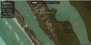
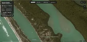
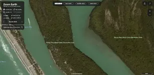
Seven chests near stump pass
- Thread starter joska
- Start date
joska
Full Member
- Joined
- Nov 21, 2012
- Messages
- 190
- Reaction score
- 93
- Golden Thread
- 0
- Primary Interest:
- All Treasure Hunting
- #22
Thread Owner
Great job Bill,but soon as I can because I,m very busy with land projects right now.I will go down there and pinpoint every chest and mark it with all red bouys with info on how deep each chest is underneath the sand.P.s you can take that to the bank because I have verified information that for 100% saw them with a certain government satellite. But does anyone has what it takes to getting them out.
Red_desert
Gold Member
- Joined
- Feb 21, 2008
- Messages
- 7,158
- Reaction score
- 3,794
- Golden Thread
- 0
- Location
- Midwest USA
- Detector(s) used
- Garrett Ace 250/GTA 1,000; Fisher Gold Bug-2; Gemini-3; Unique Design L-Rods
- Primary Interest:
- All Treasure Hunting
Red_desert
Gold Member
- Joined
- Feb 21, 2008
- Messages
- 7,158
- Reaction score
- 3,794
- Golden Thread
- 0
- Location
- Midwest USA
- Detector(s) used
- Garrett Ace 250/GTA 1,000; Fisher Gold Bug-2; Gemini-3; Unique Design L-Rods
- Primary Interest:
- All Treasure Hunting
Red_desert
Gold Member
- Joined
- Feb 21, 2008
- Messages
- 7,158
- Reaction score
- 3,794
- Golden Thread
- 0
- Location
- Midwest USA
- Detector(s) used
- Garrett Ace 250/GTA 1,000; Fisher Gold Bug-2; Gemini-3; Unique Design L-Rods
- Primary Interest:
- All Treasure Hunting
Red_desert
Gold Member
- Joined
- Feb 21, 2008
- Messages
- 7,158
- Reaction score
- 3,794
- Golden Thread
- 0
- Location
- Midwest USA
- Detector(s) used
- Garrett Ace 250/GTA 1,000; Fisher Gold Bug-2; Gemini-3; Unique Design L-Rods
- Primary Interest:
- All Treasure Hunting
sailaway
Hero Member
- Joined
- Mar 2, 2014
- Messages
- 623
- Reaction score
- 816
- Golden Thread
- 0
- Primary Interest:
- All Treasure Hunting
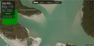
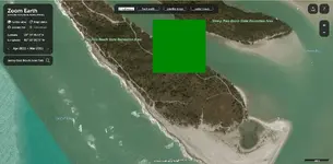
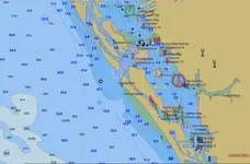
I have sailed those waters and the area is particularity nasty there. It can be clear water all along the coast but you have to give that area a wide berth as the water is murky and shallow. Normally I run my sailboat in the 15 ft water just off the beach. Last year they were dredging there so it would not be chests but removed waste unless it is onshore within the park boundaries, or farther offshore where obstruction is shown or wreck site in 22 ft of water. Also dredge had several red buoys set along where you are talking about so did they recover them and you are searching for something already gone? I have always wondered about the reported obstruction shown as round circle in channel, with no data around it.

Last edited:
Red_desert
Gold Member
- Joined
- Feb 21, 2008
- Messages
- 7,158
- Reaction score
- 3,794
- Golden Thread
- 0
- Location
- Midwest USA
- Detector(s) used
- Garrett Ace 250/GTA 1,000; Fisher Gold Bug-2; Gemini-3; Unique Design L-Rods
- Primary Interest:
- All Treasure Hunting
Even if the final resting place for the ship, I would think there could be scatter before sinking.
Red_desert
Gold Member
- Joined
- Feb 21, 2008
- Messages
- 7,158
- Reaction score
- 3,794
- Golden Thread
- 0
- Location
- Midwest USA
- Detector(s) used
- Garrett Ace 250/GTA 1,000; Fisher Gold Bug-2; Gemini-3; Unique Design L-Rods
- Primary Interest:
- All Treasure Hunting
Atocha wreck, a huge wave slammed it down on rocks or reef, breaking up some, then winds shifted and dragged it to sink in deeper water. Later hurricans the same year scattered stuff over a wide area. Main reason why it took so long to find the Atocha. On the treasure 1715 coast, the ships were moving back and forth, even overlapping their drift trails.
Last edited:
joska
Full Member
- Joined
- Nov 21, 2012
- Messages
- 190
- Reaction score
- 93
- Golden Thread
- 0
- Primary Interest:
- All Treasure Hunting
- #33
Thread Owner
Red,the chests are still intact from the wreck believe me or not.I will take the time to get the least buried one up to prove a point and than the rest.Come to Florida and I will prove to you where they are without getting one out.
joska
Full Member
- Joined
- Nov 21, 2012
- Messages
- 190
- Reaction score
- 93
- Golden Thread
- 0
- Primary Interest:
- All Treasure Hunting
- #34
Thread Owner
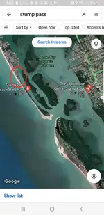
After tropical storms,Spanish coins have been washing up on the beach at Stump pass,just SW of Grove City.The dates are running from 1754-1762,and the coins are in good condition.A gold 8 Escudo with similar date was recovered in the water from the same area.
Darren in NC
Silver Member
- Joined
- Apr 1, 2004
- Messages
- 2,838
- Reaction score
- 1,735
- Golden Thread
- 0
- Detector(s) used
- Tesoro Sand Shark, Homebuilt pulse loop
- Primary Interest:
- Shipwrecks
I will prove to you where they are without getting one out.
Why not go ahead and get one out?
joska
Full Member
- Joined
- Nov 21, 2012
- Messages
- 190
- Reaction score
- 93
- Golden Thread
- 0
- Primary Interest:
- All Treasure Hunting
- #36
Thread Owner
Because,if you would have read threads pertaining to the seven chests.You would have seen that I,m in the middle of land,island projects right at the moment.They are not going anywhere lol.
Darren in NC
Silver Member
- Joined
- Apr 1, 2004
- Messages
- 2,838
- Reaction score
- 1,735
- Golden Thread
- 0
- Detector(s) used
- Tesoro Sand Shark, Homebuilt pulse loop
- Primary Interest:
- Shipwrecks
Hmm. I did read, and you said this: "I will take the time to get the least buried one up to prove a point..."
I don't care either way, but you did offer the time, and you are clearly taking the time to be generous with your knowledge here.
I don't care either way, but you did offer the time, and you are clearly taking the time to be generous with your knowledge here.

- Joined
- Aug 19, 2014
- Messages
- 39,008
- Reaction score
- 143,673
- Golden Thread
- 0
- Location
- Tarpon Springs
- Detector(s) used
- JW 8X-ML X2-VP 585
- Primary Interest:
- All Treasure Hunting
After tropical storms,Spanish coins have been washing up on the beach at Stump pass,just SW of Grove City.The dates are running from 1754-1762,and the coins are in good condition.A gold 8 Escudo with similar date was recovered in the water from the same area.
This is quoted from Jeffrey Kramer's 1964 compilations correct ?
That's an old time tale... although I have heard some claims of validity from a few old timers though.
Red_desert
Gold Member
- Joined
- Feb 21, 2008
- Messages
- 7,158
- Reaction score
- 3,794
- Golden Thread
- 0
- Location
- Midwest USA
- Detector(s) used
- Garrett Ace 250/GTA 1,000; Fisher Gold Bug-2; Gemini-3; Unique Design L-Rods
- Primary Interest:
- All Treasure Hunting
If that is the inlet I'm thinking of, I'd read the article, as published in a treasure magazine some 30+ years ago. I'm thinking the inlet of the treasure article published, was on the west Florida coast. Two different families or groups working the inlet, ended shooting at the other side. It's been a long time, but one side must have brough up or located a chest. The state finally had to close down the site, nobody would listen and stop shooting.
joska
Full Member
- Joined
- Nov 21, 2012
- Messages
- 190
- Reaction score
- 93
- Golden Thread
- 0
- Primary Interest:
- All Treasure Hunting
- #40
Thread Owner
Darren,please know that I can only be certain sites at certain time and getting things out is our number one priority .We are working on island and land targets at this time and I only was trying to give someone productive to go after them as I have gps numbers for all 7 chests and if you scan right at them,you will have no problem finding them.P.s I have detection that can and will pinpoint them all and see them under the sand period.I told you guys that I had credible information from another source that can see them underneath the sand and you can take that to the bank.I do have multiple and multiple active sites and was just thought to give someone else a good shot at it.
Similar threads
- Replies
- 2
- Views
- 459
- Replies
- 6
- Views
- 571
Users who are viewing this thread
Total: 1 (members: 0, guests: 1)

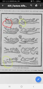
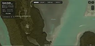
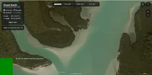
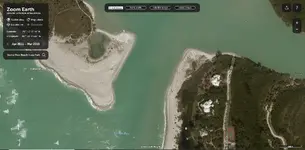
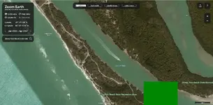
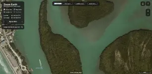
 Possibly the pass was more like this area in the 1800s and farther back.