SATELLITE IMAGES

we are seeing the beginning of images that are "game changers".

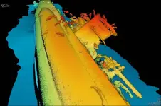
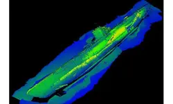
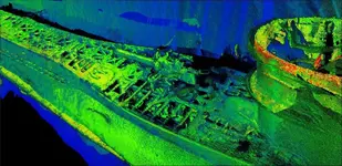
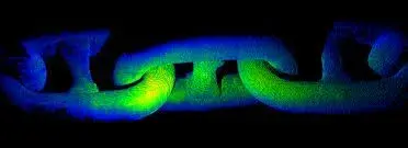
These were some of the first underwater LIDAR images taken...

Notice anything ? ? ?

Striped clean of marine growths... basically they have invented... X-Ray vision.

Tjhis has peaked my interest since fist learning of this and I have been following its growth and development for some time.

This IS the future... IMO.

-109591.jpgba1df999292f9f43ab3889d727ca3488756103a7.jpggun-and-hatch-scan.jpg

imagesN6XFIL2J.jpg
 

In 1962 President John F. Kennedy boasted that we have satellites that can read a license plate on a car in Moscow. That was almost 60 years ago. What do you think they have now? I have a buddy whos neighbor works for Homeland Security. He has access to a satellite that can see individual coins buried in the sand. I think he said it is SIR-C synthetic aperature radar. You have no idea what the gov. has top secret satellites now. I don't know what technology the satellite guy uses and I don't ask so it doesn't look like I am trying to go behind his back. He doesn't charge anything. He just asks that you send 10% of whatever you find. That is good for me.

SIR....space born imaging radar....in the "C" and "X" band salvor. https://en.m.wikipedia.org/wiki/Spaceborne_Imaging_Radar
 

Well I had to edit my post....seems I left the lat and long numbers up on an image or 2...DUHHH !! oh well...for those that caught it good for you !!
 

Thanks steve.....I was wondering how you figured that out so quick !! Lol !!
 

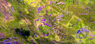
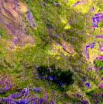
I looked at that area in Google Earth. I saw a lot of holes and caves with steep cliff sides. The spot is just on the edge of alteration zone. The quartz vein forming zone has 4 ends which oddly enough form the 4 cardinal points of the compass. The black spot is between the west and south ends.
Here is a closer look at the black area. I think that is extreme erosion below high cliffs.

Aster_1_LDM_New_Alter-Zone-LG-A.jpg
 

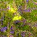
Look above top right, a patch of very bright solid yellow color. Would be nice to know what that is, if gold somebody should go get it.

Aster_1_LDM_New_Alter-Zone-LG-A1.jpg

Aster_1_LDM_New_Alter-Zone-LG-A2.jpg
 

Last edited:
Wow that is really impressive!! Looking forward to seeing what the future is like using this technology for underwater wrecks. How far under the surface can this detect do you know?

Mike
 

Wow that is really impressive!! Looking forward to seeing what the future is like using this technology for underwater wrecks. How far under the surface can this detect do you know?

Mike

Old technology, been doing it since the 60's, Coopers Treasure :laughing9:
 

Mike... are you referring to my post ?

I assume you are... but am unsure. (lack of coffee confusion)

IF so... LIDAR was first conceived in 61 but only in recent years has it stepped completely over SAT tech IMO.

https://en.wikipedia.org/wiki/Lidar
 

Last edited:
Hi AARC, Yes i was referring to yours. I had never seen that before and have been looking into lidar this morning and am very interested in how it works. Never heard of it until this post.

Mike... are you referring to my post ?

I assume you are... but am unsure. (lack of coffee confusion)

IF so... LIDAR was first conceived in 61 but only in recent years has it stepped completely over SAT tech IMO.

https://en.wikipedia.org/wiki/Lidar[/QUOTE]
 

Red Desert,I just checked it and yes its a large gold deposit there,but I believe you already knew that.there are many places like that including lava veins that include gold,rhodium and palladium in the same vein.They run for miles at certain places that has been confirmed by others but most of them will be on government land.Many gold mines out west that has good gold to be worked on,if the right person or persons can obtain permits on them.
 

Red Desert,I just checked it and yes its a large gold deposit there,but I believe you already knew that.there are many places like that including lava veins that include gold,rhodium and palladium in the same vein.They run for miles at certain places that has been confirmed by others but most of them will be on government land.Many gold mines out west that has good gold to be worked on,if the right person or persons can obtain permits on them.
It would be good if gold because you looked at the search area for the Lost Dutchman mine. Many people have got lost or died trying to search for it over the years.
 

In Lost Dutchman mine story, one vein never was mined but chopped away along the outcrop down 6 feet (so people don't see it). Bottom of bright yellow looks to be missing, I noticed that last time. Then a couple places above right, have the appearance of mine shafts. I had to enlarge the image some, original file scientist emailed me was about 6-7 MB and lost it in my old computer several years ago.

View attachment 1848510
 

Last edited:
Attachment is invalid.
 

I,m sorry Red Desert,but checking that area yesterday rushed my scan too quick and not going through my scanning to check for both as buried treasure or just raw gold deposits.My mentor whom taught me the difference of scanning each one,quickly messaged me of saying I did not conduct the scan right and the whole area in the picture is just mineral deposits and believe me that he is the best of the best to analyze any image or picture for treasure related items.Looks like I need to take my time and check according to his guidance.
 

Top Member Reactions

Users who are viewing this thread

Latest Discussions

Back
Top