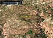
Reality?

Bodi

You believe how the red line which are cuting in half your map is the route in the Peralta ( Perfil ) map ?
You believe how the sister Molina map has any relation with the Peralta ( Perfil ) map ?

In the Peralta ( Perfil ) route , the " El Sombrero " is the Mexican name of Weavers Needle , so is in adifferent region of Tumacacori ( sister Molina map ) .
In the sister Molina map , the right side is not east , but west . If you have read a translation of the sister Molina letter about the Tumacacuri mines , you can see if fit the descriptions of the mines as are in this pictures from GE .
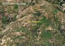
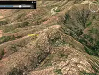
Nostra Seniora de Guadalupe.jpg Opatas.jpg Purisima Conception.jpg
 

Yes bodi , GE .

I believe to the right of Purusima Concepcion mine , one time was written " Concepcion " with bush trees . Maybe they cut the bushes , but some roots remained .

2.jpg
 

Last edited:
No I don't believe that that the red line is the line on the profile map.

And yes they are in the same area, and el sombrero is not weavers needle.

Have you physically been to that site?
The descriptions say that above the mine is chiseled the name. Not in bushes!
 

You don't think that the Indians would be interested in finding the treasure of the opatas?

This map shows the Opato mine, LA conception, Guadalupe, and the pass of Janos- all within the same proximity.

View attachment 964753

Bodi amigo I don't wish to pick a bone with you but I think this map is showing the various towns and settlements, not mines, as with the town of OPUTO, not Opata, or the town of La Purissima, etc. The area covered by the map is very large too.

Don Jose de la Mancha - are you going back on your word amigo? Did you not promise to a number of our friends here that YOU are writing the book on Tayopa? Would you like me to post your very promises? No one else can write that book but you. Besides, I am buried with Custer data, and if I wrote about Tayopa, I might be tempted to substitute Oroblanco for Don Jose for the glory! :tongue3: Yes we are going to hold you to your promises!

Please do continue,
Oroblanco
 

No I don't believe that that the red line is the line on the profile map.

And yes they are in the same area, and el sombrero is not weavers needle.

Have you physically been to that site?
The descriptions say that above the mine is chiseled the name. Not in bushes!

bodi

The line in the Perfil map is not the route which is described in the oral clue about this map . The line in the map is the last orientation of the route in the oral clue , which says " Then turn about and go back southward up this tributary canyon until you reach a point where the outline of the horizon matches the outline upon the map " .
Is the eleventh clue at Clues to the Lost Dutchman Gold Mine by Bradley Williamson

I would like to read you theory to what and where you believe is the " Sombrero " peak , and why you believe how the Perfil map and the Tumacacori map show or are in the same place .

I don't said how in the entrance of the Puricima Concepcion mine is not chiseled its name . The location of this mine was the most important in this area , because the ore from all the surrounding mines , was crushed and smelted downward in this canyon . Below the mine in this canyon were i2 crushers and 12 smelters .
 

Sheesh Oro, am on page 14 already, what's the hurry ?

As for that type of map, it can be very useful I.E look for this river or mt chain, go up it and you will see such & such a town on the left bank, continue up and the next town will be on the other bank etc etc. Simple but adequate instruction for that period.

This was carried over in early Calif, go up the north fork to the eastern fork of such & such a river until you reach the fork, take the left one and you will come to the mining town.Again, crude but effective.
t
Even oro could follow them to Tayopa. Take the left fork of the Mayo at Barborrocos, go up to the right fork on the Barranca Barbarocoss, third on one your right, go up, past the zig zags, passing the falls on your right (Paramo ) on to the end of the barrancas, you will be at El Santo Nino mine. You will have gone past Tayopa since it is hidden, but you can commence your search here.

See how simple it can be yet confusing to our so called modern techniques. Google earth, while a wonderful tool, is practically worthless in trying to use it for contours - go aerial Photographs.

Don Jose de La Mancha
 

Last edited:
I've read Bradley's clues, and they are a jumbled mess. No offense!
Is it " when you reach the highest point on this ridge you will see a sharp needle or a pointed rock with a hole in it, and to the north 4 peaks are lined up to look like one" or "from the camp in its saddle you will see a sharp needle or a pointed rock with a hole in it, and to the north 4 peaks are lined up to look like one"

Markmar do you believe that the canyon fresco is related to the Molina map?
 

bodi

I don't believe the Canon Fresco is related to the sister Molina map . The Canon Fresco is the north part of the La Barge Canyon , from the Salt River until the Bluff Spring Mountain , in the Superstition Mountains , Arizona .
The sister Molina map is for the Tumacacori region .
Your clues are not for the Perfil map , but have relation with Peralta . The secret is to know to separate the clues .
 

Don Jose

You are right . The matter is how I didn't want to show the region how really is . For this the GE .
 

Sheesh Oro, am on page 14 already, what's the hurry ?

Wow - Don Jose - now I _am_ impressed!!
It's but 5 months ago and you were on page #11!!!
Let's see - 3 pages - that would be roughly 1500 words (at most)? no?
Divide that by 5 months - and you have 300 words/month - which is 10 words/day ...
And I'll leave it up to you to figure how many words/hr ....
*chuckles*

Hope you are doin' ok down there!!
And - you know what? - I far prefer looking at El Tigre rather than the sorry-looking character besides a downed aircraft!!

You take care ole man - and we'll see who gets to the pearly gates first!! (In fact, I'll race you!!)
 

Last edited:
hi loke, race me ?? nah no way, too many lovely gals and flavorful cuppas of coffee await me. However ------.

don Jose d eLa Mancha

p.s. Ya forgot Feb---! so I am doing far better than you gave me credit for !
:laughing7:
P.P.S. wha makes you think that either of us will mae the peqrly gastes ??
 

Last edited:
Don Jose, el Tropical Tramp wrote
Sheesh Oro, am on page 14 already, what's the hurry ?

How large is the paper? Are you single spacing the lines, or double spaced? I am waiting for chapter TEN by now, hope you have more than one page per chapter. :tongue3: BTW Manana is today. Anyway you know I am kidding amigo, my mother had a saying which I am stealing as it is 100% appropriate, - TAKE YOUR TIME - but hurry!

One other thing for our readers whom do not post, but I do highly recommend Dobie's book Apache Gold and Yaqui Silver which has a large section on Tayopa and its mines. Dobie was not above a bit of embellishment, or "color" to his writing, however the basic stories and facts are correct and can be cross checked in other sources though that takes some effort to find them. Real de Tayopa's book should correct some of the errors you can find in Dobie's work, and he can point out the flaw in the map which made it impossible for anyone to find Tayopa, so I hope he is planning to include maps.

Good luck and good hunting to you all, and don't take any bets on that race, I may beat you all! However one caveat, does it have to be the Pearly gates, specifically, and not those other gates which are so famous?

Oroblanco
 

Don Jose, el Tropical Tramp wrote


How large is the paper? Are you single spacing the lines, or double spaced? I am waiting for chapter TEN by now, hope you have more than one page per chapter. :tongue3: BTW Manana is today. Anyway you know I am kidding amigo, my mother had a saying which I am stealing as it is 100% appropriate, - TAKE YOUR TIME - but hurry!

One other thing for our readers whom do not post, but I do highly recommend Dobie's book Apache Gold and Yaqui Silver which has a large section on Tayopa and its mines. Dobie was not above a bit of embellishment, or "color" to his writing, however the basic stories and facts are correct and can be cross checked in other sources though that takes some effort to find them. Real de Tayopa's book should correct some of the errors you can find in Dobie's work, and he can point out the flaw in the map which made it impossible for anyone to find Tayopa, so I hope he is planning to include maps.

Good luck and good hunting to you all, and don't take any bets on that race, I may beat you all! However one caveat, does it have to be the Pearly gates, specifically, and not those other gates which are so famous?

Oroblanco

Roy,

Did you see my copy of Dobie's book? 1939, signed by Dobie. Unfortunately, it's not the limited edition.:sad10: They are a bit too pricey.

Take care,

Joe
 

Hmmm - I guess I might have presumed too much when referring to 'the pearly gates' - I guess the other side might be somewhat easier to enter - don't have to 'squeeze through' ...
Guess we'll all end up at the same place anyhow ... so the race is still on!

Darn it - I plain forgot about double-spacing! That brings it down to a measly 5 words/day !! Don Jose - you better get crackin' - I wanna read that book while I can still read!!
 

Twas posted --- > I can still read!!

~~~~~~~~~~~~~~~~~~~~~

Obviously the fifth amend applies here on my part, . so drink yer coffee before it gets tooo cold.

As for Dobies Map Oro, as I have posted many times it is almost 99% correct, but the orientqtion and way of drawing would tend to plece it 60 some miles north.

60 miles in that country is an almost impossibble barrier to easlily overcome. Perhaps some day I iwlll explain the edge that decyphering it correctly, with the help of the Indians whom seem to like me, I was able to home on Tayopa.

Like Atlantis, it is just about where it is supposed to be.


Don Jose de La Mancha
 

I will only believe someone who can show me a gold bar, or a gold vein.
 

Cactusjumper wrote
Roy,

Did you see my copy of Dobie's book? 1939, signed by Dobie. Unfortunately, it's not the limited edition.
sad10.gif
They are a bit too pricey.

Take care,

Dang it - I did see Dobie's book (the one referred to above) but did not look to see if it were autographed by the author. And yes I AM jealous! :tongue3:

Real de Tayopa wrote
As for Dobies Map Oro, as I have posted many times it is almost 99% correct, but the orientqtion and way of drawing would tend to plece it 60 some miles north.

Umm - I am not letting you off the hook here amigo, posting stuff on the forum does not count as "writing the book". However, you could probably pull up some of the older posts to refresh your memory and help fill in things.

Bodi wrote
I will only believe someone who can show me a gold bar, or a gold vein.

800px-Gold_bullion_2.jpg
<gold bar>

Gold_veins_niogold_mining_corporation.png
<gold vein in the rock>

Will ya believe what I tell ya now amigo? :laughing7:

Before you say YES (or SI) both of those images were borrowed from Wiki Commons. :tongue3: However your stance is indeed a valid one, for there have been quite a few people whom have claimed they found a famous lost mine, usually the Lost Dutchman or lost Adams but even some on Tayopa, whom never have any gold or silver to show, not even a good assay report. Our mutual amigo has posted some of his assay reports a while ago, among other bits of proof so I don't bug him quite as much as he deserves.

Please do continue amigos,
Roy <Oroblanco>

Sock coffee?
:coffee2: :coffee: :coffee2:
 

:-) Roy I appreciate your stance!
Like I said before " theories are like a holes! Every has one!"
I am very passionate about my theory, and I can argue with anyone! However since I can't "prove" it, I'm no better, or any more correct than anyone else!
 

bodi

To support a theory is good to do a detailed research first . In my case , I am trying the best .
Now , I take the risk to uncover the place , and I show you a fragment of a real picture which shows a fragment of the Perfil map . Maybe you know how the Perfil map must to be reversed to recognized the terrain .
I have reverse the Perfil map and I have mark the fragment in a square . Now this picture is not from the side which we must to look to the Perfil map ( from north ) but from north east and little higher . From this place we can see better the face . The line in the perfil map , shows the easiest way to reach the " hole " .

part.GIFPm.jpg

Everybody has a theory , but few have a " hole " .
 

Last edited:

Top Member Reactions

Users who are viewing this thread

Back
Top