Pine Creek Document (CLINTON COUNTY)

I would to hunt those fields, but I think most of them are owned by Doebler's Farms, a company that sells corn. They have been in business a long time and own a lot of those fields. Im not sure they would allow anyone in them to MD but I guess we'll never know until we ask ;)
If we can get permission, you all might have to come up and help me, they are HUGE fields and there are many of them ;D
 

;D

alot of farmers will say yes, during the non planting
& growing season.
Late fall to early spring.
the best time is after the fields are freshly plowed.

I tried once in a corn field, just after the farmer cut his corn,
and the 10" high corn stalks still remaining, were a nightmare.
especially with a 15" open face coil.

my friends using Whites detectors with factory coils
had better luck with less frustration.
 

I used to work in those fields detasseling corn, I really dont wanna Metal Detect in them eeeww the bad memories of bugs LOL But we had some fun times working those fields tho. Too be young again ;D
 

Im gonna ask permission to hunt these fields in the fall after the crops are harvested. It's been waaaaay to hot to get out and do much detecting right now, but I wanna go over to Fort Horn soon and see what I can dig up. Im just waiting on permission :-\
 

Hi teddy,I would very very much like to go or help with detecting those fields with you and or the fort horn area,I have been interested in the document for about 10 years an i have some information on the location of said document plus my own speculation as to its location,that has not been posted.I have talked with a descendent of one of the signers.An i have fimed the fort horn area 10 yrs ago.Thank you.
 

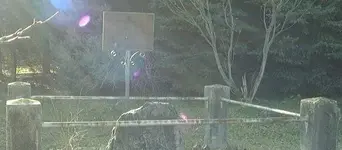
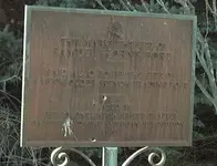
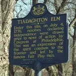
wow lots of reading here. I have been to Fort Horn and have pics of it and the rail road when it was put in went right through what I beleive was the front of the stockade, also I have a pic of the tiadahton Elm where the declaration was sighned it is about 6-7 miles or more from fort horn. mid way between fort horn and antes fort. slightly tilted and I detected there and found lead and all but nothing of real note. A man that lived near there had an arrow that he found near tiadahton elm. I know some of his family and am trying to find out more about him. I am trying to add the pics here from fort horn and the tia elm.
 

Attachments

  • fort horn 3.JPG
    fort horn 3.JPG
    37.6 KB · Views: 856
  • fort horn 4.JPG
    fort horn 4.JPG
    29.9 KB · Views: 891
  • tiadahton elm 2.JPG
    tiadahton elm 2.JPG
    50.5 KB · Views: 1,260
If the box was buried in 1776, and it's made of iron, wouldn't it be rusted out by now?
 

Nick in NEPA said:
If the box was buried in 1776, and it's made of iron, wouldn't it be rusted out by now?

Yes. There is a good chance
it has completly Disintigrated along with the Document
by now. Unless it was a Very heavy Iron box which is Doubtfull.

However since Iron Nails Survive, I wouldn't discount it's
survival completly
 

where the fort horn stood there is a rail road there not and it passes through where the parrade grouns was for fort horn. we have been there and the marker is about 75 feet off from where the fort stood if the records are correct and it having been on high ground. I have posted pics of it here too in one of the topics.
 

There is a piece of information that is not too well known by the people who have been trying to recover the Pine Creek Declaration. While nearly every treasure hunter knows the area where Fort Horn stood, the loca-tion of the Parade Ground remains a mystery. From February 1774 through May 1778, a British surveyor and spy resided in Clinton County (hanged in May 1778). Being of Eastern European descent, he was loaned to the Crown and dispatched to the colonies. He was present at both the signing of this document and when it was buried.

Commissioned as a Captain in the British Army in October 1773, Archi-bald Edward Karelitz arrived in the colonies in early December 1773 and traveled to the colonial Pennsylvania frontier where he established resi-dence in February 1774. Throughout his time along the Pennsylvania frontier, he kept a “Survey Journal” listing the location of numerous forts and blockhouses, so the British would know where they might encounter the enemy.

In May 1778, when several colonists realized that Archibald Edward Ka-relitz was a British spy, he was hung near the location where Fort Horn originally stood, but his records or “survey journal” was never found. It was believed that Captain Karelitz sent his journal to relatives in Eastern Europe for security in late 1776 or early 1777. Nevertheless, one of his descendants, residing in Philadelphia, Pennsylvania, possesses his origi-nal “survey journal.”

Eastern Europeans developed an interesting surveying technique, not in any way similar to what is used today or used by the colonial settlers during the American Revolution. The only person I’ve met who can deci-pher this system is the descendant of Captain Karelitz (whose occupation is the research and identification of subterranean earthquake faults in Pennsylvania and New York). I was quite surprised to learn that the Pa-rade Ground for Fort Horn wasn’t anywhere near the actual fort. It was an area of approximately one acre and was used by the local settlers to sell their wares and food. In my estimation, from my conversations with the descendant of Captain Karelitz, it sits roughly two miles from the fort and today is privately owned.

Because of the junk and trash in the area, including scrap from the rail-road, there is only one piece of equipment that can be used to identify a buried iron box. This box would have survived two hundred and thirty-two years buried in the ground; because the Captain’s journal stated it took three men to carry it (it must have been extremely heavy). Many of the settlers put jewelry, silver plates, gold and silver coins in the box to commerate the date the document was signed.

The piece of equipment about which I speak is used for locating subter-ranean earthquake faults (normally containing an abundance of iron). It was developed in the United States by a former NASA engineer and there is only one in existence (owned by the Captain’s descendant in Philadel-phia). It would cost more than $1.3 million to duplicate this piece of equipment, but it identifies nearly everything in the ground. It emits a digital outline and can detect items at tremendous depths (since earth-quake faults can be as little as twenty-five feet deep to several miles deep.

If anyone is interested, I will look for the name and address of the Cap-tain’s descendant in Philadelphia (I have his business card somewhere in my house).
 

I am very interested. Please look into Archibald Karelitz. I have done my research and have not found anything related to that name.

Thank you.
 

Has anyone spent any time at the Ross Library, in Lock Haven, researching this topic? Alot of material on the area is available there(I mean ALOT! Though I do not remember hearing of any map to any box - sorry.). Surely, there are "locally interested" historians at the Lock Haven University, as well? This sounds like alot of fun to look into!

If no one has time(Or lives nearby), I can stop in when I'm in town - I live in Lititz, Lancaster, Co., but am from Lock Haven and get there several times per year. I, too, know where these spots are, far as it goes(Except the "2 miles from the fort" parade grounds..? Have an actual address..?????). Let me know if any interest to "meet for a visit", sometime...... The library would be a good place to meet.

On the topic of "treasure hunting"(I just found this forum tonight), does anyone know of any other interesting "things" for this immediate area - the cemetary(Some of wife's relatives buried there), the "Camp Meeting Grounds", or Pine Station(Old station/way-stop for the P&E railroad.), or the railroad, itself(Now NS, which still runs right through the whole shebang.). I'll expand on my "thoughts" if they become of interest, but I wonder if.....? I'm not trying to be mysterious, just that I have "wondered" about this area after an experience I once had there(Nearly 40 years ago, around the time everyone was talking about "ESP", so likely meaningless). Also, I talked to an acquaintance, In Reading - now likely 25 years ago(Sigh...) who had co-written several "ghost story" books for Pennsylvania and asked him if there was anything "mysterious" about the "Pine" area(Sort've between the Tiadaughten Elm and Fort Horn). I remember he said "ya'know, I believe there was, but I can't think of what, at the moment, give me a call". I never did. He may have simply heard of this "topic" and, as it's not a "ghost story", perse, he may have just as simply forgotten it.....? Anyhow. I have "my story", too - but completely worthless - at the moment. That said, I'll be doing more exploration on this topic - thank you ALL for getting me involved - again...... I love to do research and this will be a fun and interesting thing to delve into.

Teddy G.
contact info at:
www.teddygvo.com
 

Top Member Reactions

Users who are viewing this thread

Back
Top