Jesuit map in a cave at Tayopa

I know this is an old string, but I just found it. I sat and looked at it for a while, and it looks like there is a bit to much organization to just be a story. One thing that strikes me is the postion of the birds to the right of the cicles. The man seems to be facing to the right and is depicted to be walking. I have no idea what any of this means, but when I look at it, it reminds me of a man doing a shadow compass. You place a stick upright in the ground and place your left foot on the end of the shadow. You wait for a while and then when the shadow has moved a few feet, you place your right foot on the end of where the shadow is now. north should be to your front. Again I have no idea what this meens but maybe it will give somebody some ideas. I cant post the pic with the lines that I drew, but if you wan't I can email them to you. Pay attention to the crosses they look like they are growing as they move to the right. Like a shadow does. All the birds line up perfectly. To many things line up in this picture to be the coincedences of a good indian story teller, unless the allignments in the drawing were ment to identify the timeline of events that lead up to the creation of the drawing. I don't know and I'm starting to ramble

Let me know what you all think.
 

Let me know what you all think.
~~~~~~

hola Bob: I agree on the fnding of true north by the sun,

As for the tirangles go back to posts # 1, #22 pictures. You will see that
the triangles are a fairly crude method of contour and canyon splitting drawing.

As for the acutal locations of 3 of the treasures, it is adequate, the other two ??.

Till eulenspeigel - Jose de La Mancha
 

The Pirate CRomwell was rumored to have taken the 3 treasures. Sure the three? carcass' of the mines exists, but? that is all.
CZ.
~~~~~~

A)? Nah, I have it from an impeccable source (my OUIJI board) that he missed them.? Besides being a reincarnated Jesuit, I have proprietory rights and he "well knows it", he wouldn't dare!!

The bait of "7" gold bars in the "V" is now missing, perhaps that is what he found ?
ppol. to my friends in the Jesuit society for the above levity

Till Eulenspeigle - Jose de La Mancha
 

=yurt_boy

Lastly, I noticed that the bird designs are VERY similar to ones I've seen in Garden Canyon in the Huachuca Mountains of So. AZ. Archaeologists say those are Anasazi or Apache. They're probably right, but there was a LOT of Jesuit activity in the area. The mountains have several Spanish mines, and lay right between two of Father Eusebio Kino's missions.
*************

HI, for some reason I missed this. Yes, it was inhabited by the Jesuits when they were working the Tayopa mines. After they were driven out, the Apache took over the sierras and this was rumored to be a center or stronghold.

I will see if I can find a picture of the cave that they used to hide in, and store food and weapons.

I belive that the map was used and overwritten by both.

Till Eulenspiegle
 

I am looking for a copy of "Waybill to Lost Spanish Mines and Treasures" by Gale R. Rhoades to help me understand a map I have.
 

HIO PEEPS Just put together an expedition to finish Tayopa when this happens, sheehs.

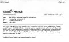
Translation--

Don Jose de al Mancha , who likes the Sierra Oscuro: (TAYOPA)

The notices yesterday said that 70 soldiers are searchng the Sierra Oscuro for a band of outlaws. There are 2 dead and one wounded in the band, The wouded one is the son-in-law of the chief of the band , Jaun Francisco Caraveo.

He has been the protector of the narcotic group, but they have not found him yet.

It is very dangerous to go into this area right now.

You should let some time pass before returning in order to not get shot in the heart..
~~~~~~~~~~~~~~~~~~~~~~~~~~~~~~~~~~~~~~~~~~~~~~~~~~~~~
p.s. My source in Hermosilo says that actually there are 700 soldiers looking since that is such rough, isolated, country. Personally, I will give 10:1 odds that they will never catch all of them.


The rest concerns renting a 4 wheel drive vehicle for the campaign to finish up tayopa..

Sooo mi bestest buddy Capi Sossi, I believe that this will tend to verify what I have before about there being no law at Tayopa, exept what you are able to enforce yourself., and yes, I have had to do this.

shees , just starting to roll again with adequate capital, after a 4 year halt, and this has to happen.

Till Eulenspiegle de La Mancha
 

Attachments

  • .jpgTemp. block on the present Tayopa expedition..jpg
    .jpgTemp. block on the present Tayopa expedition..jpg
    20.4 KB · Views: 1,571
Hi Jose de la Mancha:

I have not received any notice from you in the other forum . I thought you were minning your concesion near ?Cerruchillo?. But unfortunately I get recent knowledge that you were in medical problems. It is very interesting the information you have post. You told me you have no pictures of your explorations travels to Tayopa but I see some in the forums and you still have some nice available, Great !

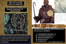
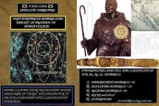
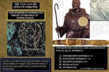
I am sending to the forum members a collage of my ?Satellite Derrotero? for THAI-OPA region in ?New Vizcaya?.This is the map I mentioned you some months ago, deciphering the Derrotero of Jesuit Padre Villegas (misnamed Dobie?s map) which is based on Scientific Hyperspectral Remote Sensing Analysis of the region and many documental research, as well as some personal exploration and from my partners.

The information of the mines in ?Varas? measurement is quite approximate with my analysis only if you apply a factor ?n? to obtain the true equidistant points distances which surely Mr. Cerdeno logical had as a secret . The original ?varas ? and convertion to kilometers would be even reducing THAI-OPA to a very small region which would make it not a legend. THAI-OPA meaning ?Many?rivers? in Opata language was a true
and historic fact on spite that there were some Philipine Jesuit Padres who knew the
meaning of the philiphine word TAYOPE =Trick-

Let me know if you are looking for $ 25,000 dlls investors.

Regards and my best desires for your recuperation.

CACHILAN
 

Attachments

  • SATELLITE DERROTERO- jllomeli-2p8ll.JPG
    SATELLITE DERROTERO- jllomeli-2p8ll.JPG
    104.7 KB · Views: 1,649
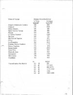
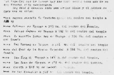
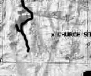
HOLA MI AMIGO Cachilan: in regards to the distances to the mines from the Chrch, see the accmpanying data.

They stated varas, but that is impossible.

Codos were also being used, so if you devide the distance in Varas by 2 then multiply the result by 10 you are now correct.

Your offer is quite interesting, but we shall continue that by em, ok?

Can you repost your correction of Padre Villegos map? It is too small and dim to make out details.

I enjoyed your collage, very well done.

I am physically recuperating only, the Cancer has been declared to have had a miraculous remission hehehe- it pays to be your own doctor sometimes. Absoloutely no evidence of it anywhere or in any tests.

Till Eulenspiegle de La Mancha
 

Attachments

  • Correctred distances from the church door to the mines?.jpg
    Correctred distances from the church door to the mines?.jpg
    20.6 KB · Views: 1,596
  • top part of distances both origonal and corrected? -.jpg
    top part of distances both origonal and corrected? -.jpg
    16.9 KB · Views: 1,588
Hola Jose de la Mancha:

Concerning the "Satellite Derrotero" The 17 jesuit mines are contained into the ovals in the satellite image, there are some other because is a very rich zone, some have claims today and had before.

The small "Dobie's map" in water color is only a make-up for the collage.

I guess it is important to clearly understand what is the Castellano meaning for the word "paramo" wich must be a kind of "arid valley" but not in intrincated elevations, maybe with a dry arroyo crossing it. A "Paramo" with vegetation must be a nice valley when it rains....

Regards

Cachilan
 

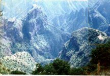
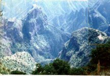
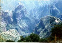
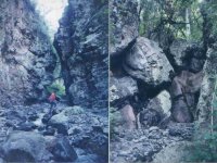
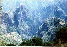
HOLA Cachilan: this is the Paramo of Tayopa. Rough. You can see the mesa chico at the bottom left. the arroyo cauldalosa comes from both the north and south ends of the fault in the center. It exits to the right into the Tayopa barranca.

As for the meaning of Paramo, you must remember that the Jeusits were known for changing the meaning 180* to the normal interpretation, hence Paramo in this case referrs to an extremely erroded steep sided barranca.

Example, the distances to the mines from the Church in the above post.


Till Eulenspiegle de La Mancha
 

Attachments

  • Paramo  Barranca 3©.jpg
    Paramo Barranca 3©.jpg
    33 KB · Views: 1,590
  • Paramo  Barranca 3©.jpg
    Paramo Barranca 3©.jpg
    33 KB · Views: 1,504
Hi Jose:

I agree with you, Jesuits surely codified many information, but in "Sierra Oscura" is a lot of sources for "Arroyos caudalosos" which you think is the good one ?

CACHILAN
 

Attachments

  • Sierra Oscura-Arroyos caudalosos-jllomeli.JPG
    Sierra Oscura-Arroyos caudalosos-jllomeli.JPG
    121 KB · Views: 1,593
CACHILAN
Hi Jose:
I agree with you, Jesuits surely codified many information, but in "Sierra Oscura" is a lot of sources for "Arroyos caudalosos" which you think is the good one ?
CACHILAN
**********
The actual cauldosos "exit" is exactly where you have the "O" of Cerrochito. It exits from the barranca Barbarrocos (Tayopa)Am reposting the pictures for Paramo and the Cauldaloso exit

Till Eulenspiegel de La Mancha
 

Attachments

  • .jpgParamo.jpg
    .jpgParamo.jpg
    33 KB · Views: 1,509
  • Exit of the Aroyo Caudaloso©.jpg
    Exit of the Aroyo Caudaloso©.jpg
    39.6 KB · Views: 1,490
  • Cauldaloso©.jpg
    Cauldaloso©.jpg
    8.2 KB · Views: 1,470
  • .jpgParamo.jpg
    .jpgParamo.jpg
    33 KB · Views: 1,478
Hola Amigo De la Mancha :

I like your “Arroyo caudaloso” pictures but they are more than 40 kms. far from Guadalupe y Santa Ana de Tayopa meaning that the third “Tayopa” was a larger region, otherwise you would be talking of the 4th Tayopa wit hits own “chapel” and “paramo”.

According with the updated Mexican government information on mining claims (Attached file) there are some small claims in the region you mentioned near “cerruchitos”, so surely is a good area for mines.

By the way I recommend to you and to our fellow members have a look to a new web page that mentions they have some of the true Tayopa mines near Guadalupe de Tayopa and “Concepcion” including photos of a “chapel” and tunnel.
http://tayopatreasure.com/

Regards

CACHILAN
 

Attachments

  • Claims JPG.JPG
    Claims JPG.JPG
    32.6 KB · Views: 1,405
CACHILAN
Hola Amigo De la Mancha :
I like your “Arroyo caudaloso” pictures but they are more than 40 kms. far from Guadalupe y Santa Ana de Tayopa meaning that the third “Tayopa” was a larger region, otherwise you would be talking of the 4th Tayopa wit hits own “chapel” and “paramo”.
*************
that is Tayopa #2, It is near Santa Rosa on the road to Yecora. It is "not" the one that all look for.

go to

http://www.goldandsilvermines.com/index.htm

click on View all lisitngs, scroll down to "Dios Padre" in Mexico, this is Guadalupe de Santa Ana de Tayopa.This not "the" Tayopa.
~~~~~~~~~~~~~~~~~~~~~~~~~~~~~~~~~~~~~~~~~~~~~~~~~~~~~~~~~~

According with the updated Mexican government information on mining claims (Attached file) there are some small claims in the region you mentioned near “cerruchitos”, so surely is a good area for mines.
**********
those three (3) Mines are our's. that is my wife's maiden name. .
~~~~~~~~~~~~~~~~~~~~~~~~~~~~~~~~~~~~~~~~~~~~~~~~~~~~~~~~~~~~~~~~
By the way I recommend to you and to our fellow members have a look to a new web page that mentions they have some of the true Tayopa mines near Guadalupe de Tayopa and “Concepcion” including photos of a “chapel” and tunnel.
http://tayopatreasure.com/
*********

Sorry CACHILAN, they are "not" the true Tayopa mines. Most of those mines were opened in the late 1800's and that is Dios Padre, Guadalupe de Santana de Tayopa, not THE Tayopa.
~~~~~~~~~~~~~~~~~~~~~~~~~~~~~~~~~~~~~~~~~~~~~~~~~~~~~~~~~~~~~~~~


]
 

Hi Amigo Jose de la Mancha:


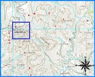
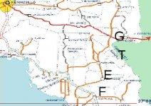
Please notify to the moderators there are some images partially displayed in the forum, that is the case of my satellite derrotero and the topo map of your "Cerruchillos region".

Is there something wrong with them ? I sent a message to Jeff which was reported to me as displayed in his PC.


Saludos. CACHILAN
 

Attachments

  • Jeff-mail received.JPG
    Jeff-mail received.JPG
    16.2 KB · Views: 1,296
Hola Amigo Jose:

I am enclosing the original size I originally posted for the satellite derrotero which is not already correctly displayed above.

I wish this won't be altered.

Saludos

CACHILAN
 

Attachments

  • SATELLITE DERROTERO- jllomeli-2p9.JPG
    SATELLITE DERROTERO- jllomeli-2p9.JPG
    104.7 KB · Views: 1,334
  • SATELLITE DERROTERO- jllomeli-2p9.JPG
    SATELLITE DERROTERO- jllomeli-2p9.JPG
    104.7 KB · Views: 1,295

Top Member Reactions

Users who are viewing this thread

Back
Top