Is Gary Drayton right? Is there 1715 treasure in the Indian River?

I’ve also been wondering as I’ve been wanting to myself. Did you find out?
Check out Shipyard Island in Mosquito Lagoon on Google Earth. This is where the Spanish prepped their ships for the voyage home and headed east to Spain at the Turtle Mound, also on GE. You can even see all the slips! I drug my skiff over 100 yards of knee deep slop to get back there. Farther South there are the ruins of a British Plantation, this is as far South as the British got, made Rum, then the Confederates used it as a salt works during the Civil War. The Union Troops never found it mounting patrols from Ponce Inlet to the North. I found that by looking for orange trees in the pine scrubs where their orchards would have been. Found the docks too. Bottle Island was used by Bootleggers in the 20s. The original Haulover Canal is still there, in ruins, about a 1/4 mile South of the present canal. This is where I had a run in back in the mangroves with a hog that weighed more than me. Also on GE. Then the town of Allenhurst that the Feds wiped off the face of the earth when they took over Merritt Island. Saints and Sinners Cemeteries, 2 abandoned Cemeteries near Edgewater, hogs everywhere on that little expedition but I found them. That was spooky, when you think of who would have been buried in the Sinners one.
Yep, lots of history in that place.
 

Last edited:
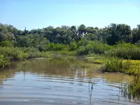
Bio lab road....eyeballed by a fisherman
IMG_08111(1).jpg
 

Bio lab road....eyeballed by a fisherman View attachment 2055702
Just there a couple weeks ago! Thats what I’m talking about. Wonder if it was under during the hurricane? My Brother in Law lives in NSB on the ICW, water came over their sea wall and the back yard right to the deck, a good 10-15’ during the combo of the full moon, high tide and 75 mph onshore winds. I don’t know how far the water got down the lagoon. All the ramps are still closed around here.
 

Just there a couple weeks ago! Thats what I’m talking about. Wonder if it was under during the hurricane? My Brother in Law lives in NSB on the ICW, water came over their sea wall and the back yard right to the deck, a good 10-15’ during the combo of the full moon, high tide and 75 mph onshore winds. I don’t know how far the water got down the lagoon. All the ramps are still closed around here.
That post was sent to me about a year and a half ago, so info is a bit dated, but info is still a hot tip !! If I was closer I would be fishing there regularly and looking for spanish clues !!
 

Check out Shipyard Island in Mosquito Lagoon on Google Earth. This is where the Spanish prepped their ships for the voyage home and headed east to Spain at the Turtle Mound, also on GE. You can even see all the slips! I drug my skiff over 100 yards of knee deep slop to get back there. Farther South there are the ruins of a British Plantation, this is as far South as the British got, made Rum, then the Confederates used it as a salt works during the Civil War. The Union Troops never found it mounting patrols from Ponce Inlet to the North. I found that by looking for orange trees in the pine scrubs where their orchards would have been. Found the docks too. Bottle Island was used by Bootleggers in the 20s. The original Haulover Canal is still there, in ruins, about a 1/4 mile South of the present canal. This is where I had a run in back in the mangroves with a hog that weighed more than me. Also on GE. Then the town of Allenhurst that the Feds wiped off the face of the earth when they took over Merritt Island. Saints and Sinners Cemeteries, 2 abandoned Cemeteries near Edgewater, hogs everywhere on that little expedition but I found them. That was spooky, when you think of who would have been buried in the Sinners one.
Yep, lots of history in that place.
I see the the Shipyard Island, but where did the Spanish access that island?
 

That post was sent to me about a year and a half ago, so info is a bit dated, but info is still a hot tip !! If I was closer I would be fishing there regularly and looking for spanish clues !!
Too close to treasure to tell you. :P
I see the the Shipyard Island, but where did the Spanish access that island?
They went North on the Indian River, the main Highway back in the day, then to where the original Haulover canal was located, pulled the ships over the thin strip of land, that’s where the term Haul Over came to be. The North on the North Indian River that ran on the West side of the lagoon until you get to Plantation Island where the River splits and the one fork turns to the NE to Eldorado then North to the Turtle Mound and Shipyard Island then on the North point of Shipyard you will see Shipyard Canal which connects to Indian River and turns NW back to the west shore of the Lagoon up to Ponce.
Pix are The Turtle Mound
The slips which are all filled in with sand with about a foot of water which gives them the tan look on Google Earth. The white circles everywhere are just sand.
On the GE photo of the Island where the “tree” icon is, is the location of the only main structure, you can see in GE the main dock heading directly east thru the mangroves. The ICW runs down the west side of the Lagoon. You can follow it by the string of spoil Islands when they dredged it out.
The other pix are of the original canal, the seawall is on the east side of the Indian River south at the canal.
3A13B852-850F-422D-8C6D-CAB4463A6A60.jpeg
5A774690-673F-4953-A963-247A56E99918.jpeg
6C152A6A-D93B-404B-82C8-C3251FED0023.jpeg
F6D38712-1346-4087-9490-97C9B1B1902C.jpeg
87B02B13-A786-4FAD-8254-21E5DA195931.jpeg
 

Attachments

  • 4E6A6923-AC98-415A-A084-71943941F53B.jpeg
    4E6A6923-AC98-415A-A084-71943941F53B.jpeg
    301.1 KB · Views: 26
They went North on the Indian River, the main Highway back in the day, then to where the original Haulover canal was located, pulled the ships over the thin strip of land, that’s where the term Haul Over came to be. The North on the North Indian River that ran on the West side of the lagoon until you get to Plantation Island where the River splits and the one fork turns to the NE to Eldorado then North to the Turtle Mound and Shipyard Island then on the North point of Shipyard you will see Shipyard Canal which connects to Indian River and turns NW back to the west shore of the Lagoon up to Ponce.
Pix are The Turtle Mound
The slips which are all filled in with sand with about a foot of water which gives them the tan look on Google Earth. The white circles everywhere are just sand.
On the GE photo of the Island where the “tree” icon is, is the location of the only main structure, you can see in GE the main dock heading directly east thru the mangroves. The ICW runs down the west side of the Lagoon. You can follow it by the string of spoil Islands when they dredged it out.
The other pix are of the original canal, the seawall is on the east side of the Indian River south at the canal.
View attachment 2055744View attachment 2055743View attachment 2055740View attachment 2055741View attachment 2055739
Thx flipper, very informative and fascinating!
 

Very cool. There has to be some fun stuff to find on the “other side”. Do y’all carry a .44 or 10mm for gator protection?
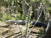
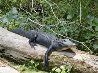
Gators don’t bother you. We were on the Wekiva River and a BIG bull gator was up on a 5-6’ River bank, Fricken thing was huge easily 12+, and were in a 12’ skiff, we were drifting in toward it to get a pix and in a blink of a eye it shot off the bank and hit the water like a telephone pole right in front of us just feet away, scared the sh!t out of me.
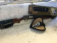
The hogs are what you have to worry about, look in the one pix of the beach shoreline and look how torn up the sand is. They stalk your ass, they will stay in the brush just out of sight. These aren’t cute porky pigs were talking about these are 200#+ killers. If they drop you to the ground your finished. The Wife carries bear spray and I carry a Ruger SP101 357mag, first 2 rounds are CCI Big4 Shot Shells, next 3 are Buffalo Bore Heavy 357 mag rounds. If we are in extreme backcountry a Stevens 520-30 Riot Gun/ 5 rounds #00.1D25DA6F-0462-4100-87FE-AD9591974A72.jpegD2F10089-6CE9-4546-802E-1B6EF78FC6AB.jpeg526C44B9-ED32-46E9-B710-253B017F1D09.jpegF7BC415C-F3AD-4E21-ACF4-7C6301886D70.jpeg8C8EBEA6-00C5-466D-B3AE-22B8ECA5791B.jpeg2D9F5B99-ACCF-4253-8D82-41CD4881E966.jpeg6B18D03F-C561-44F9-B0B6-7B4A730A23F2.jpeg8E5748D7-A39E-4C69-B341-2CC3F33835C1.jpeg75CDB2C0-EC32-4345-BC91-33253999433B.jpegEF57A87A-0296-4617-BF5C-3CCD90E505AA.jpeg
 

Gators don’t bother you. We were on the Wekiva River and a BIG bull gator was up on a 5-6’ River bank, Fricken thing was huge easily 12+, and were in a 12’ skiff, we were drifting in toward it to get a pix and in a blink of a eye it shot off the bank and hit the water like a telephone pole right in front of us just feet away, scared the sh!t out of me.
The hogs are what you have to worry about, look in the one pix of the beach shoreline and look how torn up the sand is. They stalk your ass, they will stay in the brush just out of sight. These aren’t cute porky pigs were talking about these are 200#+ killers. If they drop you to the ground your finished. The Wife carries bear spray and I carry a Ruger SP101 357mag, first 2 rounds are CCI Big4 Shot Shells, next 3 are Buffalo Bore Heavy 357 mag rounds. If we are in extreme backcountry a Stevens 520-30 Riot Gun/ 5 rounds #00.View attachment 2055780View attachment 2055781View attachment 2055782View attachment 2055783View attachment 2055784View attachment 2055785View attachment 2055786View attachment 2055787View attachment 2055788View attachment 2055789
Gator took a girl's arm off in the Wekiva river where she was swimming right off of Wekiva island launch. I use to launch a canoe from that spot to go fishing up the river, lots of gators, copperheads, and rattlesnakes along the banks of the Wekiva river..
 

Gator took a girl's arm off in the Wekiva river where she was swimming right off of Wekiva island launch. I use to launch a canoe from that spot to go fishing up the river, lots of gators, copperheads, and rattlesnakes along the banks of the Wekiva river..
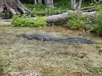
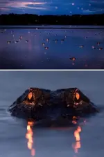
I remember that! Another girl died not to long ago.We live just a couple miles from there. There are certain places I just don’t get in the water and the Wekiva and St Johns are 2 of them. Check out this pix of a gator sitting on the bottom on the Silver River and some kids were swimming a couple hundred yards downstream!
E76283EA-B50E-4CDD-A65B-F486DF560E7A.jpeg
 

Last edited:
Sounds like we live fairly close to each other, I am about 10 driving miles from there myself.
 

BS the gators don’t care about humans 🤣. I’m not from Florida and I know that! We have them coming up the ICW into NC now on occasion. The cold winters drive them back away though. I carry Buffalo bore hard cast in my 10mm, good stuff.
2 people have been killed by gators so far in 2022 in Florida and across Florida the Florida Fish & Wildlife Conservation Commission (FWC) is investigating 16 attacks so far this year, and that was as of July 2022, there were 21 people bitten in attacks last year in Florida.

I am a Florida native, born and raised in Florida, my family history in Florida dates back to early 1800s prior to 1840. Been around gators most of my life, waded and swam in lakes and rivers too. I was taught at a young age to be careful and to respect what gators can do.

Anyone who doesn't respect what a gator will do is asking for trouble, they want attack a boat, but in the water you are in their domain so you better be observant and cautious.

maxresdefault (1).jpg
 

Attachments

  • 6mur5933eys61.jpg
    6mur5933eys61.jpg
    52 KB · Views: 24
Last edited:
Yeah, I did some stupid stuff as a kid here in Florida. Night wade fishing in Lake Jackson for big bass, walking through St. Marks at night to flounder gig. Gators everywhere. I think back on it now and wonder how we were so lucky. Gators are nothing to mess with. I'm not bullet proof anymore.
 

Top Member Reactions

Users who are viewing this thread

Back
Top