Iron Door Mine

Donald Page was the "Indiana Jones" of Arizona. His papers can be found at the state museum in Tucson if you know what to ask for. Just ask for the papers written by Page on the Lost Jesuit Mission of "Ciru" which was tied too the Iron Door Legend. Be prepared to find many other Treasures he was searching for written in his letters.
Ron Quinn just published a book on amazon with some info. Just search the name.

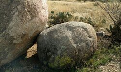
You say you live in Tucson near the Tortollita's? Ever been to Indian Town and seen the Hieroglyphs? I know of a Hieroglyphic map made up of Aztec symbols in there. I have a picture somewhere.

Here:

Montezuma's Treasure?


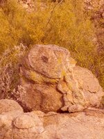
Looks like the final piece of the Map was chiseled off.

I believe Don "Indiana Jones" Page was looking for this hidden Map in his letters.
 

Last edited:
Thanks for the info.
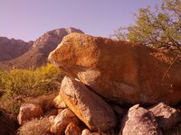
i have been in the AREA.. Here i s a pointer I located... Posted 1-9-2104.jpg
 

i think the 1880 story by the 2 prospectors is the root story from which the rest are based. the 1979 treasure hunter magazine article (from the earlier posted link) is an embellished retread of the 1956 don page desert magazine article. from the don page article, the landmarks the 2 prospectors speak of are canyons running east, a box canyon, a shear cliff face, a hidden valley and a shining stream stocked with trout. all the landmarks except the shining stream stocked with trout are common in the catalinas, so it seems to me the best way to locate the vicinity of the mine is to locate the shining stream stocked with trout.

the only possibility i can see, is the upper reaches of the canada del oro. the 1800's may have been wetter than now and it seems plausible that it could have provided enough flow to support a trout population. if anyone has another idea, i'd like to hear it.

the description of the mine says the vein is about 10 inches thick and the drift followed the vein for about 400 feet. seems to me, there should be a fair sized, overgrown tailings pile from the excavation of the adit. i dont see that in the pics of the rectangle in the cliff face. that doesnt mean the black rectangle isnt the mine, just means it isnt obviously a mine. i do believe the face of the vein was exposed and that's how it was originally discovered. if that's true, then most likely it's erosion over time has been enough to enrich the gravels downstream from the mine.

has anyone here sampled the gravels in the upper canada del oro? most of that area is granitic rocks, and here in the california gold country, gold always drops out of the stream when you cross over from the metamorphic rocks into the granites. i'd be interested to know if that rule of thumb holds true in the catalinas. if true, that would give an upper search boundary past which finding the mine would be highly unlikely.

i've found 3 areas of past mining in the canada del oro region. 1st is the burney mines, copper rose mine, canyon del oro mines, birthday mine, stove lid mine and lead reef mine area just south of the confluence with dodge wash. these were originally located in 1947. this area appears to be a lead, silver, copper district with gold only being a minor constituent of the ore bodies. 2nd is the hartman homestake (1947), geesman mine group (geesaman on the usgs topo)(1937), leatherwood mine group (1939), daily-stratton mine group (1916) area. this area is in the vicinity of marble peak, just east of the east fork of canada del oro. this was mainly a copper mining area, with only minor amounts of gold. 3rd and most interesting are 3 prospects. 1st is the copeland prospect described as "a prospect located in the upper reaches of the canada del oro". 2nd is the matas prospect, described as "a prospect located in the upper reaches of the canada del oro, south of oracle". and finally, the kerr prospect. described as "a gold claim located south of oracle, in the upper reaches of canada del oro wash." all 3 are gold claims. i haven't located these prospects yet, but their location might provide the key to locating the area of gold mineralization which most likely contains the mine with the iron door.
 

Hi Froggy, I'm also in the area. I haven't seen that marker, but I've been in the general direction it points. The growth of Oro Valley has probably misplaced and/or destroyed a lot of the other markers, but if you keep on heading in that direction, you'll find others. Happy hunting, and stay safe!

Omega.jpg
 

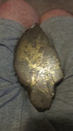
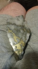
I knew Flint Carter when he was alive. He found the lost city back in the 80's. There is a video on YouTube that showed what he discovered. Just search his name on YouTube. I have been up to his cabin a few times. My Estwing rock hammer and gold pan maybe still there. There was a sign in book for hikers and such. Found good gold ore not far from there. There's a lot of info on him out there. Slept at his house a couple times. He said the mine is filled with water now and hard to get to the really rich stuff. He never showed me the exact spot because he was too old and in bad health to go up in the mountains anymore. I miss him. A couple of his better finds attached. Those are in my lap. You tell me if you think he found it. Good luck. It's rough up there. Stay smart, stay safe and alive.
 

Attachments

  • 20180525_133327.jpg
    20180525_133327.jpg
    1.1 MB · Views: 39
  • 20180525_133407.jpg
    20180525_133407.jpg
    1 MB · Views: 40

Top Member Reactions

Users who are viewing this thread

Back
Top