Indian Trace and pointer trees

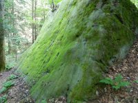
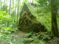
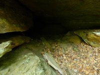
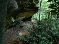
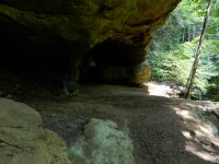
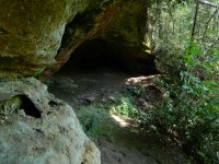
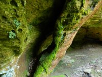
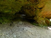
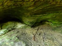
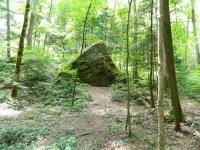
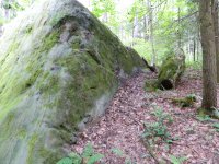
So I made it back down to the RRGorge to do more investigating to and around this trail tree I found. I took about 30+ pics of various interests. The creek 'dries up' twice before you get to the tree. I found what could be considered a monument rock and to others, a rock house. No carvings on it whatsoever...its about 20ft tall to the peak on its face and about 12ft tall on its rear face. Following the pointer Westward by compass takes you up a creek, literally and eventually up to the top of the ridge. I got no further in this direction due to the heat and everything else I had done earlier in the day. Compass bearing was just South of West (260) on the pointer tree direction. Prior to doing this walk I decided to try and follow the 'old path' or trace depression backtracking from the tree up the hill heading almost due East. I had found a narrow gap or pass upward that I stopped at last trip. I made it up and through it and realized once through it that deer were about the only thing keeping this route 'open'. I doubt buffalo could have made it down and through this 18' long narrow area. It was interesting once I worked my way around and above a 60' rockhouse on a ledge that had a pillar arch in it. Its an arch that I have never seen on any of the maps or KY arch web sites. A small cave and several windows were all nestled within a 80' long stretch along this ledge before the trail wrapped left and slightly up to the ridge top where it opened up in woodland again. This pathway through this ledge and arch got me thinking what a sacred place this must have been to the Indians! Anyway, I'll post some pics here tonight on my slow internet connection. If I have time tomorrow I'll upload some more from work where we have much faster speeds.

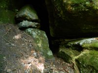
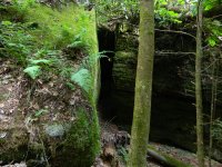
Monument stone/rock house? DSCN9474.JPG
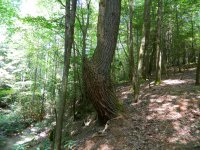
Trail tree from 50' away DSCN9482.JPG
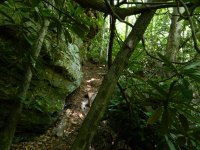
Gap leading up from old trail bed DSCN9489.JPG
 

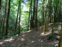
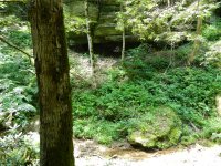
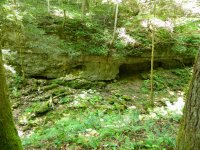
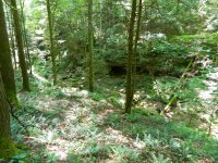
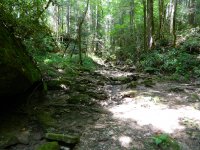
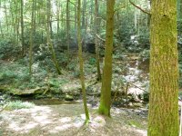
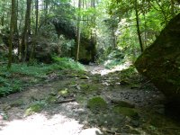
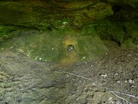
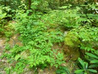
I believe that Copperas Creek has a cave system below and beside it running parallel. As I stated before it 'dries up' twice before hiking to the pointer tree. It dries up once more further North up the creek. Its a great example of a could be 'drying ground' discription. This time of year the creek actually does not flow into the Red River. It pours into an opening of a cave and passes through the ridge between it and the Red River about 500 yards from the road. Along the Red River you can hike about the same distance and see where it flows out of a cave and into the river not far from Moonshiner's Arch. Anyway here are some pictures of the creek bed on the way to the trail tree.
DSCN9456.JPG
DSCN9463.JPG
DSCN9464.JPGDSCN9470.JPGDSCN9478.JPG
DSCN9467.JPG
DSCN9469.JPG
 

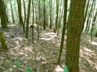
Here is a look at the old trail/trace bed from above the trail tree and looking West down toward the creek. I had trouble with the camera picking up on the depression, if the sun were at a lower angle I think it would be easier to see. A more modern trail is just off to the left, and runs parallel with this old one.DSCN9488.JPG

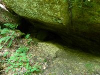
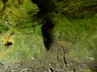
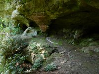
Cave opening on way to the ledge with the arch.DSCN9490.JPG

View of ledge, the pillar of the arch is furthest away and on right with cliff edge on right side 60'+ down.DSCN9491.JPG

Closer view of unknown named arch.DSCN9492.JPG

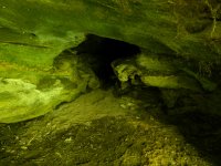
Small cave opening in the back of the arch.DSCN9493.JPG

View beside pillar and cliff edge toward the next rock shelter that contains a double window.DSCN9494.JPG

This is either an arch or window (size determines which designation) in the same rock shelter, it is almost vertical.DSCN9496.JPG

Double window in back of this rock shelter (rock house).DSCN9497.JPG

Two small alcoves in the back of the same rock shelter.DSCN9498.JPG

Old glass bottles broken and partially melted in this 14" diameter 3rd alcove in same rock house. DSCN9499.JPG

This cave opening is tucked behind the little alcove and drew my eye and interest.DSCN9500.JPG

View backwards toward the arch, where I came onto this ledge is just out of view left edge of picture.DSCN9501.JPG
 

Finally, these two pictures are of openings along the small drain the tree points West towards. First one opens into a habitable cave maybe 12'x8' when I looked inside.
DSCN9502.JPG
This opening is between two house sized boulders beside the creek just before the laurel gets nasty thick (this is where I put the camera away as I thought it might get damaged).
DSCN9503.JPG
 

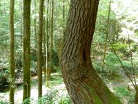
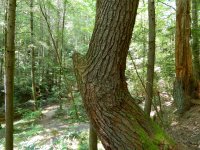
Oh forgot I have better pictures of the Indian trail tree, my phone pictures are sad compared to the camera!
DSCN9483.JPG
DSCN9484.JPG
DSCN9485.JPG
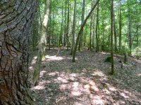
This is beside the tree facing East uphill, you may be able to make out the trace/depression leading uphill.DSCN9486.JPG
 

The rock pile is 8'x6' roughly and maybe 2' high when you stand back from it. I don't have a handheld MT to check it. It sits beside the drain that leads back to below the arch/rock house. Its quite overgrown, might be better to check it out in the winter. Looks to be a burial site, its on the opposite side of the camp from the tree and far enough away from the fire ring to not be disturbed recently. That is a 15" diameter old stump in the foreground for scale. DSCN9480.JPG


Copperas = ferrous (iron) sulfate ...sometimes in the form of green crystals

this may be why the sandstone in the cliffs around this creek are different shades of red
 

Last edited:
Decided this might need its own thread since I plan to do more investigation.
I found an Indian Pointer Tree on a weekend camping trip. Its on a drain one ridge over from where the Red River is joined by Swift Camp Creek. This drain is about 3 miles deep and full of laurel. Tree seems to point NW and is a pine tree that is over 100ft tall and just under 3ft in diameter. I back tracked from the pointer and it leads up and over the ridge through a narrow gap. Obviously just a trail pointer but interesting that I spotted it...I have passed through this area many times over the years and never noticed it.

Pictures are within this thread.
http://www.treasurenet.com/forums/lost-silver-mines-jonathan-swift/530130-swift-silver-20.html

Thanks to you all for making me 'look' for these signs. I normally would have missed this.
There are two natural arches in the general direction of the pointer on the opposite side of the creek up along the ridge. This tree is adjacent to a campsite that the locals used to use while hunting this drain. I noticed a pile of large stones on the opposite side of the camp site from the tree too. Campsite is where about 3 drains meet the creek, maybe a burial pile? or just stones piled when clearing the camp originally? I think I may have found part of the trail used by indians through the Red River Gorge. Next time I get out there I'll walk the pointer direction and see if there is another tree!

Forgot to mention, this drain is fed by a water fall...it disappears and reappears a couple of times before emptying into the Red River. Sounds like a passage from the Swift Journal ... I think it was called or named the drying ground? About 3-4miles further in the pointer direction is 'Indian Stairway' which is where the Frog's Head carving is... this may be something....View attachment 1599516

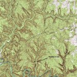
Correction, the tree points 260degrees or slightly South of West and not NW as shown on this map. So it points to the lower (Left) branch of Copperas Creek. The arches known as Double deer and Snow arch sit on the ridge between the first two left hand branches. My pictures of the arches are from the Right side (east) of Copperas Creek (behind the arrow and tree location).
 

:dontknow:KY Hiker: in one of my old note books, before computers about 1971, don't laugh. it says ( across from mouth of swift camp creek is a creek flowing into red river from north called copperas creek. there are to paths go up creek to first branch on the left, there is an old trail going north to gladie creek. went on dry fork on the left and found a branch that is called silver mine. no early cravings, but 3 graves one had a bone that I could see. most of the info I got from hershel fowler on this next part. go up
copperas creek about halfway and you will see a water fall on the right.
my great grand father dalles fowler found some old mule shoes and 4 silver squares still in molds. the 2 trails go to beaver creek and frenchburg. so far this all I could find.

Well I did count the water falls, the first one on the right is right behind this campsite and right below where I came across the ledge. I'll have to bush wack back to it next time I get out there as there is no path to it except for walking the creek from it. I need to camp there again so I can spend more time!
 

LATE Fall or Winter would be BEST time to "bush-whack", as both leaves & critters are down... pile of rocks COULD be burial CAIRN; MAYBE... HAUNTED! HA!
 

Last edited:
If they had a fallen comrade or a dead Indian, they would have buried their treasure and placed them on top of the treasure.
 

Yep, October or November will be my window to camp here again. Because of the article linked earlier in this thread and its mention of Indian burial rock mounds along the trace I may sweep for metal but doubt I'll move the stones. I spent the night at this campsite back in May and :metaldetector: no spooks :laughing7:.
Again Mrs. Perkins is Mrs.Timmins in this article...
https://chroniclingamerica.loc.gov/...lver&y=7&x=14&dateFilterType=yearRange&page=3
 

Last edited:
Well, "Indian" burial cairns (ROCKS) will USUALLY have "SPOOKS" guarding the place; wife & I had a ROCKS burial cairn next to our rental house in Tobacco Row Mountains of Amherst County of Virginia, near the Bear Mountain MONACAN Nation. Place WAS haunted (wife was NOT amused) by pre-Monacan ppl, heard the name of the place; even had a HUGE boulder for native ppl to watch over their community there. Once I built a campfire site & took rocks from the cairn & heard a voice (in English) say... "Take no more." I didn't... We had rocks "fall" on our roof; next morning, went out-side to look for rocks... there were NONE! The boulder was known as SACRED ROCK; burial cairn was place where OLD chief back then was crawling to get to SACRED ROCK, then he died. Native ppl from all around came to put rocks on his "grave" (he was @ 93); his wife Burial Mound (of dirt) was below the Cairn... INTERESTING place. We stayed there TWO years... the TRUE stories that I could tell you... WHEW!
 

Last edited:
Does anyone remember some of the names of the men associated with Swift? Was there an Osbourne, a Fletcher, and Blackburn in some versions? What were some other names beside the usual Monday/Mundy and Jeffries/Jefferson? The reason I ask is I have found some familiar names on a topo map around the trail tree and need some input.
 

Moses Fletcher, Abram Flint, Seth Mongomery, Isaac Campbell, James Ireland, Shadrack Jefferson, Joshua Mc Clintock, Samuel Blackburn, James Ireland, Henry Hazlett, Isaac Campbell, Harmon Staley, William Wilton, Alexander Bartol, Jeremiah Bates, Frenchmen Pierre St. Martin and Andrew Renound and several Shawnee Indians
 

Thanks, there is Blackburn Branch on the other side of the gorge off of Spaas Creek in the Indian Creek area. Fletcher Ridge is just North of Copperas Creek. I thought there was an Osbourne associated as well...The ridge the tree point towards is called Osbourne Bend. There is an Osbourne branch just to the East that is very Clifty...also Clifty creek beyond that.


CopperasOsbourneBendTopo.jpg
 

Last edited:
Thanks, there is Blackburn Branch on the other side of the gorge off of Spaas Creek in the Indian Creek area. Fletcher Ridge is just North of Copperas Creek. I thought there was an Osbourne associated as well...The ridge the tree point towards is called Osbourne Bend. There is an Osbourne branch just to the East that is very Clifty...also Clifty creek beyond that.


View attachment 1616255

Swift did mention others that worked for a while and left the group but he never mentioned their names.
 

Top Member Reactions

Users who are viewing this thread

Back
Top