Urien of Rheged
Sr. Member
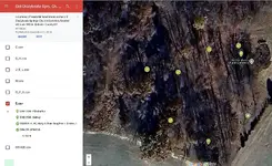
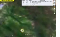
Up this morning from the deep on an old Roman road I've been focusing on recently.
The construction of this road from England's north West coast to York has been estimated to have been sometime from 70AD - 120AD
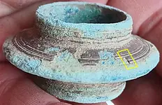
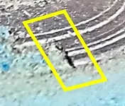
I think this sword scabbard chape is post medieval possibly Tudor or maybe even as late as the English civil war. Lancashire saw a lot of fighting in that decade long conflict and Cromwells troops are known to have come through this area from Yorkshire to do battle against a Scots royalist army in 1648 and would have undoubtedly used this old highway to get there.


The construction of this road from England's north West coast to York has been estimated to have been sometime from 70AD - 120AD
I think this sword scabbard chape is post medieval possibly Tudor or maybe even as late as the English civil war. Lancashire saw a lot of fighting in that decade long conflict and Cromwells troops are known to have come through this area from Yorkshire to do battle against a Scots royalist army in 1648 and would have undoubtedly used this old highway to get there.
Amazon Forum Fav 👍


Last edited:
Upvote
40


") Keep on finding and POSTING THEM :O) Thank you for sharing with us !!
Keep on finding and POSTING THEM :O) Thank you for sharing with us !!