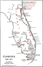
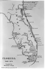
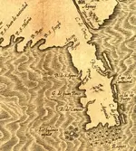
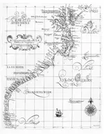
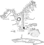
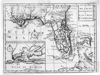
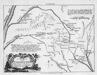
Just wanted to say this is really an awesome story! I have always wanted to see a movie made about the memoirs of fonteneda lol!! Anyway just had a few maps around on the subject -- anyway- fascinating stuff! One can never have too many historical maps of the same area lol!
You are using an out of date browser. It may not display this or other websites correctly.
You should upgrade or use an alternative browser.
You should upgrade or use an alternative browser.
French in Florida prior to Menendez
- Thread starter signumops
- Start date
grossmusic
Sr. Member
- Joined
- Jul 19, 2013
- Messages
- 348
- Reaction score
- 445
- Golden Thread
- 0
- Location
- Cape Canaveral
- Detector(s) used
- I detect the history: I've visited archives up & down the entire US East Coast, Bahamas, Jamaica, Kew, The Hague, etc. Have yet to go to Seville or S.American archives.
- Primary Interest:
- Shipwrecks
Well, it took years, and a lot of miles, but it was worth it. This is a full color book, so it is not cheap, but, if you have any interest in treasure lost, you might find it interesting. Thanks to Buddy Martin for sharing his original manuscript, and to Gaetan Algoet for his translation work. While writing this, I found out a LOT. It's been a great publishing project, that's for sure! Hats off to Bob Baer and Doug Armstrong.
Congratulations!
Can't find it. Do you have a link? Would love to read it!
signumops
Hero Member
- #43
Thread Owner
Click on the title below...
A Hundred Giants: The French Huguenot Experience in Florida: 1562-1565 Paperback
by Tyrrell L. Armstrong (Author), Dr. Robert H. Baer (Author),Gaetan Algoet (Author)
The first settlement of Europeans in Florida occurred in 1564 in the vicinity of Jacksonville. French Huguenots attempted a foothold there and lasted a year before being wiped out by the Spanish. As the struggle between the French and Spanish developed, French forces were shipwrecked along the Florida coast and executed by the Spaniards in the vicinity of Matanzas Inlet. In 2008 the authors began translating a Dutch manuscript published by Pieter Vander Aa, circa 1705, which was a collection of several French memoirs dealing with their settlement at Fort Caroline and subsequent conflicts with Spanish forces. The Vander Aa manuscript, previously unseen as an English publication, is used to drive on the investigation of new evidence found along the shore of Florida indicating where the Huguenots were killed and where at least one of their ships was wrecked. The book contains an exact reproduction of the Vander Aa manuscript, photos of artifacts supporting the new evidence, and more than twenty maps illustrating the subject locations. The French saga in Florida, albeit one thoroughly studied for more than a century, is presented here with fresh overview and comparative citations from previous scholars on the subject. More than 60 color photos and more than 20 color maps. Includes 66 image pages of the original Vander Aa manuscript. Dozens of artifact and coin photos.
bigscoop
Gold Member
- Joined
- Jun 4, 2010
- Messages
- 13,541
- Reaction score
- 9,086
- Golden Thread
- 0
- Location
- Wherever there be treasure!
- Detector(s) used
- Older blue Excal with full mods, Equinox 800.
- Primary Interest:
- All Treasure Hunting
Has anyone heard of the, "Battle of Azala?" This, apparently, was the last confrontation the French survivors had with the Spanish before departing to return home. It is told that this final confrontation took place in very close proximity to the French wrecks.
bigscoop
Gold Member
- Joined
- Jun 4, 2010
- Messages
- 13,541
- Reaction score
- 9,086
- Golden Thread
- 0
- Location
- Wherever there be treasure!
- Detector(s) used
- Older blue Excal with full mods, Equinox 800.
- Primary Interest:
- All Treasure Hunting
This thread is most interesting to me as it has been a pet-project of mine since my moving to this cost. During this time, and after a lot of research, I have come to the conclusion that both Bartram and Romans detail the sites of these wrecks on their maps, just as Romans recorded the details of the 1715 fleet on his map.
Both Bartram and Romans spent a great deal of time exploring this coast and gathering information, both of them having spent extended periods of time in both St. Augustine and at Dr. Andrew Turnbull's new colony at New Smyrna. Given the amount of time they spent here and the intelligence to be gathered it only stands to reason that they would have charted these sites had they found them, which I believe they did. Let me explain.
There are accounts that support the proposed wreck sites on the Bartram and Romans maps as being those wrecks of the Ribolt party. It has long been my personal belief that that the two wrecks on the Roman's map detailed 1768 & 1769 are not the dates on which these wrecks occurred, but rather these dates represent the years in which these sites were confirmed to be the wreck sites of the French party. Also of interest, and possibly in further support of this, is the manner in which Bartram and Roman's detail these sites, one of them simply being in singular form while the site north on the Bartram map uses the plural. Add to this that the distance between these two sites matches, nearly exactly, the reported distance between the general wreck sites of the marooned fleet and that of their leader's vessel.
Just as with the 1715 wreck site I believe the location of these historical French wrecks has been right in front of us all along.


Last edited:
Similar threads
Users who are viewing this thread
Total: 1 (members: 0, guests: 1)


