Wood River, Wyoming Solve; August 31, 2017
Perhaps the most delicious
solve for all of Wyoming, the Wood River
Solve in Shoshone National Forest has it all.
I first became aware of it less than a month ago, tried to convince my brother-in-law to drive out there with me, but since he was driving up from Santa Fe to begin with, and since we intended to watch
The Great American Eclipse from Castle Gardens, when he saw the huge number of extra miles to drive to get to the Wood River area, and coupled with our limited timeline, he explained that, “No way would Forrest Fenn hide the treasure chest way out there... too much driving.” From his point of view, it would be really, really in the middle of nowhere, and since our chances of finding it were a million to one, Wood River, with its alluring Brown Mountain campground, was not in the cards.
Still, for Wyoming, there is no better
solve.
There are a few negatives, however, but they can be brushed away.
- Too remote an area for Forrest, logistics-wise
- Ten miles to make two trips from his car
- The area really is “no place for the meek."
- There isn’t any “special place” reason for Forrest to have immediately known that this was where he would want to “throw his bones” on top of a treasure chest, and let the world wonder where he disappeared to.
On the positive side of things, if Forrest had had “Brown” on his mind immediately upon considering the hiding-a-treasure idea, the area is ground-zero for “Brown.”
- Brown Mountain
- Brown Mountain campsite
- Brown Creek
However, because the area is
Brown Central it may have already been "picked clean to the bone,” so to speak. But, because it is such a remote search area, and because searchers, early on, had not had additional clues that Forrest has provided of late, it just may be that no one has searched far enough there to find it. They may have come close, but then maybe they possibly misconstrued a few of the poem’s clues and hints, and came up empty.
Still, because of its
"Brown" magnet-like pull, several search teams, based on Internet chatter this past month, are headed to the area this very weekend, Labor Day Weekend, 2017.
Who knows, they may arrive on the treasure chest simultaneously and a “Mexican Standoff” could ensue.
Using my above post as a template for this
solve (follow along using topozone.com, toggling back and forth between Topographic and Satellite), here it is...
- BIWWWH
- County Peak (Elevation 12,115 feet); Shoshone National Forest (Washakie Wilderness)
- "Where warm waters halt" is the top of this box canyon, where you metaphorically say goodbye to the "comforts" of civilization.
- You are “mentally” transported to this starting point using your imagination.
- You will "begin it" where "it" originally began, eons and eons ago, the drip, drip, drip of water...
- South Fork Wood River's headwaters are solely in HOT SPRINGS CO DISTRICT.
- USGS topo map demarcates the ridge line of the box canyon exactly this way.
- Adjacent Middle Fork Wood River involves both PARK CO and HOT SPRINGS CO; not as pure a “warm water” identity.
- South Fork Wood River wins the “warm waters" nod of the Fenndom-gods
- ATIITCD
- Head on "down" into the "canyon."
- A treasure chest awaits you and there will be excitement with each “mental” step down.
- A man made trail begins at 9,320 feet (just above McGregor Park)
- NF,BTFTW
- Although you can “mentally” hike down, it will be a long “mental” hike.
- As with all “mental” hikes, they always seem "too far."
- It is a common lament on “mental” hikes: "How much more click-and-drag do I have to do?"
- There is an alternate route down the canyon (actually “up”) where a sedan car could get you closer to the final destination.
- Google Maps lists it as road 2011C
- PIBTHOB
- This will be some sort of "Brown" derived reference that tells you to stop hiking further.
- BROWN MOUNTAIN campground
- Extremely key, the case cracker: elevation 7,600 feet (ff clue: (5,000’ + 10,200’)/2)
- FTINPFTM
- You leave the "canyon down" trail at this point.
- This solve will now take the approach and perspective of hiking up from the 2011C road parked-car.
- Current location: Confluence of South Fork Wood River and Chimney Creek
- Elevation: 7,590 feet (Bingo!)
- "Put in" is taken to mean putting in on a shoreline, leaving the river, unquestionably.
- TEIEDN
- Since the "canyon up" trail (relative to the parked car) had been going “up,” you would now be hiking sideways perpendicular to it.
- This means constant elevation, and heading to the left a near distance.
- From the poem, “nigh” is employed duplicitously for efficiency.
- TBNPUYC/JHLAWH
- All along Chimney Creek, on the left, from the confluence to one mile upstream, are craggy, vertical rock-walls and side creeks. (very target rich)
- IYBWAFTB
- Hike "up," bushwhacking off-trail, and explore these crags and creeks looking for anything that stands out like a "blaze" in your imagination.
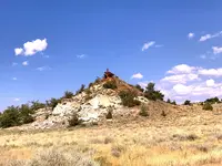
- Most appealing, from an armchair-solve, is the dry-creek, “cold” gun-metal-colored promontory, 1/3rd mile up Chimney Creek, 500 feet distance off-trail to the east.
- On this upward hike, don't stop short, for example, at the base of the “cold” gun-metal-colored promontory, especially if the promontory top is 200 feet further.
- The few who came within 200 feet of the treasure chest may have done just this and failed to find it.
- Don't be one of them. Go all the way up on top of it.
- LQD,YQTC
- Look all around, but especially in some vertical direction to where you are.
- Up, down, left, right... everywhere!
Good luck to all you Search Teams, and BOTG will be the final determinant. Get up and out early so that you don't rue the day eating your competition's dust.


