Early Florida maps, shipwrecks, &

conquistadors_ct000342-crop.webp
 

Actually Alex... I will take anything rare and prior to 1800.
 

Actually Alex... I will take anything rare and prior to 1800.


Does Bermuda counts? It has a tiny bit of Florida.. (1630)
 

Attachments

  • Bermudas.webp
    Bermudas.webp
    291 KB · Views: 199
Last edited:
Thanks for posting. Nice maps!
 

It's possible to overlay these on GoogleEarth as a transparency and stretch them to kind of fit for some entertainment. Other software using control points will do a better job of fitting the maps.
 

1591
 

Attachments

  • florida 1591.webp
    florida 1591.webp
    67.3 KB · Views: 126
1775
 

Attachments

  • 1775 Florida.webp
    1775 Florida.webp
    292.2 KB · Views: 136
Thank you. Any Gulf of Honduras / British Honduras - specifically looking at Belize / Ambergris Caye area would be appreciated.
I have quite a few but always willing to add.
 

there seems to be a gathering of map peeps,
so am looking for a med sized image of Dampier's "A Map of The Middle Part of America" (1729 ?)
I cannot find a larger one, Thanks
 

Last edited:
In English...

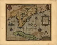
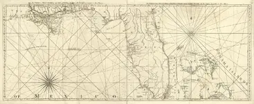
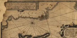
[FONT=Verdana,Arial,Tahoma,Calibri,Geneva,sans-serif]The Marine Charter could be considered the world's first printed nautical map.
It is a huge map made by the German cartographer Martin Waldseem-ller in 1516, at a key moment when there was talk of a new land but few knew what it was like.
The 1516 Marine Charter shows for the first time a drawing of the outline of the world as close to what we know today.
It includes a deformed American continent, hundreds of sea routes, and geographic information that was not previously known on other maps.
This Charter is a continuation of another famous map of the Waldseem-ller himself, which in 1507 he created and which is marked as the birth certificate of America, because it was the first time that the continent received that name.
[/FONT]
 

Top Member Reactions

Users who are viewing this thread

Back
Top Bottom