DOC NOSS-Victorio Peak OR The Caballo Mountains

I beg to differ with yoc SDC.

Why beg? If your Jesuit theory had legs, we would have at least a shred of support from other than that one map that ... poof! ... suddenly appeared. Allegedly from the Noss clan to boot! It's all just "what if" speculation - which is fun on one level, but always ends up in the same place: nowhere.
 

I would think that of all people, you would be one that agrees a lot of known history is either obfuscated, manipulated, or untrue?!?

Yeah, White would have been better if he had said "Jesuit Fray Padre Cristobal SJ DFM ACLU and Teamsters Local 1137". HAHAHA I guess Hoffa is going to be the big find in the Caballos!

Mike

Yes, I do tend to keep many unsupported ideas on the table because, well, things on this planet are seldom as they seem. However, even I am forced to draw the line on this nonsense. Of course, as always, I will change my mind if any facts surface. Please alert me if that happens.

No, the next big announcement from the Caballos is more likely to come from the Tesoro Del Alma Bigfoot Breeding Lab - investment opportunities available.
 

Iam hoping the next big announcement will be from whiskey rat, when he goes up between the rabbit ears. Our current live, foot on the ground searcher. I hope all is well with him.

Oh, he's not alone in those hills, dog. I just had a nice visit here with a friend who's in the Caballos now checking out a state-of-the-art geotech device with his long-time T or C ground searching buddies. There's always folks poking around in those hills. That said, I agree: good luck, rat, and stay safe.
 

Im trying to find the Jesuit mission foundation ruins in the Caballo Mtns. Does anyone possible have coordinates to this?

G41:
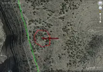
The mission ruins (said to be Jesuit by William White in his book), are located at:

32 57' 26.74" W
107 12' 49.35" W

picture below:

JESUIT MISSION RUINS.jpg
 

Oh, he's not alone in those hills, dog. I just had a nice visit here with a friend who's in the Caballos now checking out a state-of-the-art geotech device with his long-time T or C ground searching buddies. There's always folks poking around in those hills. That said, I agree: good luck, rat, and stay safe.

SDC:
any idea what type, make, mfg, model etc. of goetech device he is using?
I am currently shopping state of the art geotech devices to aid in my search.
thanks
wr
 

Oro Amigo, I dont think the ( lil map ) and the (1937)map have anything at all to do with each other. from what I understand the 1937 map has been an
Important map concerning Willie's and Doc's discovery, The ( LIL )map was never made public untill the mid 1900's, and then only to a few people, I have never tried to work on it in the past or present,
I believe in the past it to have very negative vibe's,could very well have been cursed in the past due to different situations,and promises behind it, also there were two other maps with the LIL map,and no one has paid much attention to them,and one of them is marked M.Starr and another name. np:cat:

NP: the other 2 maps with the LIL map, i have (maybe wrongly so????) assumed were maps of Victory Peak and maybe Geronimo Peak, showing the caverns below. Since both of those areas are off limits now because of WSMR, I will not search that area, so they are of no interest to me. Maybe I am wrong???
Do you think these other 2 maps refer to somewhere other than VP and GP??
thanks
wr
 

I did not put those emoticons in the above post. why does this site do that????????
Its not necessarily my feelings.
I dont like my computer (or a web site) attempting to read my emotions.
see what it does with this post
 

NP: the other 2 maps with the LIL map, i have (maybe wrongly so????) assumed were maps of Victory Peak and maybe Geronimo Peak, showing the caverns below. Since both of those areas are off limits now because of WSMR, I will not search that area, so they are of no interest to me. Maybe I am wrong???
Do you think these other 2 maps refer to somewhere other than VP and GP??
thanks
wr
Amigo, I have no idea ,I never tried to do anything with them,never had the time,good luck,maybe someone else knows. nice pictures.np:cat:
 

I just read where some "Treasure Hunter" near Santa Fe disappeared:

COLORADO TREASURE HUNTER DISAPPEARS

Looks like they found his raft and his dog, but he is goooooone. Might find him downstream near Palomas before too long.

Mike
 

SDC:
any idea what type, make, mfg, model etc. of goetech device he is using?
I am currently shopping state of the art geotech devices to aid in my search.
thanks
wr

It's a prototype gold finder (not LRL) being developed by some techie in Greece. It doesn't have a name yet. It's a handheld device about 12"x12"x4", weighs only a couple pounds.
 

It's a prototype gold finder (not LRL) being developed by some techie in Greece. It doesn't have a name yet. It's a handheld device about 12"x12"x4", weighs only a couple pounds.

What scientific principle is it based on? GPR, Resistivity, Seismic, Magnetics, BFO, Pulse Induction, VHF?

Mike
 

Hi Springfield,

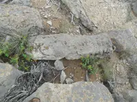
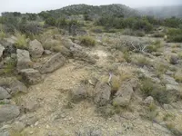
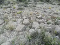
I think that the spring spelling is: "Cleto". A friend of mine has relatives that worked (as in real work...) in the mountains back when. One of his uncles was paid to dug the fluorite mine at the windmill on the way to Cable Canyon (bat cave). Also had a dugout and sheep pen in the general area by Cleto. I think that the spring is now hard to find. My buddy tries to point it out to me when we get up that way once in a while, but I've never placed it for 100%.

One can only imagine what the mountains were like before so many signs were destroyed. I finally was shown a nice Spanish cross rock that was removed in the 60's ('67 on the photo paper) near the Granite Uplift area hot zone. I had previously only seen pictures. Based on all I have seen, not even close to a fake. The small windlass symbol was dynamited within the week after my other buddy took pictures back in the same timeframe. The "Enterado 1860" rock from the same area supposedly wandered off to somebody's yard in Hot Springs, and I don't know what happened to the "7" made out of placed rocks, or the small "3" right next to the road up Burbank. All this in such a small area (not to mention the tree carvings in Sardine and (gone now) Hackberry draws) just seems too coincidental - and this is just what the one set of folks documented. Those mountains have areas with lots of weird/too coincidental stuff, and large areas without much to look at, too. I know of at least a few fakes, including a few recent glyphs in Palomas Gap. Not in every case, but I think that a first clue to modern junk is laziness: scratching vs. chiseling.

nmth
 

What scientific principle is it based on? GPR, Resistivity, Seismic, Magnetics, BFO, Pulse Induction, VHF?

Mike

Mike, I honestly have no idea. I didn't try it, didn't look closely at it, didn't ask much about it, don't even know if it works. Friends and I have tried a few of the technologies on your list in years past, but I am not a strong advocate of these methods for trying to find deep targets, voids, etc. I didn't have a whole lot of time and was more interested in some good Caballo gossip that my friend related. Does anyone have any info about a guy from MN who had a stroke on the mountain a couple years ago? How about an old cowboy in an old truck who works with a younger cowgirl?
 

Top Member Reactions

Users who are viewing this thread

Back
Top