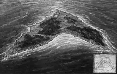
Ok, Let me clear a few things up for you all. About the compass readings being off, Cablava makes a good point. It is also a good idea to note here that when these maps were published in Wilkin's book, he was blamed for changing the compass points. On purpose maybe, so he could hear everyone's interpretations of the map, and have them figured out for himself, as he may have known the true compass readings. The Key/Skeleton Island Map, the Coral Island/Morgan Skull Map, Sarah Kidd's Bureau Map are one in the same island. I have a copy of the true original Key/Skeleton Island Map which was supposedly lost in a safety deposit box in Canada, along with an old painting of the island in which two large treasures did turn up, the first one in the 1950's. This island is located in Maine. That is the map I have already referenced earlier as map solved and in my archives. I'll send you all a picture of the original and painting with this post, I hope you enjoy it, I had to change it from a bmp to a jpg file and recieved a few error messages before it finally posted. The Yunnan Text may have referred to this island, but, it may have been in referrence to the Oak Island mystery. I believe the Plum Island Map dated 1768, the Moose Island Map of 1742, and the Flood Map of 1710 are all linked to Oak Island as well. Mar Del is different and Dated 1669 the year of Morgan's raid. If this is one of Kidd's maps and we find the wreck linked to Morgan, it would prove that he did know Morgan as some suggest and that he helped Morgan during the raid. We know very little about Kidd's life before he lived in New York, so this would be a nice little bit of history to add to his story. Also, some have told me they have had some problems zooming in on Google Earth and have asked me what version I'm using, I downloaded the latest version out in the fall of 2005. I hope that helps you and thanks so far to all of you.


 2850
2850 2202
2202 1245
1245 1167
1167 954
954 911
911 887
887 764
764 658
658 621
621 597
597 571
571 568
568 561
561 551
551