Caballo followup - stone maps?

goldseeker7

Jr. Member
Jan 21, 2008
35
0
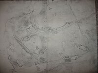
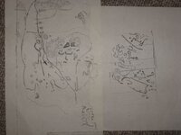
I found some drawings my Dad (he is passed now) made some years ago from a single stone he found in the Caballos. I remember the stone, it was fairly soft and a kind of fine sandstone in appearance. Yellow tan in color. It was sort-of arrowhead shaped; I'd say 16 inches long toward the point and about 10 inches wide by 4 inches thick, fairly uniform thickness. Using tracing paper, he methodically wiped crushed lead across the stone to get its features. What was unusual was that the stone had stuff on both sides, as well as one edge. We thought it might use the natural cracks in the stone to represent crevaces, draws or canyons. These are photographs of his original drawings.
Does anyone know what any of this is? Does anyone see anything that might help me interpret? Thanks. G7
 

Attachments

  • 2Caballo 6-75.jpg
    2Caballo 6-75.jpg
    51.9 KB · Views: 2,870
  • 3-4Caballo 6-75.jpg
    3-4Caballo 6-75.jpg
    39.7 KB · Views: 2,853
That is an extremely finely detailed map!
Normally, The Spanish didn't do anything any where near that fine/detailed!
The Spanish Maps assume ,that the person reading them, has some idea of the terrain near the site
Or! Where they ae going to be going ...
The maps won't take just anyone to what the maps are depicting !
I have seen only one other that was that finely detailed !
It too, was a relatively small sized map, & on both sides of a small rock/stone
The person who has it, has yet to figure out what or where it is pointing!
But!
Then, again, he isn't in the field with it, using it as a guide!
He has it at his home.
Then too, it may tie into another set of directions....
Directions that are carved into some large perment rocks, flat rock faces, etc... along a canyon
Near a spring, or etc ..
If you need some help, I & my Partners will be in "The Caballos" sometime this summer ..
We'll be working on the west side and also, up at the very top!
If you go to:
"General Discussion".... then to, "Arizona" ... Then to, "Bradshaw/Firstwater"...
Reply # 14...
You'll see a photo of us working at a site in the Caballo Mnts, just north of "Long Bottom Canyon"
If interested, contact me ...
Your Map! Maybe THE! MAP! To the huge Spanish Cache that is deep inside the Mnts (Huge Cavern) ;)
 

Hey Cptbil,
I might get away this summer, hard to tell just now as I never know what work brings. I looked at # 14. You can sure tell it's the Horse mts. by that black lead half way up. You guys are serious! hahaha. I know where ya are, walked that out one time. Best of luck. Give me a shout.
There are some things I know, but it would take alot of funds to get there, thus I have never been able to proceed. I sure don't want to mess with investors and in the end be sued like some we know. My learning comes from persons on the ground there as far back as the 50's, as well as my own studies and searches in many places and recon and exploring. We held to ourselves and didn't get into that mountain crowd. (like a bowl of Cereal - too many nuts, fruits, and flakes!) hahaha. We did know know some of the good guys though...
I really am considering just to put all in a book. All of it. Proof and pictures and all. Of course to do so would create a situation in itself, but I am getting older and time is marching on... so.... I'll see. If I wrote the book, and it was found, I would get my moment of fame and glory!
 

Kewl,,,I saved it to my computer,,,don't do that very often,,I don't usually even read what anyone has to say,,,pretty bad-huh. But a bit impatient.
So I never read but the part that it was your dads. I don't like to know much about where it is right now,,,because I didn't read,,and I don't know what anyone else said also. I like it that way. Nothing can interfere with my thoughts. But I want to say, that it looks all to close to something I have or have seen, I would have to search my endless files out.
I have worked these maps before. It may just be that,,,but,,,it seems a bit more than that,,closer. I riddle alot. ha!
Send me an email,,,I may have something for you. mail it to my addy,,put my dads map on heading.
[email protected]
I do some things,,,I don't talk about,,,But it gets results.
I will gander at them later to day, add my own stuff,,,keep a copy and send it to you ifn you want it.
 

Goldseeker7:
Before you go public, let's get togather first
I have my own "Funds" !
I also have, plenty of time, equipment, experience, etc
And!
As you said, "we" are "serious !
BUT!
Also...We are honest...
I don't know if you know/knew "John Ballinger", last lived in Hatch, ( The Institute"), TH'ers
Formerly of T or C & before that, Oscoda Mich
Where "They", Gene & John ( Father&Son), had "The Association" way back in the '50-'60's
 

Goldseeker
Im Cptbills partner and we do have the funding and time and expertise to get this done,please ship us a PM either bill or myself and we can chat in a 3 way phone conference.Hope and wish you all the best.......


DOCC & ARAGORN
 

Most interesting thread. It might be worth goldseeker7 time to work with these folks. For some reason these maps do look a bit familiar.
Remind me of the ones I saw working with Newt.

Some of the marks on them do show up on other ones I have seen.

Do be carefull about actual markings or rocks on the mountain. To many have been destroyed, moved etc. Perick being one of the worst.
 

Hey thanks for the reply.
Yeah there were more stone maps. I know of 3 that have dissappeared that were good. One had numbers.
All had arrows and line marker stuff. At least one fell prey to a Bulldozer and the others to someone.
Yeah I heard Doc blew alot of stuff up. Too bad. Probably knew stuff.
I am writing a book with everything in it. The catch 22 is that once it's done, folks for years will tramp out these maps and be in the way for the serious, on the other hand I can't do it by myself and will not use investors. There are a couple very hot spots, but very tough country.
G7
 

Goldseaker7 I love them mountains. Have had a great deal of fun in them, as well as a few encounters with folk that believe they are to be the chosen finders. LOL

I now the Chatfeilds, ( grew up with Norman, Harveys son: new Bobby Holden ( worked with him of and on) his mother, Melvin M etc. Ah the story's on that place, More than one volume could be wrote.

Such as knowing these folks helped thin out a bunch of the stories about WD.

As for collecting the info I still believe Rex W has the best collection of it. As for the story's John V is still the teller of them.

By the way the RD rock was still intact the last I new. Though one guy keeps moving the thing. LOL what can one do.
 

Speaking of doc P, in the 70s he blew the face of a clif that covered with a large amount of material a place I was hunting for.

Strangely enough it was used by a gang doing a gold smuggling operation on the gold price fix in the US. Oh well. LOL Later to get a road into Cable canyon others added more material right on top of it. Will just have to keep a watch on the area. Some day some one may remove that massive overburden.
 

Hey..
Would those guys talk about some they know? I'd still be for getting new perspectives, or maybe relieving some speculation with facts.
You spoke of Holden, would he be from the old Ranch accross the river?
Yeah that blasting has done damage in alot of places. Longbottom, Burbank, and up Bat Cave all have had there share. Lot of stuff missing up on top of Brushy too. I heard there used to be a trail up there with the carving of 3 soldiers carrying their hats, ever seen it?
G7
 

Willie was staying at the Holden ranch. First day he went out with a sextant. Returned that night and asked for a saw, Holden did not have one gave him a file and hammer. that evening he returned with a half bar and placed it on the table. There were others there at the time including Chatfield. Real basic version. Folks always get into arguments from here. LOL Time period was circa late 1929.

He asked for protection from the sheriff in nov 19th puplished in an el Paso Texas news paper after claiming he had been kidnapped from the Jorndo motel in Hatch. Stories abound from there.

Just to let you know goldseeker7 the versions of maps you show seem to be variations of what is called the sheep herders map. Original was supposedly on skin handed down among the family for ages.
 

yeah that's the general theme of the story told by Bilton. Argosy printed it in Feb. of 62.
There was a Mexican boy whose father had a "sheep herder" map. It's in Chandlers book I think. There was also some letters back in the 50's that somebody said they had seen a map, and was writing explaining it.
 

"Bilton." Actual name was Milton. it shows up in a lot of the old mining recored at the county offices. That is one problem with the story's. them folks; Holden Gorden and Chatfield new them mountains. The story in Argosy is close to what the Holdens said was the real story.

Chatfeilds prefer the Burbank Caynon area. etc.

My step grandparents was involved in the trucks waiting for buster to show them were to start loading. That happened also. LOL

I have seen a few variations of the sheep herder map, the j 7 map, about twenty variations of the Naverez way bill, etc. The storys about Wilie killing the red head kid is also a variation. Wont even begin to get into the dowsing maps.

Reality is if he used a sextant then the location was most likely more modern than Spanish.

Allso cross check the asti orro rock in NM magazine march 1940. It shows marks close to what is on your maps.

Heck you talk about a bunch of folks going in there because you write a book; LOL they always come in. Every year I encounter new folks going to find it. Who nows maybe some one will stumble in to a stash.
 

That's where some retreating Confederates hid & camped after Glorietta. I suspect some marks are theirs.

Yep and some of them treasure like Willie's. They had a camp from the time they entered NM around Las Palomas. One guy got over 50 cs buckle brass that had been striped of the lead some were around LP. Suspect they needed the lead fer dem bullets. Folks did not like that confederate money much, or them confederate I owe Yous.

I suspect the rd rock was related to such. It has damage to it already and is now were near original location. Have tryed a bit to understand it.

Were my interests now end up is the 33 parallel and the old stone foundation in that area. story goes with it as a German living in the area had saw a bunch of priest with mules and carts go into that area and when they left he built the place close to were it was. The geology in that area is interesting also. It had a spring at one time that still functions at times.

As for claims I do try to find out who has them and get permision before going in there.

A for the brothers, well what can one say? Every year more and more marks get damaged, and more get made! LOL

Just for info the Rd map is in the GP area below the drolty hole and the tds claims/treasuretrove.

Ahh what I usualy ask folks going out to hunt is Were are you going to dig and why? LOL Most areas I could give em a tour and they would realy wounder when I ask em that. Note I am not talking about them dowsers, they would dig any were due to there sticks crossed.

Just a note on the lower hole and were some of the damage occured. Some one had built a GPR and located a signal that apeared to be a box. They waited for Drolty to leave and whent in with a back hoe. They did not find anything but when drolty came back he went there and started digging. Interesting for some one to claim the drill hole whent into gold to move from that location to were some one disturbed the ground dontcha think?
 

LostCauses
Ya might do good there, right cross the stream from that old Place. Access over the top there?

I make out a compass in 1/8's. on the RD. Which way did the long shaft go? Or was an 1/8 missing? Also a sun sign and triangle with a pointing side. Did you draw what was on it?
I had a pic of the tree with the rebel stuff on it, from near GP.
 

Top Member Reactions

Users who are viewing this thread

Back
Top