Buried Money in Portland Oregon

Behind the barn. (Ha! , nothing unusual there! Sorry.)
11?Then hash marks denoting distance to stump? Hash marks start where? A yellow lined block.
I don't see graves.
Above what looks like graves is another G /g in "get" well to confirm it is a G.
So , to go literal it looks like graues. Which means agreeing that is a u and not a v.

Any one involved German?
Graues is /= grey. Or dark. .

Both yellow and blue lines might highlite in places. Above a word here. Below a word there. Then just a random appearing line that might as well be a hand drag for all it tells.. Being both colors and not both colors together has me requestioning number of hands drawing/writing. Knowing still it was multiples.
Someone may have enhanced for clarity's sake. Then perhaps someone else added to it as they studied it. Different time frames make sense when the port is more built up in blue? Even given a tracing medium being transferred , the entire map isn't solid blue. Making yellow predate blue in the case of Port. House. Barn.
Orchard was already treed in yellow to not be enhanced. But then there was more focus on other objects within range.

And an odd barn drawn. One dimensional makes it look like a tailed ham can with an antenna , or a trolling motor handle atop.
A damaged lightning rod on the roof?A type or condition of windmill? And a corral nearest the road/trail maybe?
It's just a square or rectangular barn? a near flat roof?
The barn is odd for sure.
Perhaps it’s partially collapsed …. and some 😆
That would be my first guess.

I Agree, graves behind the barn could be interpreted many different ways. 🥸

Why is it called a “chart”?
🤷🏼‍♂️ 🤔
 

My phone only gets one date 🤷🏼‍♂️
If you have access, please post, I already said I had doubts. 😁
Not enough zoom.
And geez it's a busy area!
There were a couple stones in the park I tried to copy a picture of. Not graves.
And on the golf course North , a big grey boulder. L.o.l.

45.474069, -122.636041
 

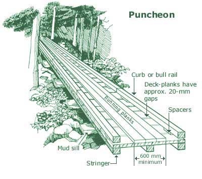
I think the plank road idea as a pike might be right
this might be why the chart/map says pike, in February 1856 a new co. built more plank road & charged a toll.
I think that tolls were charged back east too & called pikes. JMO that suggests the chart/map marker was familiar
with pike roads back east. more info @links


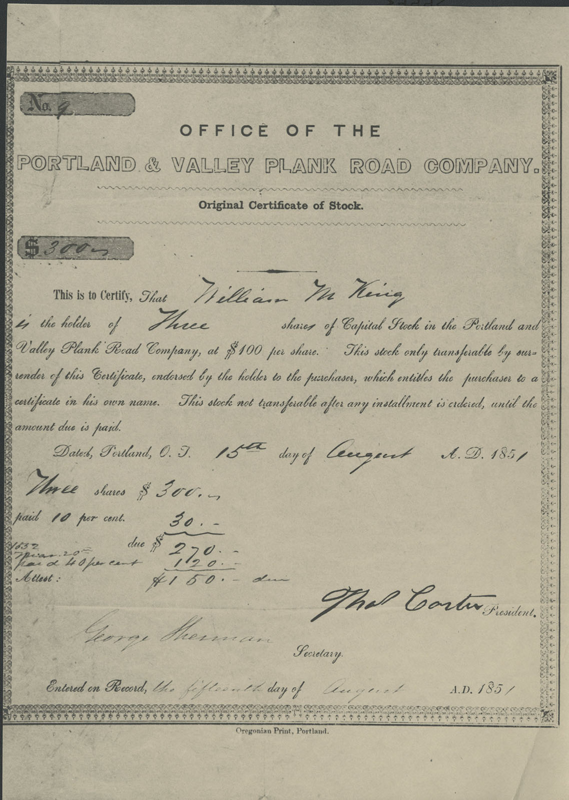
the first planks on September 27, 1851 were laid for the great plank road,the effort went bankrupt January 1853.
By early 1852, workers had laid planks up present-day Canyon Road,put in a bid to complete the city portion of the
road to Park Avenue on Jefferson Street. After bankrupt, a new company formed in February 1856 as the Portland and
Tualatin Plains Plank Road Company,to complete the plank road & to help finance there was a toll charge for use.
By 1867 the road was deteriorating, 5 years later,The Great Plank Road had become anachronistic.

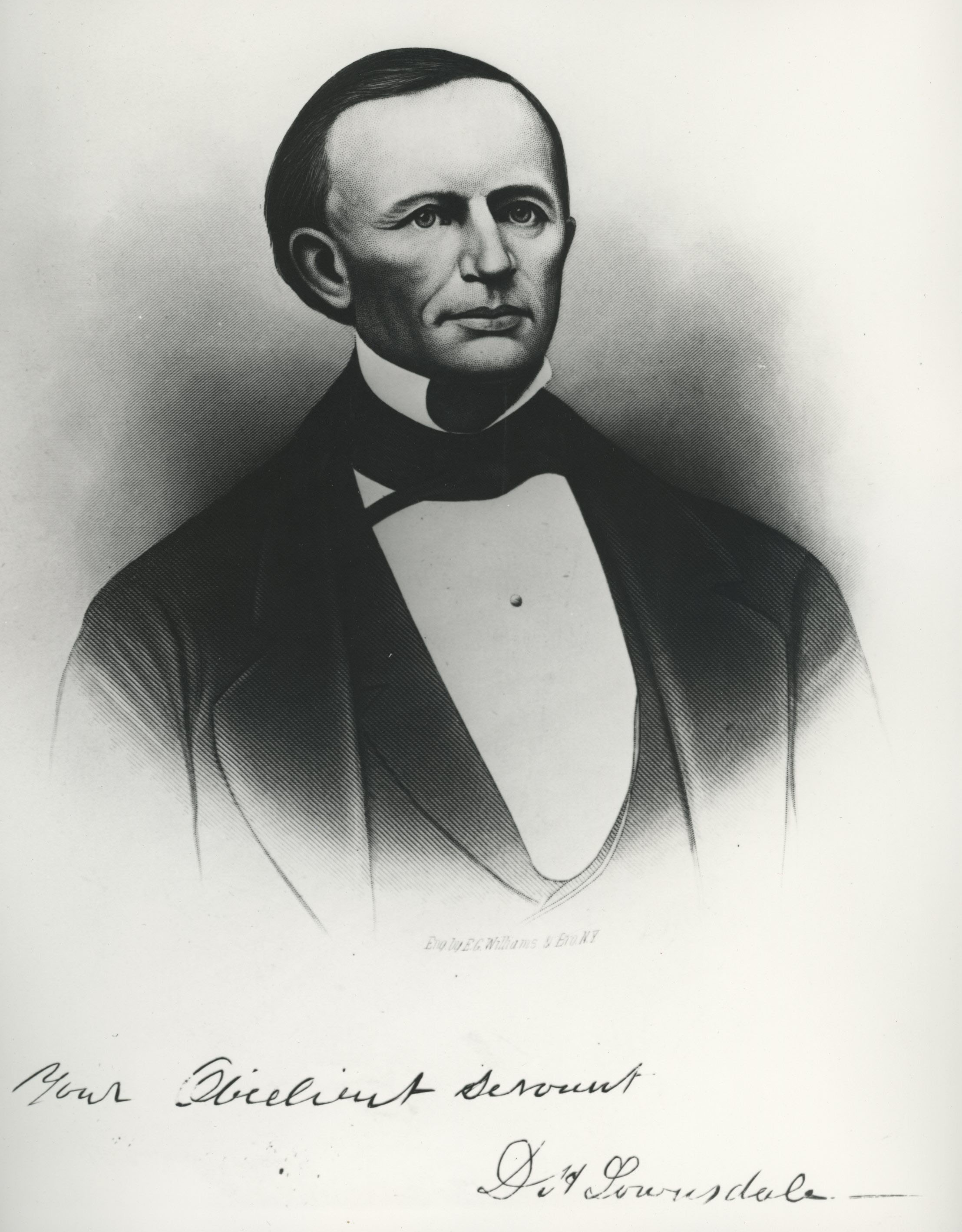
more on Lownsdal & the road, from the goose hollow link

Lownsdale sold the tannery and land in 1848 and bought out Francis Pettygrove’s claim on the Willamette River.
A town booster, he helped persuade Portland to tax itself and build the Great Plank Road (now Jefferson Street,
which becomes Canyon Road as it leaves Goose Hollow). The planks covered a muddy road in the narrow Tanner Creek
Canyon and led to the Willamette River, providing a somewhat navigable road for Tualatin Valley farmers to take
produce to the port.


Daniel H. Lownsdale

plank toll road history
 

Once again great stuff. :thumbsup:

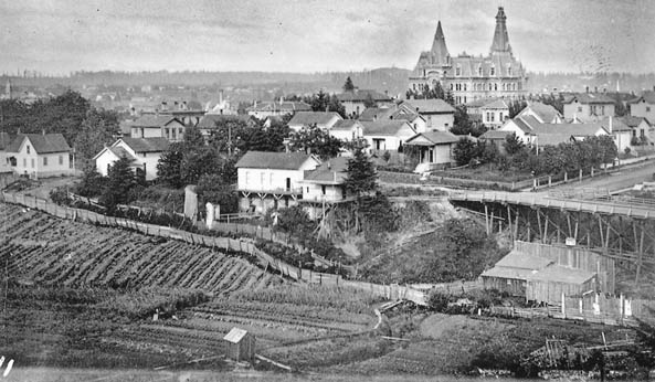
I love looking at those old photographs it like going back in time. machine.

This is one of the reasons why I find this alleged treasure map so interesting and intriguing?

Crow
 

I had no idea that plank roads were a craze mania for a while. I guess I missed that day in school .. 🤔
Plank roads were a huge improvement over muddy ruts…. Especially for farmers getting produce to market. I was reading that 5 or 6 day trip, could be cut to 15 hours. No wonder all the excitement, and investments that it generated. 🤓

I enjoyed this story, 👍
Thanks Crow for sharing it.

Idahodutch
 

Attachments

  • Screenshot 2023-10-05 at 4.20.14 PM.png
    Screenshot 2023-10-05 at 4.20.14 PM.png
    652.9 KB · Views: 39
found some img/pics done along the Willamette River in Portland,I'm not seeing the chart/map
building,but some of the img need a tweak of exposure, enlargement for my old eyes

I tried to load the img,it wouldn't, just click on pic for a lg jpg
this Panorama in 3 parts of Portland, Oregon 1882, shows the changes in 20yrs


Panorama of Portland and the Willamette River, Oregon. No.1-8
date: 1861-1867 by Carleton E. Watkins


more C Watkins

search his name & found this collection,haven't looked at this collection yet
 

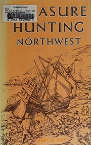
finally remembered I wanted to look for the book by Ruby Hult in the Atlas Obscura article
it can be read at see link, just need to register it's free to read,good read for more detail
found some info in it about where and what was the pike road, AKA plank road, see links
don't want to post to much from book, b/c don't want to cross the fair use rule

from the book
If Canyon Road is the Pike Road referred to, from what point should one measure the two miles?
Interestingly enough there is a plaque near the center walk in the South Park Blocks in Portland,
at the corner of S.W. Park Avenue and S.W. Jefferson, which reads:


where the block with the plaque is @ sw park & sw jefferson


the book
Lost Mines and Treasures of the Pacific Northwest ruby Hult

info
the great plank road

Portland Transportation History Timeline

Great Plank Road
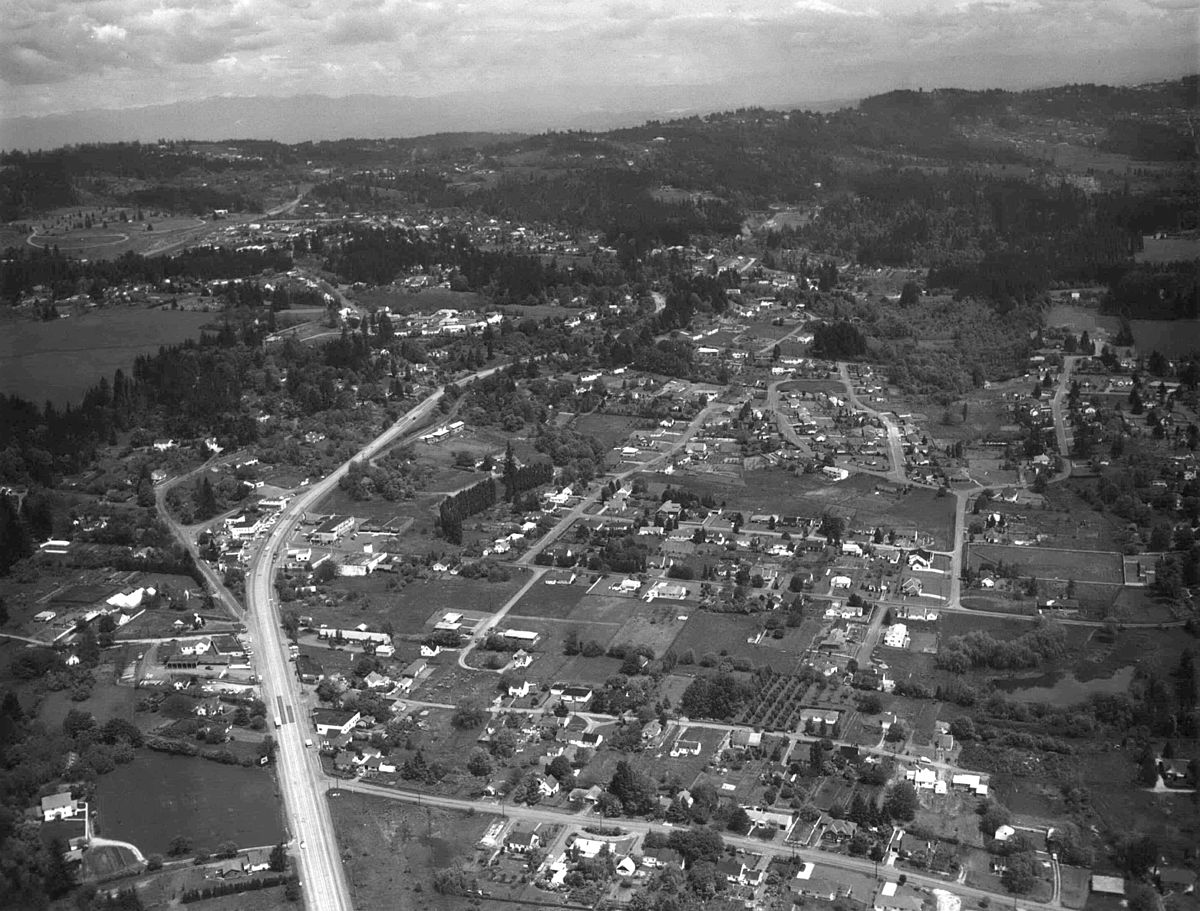
This is Canyon Road in 1896.
----------------------------

The source of her brief account was a note headed ‘““Treasure Chart,” published in the Oregon Historical Quarterly, Volume 41, Page 109

can be purchased here
Volumes 41 through 61, 1940-1960, paperbound, $20.00
 

………….Interestingly enough there is a plaque near the center walk in the South Park Blocks in Portland,
at the corner of S.W. Park Avenue and S.W. Jefferson, which reads ………….

cw0909,
You were asking where to start the 2 mile measurement from.

The map/chart says 2 miles from Portland.
From the Willamette river to the western edge of town wasn’t even a mile…. In 1862.
The center of west Portland is east of Park & Jefferson (the start of the plank road heading towards canyon road route).
From Park and Jefferson, to the edge of town, was less than 800 yards.

Here is a snapshot of GE measurement from the marker at Park & Jefferson, on out canyon road. 2miles puts you up the hill at the Zoo. 👍
IMG_0720.jpeg

The starting point is coming from the other direction….. at the church (one that looks to have a steeple in 1862) then from the church …. Down the road to within 2 miles from Portland. There you used to find …. Old house, barn, and couple of graves, in 1862.

Looks like it might be under the lions exhibit 😂😁 (just kidding)
Idahodutch

PS- According to the map, near the church, is a port…… I don’t know of any port just a couple miles farther west of the zoo on canyon road. ??

Going even 3 miles back from the zoo, only gets you to Raleigh Hills, or cutting cross country, you could get to Saint Vincent Hospital. 🤓
No port 🥴😕

This story is a tough one 🤓🤷🏼‍♂️👍
 

Last edited:
CW0909 Some excellent research utterly fascinating. I love those old photos it like looking through a window back in time. I tried to see if there was Church steeple? in 1867 it was just no clear enough blown up to see. Either that or my eyes was too crap?

Maybe the church was just illustration in the rough crude diagram of Portland and was not as import as we first thought?

This plank road / pike road is perhaps the key? the House, the barn the graves and tree stump?

Fascinating

Crow
No port
I got excited about the plank road, but then ….. no port when you need one 🥴🤓
 

Idahodutch

I though the top of map was north? and the pike road was going east from the river and based on the church yet the steeple was added so it never had a steeple in 1862. In fact as far as i am aware none of churches had steeples back then?

Maybe i had the orientation wrong? maybe the top of map was looking south? :dontknow:

So i am none the wiser as I am not sure where the two miles start from?

Crow.

:dontknow:
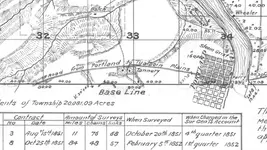
Crow, the map starts on the road to Portland. At or near the starting point is the following:
1. The road to Portland.
2. A church.
3. A port
4. A bunch of short lines (we called them pikes)

That’s at the start. The finish is about 2 miles from Portland. And there is :
1. The road to Portland nearby.
2. The old house nearby.
3. The barn, very nearby.
4. The 2 graves, even closer.
5. The buried money.

That’s what I got anyway. 🤷🏼‍♂️
Idahodutch
 

Crow,
The Milwaukie scenario fits for the church location, and the port. the orchards being there at the place where orchards were shown, is important too, especially in 1862.

It’s just all been built out. 😵‍💫

I would be interested in if An old house and barn are distinguishable on those old property maps you found ?

Maybe the old barn location could be identified to a close proximity ? 🤷🏼‍♂️🤓
Idahodutch

Idahodutch.
 

the 2mile start point, and no directional for NESW, just Portland and port, is port short for Portland
the map orientation, not sure don't think north, east maybe, would ya cross on a ferry with 6k
maybe came from the east to west, & the map just shows ya need to know the port.south I
think I read it was marshy, not sure if the marsh was far south or closer to town outskirts
west was farm & herd animals.
If the graves are a family Cemetery on their land, would they put it near a barn.
If east found a stump marker @ Powell Grove Cemetery, was searching S @ the site, instead
of all variations of Sims


it is located in a crazy place
 

Last edited:
found some maps, show some cemeteries

penitentiary,lower left of map
old & new cemetery upper right black lines, near text box
penitentiary & old & new cemetery

old cemetery , west bank, far left

still shows old cemetery bottom of map west bank of river

still shows old cemetery

new street names, old cemetery not shown

old cemetery shown

pic of buildings, bottom row a Catholic church, I dont see it in the view of town
cw0909,
One of the pics you posted a link to … they showed pics of various buildings in Portland. The picture was from the 1850’s

Here is a snip of one of the buildings it showed.
IMG_0721.jpeg

A Catholic Church, with a steeple.
Not to get too excited, but this church was in Portland, not near a port several miles away.
It may be that Port is short for Portland, however, as far as directions go, in the map/chart, East is given …. Where it says the money is 10’ East of the graves
IMG_0722.jpeg

There are not that many ports, that are several miles from Portland.

Two scenarios possible here;
1. Portland is north of this map, and the church is south of Portland near a port.
Or
2. Port is short for Portland, and the house, barn, (2) graves, and the money, are all north of Portland just off the main road heading north at the time. And maybe the steeple church is near the starting point in Portland, not somewhere else. 🤷🏼‍♂️

In all honesty, if this map is real, then East is East. …… and pretty much, I’m only seeing those two possibilities. 🤓👍

Idahodutch
 

Top Member Reactions

Users who are viewing this thread

Latest Discussions

Back
Top