A Heap of Proof.

Status
Not open for further replies.
18 mines 47 vara apart.

Incidentally, the Solar maps are read between 2-3 Decans in the afternoon and the morning maps are read between 18=7 Decans in the morning. Each Decan cycle begins at high noon so the first cycle is zero or 18.

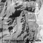
The arch of the sun appears high in the sky in my previous pictures. The last photo shows how the sun works the map and if you look you can see the sunlight shining on the sides of the bedrock gap where the keystone is inserted and hits the keystone directly when 1:00PM too 2:00pm (2-3 Decan) arch's over the mountain top. Each decan is about 33 minutes of our time. Three Decans is about 1.39pm so the viewing lasts for about twenty minutes until the fourth Decan appears.


18 places (Decans) indicates where the sun will be for viewing the final map in relation to Virgo and the Solstice.
18 Decans is halfway through the solar calendar of 36 Decans or 10 months of the Egyptian calender. Also solar noon each day.
It also represents the mid-day solar cycle or high noon solar which is about 1-2pm our modern time. 7 decans equals about 3hours and 51 minutes or about 4:00 clock in the morning the time you look for rise of the astrological sign associated with each cycle of ten for the time of year or 4:00 oclock in the afternoon each day the time of the last viewings for instructions during the solar day.


18=7, 25 Decans is about this time of year.
 

Bill

" 18 mines 47 vara apart. "

Are you talking about Tayopa ?
 

Back to the stone map .
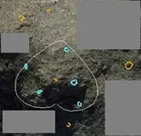
I believe in the region of the heart are 10 mines . Five are recognized on the stone trail map ( the four black holes and the end point of the trail ) and five on the Latin heart ( 3 Meus , a Moneta and a Caverna Aurum ) .
So , in the field would be looking like this

Mines.jpg
 

That would be fine but gold and silver mines are few and far apart. If they were prospects that's something different but mines would have to be located in a very rich area with lots of hiding places. Mother Load mines of the crown had to produce a certain rich ore. 25 pounds to the square yard. If they didn't they were not worked as the methods were too primitive for processing low grade ore bodies. Cache holes maybe. I look at the maps as an information tool for helping locate single mine entrances or Pozo's. (Air Vents) With some of the maps missing or destroyed it's likely no one could solve the mystery.


Back to the stone map .
I believe in the region of the heart are 10 mines . Five are recognized on the stone trail map ( the four black holes and the end point of the trail ) and five on the Latin heart ( 3 Meus , a Moneta and a Caverna Aurum ) .
So , in the field would be looking like this

View attachment 1201879
 

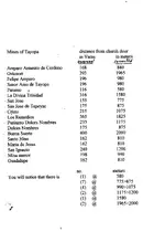
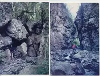
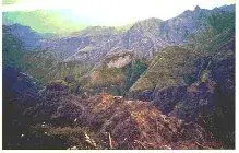
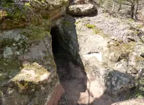
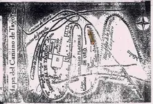
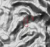
Marius, those distances are the width of a barranca (canyon) They are at the deviding line between the Basalt over lay and the natural limestone base. Notice the close proximity of the canyons one with the other. I.E. on both sides of the canyons. The last picture of a mine was a mistake, it is not Tayopa mine, but it will give you an idea.

.Aerial.jpg Entrance to Tayopa©@.JPG photo Tayopa.jpg
 

Attachments

  • Tunnel.JPG
    Tunnel.JPG
    2.6 MB · Views: 161
Last edited:
Marius, the formation of the Tayopa complex was due to a volcanic uplift of the 800 ft. basaltic layer, fracturing it both verticslly and horizontally, forming voids for the deposition of rich Hydro Thermal soloutions both horizontlly and vertically. It also led to many very narrow, deep canyons that were rich on both sides.

There was a reson for Tayopa being called the richest mine in North America.
 

Last edited:
Is that correct?

It seems we have another Map showing a rich mine or cache / Treasure located inside a Church / Mission building!
No wonder early Treasure Hunters were digging in missions for Gold!

Those maps I posted earlier clearly showed the same type of system under Missions.

Possibly a Shrine locator or a cross location marker.
My wife and once dug under a cross on top of a mountain during a lightening storm and hit bedrock about five feet down only too go home empty handed at three in the morning. It was a measured point showing on the Petroglyph Map a half a league away. One of many points on that Petroglyph locator map I posted earlier.

I wonder if near this location exists a locator petroglyph map pecked on rock face?

Since these maps were created by lantern light and have age fading so bad you have to experiment with spectrum gel films utilizing manual camera mode too decrease the sunlight.

They created the hidden portion of the maps by stacking.


Dog, You seem to be quite versed in this which is great. Lightening Hearts and Exclamation Points are always near dig sites with gold buried at least that I've found. If you do find one of these sites like we have you know your close, very close. Tell me Dog have you seen the Ore carrying snails or the Turtles at these sites? The smaller the turtle the more importance it has. This site is special as yours is I'm sure. There is not very many of these out there. Only mother load gold mines were hidden with this system.

I know as you do that just because you find these your still a ways away and you'd better be careful if you don't want to end up trapped underground for eternity!

I've tried using ground radar at this site, a round about unit from accurate locators, and my deep seeker but with the bad terrain it has near these you can't get a good reading with out cutting the brush and moving masses of boulders.

So I just studied it now for years that's how I found out about the light map near here.

Have you found any of the Skulls yet?

So far I've only found two down here and there isn't many so we have some pretty special sites. This site has so many of the Peralta Stone Map aspects that it has me convinced the stone maps are real or made from a real map.

I just watched that show Treasure Quest Snake Island this last weekend and they showed the symbols of treasure they're using for finding the Treasure of the Trinity.
Right off the Peralta Stones and out of Chuck Kenworthy's Books!

They were talking about the Southern Cross navigation symbol which is true. I know their compasses were set up as South pointing not north even though they used the north star in this area.

Near this area of the heart there is a simple pile of rocks as a measuring point. Until I decode the sun map I only have one numeral set which is 75. I'm waiting for the season to be begin for opening the door so to speak and unlocking the rest of the map. I was convinced up until now that moving the stone blocking the sun was not in my best interest because I thought it was creating a sun sign with the light sky under it now I see it was blocking the other half of the map so I'm removing it this fall and placing a time lapsed camera pointing at it.

The rock is pretty large and it will take everything I have to move it and place it back when done. But it's pretty ingenious of those rascals to make something like this and hide it so well. I'm hoping it will give me another number so I can complete a distance and direction to a dig spot.

If you find those skulls your in a real treasure site. Treasure or gold mines it's all the same they hid the treasures in the mine shafts like a vault.

Howdy Bill R, sorry about the late response. I haven't found any skulls yet, but i could have easily over looked them,just so much there. there's a small turtle there that caught my eye. Where its sits,that area caught my eye from far off. seen some snake heads there,among other things. the full heart, the cracked heart.Iam gonna try and pin point it with dowsing,best i can do for now.Some other things id like to mention,but i just dont want to at this time. the lichen circle on the stone at my place,is about the same size as yours, but i kinda had the thought of it being a frog. ill have to photo it better when i get back out there.I was shocked to see you post that,and about the ! marks. I know i wasnt going to give that away. I wonder about that lichen circle, could it be the Bulls Eye?, Meaning both hitting the bulls eye, and the bulls animal eye. I havent seen the gold carrying snail there yet either,at that site. could the snail mean the golden ratio? All thats way to much for me. ill have to stick with a sixth sense and dowsing.Thanks again Bill R for the info. and photos to back it up. Id like to hear more about the warlock, if your wanting to share more. Heres a photo of the small turtle,snail,frog.View attachment 1204272
 

Last edited:
Howdy Bill R, sorry about the late response. I haven't found any skulls yet, but i could have easily over looked them,just so much there. there's a small turtle there that caught my eye. Where its sits,that area caught my eye from far off. seen some snake heads there,among other things. the full heart, the cracked heart.Iam gonna try and pin point it with dowsing,best i can do for now.Some other things id like to mention,but i just dont want to at this time. the lichen circle on the stone at my place,is about the same size as yours, but i kinda had the thought of it being a frog. ill have to photo it better when i get back out there.I was shocked to see you post that,and about the ! marks. I know i wasnt going to give that away. I wonder about that lichen circle, could it be the Bulls Eye?, Meaning both hitting the bulls eye, and the bulls animal eye. I havent seen the gold carrying snail there yet either,at that site. could the snail mean the golden ratio? All thats way to much for me. ill have to stick with a sixth sense and dowsing.Thanks again Bill R for the info. and photos to back it up. Id like to hear more about the warlock, if your wanting to share more. Heres a photo of the small turtle,snail,frog.View attachment 1204272


Dog, the treasure hunter,

While your image is difficult to discern, the turtle was absolutely used as a treasure/directional symbol/marker. There is an example of one here in the US weighing several tons with carvings on its shell that would impress even the most die-hard skeptics.
 

Ore and Gear Carrying Snails.


View attachment 1204388View attachment 1204389


Turtle on a Turtle's back with the large Turtle sporting a green lichen Heart Eye.

View attachment 1204391View attachment 1204392View attachment 1204393


Howdy Bill R, sorry about the late response. I haven't found any skulls yet, but i could have easily over looked them,just so much there. there's a small turtle there that caught my eye. Where its sits,that area caught my eye from far off. seen some snake heads there,among other things. the full heart, the cracked heart.Iam gonna try and pin point it with dowsing,best i can do for now.Some other things id like to mention,but i just dont want to at this time. the lichen circle on the stone at my place,is about the same size as yours, but i kinda had the thought of it being a frog. ill have to photo it better when i get back out there.I was shocked to see you post that,and about the ! marks. I know i wasnt going to give that away. I wonder about that lichen circle, could it be the Bulls Eye?, Meaning both hitting the bulls eye, and the bulls animal eye. I havent seen the gold carrying snail there yet either,at that site. could the snail mean the golden ratio? All thats way to much for me. ill have to stick with a sixth sense and dowsing.Thanks again Bill R for the info. and photos to back it up. Id like to hear more about the warlock, if your wanting to share more. Heres a photo of the small turtle,snail,frog.View attachment 1204272
 

View attachment 1204431

A very large stone turtle with carvings on its shell from the great state of...
Anyway, the complete article can be found in my album "Treasure Signs & Symbols". Its a fascinating story.
 

Status
Not open for further replies.

Top Member Reactions

Users who are viewing this thread

Back
Top