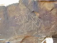
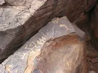
A Heap of Proof.

Status
Not open for further replies.
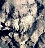
Well i like the map NP posted,and what Real TTT has said about the treasure coming from the mines west to east, i like to think they came thru the area i hunt in. I see a heart here with the Tayopa T on it. And i see what i believe to be the serpent staff from the map NP posted.

Just curious dog - do you explore in the Cookes Peak area?
 

To all

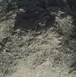
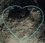
The horns/ears of the heart ( from the lil map and not the Latin/stonetrail map ) are land shapes . Look at this GE picture . We can recognize the heart ( with the ears or not ) , the canyon which starts from the up right of the heart and go circular below , the priest in the middle of the heart , and if we turn the picture up side down , we can recognize a part of the horse ( in the right down quarter ) .

heart.jpg
 

Last edited:
Just curious dog - do you explore in the Cookes Peak area?
No sdcfia, i havent made it into the Cookes peak area yet. But it looks very interesting,i want to make it to the pony hills area to see that work. I always kinda figured you knew the areas i hunt in,because i know that you know the area and have alot of experience. If i get lucky enough to make a hit, I plan to let you in on it.If you have a interest in it.:thumbsup:
 

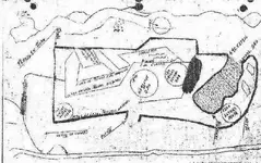
And ... the other heart of Latin and stone trail maps .

Latin-stone trail heart.jpg h.jpg

For your collection .
 

Don Jose

And ... for your Tayopa map , perhaps I have the solution . i will post it in your Tayopa thread .

Map to mt..jpg
 

No sdcfia, i havent made it into the Cookes peak area yet. But it looks very interesting,i want to make it to the pony hills area to see that work. I always kinda figured you knew the areas i hunt in,because i know that you know the area and have alot of experience. If i get lucky enough to make a hit, I plan to let you in on it.If you have a interest in it.:thumbsup:

Pony Hills has some magnificent petroglyphs - many of them. Further east is Frying Pan Canyon - more of the same, including some "Aztec" stuff. Lots of Apache camps, graves, caves and many, many remnants of old mining in that range. If you're looking for metal, go where it's been found. I hope you hit something. I may be too broken down to help, but maybe I could rally.
 

Hola Himar "Corozone", as I mentioned, there were probably additions made to the origional map

When was Apche Springs first known by that name ?

Fresh Mango ??

Don Jose,

There are a number of springs that have Apache attached to them. I believe the closest to our area of interest is near Apache Cave, (Skeleton or Skull Cave). If named by the troops involved in the battle, it would have been named around 1872. At that, the "Apache" were actually Yavapai Indians led by Nani-chaddi. The whites of that era were seldom able to differentiated between the tribes who lived in the area.

Lt. John G. Bourke, I suspect, may have applied the Apache name to the nearby spring, or it could have been named at a later date.:dontknow:

Take care,

Joe
 

Last edited:
Pony Hills has some magnificent petroglyphs - many of them. Further east is Frying Pan Canyon - more of the same, including some "Aztec" stuff. Lots of Apache camps, graves, caves and many, many remnants of old mining in that range. If you're looking for metal, go where it's been found. I hope you hit something. I may be too broken down to help, but maybe I could rally.

Thanks sdcfia on that info about frying pan canyon, id really like seeing that Aztec stuff, thats very interesting. no sweat on the help, if i find something, iam offering the goods and info. as a gift. Its always nice to share with someone who has a coming interest in things, and that you trust. iam sure you would only tell those who you trust.:thumbsup:
 

Thanks sdcfia on that info about frying pan canyon, id really like seeing that Aztec stuff, thats very interesting. no sweat on the help, if i find something, iam offering the goods and info. as a gift. Its always nice to share with someone who has a coming interest in things, and that you trust. iam sure you would only tell those who you trust.:thumbsup:

From Frying Pan Canyon

Quetzalcoatl-3.jpg Totonteac-5.JPG
 

And ... the other heart of Latin and stone trail maps .

View attachment 1194532 View attachment 1194533

For your collection .
I see the wolf in those pictures. What does it mean? What direction is the heard pointing? I see a bird in flight,small but there.
Thanks sdcfia on that info about frying pan canyon, id really like seeing that Aztec stuff, thats very interesting. no sweat on the help, if i find something, iam offering the goods and info. as a gift. Its always nice to share with someone who has a coming interest in things, and that you trust. iam sure you would only tell those who you trust.[emoji106]


Sent from my SGH-T989 using Tapatalk
 

Last edited:
Backwoodsbob

The heart points south , and the wolf could be Nature's game .
 

Thanks you for the reply.The wolf shares the nose of the ram but that's ok. The ram is in the circle. Its nose and mouth are in the right side of the heart. Just below center. The rams horns are seen on the left side of heart. Can you see that? What does the wolf represent. I can show some example.

Sent from my SGH-T989 using Tapatalk
 

Here are my examples
9cc5ceb47b0f5bf4a112a78a6a94ee3e.jpg
of the wolf. A head profile on right. If you turn 180° you can see him laying down. More pictures to come.

Sent from my SGH-T989 using Tapatalk
 

Status
Not open for further replies.

Top Member Reactions

Users who are viewing this thread

Back
Top