A GUIDE TO VAULT TREASURE HUNTING (Condensed)

I have seen these exact same types of cache sites in NM, UT, CO, CA, The vaults are literally anywhere there was a major river that could be followed, the main storages are always near a wash or up a canyon that they could bring a wagon up to easily as well as find easily by using the wash as a road or a mountain that was out of place or unusual in some way, that big aura I showed on the mountain is a good example you follow the wash right up to the mountain and it is the first hill you come to in front of the mountain range.
As far as the Superstitions, there are many vaults located all around that mountain, its just people don't seem to know it.
Remember these storages are not mines but temporary storage vaults.

Have you ever found any along the Colorado River or the Arkansas River? I've done some research and have a theory that precious metals might have been moved northeast, along the Colorado River to the Platte and east, along the Arkansas River to the Mississippi. Also, there was supposed to have been a trail, in Colorado, that moved north-south on the east side of the front range. Have you ever seen anything along the front range? Thanks.
 

The only one I can say for sure is the Colorado, and they put storages on mountains all up and down the Colorado, all you have to do is look for the man made Holes in the mountains that you would see going along the colorado,If anybody is going to Vegas from Kingman there is one on the left between K and V and anybody going from Quartzite to Yuma there is another one on a peaked mountain between those to towns The holes are used to show the mountain ranges with storages. If memory serves me at the Peralta trailhead in the Superstitions there is a hole that you can see from the parking lot also.
 

I have seen these exact same types of cache sites in NM, UT, CO, CA, The vaults are literally anywhere there was a major river that could be followed, the main storages are always near a wash or up a canyon that they could bring a wagon up to easily as well as find easily by using the wash as a road or a mountain that was out of place or unusual in some way, that big aura I showed on the mountain is a good example you follow the wash right up to the mountain and it is the first hill you come to in front of the mountain range.
As far as the Superstitions, there are many vaults located all around that mountain, its just people don't seem to know it.
Remember these storages are not mines but temporary storage vaults.

Hmm. Now I'm beginning to connect some dots - explaining why you guys have been able to back-engineer all those mysterious empty holes you've found that may have some markings in common, and that may date back to the pre-Mexican War period . A number of treasure hunters have reported similar enigmas in the past.

I know that you will likely savage me for suggesting this (I expect it), but if you read a comprehensive history - especially the many available personal memoirs and journals of the French and American fur trappers in the CO-NM-AZ-CA region, much of it ca 1820s - you will find some very, very interesting facts. There is a lot of published information about this. One: virtually every river stream and intermittent drainage in this entire region was explored and trapped for beaver. Yes, even NM and AZ was rich in beaver before settlement, even desert areas where there was water - especially the entire length of the Colorado River. These guys worked either for the large fur companies directly or as groups of independent contractors for them. Many of the trappers wintered in Taos. Two: because of the weight and bulk of the prolific harvest of pelts, they quite frequently cached bundles of pelts as they worked their way along. The pelts were normally wrapped and buried in the ground to protect them from other animals, then retrieved later in the season for shipment. Three: the cache locations were marked with rock piles and other signs that would enable the trappers to easily retrieve them. They used common techniques of marking the caches so that they would be easier to locate later.

I know you want these empty holes to be Spanish treasure vaults, but what you might have was even more valuable during the time period. Now at least some of your allegations make sense to me. The one thing that always bothered me about your claims was the alleged great number of mine caches. For what it's worth, you might look at this post I made on another thread. You can believe as you wish, but there are facts available that contradict the wishes of many believers of treasure legends. http://www.treasurenet.com/forums/lost-dutchman-s-mine/538428-cave-gold-bars.html#post5479817
 

Last edited:
Something else alot of people bring up is buried Gold, while there has been gold found it is by far less abundant than Silver which is much more likely to be found in a treasure vault.

Is that also depending on the particular geographical area, whether high in gold bearing?
 

Is that also depending on the particular geographical area, whether high in gold bearing?
Yes I am sure that would change things.

I went out this morning to get some treasure marker shots, but unfortunately I only got one just before my bike decided to die on me.
I will post it here in a minute when I get it loaded into the computer.
 

Sandy do you ever meet with members?

Sent from my SM-G900T using Tapatalk
 

I have met with a few, but they were through people I already knew.
 

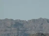
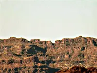
Here is the one picture I managed to get today.

This is one of the squared U's (it has a tree growing in the left lower corner so its tough to see it as Squared)

Just to the left of the Squared U is a short flat top mesa with a Hole going all the way through it, this is just one of several that I will be showing, and its meaning is that there are storages/vaults on this mountain range. You can only see the hole from this angle.
1.JPG
 

Last edited:
Did you remove picture? I can't pull it up

Sent from my SM-G900T using Tapatalk
 

I put it in again so let me know if you can see it now.
 

Do you have any time lapse of that one. Noticing the shadows on it

Sent from my SM-G900T using Tapatalk
 

It's hard to see the hole ,but I do. Do you have time lapse of the mountain. Would love to see the shadows symbols

Sent from my SM-G900T using Tapatalk
 

Wow I don't know what happened. All good now

Sent from my SM-G900T using Tapatalk
 

Yeah it was duplicated, I only got the one shot of that marker today I was having vehicle troubles at the time, its too hot out here to be on the side of the road right now.
 

I could imagine. I just left California and your probably hotter. It's that way here along with humidity. That's why I'm inside.

Sent from my SM-G900T using Tapatalk
 

Here is the one picture I managed to get today.

This is one of the squared U's (it has a tree growing in the left lower corner so its tough to see it as Squared)

Just to the left of the Squared U is a short flat top mesa with a Hole going all the way through it, this is just one that I will be showing, and its meaning is that there are storages/vaults on this mountain range. You can only see the hole from this angle.
View attachment 1476763

Removed the haze from the image ... if that's not a problem.

Sandy_1-haze.png
 

Top Member Reactions

Users who are viewing this thread

Back
Top