Along the Royal Trail with Lost Horse


Looking back at the process, the way this was set up


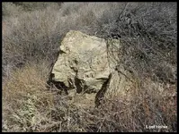
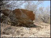
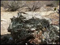
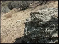
Note: This Large Flat Rock makes it our
6[SUP]th[/SUP] Iconic Marker or Step Six and our 3[SUP]rd[/SUP] Vista Point.

Vista Points Are:

1 - Looking at the Range Marker, from the Royal Trail.

2 - The Bird’s Nest.

3 - This Large Flat Boulder.

And for those who love to play with Sacred Numbers take note.
just in case you haven’t noticed,

3[SUP]rd[/SUP] vista point, 3 = Gold

our 6[SUP]th[/SUP] Iconic Marker, Step Six,
“The Last Step” = The last day God created the Earth.

And heading for the 7[SUP]th[/SUP] Step = The Day God Rested. (The Treasure)...

Could This Be just Coincidences?


As God Rested, up on High,
and Stands on this Big Flat Boulder, “Heaven”,
He looks down upon The Earth, “His Treasure”.
Lost Horse.

To Be Continued...
 

Last edited:
The Journey Continues


Hello Trackers,
Now that you have seen the Process, and we have gathered our message
or data from the Vista Point, Birds Nest area, its time to go over there and
Stand on our next Vista Point to take in the View.

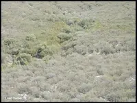
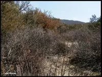
As I look at my situation, at this point its going to be a challenge,
to get to the other side of that heavily brushy canyon.

So after spending some time looking over the canyon from high,
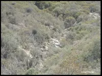
I decided to enter the canyon from it’s mouth, there was evidence
that there was a small
dry wash or tributary exiting the mouth of this canyon.


0019.JPG
 

Last edited:

I found from experience that walking a dry wash is one way to avoid

some brush. I know there will possibly be some poison oak and
who knows what else.

This seems to be the best strategy, it runs along the bottom or base
of the King’s Marker, all I have to do is find my way over there.

0020.JPG
 

Last edited:

So one morning, I headed out the door very early,

I wanted to be on that Boulder at day light,
to get some good photographs – hang around and then later do the same,
bringing home a variety of photos to look through.


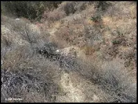
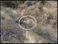
Once there, I started to fight my way through the brush
and in the direction of the dry wash.


0021.JPG
 

Last edited:

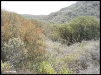
Some areas had Small clearings,
so I could rest and check on my direction, hoping to see if I had much more to go.


I could see I was about half way there.
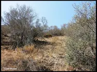
And as I was walking I could see another small clearing,
which looked like it would be easy to travel through.

0022.JPG
 

Last edited:

And then, all of a sudden, a little fear and a lot of caution came over me.

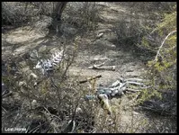
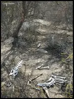
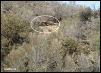
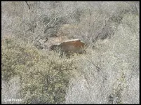
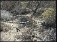
In the path in front of me, I could see what looked like scatted bones.

As I crept closer with eyes and ears wide open, I started to identify the bones
and was relived that they were only from a deer.

0023.JPG

0023 a.JPG
 

Last edited:

I start to realize, that I am now in the home of a possible Cat,

Cougar, and there are some big one out here.

But still, I am more curious than fearful, and on a mission,
before I lose to much of the morning light. Got to get to that dry wash.

Following what looks like the cougar’s favorite trail,
I could see that I was getting closer to the wash.

0023 b.JPG
 

Last edited:

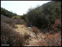
Finally a good feeling came over me when I step foot in the middle

of a sandy wash. The wash was covered in small and large granite boulders,
and a lot of DG sand.

I looked up the wash and I could see that there was still some brush,
but nothing like what I just came through to get here.

I started to follow it up the canyon, and along the base of the mountain.
working my way through the bush, Being in the dry wash,
the hike was relatively fast, well it appeared that way to me,
compared to all the other trails around here.

0024.JPG
 

Last edited:

I start to realize, that I have no way of knowing, when I will be at the Bottom

of the King’s Marker. Being this close to the bottom,
brush and trees block any view.

I am afraid I mite walk past it, where I planed to hike up to it.

So I started to take my time, looking at everything, and hoping something
would catch my eye. - And then it happened,
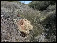
a large boulder, something different about it, catches my eye.

I see this large off colored boulder, that was a light red in color.
It was different and stood out from all the other white granite boulders
that were in the area.

0025.JPG

0025 a.jpg
 

Last edited:

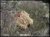
As I start to get closer, it’s looking more like a Lion’s Head facing the mountain.

Pointing out a Trail, I took notice where the Lion Marker was looking.

0026.jpg
 

Last edited:

You know I had to stop at this moment, and give thanks to the Spanish / Artist,

for giving me the direction.

They thought of everything, knowing I would not be able to see the King,
so, created a Trail Marker to tell me I am here, and this is the way up.

0026 a.jpg
 

Last edited:

As you mite guess, I had to check out this marker.

So as I walk up, behind and around this marker,
I see that this marker was created, so no matter what direction
you are coming from, up or down the dry wash, it will still look like a Lion.

This is not mother nature – more like conformation.
Pointing out the trail going up the mountain.

0027 a.JPG
 

Last edited:

I stop to rest a bit, to contemplate the art work,

before I attempt to hike up this steep trail,
that’s going up the mountain.

Lost Horse.

To Be Continued...

0027 b.JPG
 

Last edited:
The Journey Continues

Hello Trackers,

While I was resting, I stopped to take the time to see what was the best way
to start up the mountain. I walked down into the dry wash,
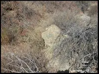
I turned and looked back at the Lion Marker one more time.
Changing my position and view,
The lion, now looks like a Poodle with that long snout.

This Iconic Marker - The Poodle Marker, is some what like the Lion Marker,
Meaning or representing Royalty / Government control.

So here we have this one Boulder, that has three main Royalty Markers
attached to it, and a lot depends on the direction you are looking at it.

They are all looking at the entrance of the trail head.
Three creations, and the one same message.
This was definitely a professional Artist, who incorporated three markers
on one stone. - So here again, is evidence of intelligent Design
and conformation, of a King’s Trail.


0028.JPG
 

Last edited:

Standing at the base, looking at this steep mountain,

I started to head up what looked like a trail.
But that didn’t last long, it soon ended, so at that point I was on my own.
After some struggle, and switch backing my way up,
I managed to get to a point where I could take a break and rest a bit.
Looking around I start to see, what looked liked the Flat Boulder.

This path is taking me, Not where I wanted to go, but where I Needed to go.
This trail was headed for the the Big Flat Boulder “our next vista point”,
Not the King.

This is Intelligent Design, The King Marker as grand as it is,
has already served its function in the trail process.
And the Artist is sending me to where I need to be, to get to my goal.


0029.JPG

0029 a.JPG
 

Last edited:

So as I continue to switch back my way up through the brush and trees,

I get closer and close to our next Visa Point.
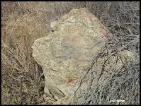
As you can see it doesn’t look like an Iconic Treasure Marker,
But possibly a Face Trail Marker.

0029 b.JPG

0030.JPG
 

Last edited:

So how can I call this my 6[SUP]th[/SUP] Iconic Treasure Marker?

If you don’t understand the process, you can get confused and lost in your search for the Treasure.

If you were to stumble on to this Boulder randomly, you would think its just another trail marker,
and would not understand it’s true nature, and move on.


This Face Marker, is looking North, back at the Bird Nesting Marker.

0031.JPG

0031 a.JPG


Last edited:

The 6[SUP]th[/SUP] Iconic Treasure Marker, and 3[SUP]rd[/SUP] Vista Point -

Is actually an Unseen Marker called The Omega Marker.

Only if you understand the process by following the trail,
Only then, will it make any sense.
It has all the characteristics of an Omega Marker.

Characteristics,
As I analyze its location, it is South of the Bird Nest Marker,
making the Bird Nest Marker our Alpha Marker.

The Alpha Marker,
is always North of the Omega Marker.
and we know, is the Beginning of the Treasure Trail,
And has the information where and how many treasures,
and, will lead us to the Omega Marker -

The Omega Maker,
as we know, is the Last Marker.
Showing us where the Treasures are buried.
There is nothing Visual about this Iconic Marker.
This one is unseen, hidden in the Treasure Trail process.

The Omega Maker – is always South of the Alpha Marker.
I have seen this Characteristics being used in my research
at least four different times, in large mining areas.
So I can state that this mite be a common practice.

But this is Not a Mining Area.
The King Mountain Range Marker, is not a mining area marker.
This is a Dumping Ground for the King’s Treasure, or payment.

Imagine all the mining areas big and small, spread out all over the areas
that are gold bearing.
Only have to go to one area along the Royal Trail, to deposit the King’s portion.
And the King’s Men, instead of going to mining area to mining area,
only have to make one trip to this area, to pick up the king’s treasure or portion.

But, Large Mining Areas have their own Alpha / Omega Markers.
Leading you into the mining area. And have their own vaults / storage areas.
Storing Their Finished Product, until the season was over,
load up, and head home.

Lost Horse.

To Be Continued...
 

Last edited:
Good Morning, LH, I am going out on a pretty long limb here and its just a guess on my part BUT on the league square sections, In my part of the world ( cause it's not so cluttered with ) Royal trails, and so forth that I feel that it a dividing line between two pieces of property, one on the left and one on the right the 3rd would verify if it is three of the 3 of four direction. Anyway that's what I have marked on my piece of paper. GOOD post Thanks
 

Top Member Reactions

Users who are viewing this thread

Back
Top